
The avalanche danger in the west central Montana backcountry is a strong Moderate. Isolated pockets of higher hazard may exist.
Good morning, this is Jeff Carty with the West Central Montana Avalanche Center’s avalanche advisory for December 17, 2020. This advisory does not apply to operating ski areas, expires at midnight tonight, and is the sole responsibility of the U.S. Forest Service.
Mountain temperatures are 23º to 32º this morning.
The Snotel sites tell us the mountains received between 0.3″ and 0.7″ of snow water equivalent in the past 24 hours. Tours yesterday revealed 4-6″ of new snow on the ground at St. Mary’s, 6″ at Glen lake, 3″ at Sheep Mt, and 2″ in the southern Bitterroot around Lost Trail.
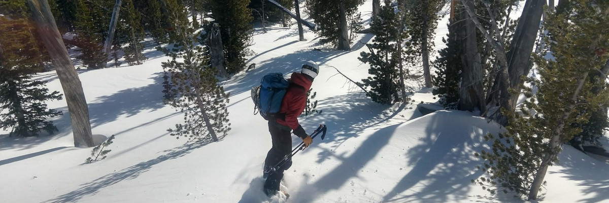
There is a broad range of conditions throughout the forecast area, some areas have touchy windslab, some have a reactive surface hoar layer under the new snow, others are still generally stable. Approach all slopes with suspicion and practice extra caution as the mountains receive more snow and wind.
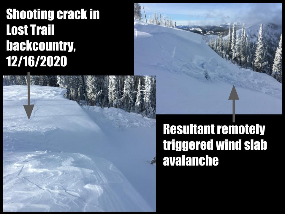
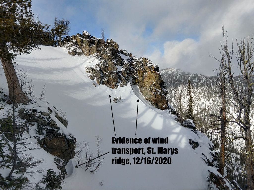
Tuesday’s snow came in with moderate winds at upper elevations and there was evidence of considerable wind transport yesterday. Further snow and wind last night have added to the thickness and size of wind slabs. These overlay a variety of surfaces including near surface facets and surface hoar compounding the wind slab problem. Yesterday in the Lost trail backcountry wind slabs at ridge top were remotely triggered and some combination of persistent weak grains likely played a role. Due to the presence of the weak grains wind slabs may remain touchy for longer than normal. All upper elevation, leeward slopes likely have windslab.
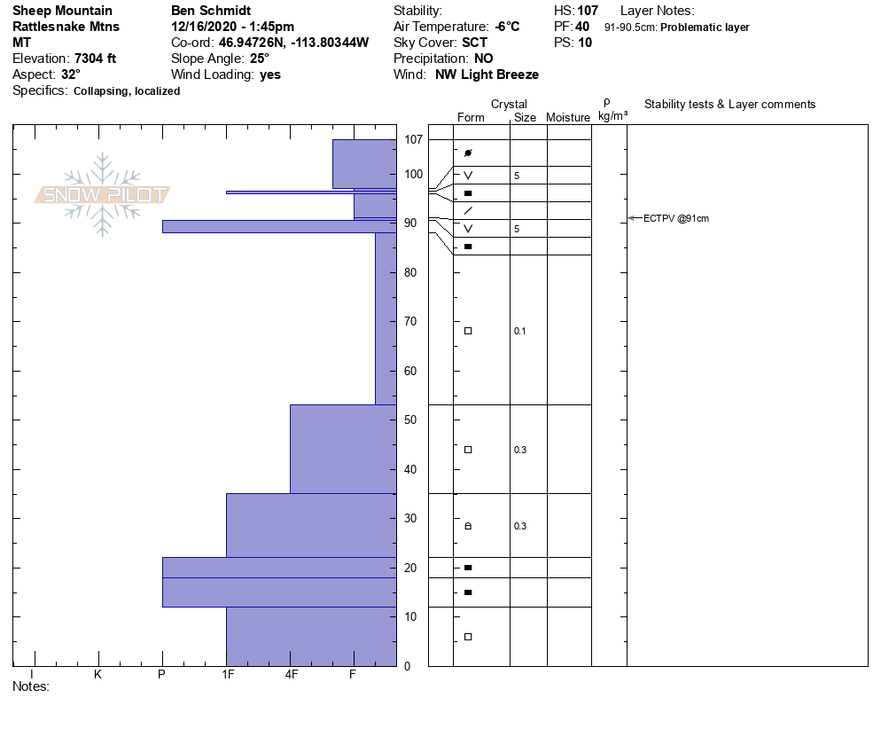
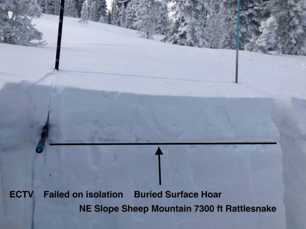
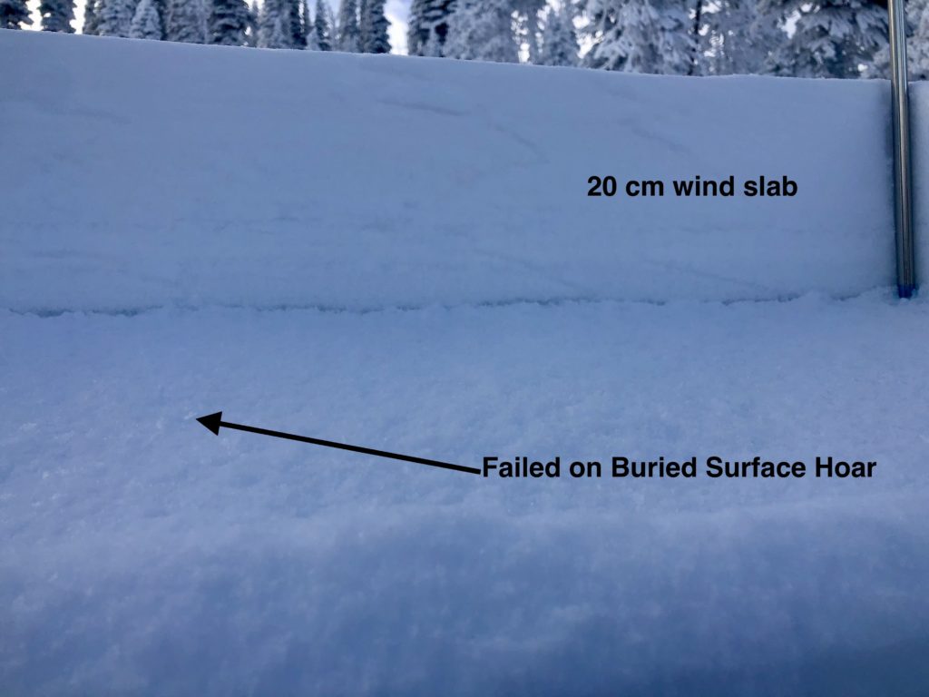
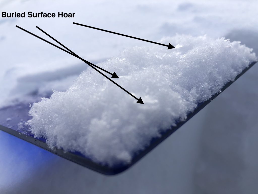
Buried surface hoar can be found throughout the forecast area. In many places, the overlying slab lacks the cohesion or depth to propagate. However, it was very reactive, failing on isolation on a NE slope at 7300′ on Sheep Mt yesterday and woomfing was experienced. In the Rattlesnake, 6″ of storm snow was failing easily on surface hoar and there were rumors of cracking and shifting snow on Mt. Fuji at Lolo Pass where widespread surface hoar was noted. Lolo Pass received the most snow last night, roughly 7″, bringing the storm total to over 12″ so far, and creating the thickest slab over this problem layer in the forecast area. Practice extra caution if you are riding there today. As more snow accumulates throughout the forecast area this could become a widespread problem.
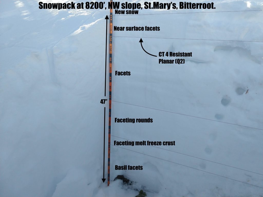
Most areas are also plagued by faceting deep in the snowpack, which has continued to lose cohesiveness. These layers are not yet propagating consistently in stability tests but the structure is very poor. Observations yesterday indicated these facets are continuing to grow. The snowpack on sheep Mt. was considerably more faceted than 2 weeks ago. The snowpack on NW slopes on Pyramid peak is composed entirely of noncohesive facets, reminiscent of our snowpack leading up to the January avalanche cycle last year. The concern is that as snow piles up as a cohesive slab over these weak layers it may trigger a large avalanche cycle. With snow in the forecast throughout the week, high winds, increased temps, and abundant moisture forecast this weekend we may see the avalanche hazard rise sharply.
The Bottom Line:
Winds have created touchy windslab that will continue to grow with snow and wind today. Avoid wind loaded start zones greater than 30º. A variety of persistent weak layers exist throughout the snowpack which is currently being loaded by new snow. Storm snow failing on buried surface hoar is possible, with more risk in areas that received more snow. The likelihood of avalanches will increase with continued snowfall. As always practice safe travel protocols. Travel one at a time in avalanche terrain, carry a beacon, shovel, and probe, and stay alert for signs of instability. Dig a pit. Look for red flags.
The current storm cycle coincides with the start of the holidays and we expect to see more people out in the backcountry in the coming week. Please exercise caution. We are coming out of a long stretch of low hazard and no snow, the draw of fresh powder is strong but we may be entering into a very active avalanche cycle.
We generate avalanche forecasts for a 1420 square mile area that stretches from Lost Trail Pass to just north of Seeley Lake. We work hard to keep you informed of current avalanche dangers but, we can’t see everything. Your snowpack and weather observations help us fill in the gaps and produce a more accurate forecast. If you get out, please take a moment to fill out the online observation form.
Ski and ride safe


