
The avalanche danger in the west central Montana backcountry is considerable. Cautious route finding is needed today. Wind Slabs and weak facets are creating dangerous avalanche conditions.
Good morning; this is Travis Craft with the West Central Montana Avalanche Center’s avalanche advisory for December 24, 2020. This advisory does not apply to operating ski areas, expires at midnight tonight, and is the sole responsibility of the U.S. Forest Service.
Weather and Snowpack
Temperatures range from 5 degrees to 17 degrees F this morning. No new snow overnight. Winds are 6 mph to 12 mph.
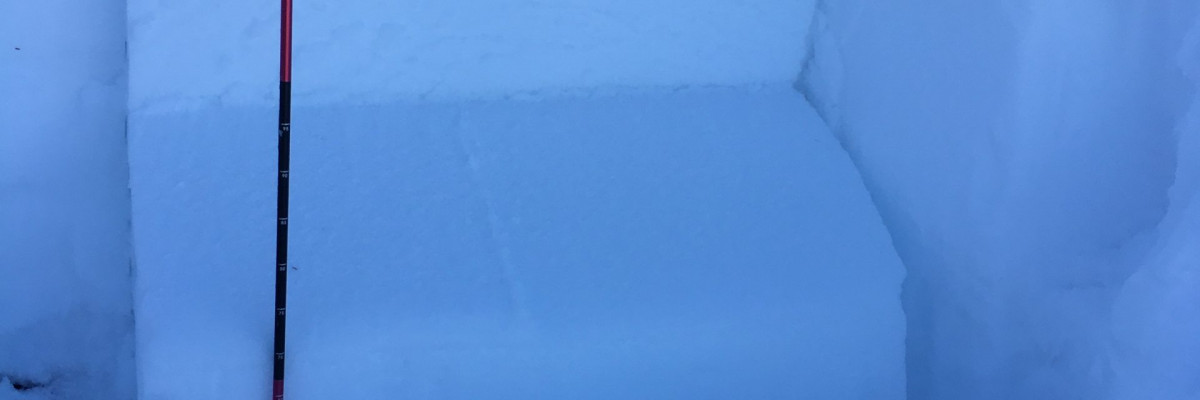
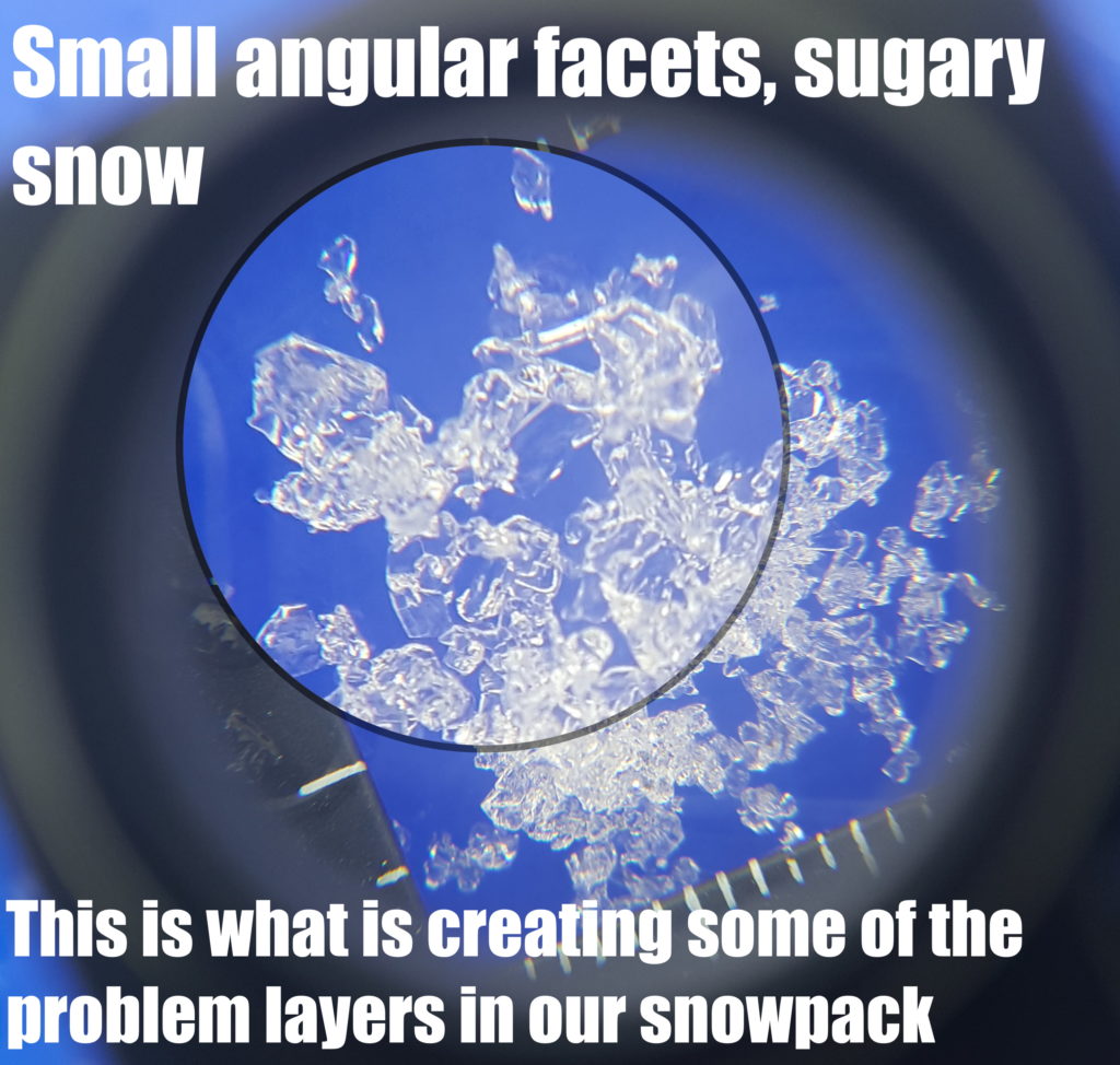
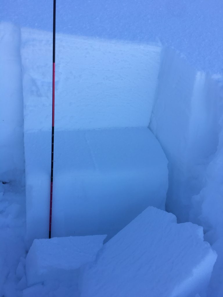
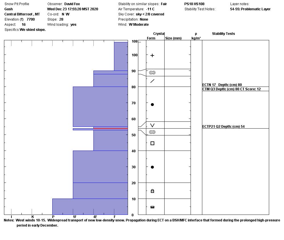
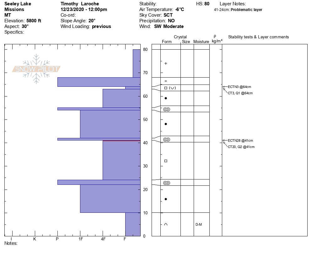
The snowpack has weak facets with a large slab on it. This layer is in the bottom third of the snowpack. Yesterday, we got this layer to propagate in pit tests from the Lost Trail backcountry, Gash Point in the central Bitterroot, Lolo Pass ,and the Rattlesnake.
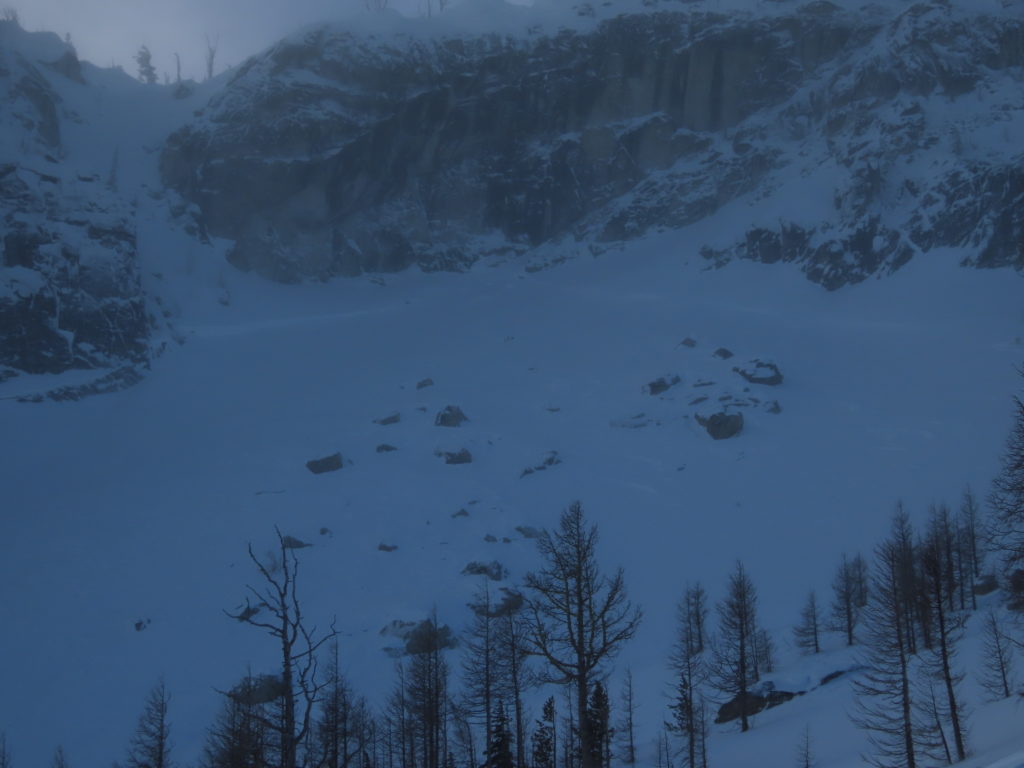
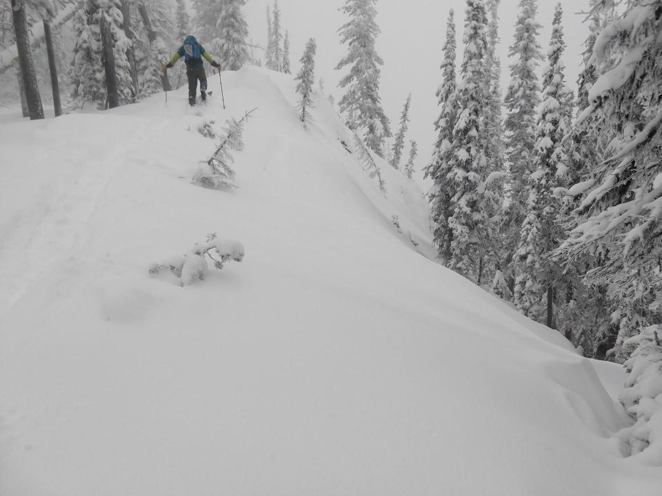
The primary avalanche problem today is persistent slabs. Natural slides were reported from Gash point yesterday. Old crowns were visible when the skies cleared yesterday, this is evidence that our snowpack can produce large dangerous slides. Throughout the advisory area, whumphing and collapsing were reported. These are two red flags that our snowpack is unstable.
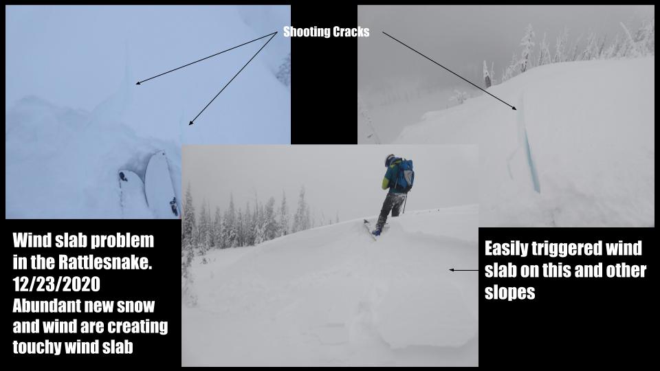
The second avalanche problem is wind drifted snow. We saw active wind loading on slopes yesterday throughout the advisory area. These slopes will be very sensitive human triggers today. Look for pillows and hollow sounding snow slopes to identify this hazard.
Bottom Line
The buried weak layers are capable of producing large dangerous avalanches. Choose slopes less than 30 degrees that are not connected to steeper terrain. You can trigger an avalanche from below, the side, or from a ridge. You can trigger an avalanche from flat ground if the slope is connected to steep terrain (> 30 degrees). The riding is good on simple low angle slopes. Get the forecast. Carry a shovel beacon and probe. Only have one person on a slope at a time.
Public Observations
Thank you to everyone who has taken the time to send in a public observation. Please keep sharing what you find and see while out in the backcountry. This is a great resource to glean information about current conditions. Here is the link to Public Observations.
We generate avalanche forecasts for a 1,420 square mile area that stretches from Lost Trail Pass to just north of Seeley Lake. We work hard to keep you informed of current avalanche dangers but, we can’t see everything. Your snowpack and weather observations help us fill in the gaps and produce a more accurate forecast. If you get out, please take a moment to fill out the online observation form.
Ski and ride safe.


