Posted:
Dec 26, 2020 @ 6:07 am

The avalanche danger in the west central Montana backcountry is moderate . It is possible to trigger an avalanche on steep slopes today.

Good morning; this is Travis Craft with the West Central Montana Avalanche Center’s avalanche advisory for December 26, 2020. This advisory does not apply to operating ski areas, expires at midnight tonight, and is the sole responsibility of the U.S. Forest Service.

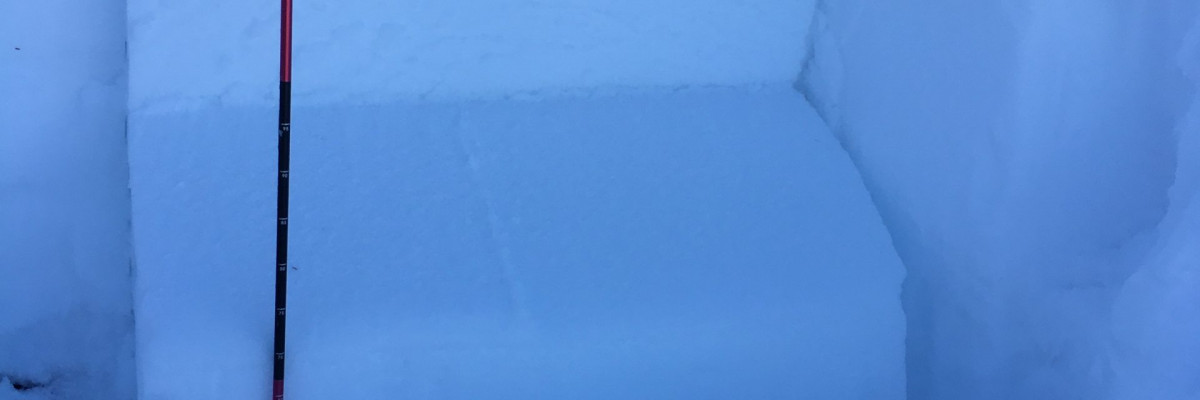
Weather and Snowpack

Temperatures range from 22 to 32 degrees F this morning. A trace to 4 inches of snow has fallen over the advisory area overnight.

The snowpack structure is still weak. Facets and crust combinations are still reactive in pit tests. It is still possible to trigger these layers on steep slopes.

Winds today will load leeward terrain. Wind slabs are a avalanche problem today.

The primary avalanche concern is persistent slabs. The second avalanche problem is wind slabs.

Bottom Line

Choose low angle slopes today less than 30 degrees. As always, practice safe travel protocols. Travel one at a time in avalanche terrain, carry a beacon, shovel, and probe. Remember to re-assess conditions throughout the day and stay alert for signs of instability. Dig a pit. Look for red flags.

Public Observations

Thank you to everyone who has taken the time to send in a public observation. Please keep sharing what you find and see while out in the backcountry. This is a great resource to glean information about current conditions. Here is the link to Public Observations.

We generate avalanche forecasts for a 1,420 square mile area that stretches from Lost Trail Pass to just north of Seeley Lake. We work hard to keep you informed of current avalanche dangers but, we can’t see everything. Your snowpack and weather observations help us fill in the gaps and produce a more accurate forecast. If you get out, please take a moment to fill out the online observation form.

Ski and ride safe.

READ FULL ADVISORY  

Problem 1 - persistent Slabs

  • TYPE

    persistent-slabs

    Persistent Slabs

    Release of a cohesive layer of soft to hard snow (a slab) in the middle to upper snowpack, when the bond to an underlying persistent weak layer breaks.  Persistent layers include: surface hoar, depth hoar, near-surface facets, or faceted snow. Persistent weak layers can continue to produce avalanches for days, weeks or even months, making them especially dangerous and tricky. As additional snow and wind events build a thicker slab on top of the persistent weak layer, this avalanche problem may develop into a Persistent, Deep-Slab.

  • SIZE

    4-5

    2 (Large)

    The potential size of avalanche resulting from this problem.

  • LIKELIHOOD

    Likelihood-3

    Possible

    The likelihood of an avalanche resulting from this problem.

Avoid steep slopes. Dig a pit and do an ECT before committing to any steep terrain. Look for red flags.

Problem 2 - Wind Slabs

  • TYPE

    wind-slabs

    Wind Slabs

    Release of a cohesive layer of snow (a slab) formed by the wind.  Wind typically erodes snow from the upwind sides of terrain features and deposits snow on the downwind side.  Wind slabs are often smooth and rounded and sometimes sound hollow, and can range from soft to hard. Wind slabs that form over a persistent weak layer (surface hoar, depth hoar, or near-surface facets) may be termed Persistent Slabs or may develop into Persistent Slabs.

  • SIZE

    3-4

    1-2 (Small-Large)

    The potential size of avalanche resulting from this problem.

  • LIKELIHOOD

    Likelihood-3

    Possible

    The likelihood of an avalanche resulting from this problem.

Look for active loading of slopes from the wind. Avoid wind loaded zones.

FORECAST & OUTLOOK

Light snow and winds today. See the forecast.

This information is the sole responsibility of the Forest Service and does not apply to operating ski areas. The avalanche danger rating expires at midnight tonight but the information can help you make a more informed decision regarding travel in avalanche terrain for the next few days.

Our advisory area includes National Forest System lands in the Bitterroot Mountains from Lost Trail Pass north to Granite Pass, the Rattlesnake Mountains north of Missoula and the Southern Swan and Mission Mountains near Seeley Lake, MT. Avalanche information for the Lookout Pass/St. Regis Basin area is available from the Idaho Panhandle Avalanche Center.