
The avalanche danger in the west central Montana backcountry is MODERATE.
Good morning; this is Jeff Carty with the West Central Montana Avalanche Center’s avalanche advisory for December 29, 2020. This advisory does not apply to operating ski areas, expires at midnight tonight, and is the sole responsibility of the U.S. Forest Service.
Weather and Snowpack
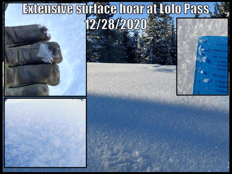
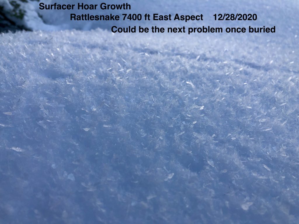
Mountain temperatures are 16º F this morning and are forecast to reach the high 20’s today. Clear skies and cold nights have dominated since the last forecast and extensive surface hoar has grown throughout the forecast area. Winds were calm to mild yesterday and will be light with moderate gusts today. Wind slabs are not expected to build in the next 12 hours, but increasing winds tonight will start to transfer snow to leeward slopes.
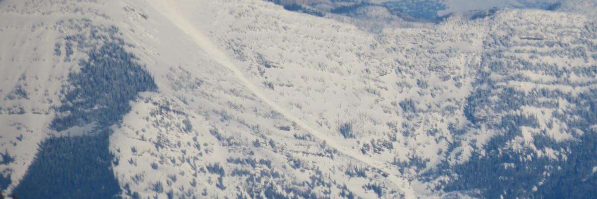
The snowpack is varied throughout the forecast area. Deeper areas have better bonding and are not showing consistent failures in stability tests. Weak layers still exist in isolated areas and avalanches are possible in these zones.
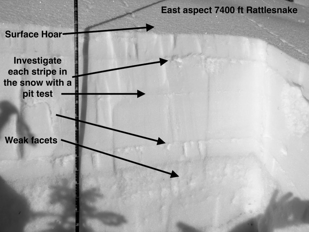
In shallow areas, generally under 5 feet in depth, the snowpack structure is still poor. Facets and crust combinations are reactive in pit tests. While the strength is increasing, propagation in tests shows us that slab avalanches are possible. These are becoming a low likelihood high consequence problem as persistent weak layers get buried deeper.
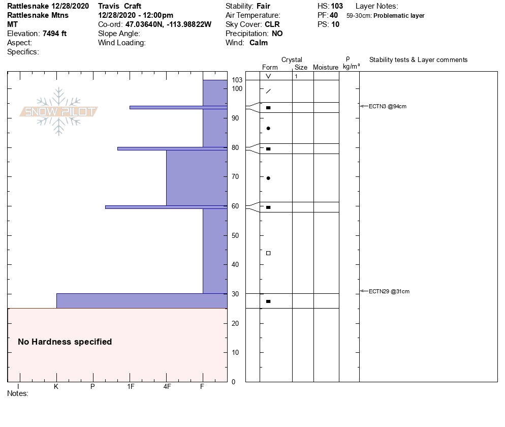
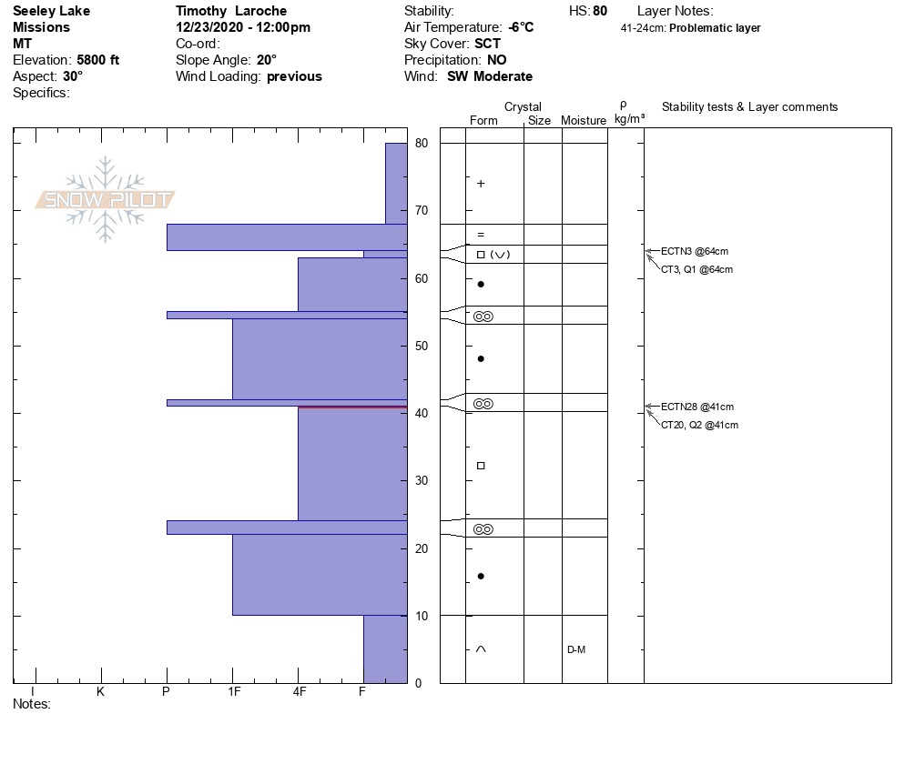
Lolo Pass had two concerning faceted layers yesterday, 8” and 31” deep that were propagating in extended column tests. These exist on multiple aspects, and staying on slopes under 33º is wise if you are riding in the Lolo Pass area.
A natural avalanche was reported in the Swans yesterday. This area had extensive faceting before Christmas that is likely still lurking and contributed to this slide. Extended column tests on Pyramid Peak were failing on buried facets on the 24th. Investigate the Swan snowpack carefully before committing to steeper slopes.
The southern Bitterroots, outside of Lost Trail has also had a shallower, faceted snowpack.
Extensive surface hoar has grown throughout the forecast area and will be a problem layer with our next snow load.
Bottom Line
Careful snowpack assessment is required as persistent weak layers exist in specific areas. Digging a pit, looking for sugary snow layers, and performing stability tests is crucial for making informed decisions. Where persistent grains are present stick to slopes under 33º that are not connected to steeper slopes. Practice safe travel protocols. Travel one at a time in avalanche terrain, carry a beacon, shovel, and probe. Remember to re-assess conditions throughout the day and stay alert for signs of instability. Look for red flags.
Public Observations
Thank you to everyone who has taken the time to send in a public observation. Please keep sharing what you find and see while out in the backcountry. This is a great resource to glean information about current conditions. Here is the link to Public Observations.
Ski and ride safe.


