Posted:
Dec 31, 2020 @ 6:56 am

The avalanche danger in the west central Montana backcountry is Considerable. Human triggered avalanches are likely, especially in wind loaded terrain. 

Good morning; this is Jeff Carty with the West Central Montana Avalanche Center’s avalanche advisory for December 31, 2020. This advisory does not apply to operating ski areas, expires at midnight tonight, and is the sole responsibility of the U.S. Forest Service.

Weather and Snowpack

Mountain temperatures are 18-29º F this morning and are forecast to reach the low 30’s today. 7″ to 14” of snow has fallen in the last 24 hours. 1”-3″ more is expected today. Winds have been moderate with strong gusts and are expected to reach 13mph with gusts to 25mph today. 

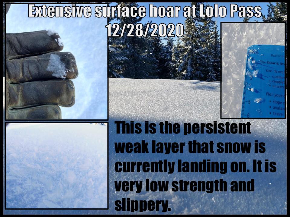
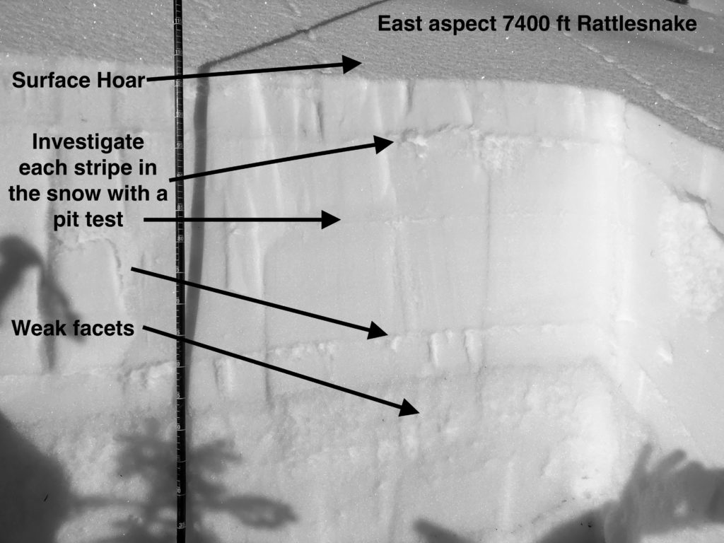
New snow and wind slab are falling on extensive surface hoar and near surface facets that developed during the high pressure over the weekend. These are very weak, slippery layers that will become more reactive with increased load and may slide on lower angle slopes than other problem layers. They have the potential to propagate long distances and the potential size of avalanches will increase with further loading and consolidation. Remotely triggered avalanches are possible.

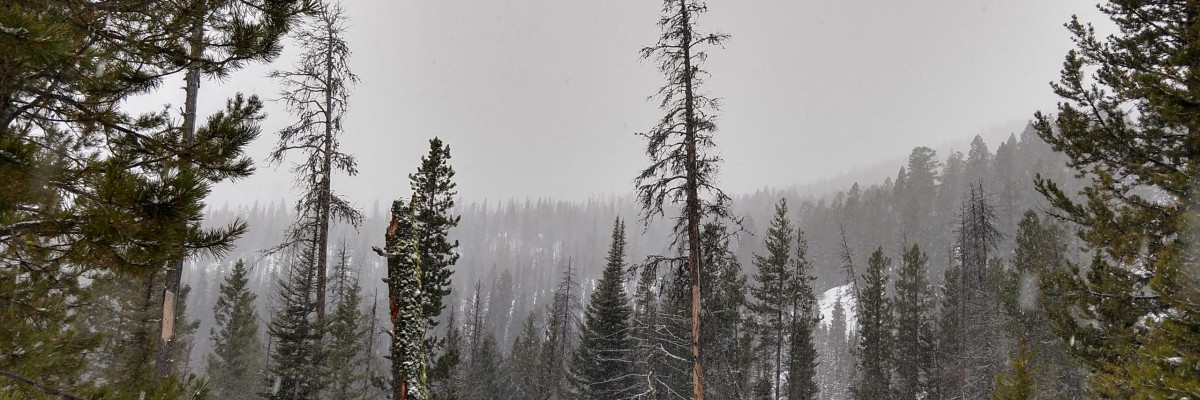
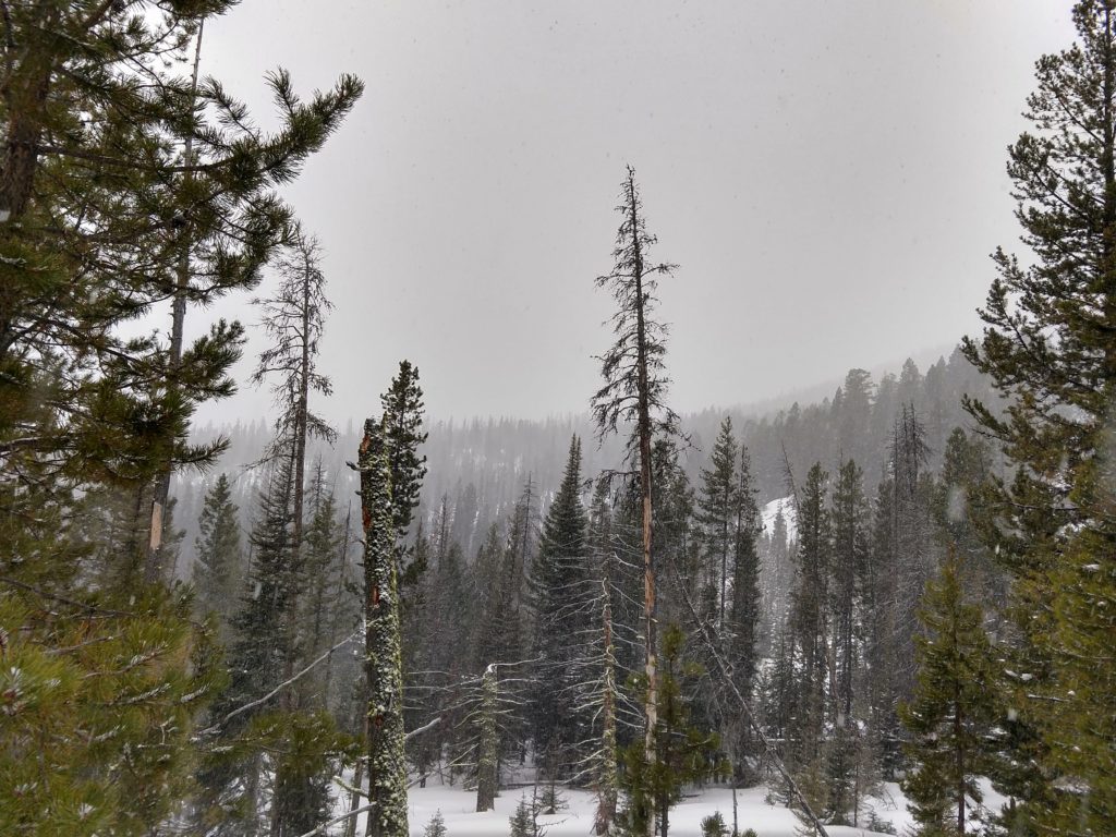
The underlying snowpack is varied throughout the forecast area. Deeper areas have better bonding and instabilities are isolated to the new snow/old snow interface. The central Bitterroot has been the most stable zone in the past week.

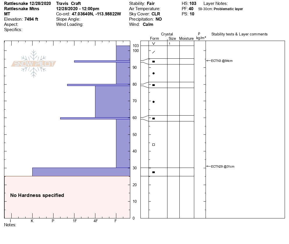
In shallow areas, generally under 5 feet in depth, the snowpack structure is still poor. Facets and crust combinations are propagating in stability tests. These are becoming a low likelihood high consequence problem as persistent weak layers get buried deeper. However, wind slab or storm slab avalanches may be able to trigger avalanches on these deeper layers.

Lolo Pass had two concerning faceted layers Monday, 8” and 31” deep, that are currently being buried deeper. These exist on multiple aspects.

A natural avalanche was reported in the Swans Monday. This area had extensive faceting before Christmas and tests on Pyramid Peak were failing on buried facets. This area received the most snow in the past 24 hours and has the highest hazard.

The southern Bitterroots, outside of Lost Trail has also had a shallower, faceted snowpack. 

Bottom Line

Extensive surface hoar is being loaded by new snow and wind creating dangerous avalanche conditions. The size and likelihood of potential avalanches will increase throughout the day with further loading. In some areas, storm and wind slab have the potential to trigger deeper avalanches. Stay on slopes under 30º, avoid traveling under avalanche slopes. Travel one at a time in avalanche terrain, carry a beacon, shovel, and probe. Re-assess conditions throughout the day and stay alert for signs of instability. Look for red flags.

Public Observations

Thank you to everyone who has taken the time to send in a public observation. Please keep sharing what you find and see while out in the backcountry. This is a great resource to glean information about current conditions. Here is the link to Public Observations.

Ski and ride safe.


READ FULL ADVISORY  

Problem 1 - Wind Slab

  • TYPE

    wind-slabs

    Wind Slabs

    Release of a cohesive layer of snow (a slab) formed by the wind.  Wind typically erodes snow from the upwind sides of terrain features and deposits snow on the downwind side.  Wind slabs are often smooth and rounded and sometimes sound hollow, and can range from soft to hard. Wind slabs that form over a persistent weak layer (surface hoar, depth hoar, or near-surface facets) may be termed Persistent Slabs or may develop into Persistent Slabs.

  • SIZE

    3-4

    1-2 (Small-Large)

    The potential size of avalanche resulting from this problem.

  • LIKELIHOOD

    Likelihood-5

    Likely

    The likelihood of an avalanche resulting from this problem.

  • ADDED DANGER

    Increased Slope Danger

    Increased/Added Danger

    There is an increased risk of avalanches on these slopes:

    N - North
    NE - Northeast
    E - East
    SE - Southeast

Moderate to strong winds are loading upper elevation slopes and creating dangerous windslab.

This windslab is being deposited on surface hoar and near surface facets.

Potential exists of remotely triggered avalanches and for avalanches to run on lower angle slopes than normally encountered.

Avoid wind loaded slopes over 30º, stay out from under steep slopes as avalanches may be triggered from below.

Problem 2 - Persistent Slab

  • TYPE

    persistent-slabs

    Persistent Slabs

    Release of a cohesive layer of soft to hard snow (a slab) in the middle to upper snowpack, when the bond to an underlying persistent weak layer breaks.  Persistent layers include: surface hoar, depth hoar, near-surface facets, or faceted snow. Persistent weak layers can continue to produce avalanches for days, weeks or even months, making them especially dangerous and tricky. As additional snow and wind events build a thicker slab on top of the persistent weak layer, this avalanche problem may develop into a Persistent, Deep-Slab.

  • SIZE

    3-4

    1-2 (Small-Large)

    The potential size of avalanche resulting from this problem.

  • LIKELIHOOD

    Likelihood-4

    Possible/Likely

    The likelihood of an avalanche resulting from this problem.

  • ADDED DANGER

    Increased Slope Danger

    Increased/Added Danger

    There is an increased risk of avalanches on these slopes:

    N - North
    NE - Northeast
    E - East
    SE - Southeast
    S - South
    SW - Southwest
    W - West
    NW - Northwest

Two persistent problems exist:

  • Surface hoar under the new snow
  • Deeper facet/crust layers

The surface hoar is of greatest concern where it underlies windslab. As new snow accumulates the risk from this layer will increase in non-windloaded areas.

The southern Missions received up to 14″ of snow in the past 24 hours and storm slab avalanches failing on the surface hoar are a greater concern in this area.

Deeper faceted layers, concentrated around crusts, can be found throughout the forecast area. Shallower snowpacks are more suspect. In some places, persistent slabs are up to 40″ thick and becoming low likelihood, high consequence problems. In other areas problem layers in the upper foot of snowpack are being loaded by the current snow.

The best way to deal with these layers is to stay on slopes under 30º and avoid traveling under avalanche slopes. With snow in the forecast through the weekend loading of these layers and the likelihood of avalanches will increase.


Problem 3 - Storm slab

  • TYPE

    storm-slabs

    Storm Slabs

    Release of a soft cohesive layer (a slab) of new snow which breaks within the storm snow or on the old snow surface. Storm-slab problems typically last between a few hours and few days. Storm-slabs that form over a persistent weak layer (surface hoar, depth hoar, or near-surface facets) may be termed Persistent Slabs or may develop into Persistent Slabs.

  • SIZE

    3-4

    1-2 (Small-Large)

    The potential size of avalanche resulting from this problem.

  • LIKELIHOOD

    Likelihood-4

    Possible/Likely

    The likelihood of an avalanche resulting from this problem.

  • ADDED DANGER

    Increased Slope Danger

    Increased/Added Danger

    There is an increased risk of avalanches on these slopes:

    N - North
    NE - Northeast
    E - East
    SE - Southeast
    S - South
    SW - Southwest
    W - West
    NW - Northwest

Avalanches within the new snow are tied with the persistent slab as they overlie surface hoar.

Depth, size, and likelihood of storm slab avalanches will increase with continued load.

Areas with higher snowfall amounts, such as the southern Missions have a higher risk from storm slab currently.

Smaller storm slab avalanches are possible throughout the forecast area. Terrain traps will increase the consequences of any slide.

Avoid slopes over 30º and convexities.


VIDEO

FORECAST & OUTLOOK

Snowfall will increase again this morning as a secondary upper level disturbance moves into western Montana. The heaviest accumulations still favor the southern Mission and northern Bitterroot mountains. Snow will linger on mountain terrain tonight but with diminished intensity. Abundant moisture streaming across the area will lead to a relatively heavy mountain snowfall event over the weekend, especially on Sunday. Southwesterly ridge top winds could exceed 50 mph Sunday. An active weather pattern will continue into next week.

This information is the sole responsibility of the Forest Service and does not apply to operating ski areas. The avalanche danger rating expires at midnight tonight but the information can help you make a more informed decision regarding travel in avalanche terrain for the next few days.

Our advisory area includes National Forest System lands in the Bitterroot Mountains from Lost Trail Pass north to Granite Pass, the Rattlesnake Mountains north of Missoula and the Southern Swan and Mission Mountains near Seeley Lake, MT. Avalanche information for the Lookout Pass/St. Regis Basin area is available from the Idaho Panhandle Avalanche Center.