Posted:
Jan 12, 2021 @ 7:01 pm

An avalanche warning has been issued for the southern Mission, southern Swan, Rattlesnake, and southern and central Bitterroot mountains. The avalanche danger for the west central Montana backcountry is HIGH. The avalanche hazard is increasing with continued snowfall, rising temperatures, wind, and rain. Human triggered avalanches are certain. Avalanches may run long distances.  Travel in avalanche terrain is not recommended. This avalanche warning is valid for 24 hours. The avalanche warning will either be extended or terminated at 7:00 pm on January 13, 2021. This danger rating does not apply to operating ski areas and is the sole responsibility of the U.S. Forest Service.

Continued snow and wind will accompany rising temperatures with freezing levels climbing up to 8000′ and rain to 7000′ by Wednesday morning.  Up to 3” of SWE is expected by tomorrow night. Avalanche hazard will increase with the storm. Of particular concern is the effect of warm temps, heavy snow, and rain on mid-elevations where the snowpack has the worst structure. Wind slab will be growing. Widespread surface hoar under the new snow is an issue. Natural avalanches are likely, human triggered avalanches are certain.

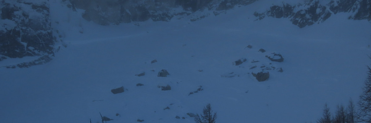
Variable is the best way to describe the snowpack throughout the forecast area. Minutely variable. Wide-ranging conditions can be found in very close proximity making stability assessments challenging. Yesterday at Gash Point the 6’ deep snowpack at 7300’ on the north aspect was well consolidated with no concerning layers. 500’ lower at 6800’ on the same aspect the snowpack was 3’ deep, comprised entirely of facets. It has truly terrible structure that cannot be trusted. Shallow mid-elevation and wind-scoured areas have similar faceting throughout the forecast area.

In the southern Missions yesterday, a small human triggered avalanche ran on buried surface hoar. A similar problem exists throughout the forecast area.

The north aspect of Mt. Fuji over the weekend was showing increased strength and consolidation, while the south face has developed depth hoar and failing in tests.

In the southern Bitterroot yesterday, small wind slabs were touchy, and faceted layers remain a concern.

The Rattlesnake may have the shallowest snowpack in the area and as a result the worst structure. Some spots are touchier than others but the whole zone requires caution. Staying under 30º is wise.

Throughout the forecast area there was widespread surface hoar prior to this storm.

Heavy snow and wind are rapidly loading all of these layers and problems. Warm temperatures are loosening bonds within the snowpack. Rain may further deteriorate stability.

The Bottom Line

Travel in avalanche terrain is not recommended. Avoid runout zones. You can trigger an avalanche remotely.

This warning will be terminated or extended tomorrow at 7:00 pm.

Ski and ride safe.

READ FULL ADVISORY  

Problem 1 - Storm slab

  • TYPE

    storm-slabs

    Storm Slabs

    Release of a soft cohesive layer (a slab) of new snow which breaks within the storm snow or on the old snow surface. Storm-slab problems typically last between a few hours and few days. Storm-slabs that form over a persistent weak layer (surface hoar, depth hoar, or near-surface facets) may be termed Persistent Slabs or may develop into Persistent Slabs.

  • SIZE

    3-4

    1-2 (Small-Large)

    The potential size of avalanche resulting from this problem.

  • LIKELIHOOD

    Likelihood-8

    Very Likely/Certain

    The likelihood of an avalanche resulting from this problem.

  • ADDED DANGER

    Increased Slope Danger

    Increased/Added Danger

    There is an increased risk of avalanches on these slopes:

    N - North
    NE - Northeast
    E - East
    SE - Southeast
    S - South
    SW - Southwest
    W - West
    NW - Northwest

Heavy snowfall will consolidate quickly into slabs.

The new snow is falling on widespread surface hoar which will increase the likelihood of avalanches.

Problem 2 - Wind Slabs

  • TYPE

    wind-slabs

    Wind Slabs

    Release of a cohesive layer of snow (a slab) formed by the wind.  Wind typically erodes snow from the upwind sides of terrain features and deposits snow on the downwind side.  Wind slabs are often smooth and rounded and sometimes sound hollow, and can range from soft to hard. Wind slabs that form over a persistent weak layer (surface hoar, depth hoar, or near-surface facets) may be termed Persistent Slabs or may develop into Persistent Slabs.

  • SIZE

    3-4

    1-2 (Small-Large)

    The potential size of avalanche resulting from this problem.

  • LIKELIHOOD

    Likelihood-8

    Very Likely/Certain

    The likelihood of an avalanche resulting from this problem.

  • ADDED DANGER

    Increased Slope Danger

    Increased/Added Danger

    There is an increased risk of avalanches on these slopes:

    N - North
    NE - Northeast
    E - East
    SE - Southeast
    NW - Northwest

Strong to extreme winds and are loading leeward slopes.

Windslab has been growing with new snow and wind. These have become a dangerous problem.

Avoid wind loaded and cross-loaded slopes.

Problem 3 - Persistent Slabs

  • TYPE

    persistent-slabs

    Persistent Slabs

    Release of a cohesive layer of soft to hard snow (a slab) in the middle to upper snowpack, when the bond to an underlying persistent weak layer breaks.  Persistent layers include: surface hoar, depth hoar, near-surface facets, or faceted snow. Persistent weak layers can continue to produce avalanches for days, weeks or even months, making them especially dangerous and tricky. As additional snow and wind events build a thicker slab on top of the persistent weak layer, this avalanche problem may develop into a Persistent, Deep-Slab.

  • SIZE

    5-6

    2-3 (Large)

    The potential size of avalanche resulting from this problem.

  • LIKELIHOOD

    Likelihood-5

    Likely

    The likelihood of an avalanche resulting from this problem.

  • ADDED DANGER

    Increased Slope Danger

    Increased/Added Danger

    There is an increased risk of avalanches on these slopes:

    N - North
    NE - Northeast
    E - East
    SE - Southeast
    S - South
    SW - Southwest
    W - West
    NW - Northwest

Faceted layers can be found throughout the forecast area. Shallower snowpacks have worse structure than deeper areas and are more suspect. In some places, persistent slabs are up to 40 inches thick and becoming low likelihood, high consequence problems.

The problem facets tend to be concentrated around crusts. Look for these and soft sugary snow above and below as you assess the snowpack.

In other areas problem layers are in the upper two feet of the snowpack and involve buried surface hoar.

The past week’s surface hoar has now been buried by snow that will consolidate into slabs quickly. These will be touchy and human triggered avalanches are certain.

The extended column test (ECT) and the propagation saw test (PST) are best for assessing the stability of these layers.

All faceted layers are being rapidly loaded. Deeper slabs may pull back onto lower angle slopes adjacent to avalanche terrain.

Stay well away from avalanche terrain

Problem 4 - Wet Snow

  • TYPE

    wet-slabs

    Wet Slabs

    Release of a cohesive layer of snow (a slab) that is generally moist or wet when the flow of liquid water weakens the bond between the slab and the surface below (snow or ground). They often occur during prolonged warming events and/or rain-on-snow events. Wet slabs can be very destructive.

  • SIZE

    3-4

    1-2 (Small-Large)

    The potential size of avalanche resulting from this problem.

  • LIKELIHOOD

    Likelihood-6

    Likely/Very Likely

    The likelihood of an avalanche resulting from this problem.

  • ADDED DANGER

    Increased Slope Danger

    Increased/Added Danger

    There is an increased risk of avalanches on these slopes:

    N - North
    NE - Northeast
    E - East
    SE - Southeast
    S - South
    SW - Southwest
    W - West
    NW - Northwest

Rising temperatures and potential rain make wet avalanche problems possible at elevations up to 8000′

Just how warm and wet it will get is hard to predict, but any rain on snow is bad for avalanche conditions. Instabilities could range from roller balls to wet slabs.

Above freezing temperatures will loosen bonds within the snowpack and free water can lubricate layers. Wet snow problems are difficult to predict and standard snowpack tests are not effective in their assessment.

Mid elevations are where we have the worst snowpack structure, and the potential for larger persistent slab avalanches, compounding the issue.

As temperatures rise and if rain falls, be very cautious of any slopes over or close to 30º.  Stay well away from the runout zone of avalanche paths.

Rising overnight temperatures could affect elevations to 8000′. Wednesday morning will have the highest hazard of wet slides.

FORECAST & OUTLOOK

While steady precipitation is expected, two periods of heavy rain and snow are expected to impact the area over the next 24 hours. The snow level is still expected to rise throughout the day, approaching 7000 and perhaps even 8000 feet for a short time early Wednesday. Liquid amounts of 1.00-2.00 inches are possible in the Bitterroot Mountains, and 0.50-1.00 inch possible in the Swan Range by Thursday morning. Localized amounts of near 3 inches may be possible along the Idaho/Montana border. Blizzard conditions will impact mountain locations Wednesday morning with the arrival of the cold front. Wind gusts in excess of 60 mph will be possible along with heavy snowfall.

This information is the sole responsibility of the Forest Service and does not apply to operating ski areas. The avalanche danger rating expires at midnight tonight but the information can help you make a more informed decision regarding travel in avalanche terrain for the next few days.

Our advisory area includes National Forest System lands in the Bitterroot Mountains from Lost Trail Pass north to Granite Pass, the Rattlesnake Mountains north of Missoula and the Southern Swan and Mission Mountains near Seeley Lake, MT. Avalanche information for the Lookout Pass/St. Regis Basin area is available from the Idaho Panhandle Avalanche Center.