December 8, 2012 Avalanche Information Update
Weather and Snowpack
Recent weather dumped abundant snow in the west central Montana mountains. SNOTEL sites above 7000 feet report an average of 48″ with Hoodoo showing 59″, Saddle Mountain 51″, Stuart Pk. 45″ and Lolo and Lookout passes at 32″ each. This newest snow came in moist which results in most mountain locations above 6500 feet starting out with a solid base and no faceted weak layers. Missoula Weather Service is again forecasting heavy snow Sunday and Monday.
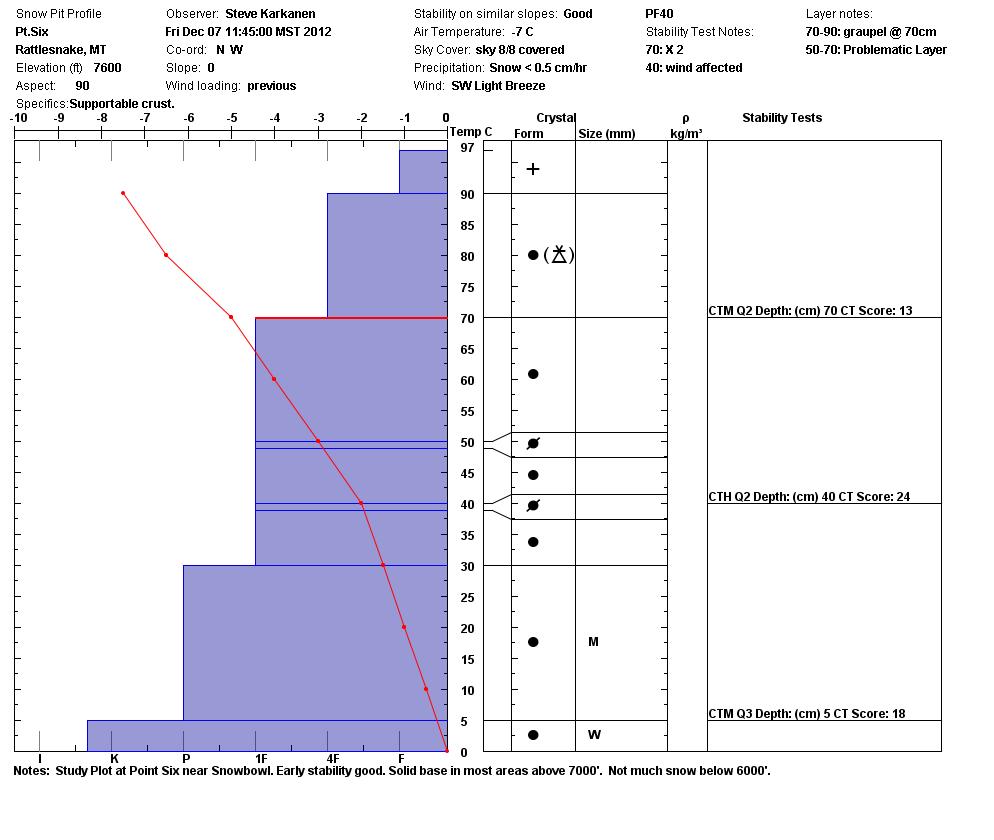
We’ve received many good reports from the Hoodoo Pass area this week. The avalanche specialists toured into the Rattlesnake Wilderness Friday after setting up the Beacon Park at the top of Montana Snowbowl.
We found a mostly stable snowpack that skied well for the first week of December. There are some considerations that need to find their way into your decision making if you plan to leave ski area boundaries or ride a heavy sled on steep open terrain.
All the pits and stability tests indicate mostly stable snow but we did experience minor sluffing on the steepest slope angles involving the new storm snow. These sluffs will be bigger today after last nights heavy snow. Another consideration is that in some areas the snow of the past week or two has not had time to strongly bond to the old early season snow that was exposed to warm temperatures and rain in many locations. On an east aspect at 7700 feet I was able to get a 25″ slab to propagate consistently on the rain crust about a foot from the ground. The extended column test score is ECTP18 Q1. You can view these profiles on our photo gallery.
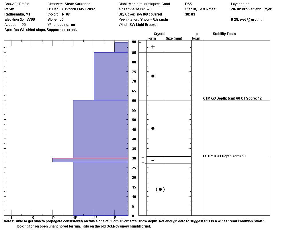
This alone should make you want to think pretty hard about how steep and how big a line you want to ride. The good thing about this is that most areas don’t yet have enough snow to cover terrain features and vegetation that anchor snow to steep slopes. If you are unsure about a slopes stability, dig a quick pit or find less steep or exposed terrain.
The main snow safety concerns during the next few days will be storm snow, development of wind slabs, cornice collapse and thin snow conditions as you lose elevation. Remember most avalanches happen during and immediately after storms. We saw evidence of the potential for this yesterday and received a report from the Hoodoo area of a natural cornice fall that triggered a loose snow avalanche. We also heard of someone dropping off the edge while kicking cornices in the same area last week. Cornices can be an excellent device to test a slopes stability but they have this nasty habit of breaking further back than you might expect.
Early Season Considerations
Now that the ski areas are open and conditions are good for backcountry travel, please keep your safety and the safety of others you may encounter in the backcountry. More people are leaving ski area boundaries for fresh tracks many of whom clueless to the danger they present to themselves, other parties or their rescuers. Side-country is backcountry. No exceptions! You must be prepared to deal with avalanche conditions, survival and rescue on your own.
Always carry an avalanche transceiver, probe pole and shovel. Go with partners that you know and can deal with an emergency and if you ski or ride on slopes steep enough to slide, do it one at a time.
We begin the regular Friday/Tuesday advisory program December 21 and will post updates as conditions change. We are not issuing avalanche danger ratings until we start getting consistent data from our partners and observers in the Bitterroot Mountains and near Seeley Lake.


