Missoula Avalanche
  • Forecasts
    • Current Forecast
    • Forecast Archive
    • Forecast Mailing List
    • National Map
  • Observations
    • Recent Observations
    • Submit Observation
  • Education
    • All Education Events
    • Education Information
  • Resources
    • Weather Stations
    • Avalanche Links
    • Accidents & Reports
    • Photo Archive
    • Snow Profiles
    •   Avalanche Terms
    •   Weather Forecast
  • Blog
  • Donate

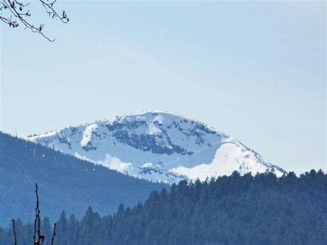
Lolo Peak Avalanche – April 16, 2010

 Missoula Avalanche Photo Gallery
Large slab avalanche on the false peak (Mormon Ridge) of Lolo Peak. Photo taken on April 16, 2010 by Dale Dufor from the bridge across Lolo Creek at Travelers Rest State Park.

Supporters

Gull Ski & Snowboard Image
LB Snow Image
On X Maps Image
The TrailHead Image
Gull Boats & RV Image
Krispy Kreme Image
Board of Missoula Image

Resources

  • Public Observations
  • Avalanche Links
  • Accidents & Reports
  • Photo Gallery
  • Snow Profiles
  • Avalanche Terms
  • Weather Forecast

About

  • Mission & Structure
  • Board of Directors
  • Program Staff
  • Beacon Training Parks
  • Contact Us

Support

  • Advertising & Sponsorship
  • Make A Donation
West Central Montana Avalanche Foundation - Missoula Avalanche

© 2022 MissoulaAvalanche.org  |  Contact Us

Advisories, News & Updates

Forest Service Logo

The West Central Montana Avalanche Center is hosted on the Lolo National Forest with support from the Bitterroot and Clearwater National Forests. The advisory content is the sole responsibility of the Forest Service and does not apply to operating ski areas. Avalanche specialists can be contacted by email.

Pro Login