Missoula Avalanche
  • Forecasts
    • Current Forecast
    • Forecast Archive
    • Forecast Mailing List
    • National Map
  • Observations
    • Recent Observations
    • 2022 Obs before 12/10
    • Submit Observation
  • Education
    • All Education Events
    • Education Information
  • Resources
    • Weather Stations
    • Avalanche Links
    • Accidents & Reports
    • Photo Archive
    • Snow Profiles
    •   Avalanche Terms
    •   Weather Forecast
  • Blog
  • Donate

Mount Jumbo Avalanche – February 28, 2014

 Missoula Avalanche Photo Gallery
Goggle Earth screen shot. Red lines approximate the crown and track.
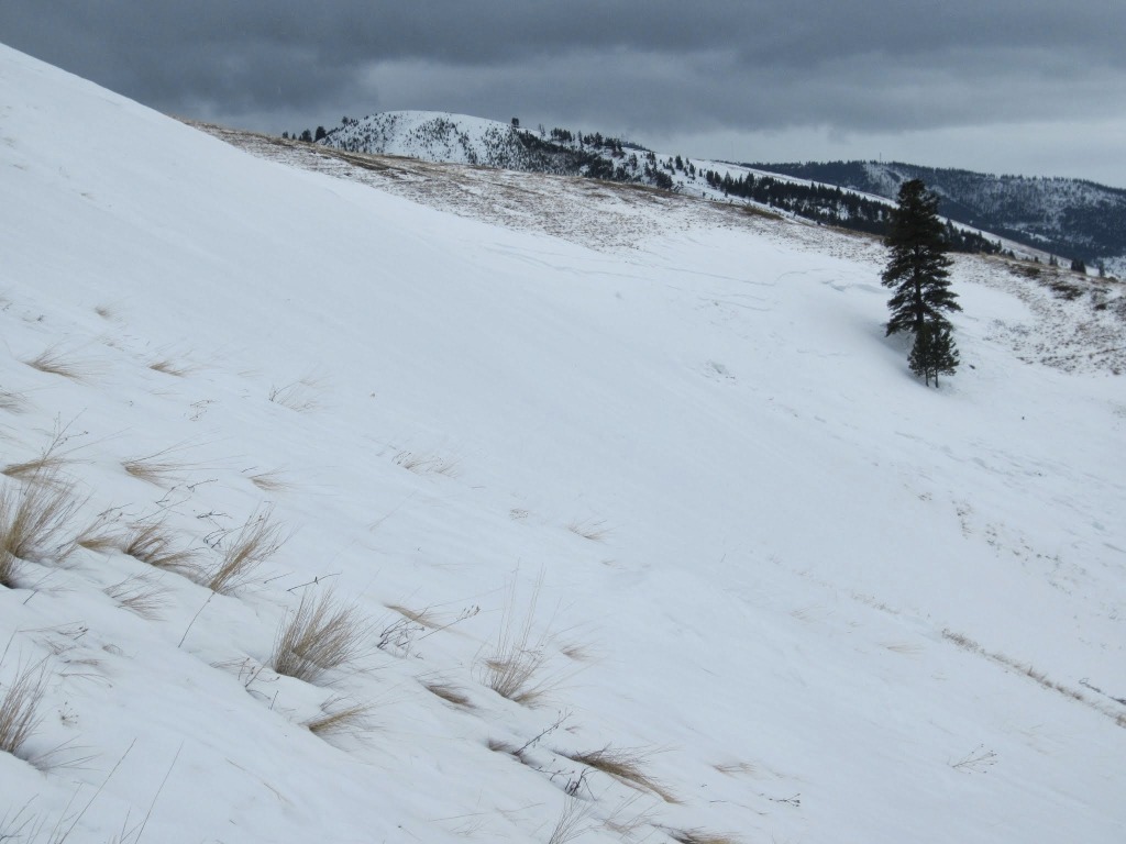
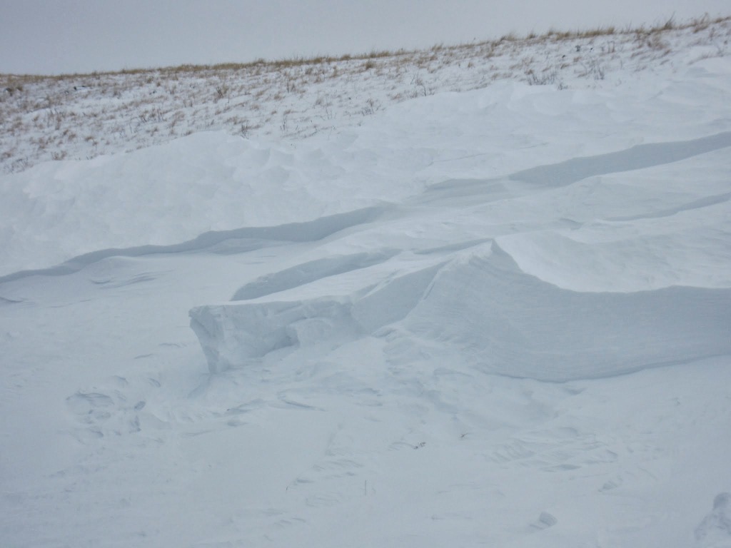
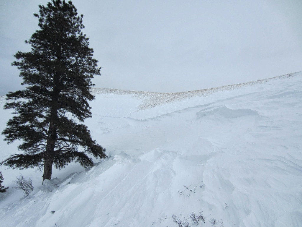
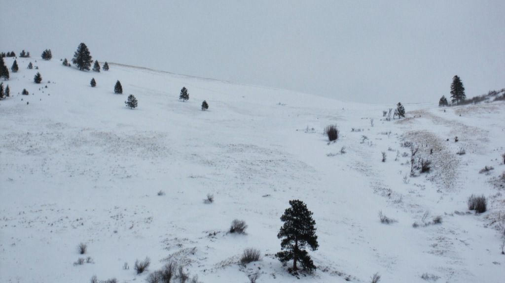
Crown on March 2. High winds and snow had covered much of the area. The crown ran from a point just below the photo point to the trees on the next ridgeline. Measured approximately 700' across.
Looking south across the starting zone.
Jumbo Avalanche Crown
IMG_0010_2
IMG_0010_2
Dudley Improta gathering data from the crown on March 2. Looking into the Rattlesnake Valley neighborhood.
Start zone and track.
Deposition area from the foundation of the destroyed home.
Toe or terminus of avalanche debris at the intersection of Holly and Van Buren streets.
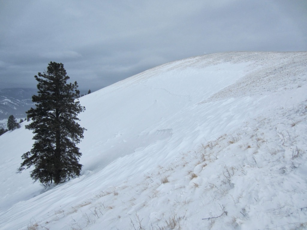
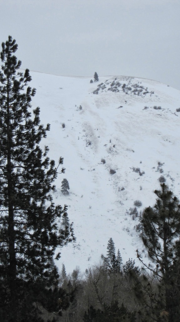
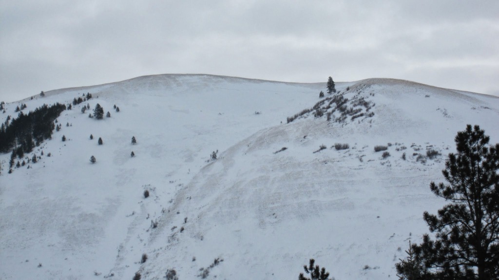
The crown extends from the tall tree on the ridgeline in the upper right quadrant to the smaller trees to the right of the tall tree in the upper left quadrant of the photo.
View of fetch zone and crown.
Mount Jumbo from across Rattlesnake Valley on March 5, 2014. Slide path is in the lower right quadrant of the photo.
Rescue workers and neighbors attempting to free Fred Allendorf from his destroyed home.
Crown profile from the site on March 2.

Supporters

Gull Boats & RV Image
Krispy Kreme Image
Board of Missoula Image
The TrailHead Image
CalTopo Image
On X Maps Image
Russell Motorsports Image
Gull Ski & Snowboard Image
LB Snow Image

Resources

  • Observations
  • Avalanche Links
  • Accidents & Reports
  • Photo Gallery
  • Snow Profiles
  • Avalanche Terms
  • Weather Forecast

About

  • Mission, Vision & Commitment
  • Board of Directors
  • Staff
  • Beacon Training Parks
  • Contact Us

Support

  • Advertising & Sponsorship
  • Donate
West Central Montana Avalanche Foundation - Missoula Avalanche

© 2023 MissoulaAvalanche.org  |  Contact Us

Subscribe: Forecasts, News, Events

Forest Service Logo

This West Central Montana Avalanche Foundation is a 501(c)(3) nonprofit organization, an equal opportunity employer, and a special use permittee of the Bitterroot, Nez Perce-Clearwater, and Lolo National Forests. Avalanche information is provided through the U.S.D.A. Forest Service and describes general backcountry avalanche hazards and conditions. It does not apply to ski areas and highways where avalanche mitigation occurs.

Pro Login