Missoula Avalanche
  • Forecasts
    • Current Forecast
    • Forecast Archive
    • Forecast Mailing List
    • National Map
  • Observations
    • Recent Observations
    • 2022 Obs before 12/10
    • Submit Observation
  • Education
    • All Education Events
    • Education Information
  • Resources
    • Weather Stations
    • Avalanche Links
    • Accidents & Reports
    • Photo Archive
    • Snow Profiles
    •   Avalanche Terms
    •   Weather Forecast
  • Blog
  • Donate

Redlion Area Avalanche – January 01, 2012

 Missoula Avalanche Photo Gallery
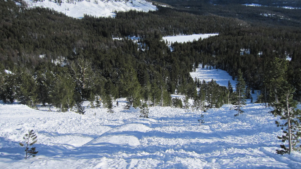
View of avalanche from near terminus of the historic avalanche path. The toe of this avalanche is located within the trees at lower-mid-center of picture.
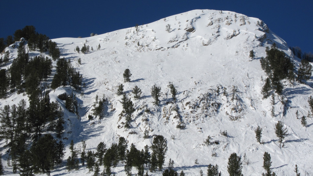
Looking at crown. 1 rider was caught in middle of path below rock band, knocked off his sled and uninjured - partially buried. 2nd rider was caught in the area at extreme lower right corner of picture.
Rider was carried approximately 150' through trees at mid-left and ended up against a small tree where the person w/yellow jacket stands.
West side of Point Six below the access road.
Looking up area adjacent to avalanche. SAR personnel believe this area slid on January 2.
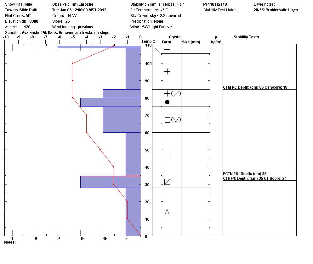
Pit profile from January 3, 2012, 2 days after the accident. Shows a mostly faceted base layer with a stronger slab above it. Profile is adjacent to area where rider was caught.

Supporters

On X Maps Image
Russell Motorsports Image
Board of Missoula Image
CalTopo Image
Krispy Kreme Image
LB Snow Image
Gull Ski & Snowboard Image
The TrailHead Image
Gull Boats & RV Image

Resources

  • Observations
  • Avalanche Links
  • Accidents & Reports
  • Photo Gallery
  • Snow Profiles
  • Avalanche Terms
  • Weather Forecast

About

  • Mission, Vision & Commitment
  • Board of Directors
  • Staff
  • Beacon Training Parks
  • Contact Us

Support

  • Advertising & Sponsorship
  • Donate
West Central Montana Avalanche Foundation - Missoula Avalanche

© 2023 MissoulaAvalanche.org  |  Contact Us

Subscribe: Forecasts, News, Events

Forest Service Logo

This West Central Montana Avalanche Foundation is a 501(c)(3) nonprofit organization, an equal opportunity employer, and a special use permittee of the Bitterroot, Nez Perce-Clearwater, and Lolo National Forests. Avalanche information is provided through the U.S.D.A. Forest Service and describes general backcountry avalanche hazards and conditions. It does not apply to ski areas and highways where avalanche mitigation occurs.

Pro Login