Observation Date: 02/21/2021
Route/Location:
Various locations around LT
Weather:
Saturday was colder but sunnier than Sunday. Sun popped out long enough to affect Western slopes in PM. Saw roller balls on steeper west facing slopes. Winds were light and westerly on Saturday below treeline and moderate gusting strong on Sunday at ridgetops. Lots of wind loading and touchy wind slabs. Temperatures were warming a bit on Sunday still in the mid 20s.
Wind:
Winds were moderate gusting strong from the W. Localized winds had alot of directional variability
New Snow: 3-6″
Avalanche Activity:
able to trigger small D1 windslabs on east facing slope.
Other Comments:
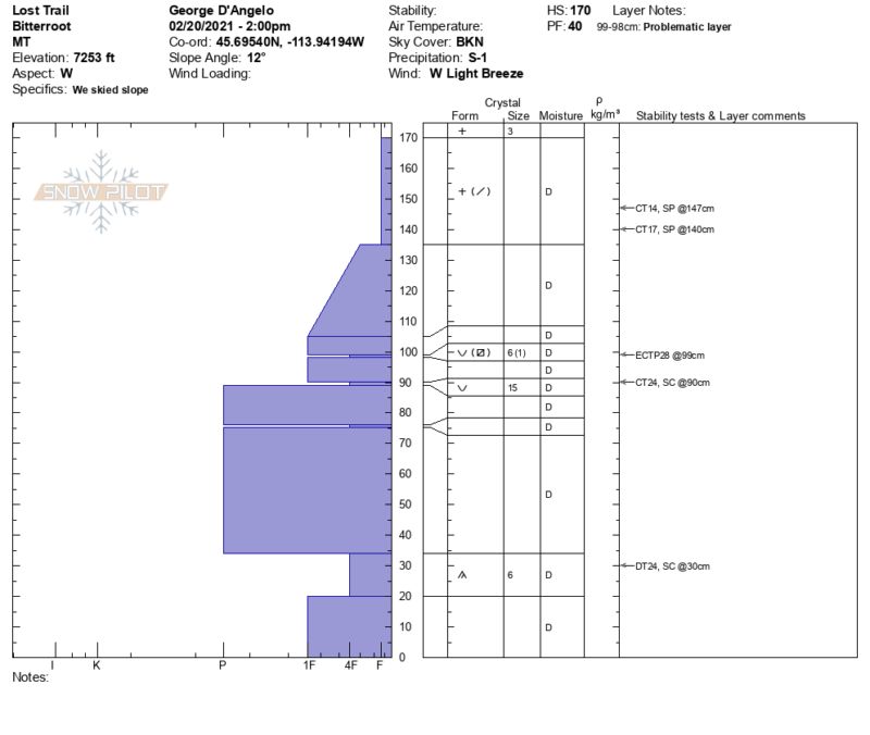
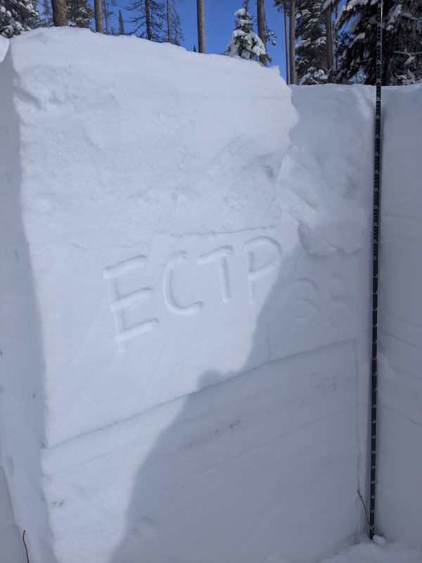
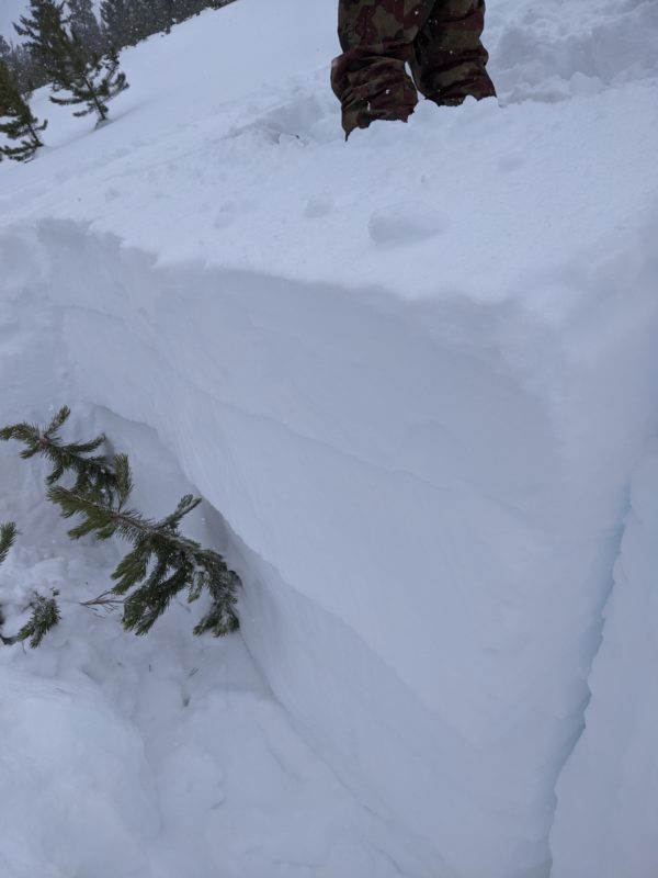
We dug a number of pits in between 7000-8000′ this weekend. We found snow depths from 140cm to 250cm (wind loaded location). A relatively rightside up snowpack sits on a very weak base near the ground of Depth Hoar. The new snow is showing near surface instabilities around 20-40cm down. In most places there is not a cohesive slab yet but on windloaded slopes the slab was cohesive enough to propagate a fracture (ECTP28) on a north facing slope near ~8000′. The mid pack has several buried surface hoar layers from 65-90cm deep that showed sudden fracture character and propagation in our west facing location @ 7300′. The bottom of the snowpack is very weak and could create large avalanches if triggered in shallower areas or by smaller avalanches stepping down. Recent large avalanches have ran on this deep layer in the Southern Bitterroots. With more snow and warmer temps Monday, I would expect near surface windslabs and stormslabs to get more touchy as well as an increased likelihood of triggering a deeper weak layer over the next 24-48 hours.
Observer: George D’Angelo