Observation Date: 01/03/2020
Route/Location:
Traveled up the southern Bitterroot face to 8100′.
Weather:
partly cloudy, very windy
Wind:
Strong erratic winds. Lots of snow moving around. However, the winds were so strong, most snow was not being deposited in starting zones, but instead was forming drifts on the lower slopes.
New Snow: 12+”
Avalanche Activity:
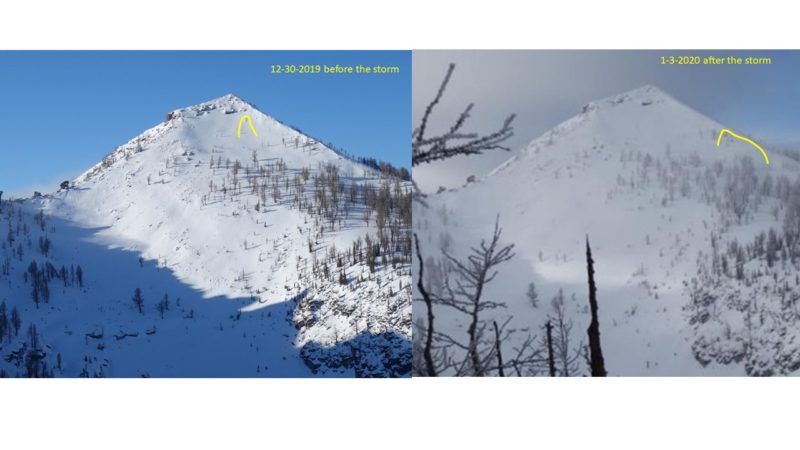
Surprisingly, saw only 1 crown about 75 feet wide of unknown depth. See discussion and photo below.
Other Comments:
What a storm! On the southern Bitterroot front, it was all rain below 4700’ (more than 1”), but more than 2 feet of dense, new snow above 5600’. The before and after photos below show E through SE aspects with crowns drawn in. It’s surprising that more avalanches were not visible after the storm, but wind and snow might have filled in the early crowns, or maybe the abundant talus visible in the “before” photo provided enough anchors within the weak, old snow. Or maybe these slopes are not quite ready- I’m not going to trust them. There was also a density inversion about a foot down in the new snow that cracked and sheared easily, probably resulting from the recent strong winds. That is likely to stabilize more quickly than the buried weak layers in the old snow. Its hard to see in the fuzzy “after” photo, but the slopes are full of wind rows/drifts.
Observer: J Lonn