Posted:
Dec 15, 2015 @ 6:35 am

The avalanche danger is rated Moderate in the west central Montana backcountry above 7000 feet. Human-triggered avalanches are possible. Evaluate snow and terrain carefully. Heightened avalanche conditions for some specific terrain.

Good morning, this is Travis Craft with the West Central Montana Avalanche Center’s avalanche advisory for December15, 2015. This danger rating does not apply to operating ski areas, expires at midnight tonight (Dec.15) and is the sole responsibility of the U.S. Forest Service.

Weather and Snowpack Discussion

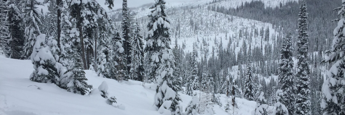
Winds are light out of the northwest in the Bitterroot, Point Six is not reporting this morning.  Mountain temperatures are in the upper teen’s and low twenties.  The advisory area has received varying amounts of snow, 6 inches in the northern portion and 11 inches in the southern portion since Saturday. This last storm cycle has produced different avalanche problems, they are geographically concentrated from north to south.

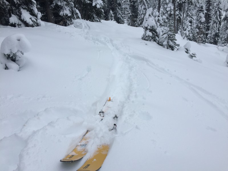
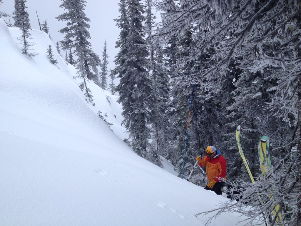
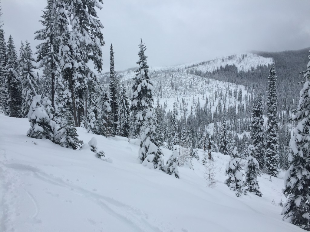
Steve and I toured the Lolo Pass Area yesterday and found a snowpack that was well-bonded with rounding basal facets.(pic2) We have had many public observations from the area which have been very useful in showing that the basal facets are rounding and becoming less reactive.

The main avalanche concern is the wind slabs that formed from the accompanying winds with the last storm cycle. We had plenty of snow to be transported, so be aware of those slabs lurking about.  These wind slabs are located on leeward terrain.  Be looking at ridge lines and be aware of cross loaded slopes too.

The second avalanche problem is that a storm slab has developed throughout the advisory area. This storm slab size varies from 6 inches in the northern range, to 11 inches in the southern range. These slabs should settle out with time and be less sensitive to triggers as the snowpack adjusts to the new load.

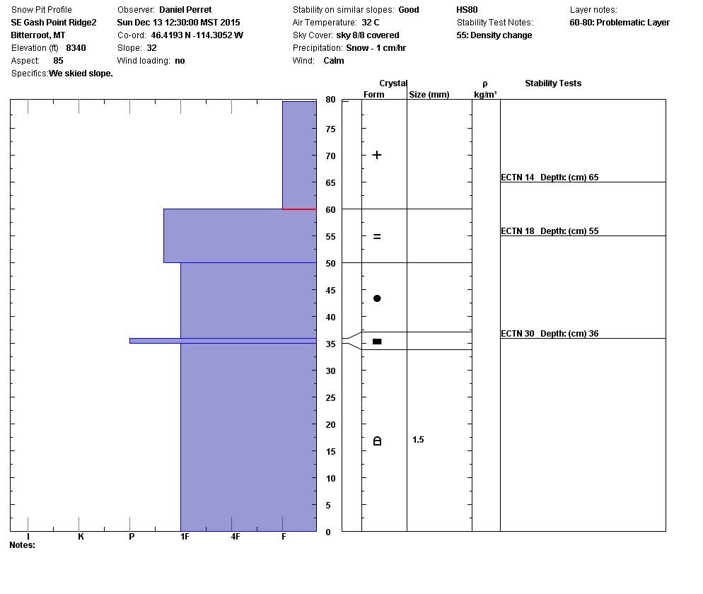
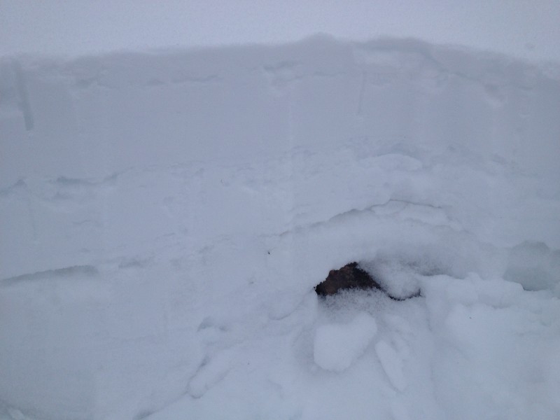
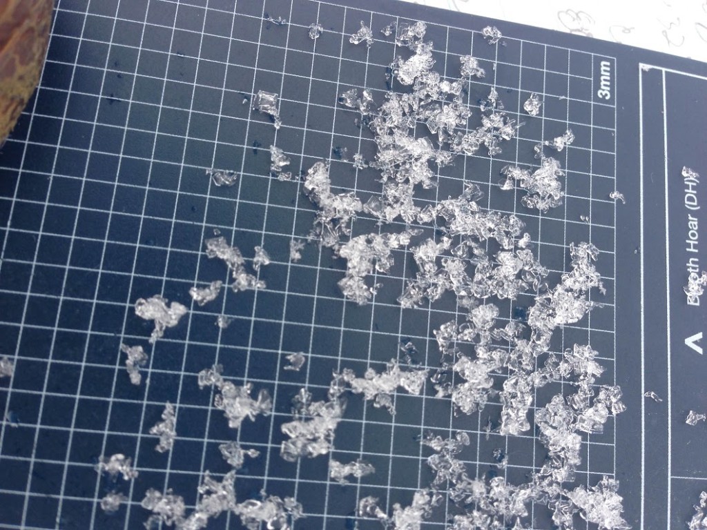
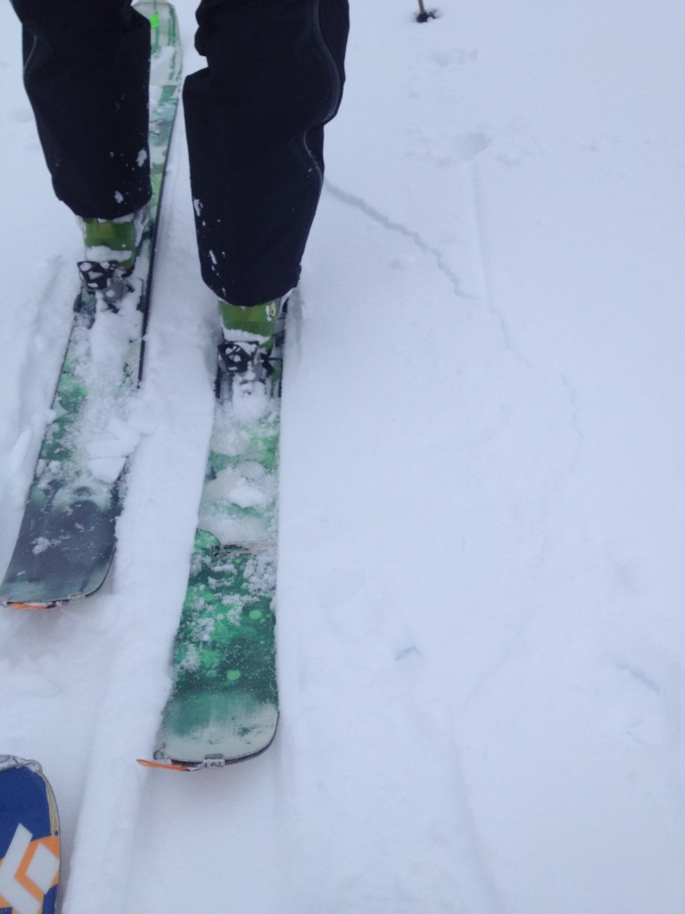
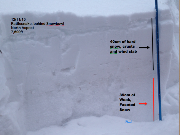
The third avalanche concern is our persistent weak layer of buried facets in the bottom of our snowpack.  This weak layer is currently rounding in lower elevations.(pic1)  It is not as prevalent in the southern area, but still exists in isolated pockets which consist of shallow snowpack or near rocks and outcrops.  The northern area has a shallower snowpack and this weak layer is more prevalent.(pit2) Brian was touring in the Rattlesnake yesterday and was able to get this layer to propagate in some of his tests.(pit2) According to public observations, the weak layer has become less reactive (Gash Point, Snake, Public obs Root ). Five Valley’s Backcountry Ski Patrol also sent in observations showing these same results from the central bitterroot.(pit1)  The best way to find this layer is by digging down into the snowpack and seeing if it is present and reactive in tests.(pic3)  Remember, a stable result in a pit plays a very little part in the avalanche decision making process and an unstable result is the only result one needs for assessment.

Weather and Avalanche Outlook

We are currently between storms.  The next storm is forecasted to hit the area starting later tonight and into Wednesday with a storm total of 5-10 inches in the high country.  I would expect this to increase the avalanche hazard.

Logan King will issue the next advisory on Thursday, December 17. Remember, if you are out send us a public observation. Ski and ride safe.


READ FULL ADVISORY  

Problem 1 - Wind Slabs

  • TYPE

    wind-slabs

    Wind Slabs

    Release of a cohesive layer of snow (a slab) formed by the wind.  Wind typically erodes snow from the upwind sides of terrain features and deposits snow on the downwind side.  Wind slabs are often smooth and rounded and sometimes sound hollow, and can range from soft to hard. Wind slabs that form over a persistent weak layer (surface hoar, depth hoar, or near-surface facets) may be termed Persistent Slabs or may develop into Persistent Slabs.

  • SIZE

    2-3

    1 (Small)

    The potential size of avalanche resulting from this problem.

  • LIKELIHOOD

    Likelihood-3

    Possible

    The likelihood of an avalanche resulting from this problem.

Wind slabs have formed on lee terrain with this last series of storms. Do not forget about cross loaded aspects.

Problem 2 - Storm Slabs

  • TYPE

    storm-slabs

    Storm Slabs

    Release of a soft cohesive layer (a slab) of new snow which breaks within the storm snow or on the old snow surface. Storm-slab problems typically last between a few hours and few days. Storm-slabs that form over a persistent weak layer (surface hoar, depth hoar, or near-surface facets) may be termed Persistent Slabs or may develop into Persistent Slabs.

  • SIZE

    3-4

    1-2 (Small-Large)

    The potential size of avalanche resulting from this problem.

  • LIKELIHOOD

    Likelihood-2

    Unlikely/Possible

    The likelihood of an avalanche resulting from this problem.

  • IMAGE

Storm slabs have formed throughout the advisory area.  The Southern half of the range has received more than 10 inches and the Northern half has received 6 inches of new snow in this last storm cycle.

Problem 3 - Facets

  • TYPE

    persistent-slabs

    Persistent Slabs

    Release of a cohesive layer of soft to hard snow (a slab) in the middle to upper snowpack, when the bond to an underlying persistent weak layer breaks.  Persistent layers include: surface hoar, depth hoar, near-surface facets, or faceted snow. Persistent weak layers can continue to produce avalanches for days, weeks or even months, making them especially dangerous and tricky. As additional snow and wind events build a thicker slab on top of the persistent weak layer, this avalanche problem may develop into a Persistent, Deep-Slab.

  • SIZE

    4-5

    2 (Large)

    The potential size of avalanche resulting from this problem.

  • LIKELIHOOD

    Likelihood-2

    Unlikely/Possible

    The likelihood of an avalanche resulting from this problem.

  • IMAGE

There are basal facets in shallow snowpacks that are reactive. The only way to find these are to dig into the snowpack.  They are not uniformly distributed across the slopes. Look for shallow snowpacks near rocks and other likely trigger points.

FORECAST & OUTLOOK

New loading by Wednesday night.

This information is the sole responsibility of the Forest Service and does not apply to operating ski areas. The avalanche danger rating expires at midnight tonight but the information can help you make a more informed decision regarding travel in avalanche terrain for the next few days.

Our advisory area includes National Forest System lands in the Bitterroot Mountains from Lost Trail Pass north to Granite Pass, the Rattlesnake Mountains north of Missoula and the Southern Swan and Mission Mountains near Seeley Lake, MT. Avalanche information for the Lookout Pass/St. Regis Basin area is available from the Idaho Panhandle Avalanche Center.