Posted:
Feb 9, 2016 @ 6:12 am

Good morning, this is Logan King with the West Central Montana Avalanche Center’s avalanche advisory for Tuesday February 9th, 2016.

The current avalanche danger for the west central Montana backcountry is LOW. Avalanches may be triggered in isolated areas or extreme terrain specifically as solar radiation peaks in the afternoon. This danger rating does not apply to operating ski areas, expires at midnight tonight and is the sole responsibility of the U.S. Forest Service.

Weather and Snowpack

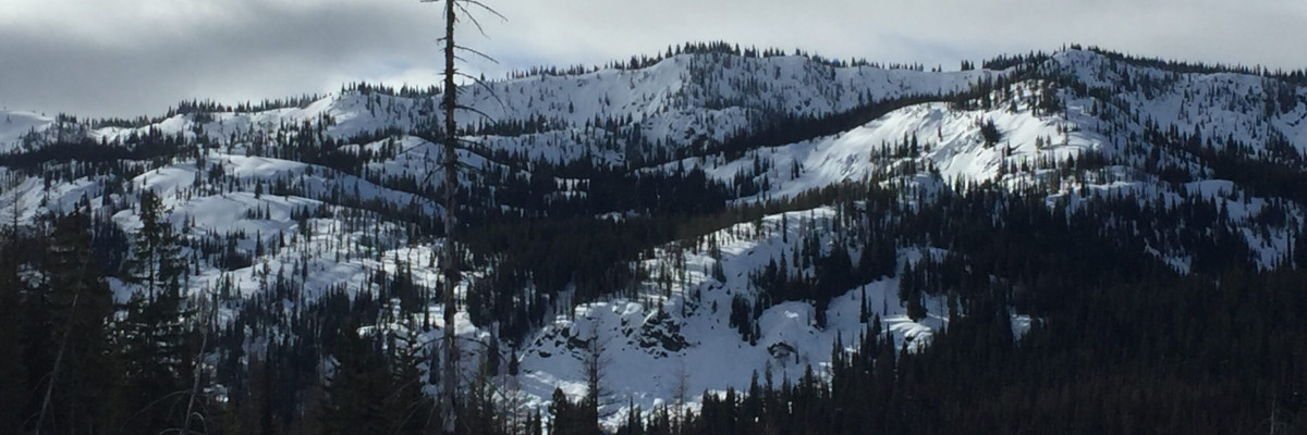
A ridge of high pressure has set up over the advisory area bringing warm day time temperatures. The mild temps have further settled and strengthened the snowpack. Overnight temperatures in the mountains have dropped and are 24-32 degrees across the advisory area. No new snow has accumulated and winds are currently calm at 9mph gusting to 13mph from the South West.

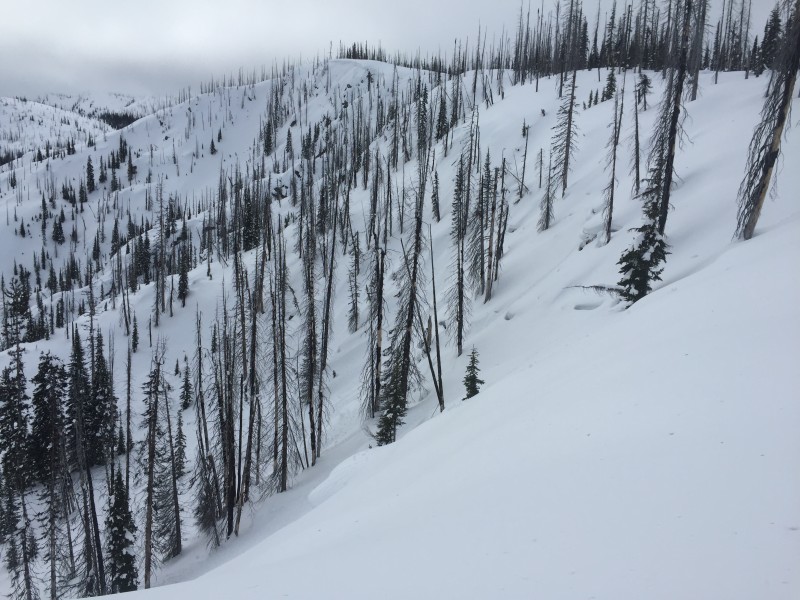
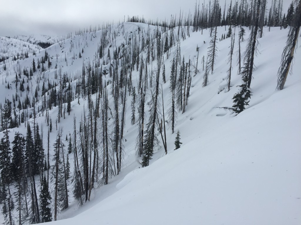
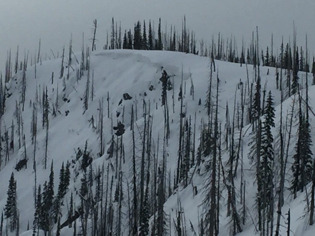
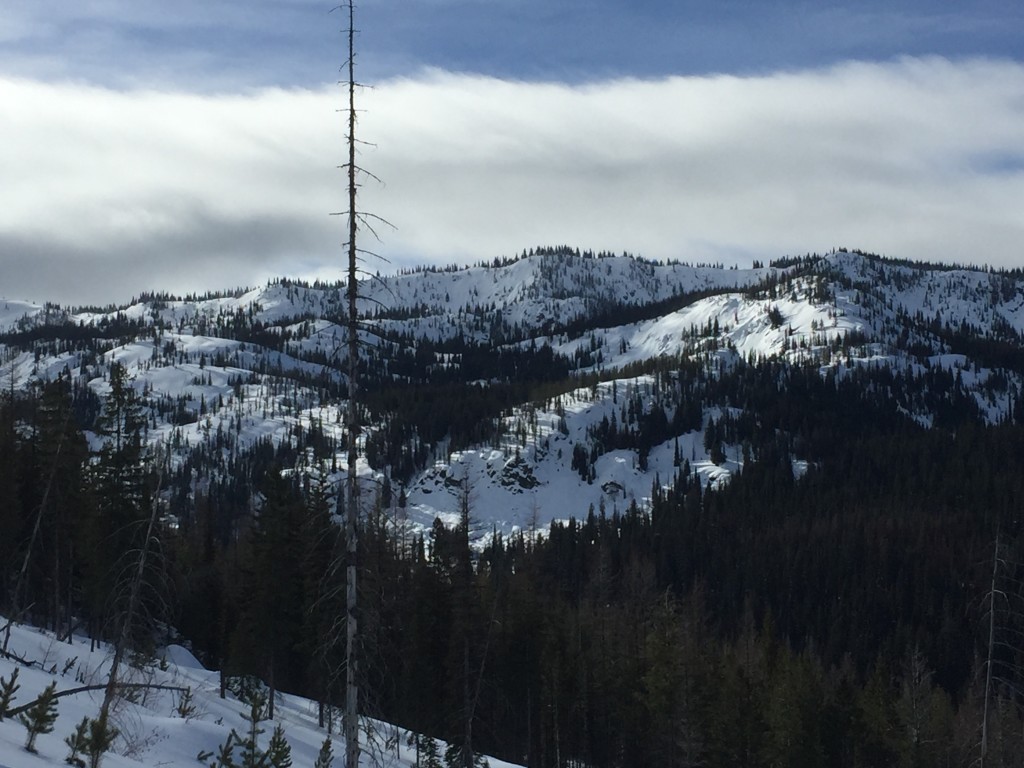
Tim and I rode into the Brushy Fork yesterday and found the snow surface to be warm and wet. Multiple wet point releases were seen on the majority of steep terrain. We also saw rollerballs throughout the day on all aspects. Temperatures will be warm again today and there will likely be significant solar radiation as well, this will lead to more loose snow avalanches. Be aware of the risks of these slides in steep terrain and near terrain traps.

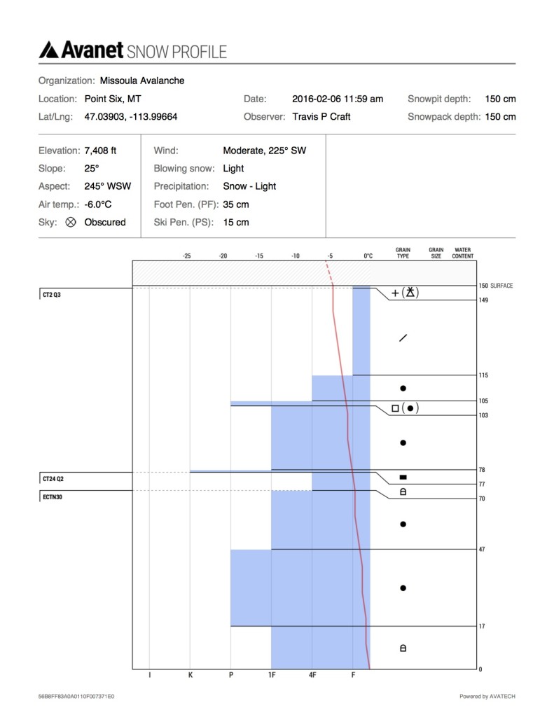
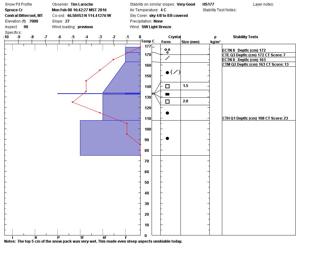
Winds have tapered off following the last storm cycle and the snow surface is getting too dense for transport but windslabs that formed during last weeks storm are still lurking. Pay attention to areas where wind slabs may have formed and evaluate the windslabs carefully. Wind slabs were seen running naturally on friday (public obs) but are strengthening and bonding with time.

Avalanche and Weather Outlook

The forecast suggest high pressure will continue to dominate the region bringing warm day time temps to the mountains and setting up conditions for inversions. There is a chance of a low pressure trough moving in this weekend but it’s a bit early to tell when patterns will shift and bring more moisture to the advisory area. Conditions will settle further while the high pressure lingers around, however wet slabs and cornice failure may become a reality if freezing temperatures aren’t reached overnight.

Travis will issue the next avalanche advisory on Thursday.

READ FULL ADVISORY  

Problem 1 - Loose Snow

  • TYPE

    loose-wet

    Loose Wet

    Release of wet unconsolidated snow or slush. These avalanches typically occur within layers of wet snow near the surface of the snowpack, but they may quickly gouge into lower snowpack layers. Like Loose-Dry Avalanches,they start at a point and entrain snow as they move downhill, forming a fan-shaped avalanche. They generally move slowly, but can contain enough mass to cause significant damage to trees, cars or buildings. Other names for loose-wet avalanches include point-release avalanches or sluffs. Loose-wet avalanches can trigger slab avalanches that break into deeper snow layers.

  • SIZE

    1-2

    < 1 (Small)

    The potential size of avalanche resulting from this problem.

  • LIKELIHOOD

    Likelihood-4

    Possible/Likely

    The likelihood of an avalanche resulting from this problem.

  • IMAGE

As the snow surface thaws out and solar radiation increases the snow surface will become reactive in the form of loose snow slides.

Problem 2 - Wind slabs

  • TYPE

    wind-slabs

    Wind Slabs

    Release of a cohesive layer of snow (a slab) formed by the wind.  Wind typically erodes snow from the upwind sides of terrain features and deposits snow on the downwind side.  Wind slabs are often smooth and rounded and sometimes sound hollow, and can range from soft to hard. Wind slabs that form over a persistent weak layer (surface hoar, depth hoar, or near-surface facets) may be termed Persistent Slabs or may develop into Persistent Slabs.

  • SIZE

    3-4

    1-2 (Small-Large)

    The potential size of avalanche resulting from this problem.

  • LIKELIHOOD

    Likelihood-2

    Unlikely/Possible

    The likelihood of an avalanche resulting from this problem.

Wind slab formation has decreased but the slabs are out there and have the potential to fail under the right conditions.

FORECAST & OUTLOOK

A high pressure ridge is setting up conditions conducive to inversions and mountain locations will be warm and clear during the daytime.

This information is the sole responsibility of the Forest Service and does not apply to operating ski areas. The avalanche danger rating expires at midnight tonight but the information can help you make a more informed decision regarding travel in avalanche terrain for the next few days.

Our advisory area includes National Forest System lands in the Bitterroot Mountains from Lost Trail Pass north to Granite Pass, the Rattlesnake Mountains north of Missoula and the Southern Swan and Mission Mountains near Seeley Lake, MT. Avalanche information for the Lookout Pass/St. Regis Basin area is available from the Idaho Panhandle Avalanche Center.