Posted:
Feb 9, 2021 @ 6:49 am

The avalanche danger in the west central Montana backcountry is considerable.

Good Morning. This is Jeff Carty with the West Central Montana Avalanche Center advisory on Tuesday, February 9, 2021. This advisory is sponsored by Spark R&D. This advisory does not apply to operating ski areas and expires at midnight tonight. The USDA Forest Service is solely responsible for its content.

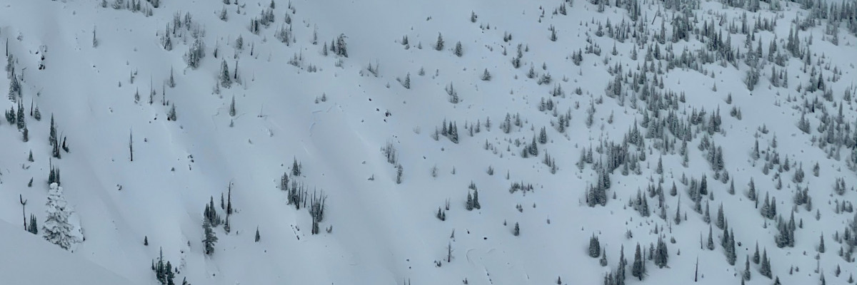
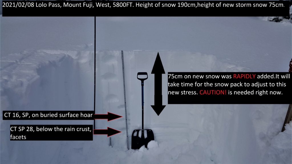
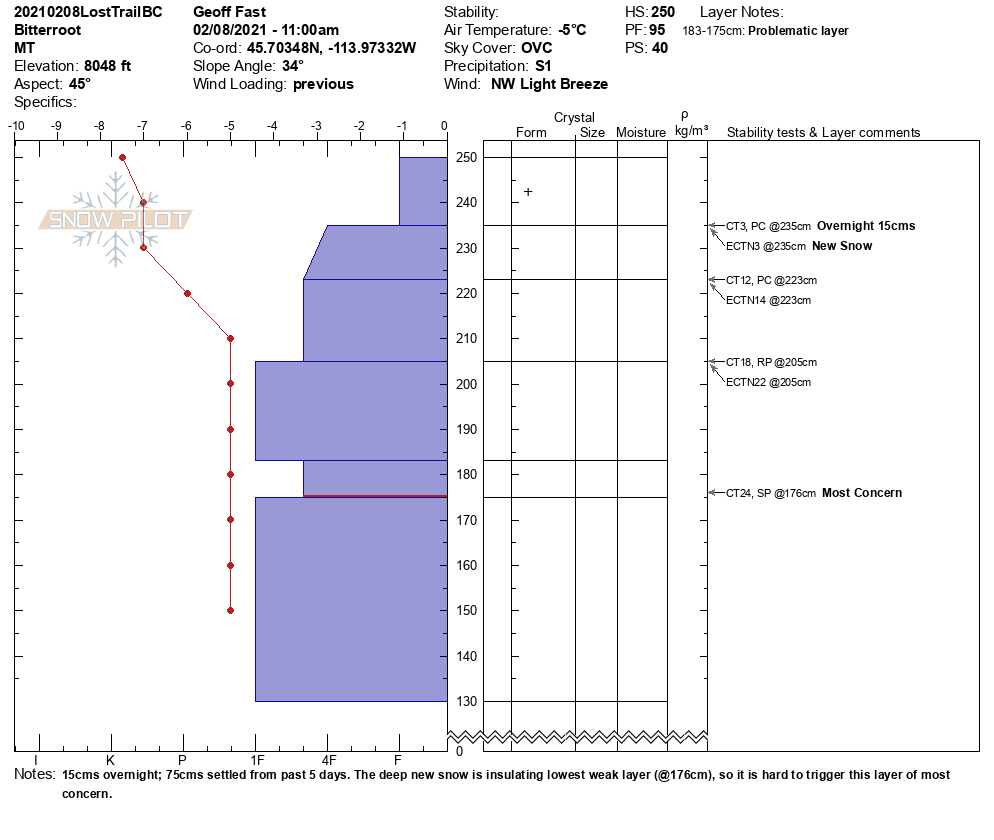
It seems like it is properly winter all of a sudden. New snow again yesterday, 4-10″, and cold temperatures have it feeling right for the season. Up to 48″ of new snow fell in some areas over the last week, this is compacting to around 2.5′ as it settles. It is great to look at a pit wall and see a uniform mass of snow over two feet thick without a crust or facet layer, although this is still something that plagues our lower snowpack. While the skiing and riding have improved dramatically, it is not open season yet. Dangerous avalanche conditions exist. Caution is still warranted, and travel on slopes steeper than 30º is not yet recommended.

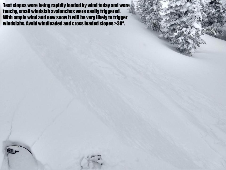
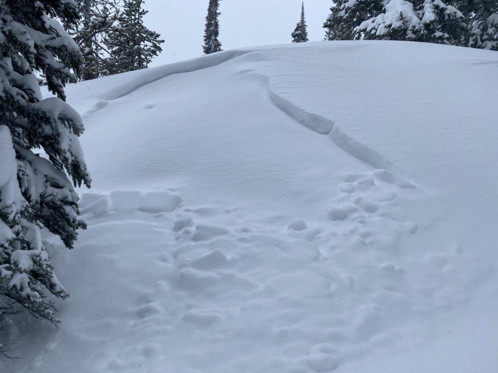
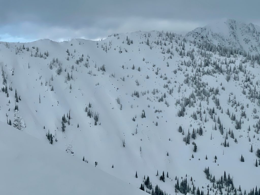
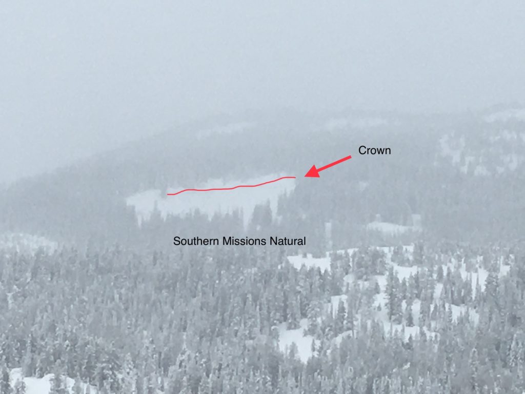
Winds increased yesterday and ample fresh snow was loading leeward slopes. Wind slabs were very touchy and growing in the Rattlesnake yesterday. There was evidence of wind loading and mid-storm wind slab avalanches at Lolo, the Southern Missions, and the Bitterroot. Winds started from the west yesterday and switched to northerly. Moderate northeast winds are forecast for today will continue to load slopes. Multiple aspects may have wind slabs due to these shifting winds. Prior to the storm, cornices were already large and collapsing. Any that remain are larger, unstable, unpredictable, and could trigger avalanches if they fall.

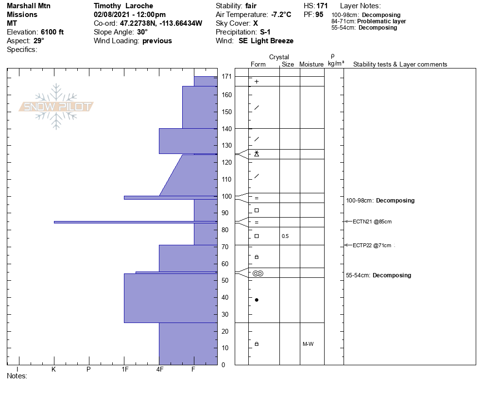
There were widespread natural avalanches throughout the forecast area this weekend. These slid on existing persistent week layers such as the January 13 facet/crust combo. For example, a fairly large avalanche, several hundred feet wide, with up to 4-foot crown happened this weekend in Jenny Bowl.  Long-distance propagation like this is typical of persistent weak layers. The new snow sits on various facet layers throughout the forecast area, and we are seeing propagation in these during stability tests. It is possible to trigger avalanches within the facets, and shallower avalanches may step down to deeper layers creating large avalanches.

Last week, there were 15 avalanche fatalities in the US, including one in the northern Swans on Saturday. This is the most avalanche deaths in a week since 1910. The snowpack throughout the western US is unstable and precarious. Don’t add to the numbers. Now is not the time to push into steep terrain. The snowpack needs time to settle out and bond.

The Bottom Line

Travel in avalanche terrain is not recommended, dangerous avalanche conditions exist. Avoid slopes over 30º and runout zones. Remotely triggered avalanches from the side, below, or above are possible. Natural avalanches are possible, human triggered avalanches in wind slab are likely.

Carry a beacon, shovel, and probe. Remember to reassess conditions throughout the day and stay alert for signs of instability. Dig a pit. Look for red flags.

Upcoming Education Events:

Please visit our education page for an up to date list of regional educational events and course offerings. Below are a few select events and opportunities to check out.

  • February 10th, 6-7:30 PM MST | FREE Online 1.5-hr Avalanche Awareness Session | Missoulaavalanche.org event | Delivered by A3 Pro instructors | Get more details and register HERE

Public Observations

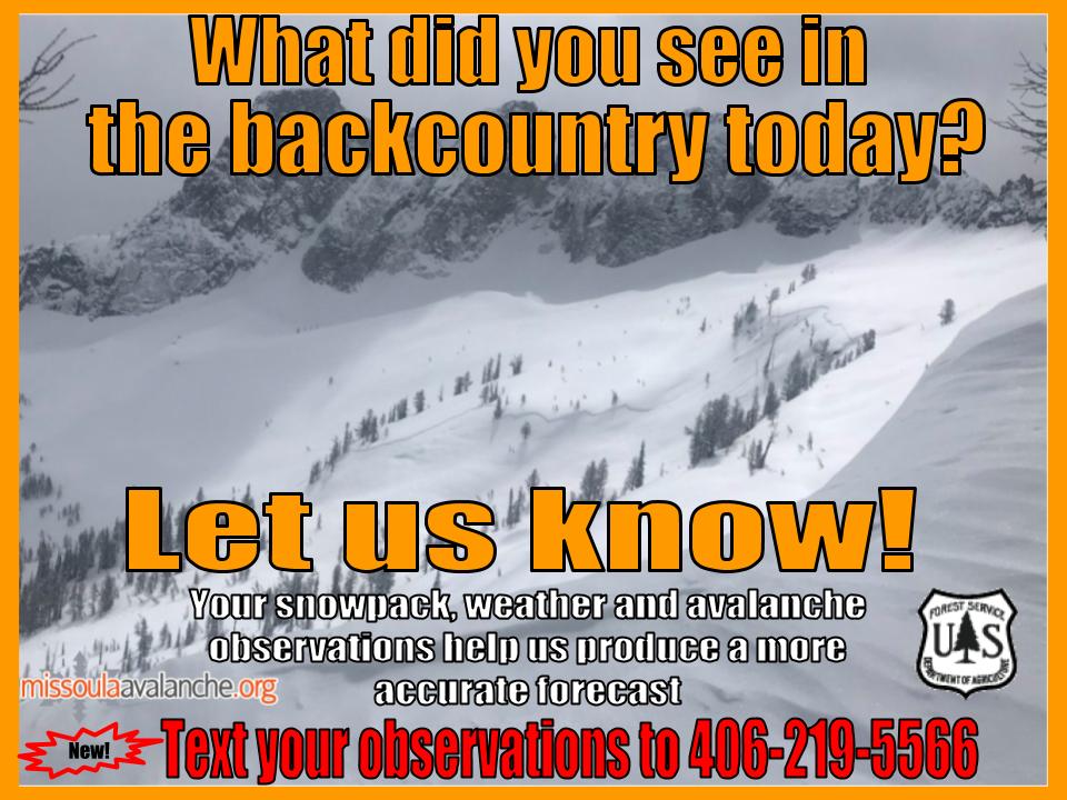
Thank you to everyone who has taken the time to send in a public observation. Please keep sharing what you find and see while out in the backcountry. This online forum is a great resource to glean information about current conditions.

You can now text us your observations to (406) 219-5566 when you don’t have time to fill out the observations page. Texted observations won’t get posted on the website, but will be used in the development of the forecast.

Ski and ride safe.

READ FULL ADVISORY  

Problem 1 - Wind Slab and Cornices

  • TYPE

    wind-slabs

    Wind Slabs

    Release of a cohesive layer of snow (a slab) formed by the wind.  Wind typically erodes snow from the upwind sides of terrain features and deposits snow on the downwind side.  Wind slabs are often smooth and rounded and sometimes sound hollow, and can range from soft to hard. Wind slabs that form over a persistent weak layer (surface hoar, depth hoar, or near-surface facets) may be termed Persistent Slabs or may develop into Persistent Slabs.

  • SIZE

    3-4

    1-2 (Small-Large)

    The potential size of avalanche resulting from this problem.

  • LIKELIHOOD

    Likelihood-5

    Likely

    The likelihood of an avalanche resulting from this problem.

  • ADDED DANGER

    Increased Slope Danger

    Increased/Added Danger

    There is an increased risk of avalanches on these slopes:

    N - North
    NE - Northeast
    E - East
    SE - Southeast
    S - South
    SW - Southwest
    W - West
    NW - Northwest

Moderate winds are loading slopes with ample new snow. Winds are shifting from westerly to the northeast, as a result, all aspects may have some amount of windslab, including cross loading.

Wind slabs may be deep and destructive, especially in areas where they sit on persistent weak layers and where natural avalanches did not release during the storm. Human triggered avalanches are likely.

Cornices are growing and fragile. Cornice fall could trigger larger avalanches. Give them a wide berth.

Avoid wind loaded terrain and do not travel under cornices. Stay well away from the top, they can break far back onto flat ground.

Problem 2 - Persistent weak layers

  • TYPE

    persistent-slabs

    Persistent Slabs

    Release of a cohesive layer of soft to hard snow (a slab) in the middle to upper snowpack, when the bond to an underlying persistent weak layer breaks.  Persistent layers include: surface hoar, depth hoar, near-surface facets, or faceted snow. Persistent weak layers can continue to produce avalanches for days, weeks or even months, making them especially dangerous and tricky. As additional snow and wind events build a thicker slab on top of the persistent weak layer, this avalanche problem may develop into a Persistent, Deep-Slab.

  • SIZE

    5-6

    2-3 (Large)

    The potential size of avalanche resulting from this problem.

  • LIKELIHOOD

    Likelihood-3

    Possible

    The likelihood of an avalanche resulting from this problem.

  • ADDED DANGER

    Increased Slope Danger

    Increased/Added Danger

    There is an increased risk of avalanches on these slopes:

    N - North
    NE - Northeast
    E - East
    SE - Southeast
    S - South
    SW - Southwest
    W - West
    NW - Northwest

Throughout the forecast area, the new snow sits on a variety of faceted layers. We are seeing propagation on near surface facets, buried surface hoar, and the January 13 crust/facets combo. It is possible to trigger an avalanche on any of these surfaces and given the depth of the new snow these would be hard to survive.

Mid elevations and areas that were shallow prior to the storm have weak faceted snow as the base. It is possible to trigger these deeper layers. Shallower avalanches or cornice fall may step down to these deep persistent layers causing large destructive slides.

It is possible to trigger an avalanche remotely from the side, below and above.

Avoid slopes over 30º and provide wide margins below and adjacent to avalanche slopes.

FORECAST & OUTLOOK

Light snow will continue today, especially in higher terrain. Currently, strong westerly ridgetop winds are holding Arctic air east of Missoula Valley. This may continue into Wednesday when a weak wave will slide through the Northern Rockies. The energy from the wave will pull the Arctic air mass all the way into the Bitterroot Valley and turn ridgetop winds to the northeast. There are questions in the models concerning snow on both Thursday and Friday. On Thursday, it is likely a little light snow will make it into the Bitterroot Mountains. Then on Friday, a potential mid-level low may wrap moisture into west central Montana bringing a prolonged light snow event.

This information is the sole responsibility of the Forest Service and does not apply to operating ski areas. The avalanche danger rating expires at midnight tonight but the information can help you make a more informed decision regarding travel in avalanche terrain for the next few days.

Our advisory area includes National Forest System lands in the Bitterroot Mountains from Lost Trail Pass north to Granite Pass, the Rattlesnake Mountains north of Missoula and the Southern Swan and Mission Mountains near Seeley Lake, MT. Avalanche information for the Lookout Pass/St. Regis Basin area is available from the Idaho Panhandle Avalanche Center.