Posted:
Feb 17, 2015 @ 6:35 am

The avalanche danger in west central Montana Backcountry is rated moderate today. The main problem is the possibility to trigger a slab avalanche on slopes >35 degrees above 7000 feet. The secondary problem is loose wet releases.

Good morning this is Travis Craft with the West Central Montana Avalanche Center’s advisory for February 17, 2015.  The danger rating does not apply to operating ski areas, is the sole responsibility of the U.S. Forest Service and expires at midnight.

Avalanche and Weather Discussion

This morning mountain temperatures are in the mid to high teens and winds are out of the WNW at 15 mph and gusts of 18 mph. We have accumulated small amounts of snow throughout the advisory area over night with the Stuart Mountain Snotel picking up 5 new inches.

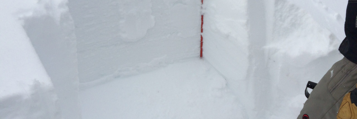
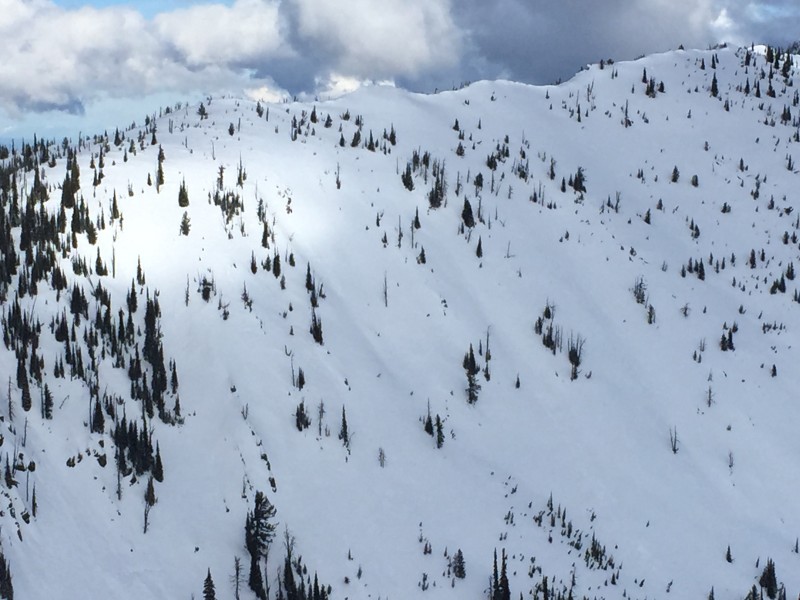
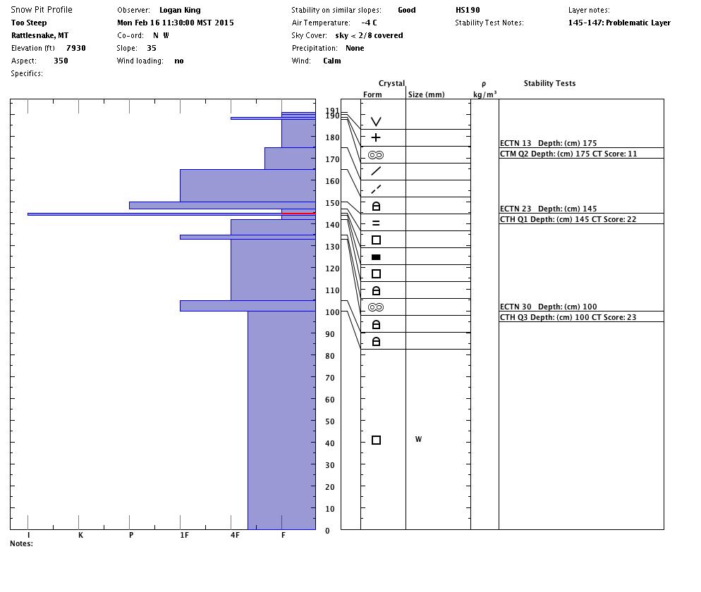
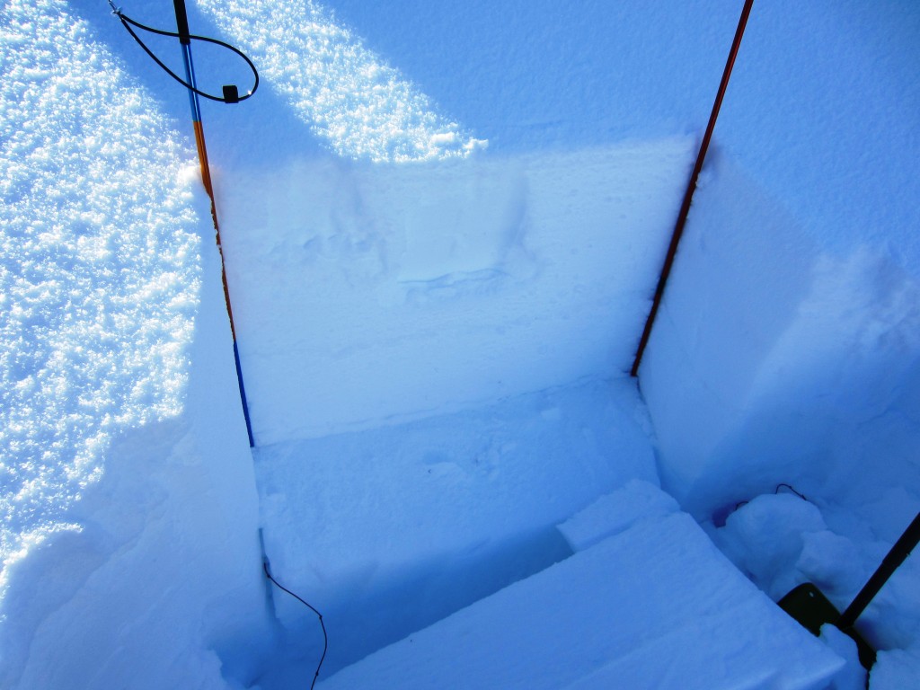
The main problem we are facing right now is on slopes >35 degrees it is possible to trigger a large slab avalanche in isolated areas. This persistent slab varies in depth from 35 cm to 65 cm depending on where you are in the advisory area. Dudley was in the Southern portion of the Bitterrroots over the weekend and got deeply buried facets to propagate on a North facing slope around 7700 feet . Logan and I toured in the Rattlesnake yesterday and found this layer at a depth of 35 cm where it was reactive in propagation tests on a SE aspect at 7500 feet. These buried facets are widespread in the advisory area but are not propagating on all aspects. The only way to find this layer is to dig down 75 cm into the snowpack and see if they are reactive. This layer is one that just keeps hanging around with us and is attributed to the close call in the Lost Trail backcountry as well as the natural slide on Sky Pilot in the Bitterroots.

The secondary problem of loose wet releases will increase throughout the day as temperatures rise.We observed many releases yesterday in the Rattlesnake on aspects with sun exposure. Pay attention to changing weather and aspects while recreating.

Weather and Avalanche Outlook

High pressure is forecasted to stay with us until Thursday evening bringing with it above average temperatures. I expect the lingering slab to stay reactive in the advisory area and loose wet releases to be a problem with temperatures reaching  above freezing. With continued cool clear nights expect to see surface hoar development which will lead to our potential new problem as it is buried in our snowpack.

Steve Karkanen will issue the next regularly scheduled advisory on Friday, February 20.


READ FULL ADVISORY  

Problem 1 - Facets

  • TYPE

    persistent-slabs

    Persistent Slabs

    Release of a cohesive layer of soft to hard snow (a slab) in the middle to upper snowpack, when the bond to an underlying persistent weak layer breaks.  Persistent layers include: surface hoar, depth hoar, near-surface facets, or faceted snow. Persistent weak layers can continue to produce avalanches for days, weeks or even months, making them especially dangerous and tricky. As additional snow and wind events build a thicker slab on top of the persistent weak layer, this avalanche problem may develop into a Persistent, Deep-Slab.

  • SIZE

    4-5

    2 (Large)

    The potential size of avalanche resulting from this problem.

  • LIKELIHOOD

    Likelihood-2

    Unlikely/Possible

    The likelihood of an avalanche resulting from this problem.

  • ADDED DANGER

    Increased Slope Danger

    Increased/Added Danger

    There is an increased risk of avalanches on these slopes:

    N - North
    NE - Northeast
    E - East
    SE - Southeast
    SW - Southwest
    W - West
    NW - Northwest

  • IMAGE

Persistent Slab

Problem 2 - Wet Snow Releases

  • TYPE

    loose-wet

    Loose Wet

    Release of wet unconsolidated snow or slush. These avalanches typically occur within layers of wet snow near the surface of the snowpack, but they may quickly gouge into lower snowpack layers. Like Loose-Dry Avalanches,they start at a point and entrain snow as they move downhill, forming a fan-shaped avalanche. They generally move slowly, but can contain enough mass to cause significant damage to trees, cars or buildings. Other names for loose-wet avalanches include point-release avalanches or sluffs. Loose-wet avalanches can trigger slab avalanches that break into deeper snow layers.

  • SIZE

    3-4

    1-2 (Small-Large)

    The potential size of avalanche resulting from this problem.

  • LIKELIHOOD

    Likelihood-5

    Likely

    The likelihood of an avalanche resulting from this problem.

  • IMAGE

Above Average temperatures

FORECAST & OUTLOOK

High pressure is forecasted to stay with us until Thursday evening bringing with it above average temperatures. I expect the lingering slab to stay reactive in the advisory area and loose wet releases to be a problem with temperatures reaching above freezing. With continued cool clear nights expect to see surface hoar development which will lead to our potential new problem as it is buried in our snowpack.

This information is the sole responsibility of the Forest Service and does not apply to operating ski areas. The avalanche danger rating expires at midnight tonight but the information can help you make a more informed decision regarding travel in avalanche terrain for the next few days.

Our advisory area includes National Forest System lands in the Bitterroot Mountains from Lost Trail Pass north to Granite Pass, the Rattlesnake Mountains north of Missoula and the Southern Swan and Mission Mountains near Seeley Lake, MT. Avalanche information for the Lookout Pass/St. Regis Basin area is available from the Idaho Panhandle Avalanche Center.