
The avalanche danger in the west central Montana backcountry is CONSIDERABLE. The avalanche warning has been terminated.
Good Morning. This is Jeff Carty with the West Central Montana Avalanche Center advisory on Thursday, February 25, 2021. This advisory is sponsored by LB Snow. This advisory does not apply to operating ski areas and expires at midnight tonight. The USDA Forest Service is solely responsible for its content.
Snowpack and Weather
Mountain temps are currently 8º-11º F and will rise to the upper 20s today. The last 24hrs of weather brought us up to 0.4” SWE and light to moderate winds. Storm totals were between 8″ on the lower end and 30″ at upper elevations. The next round of snow, 2-5”, arrives late this morning with moderate to strong westerly winds. Precipitation will continue till Sunday.
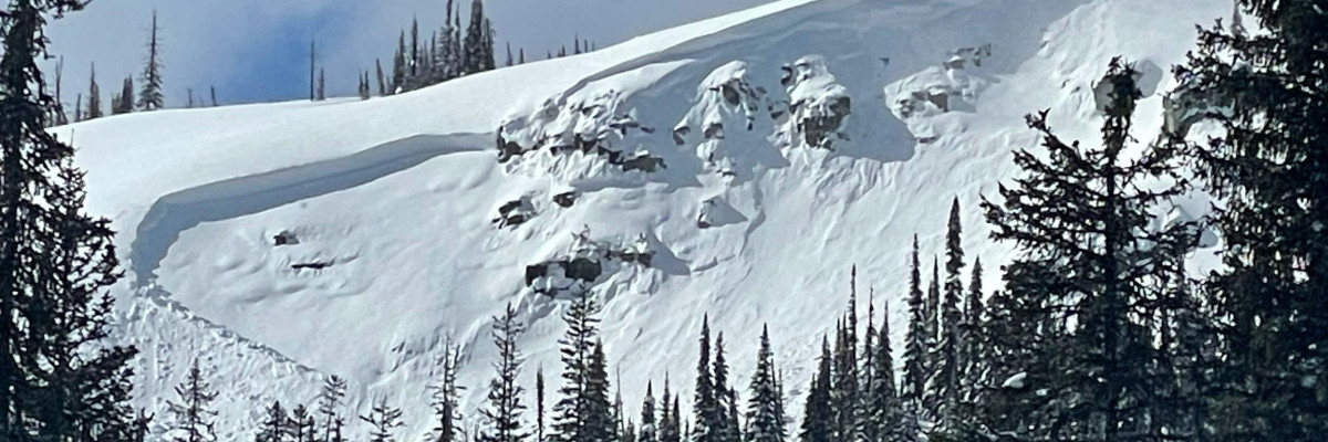
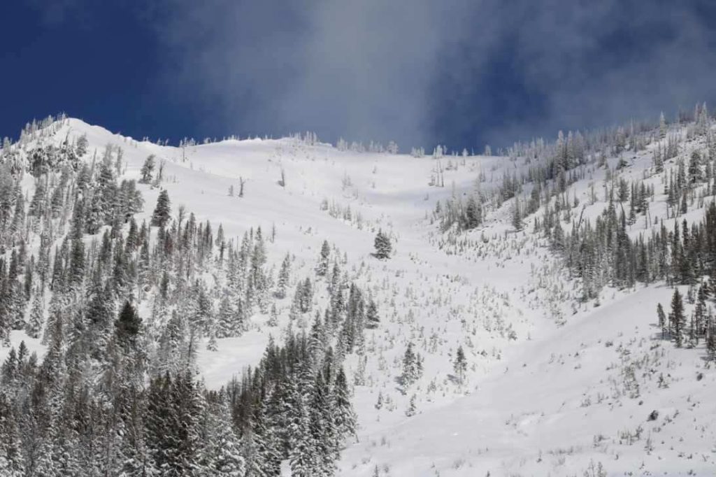
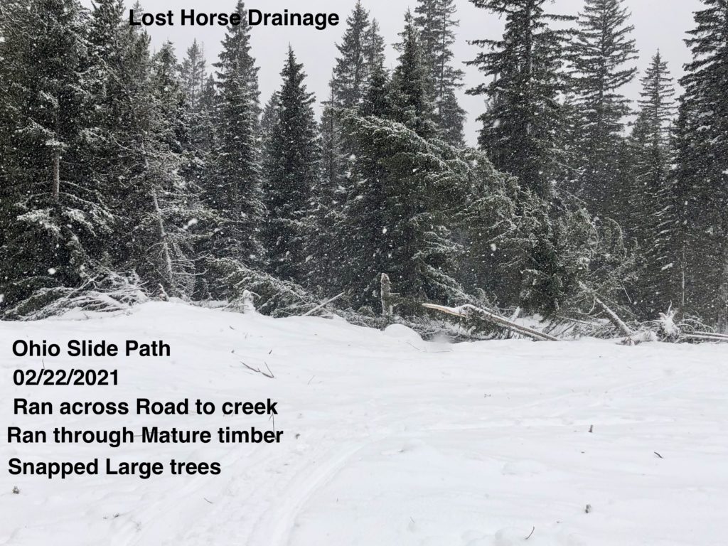
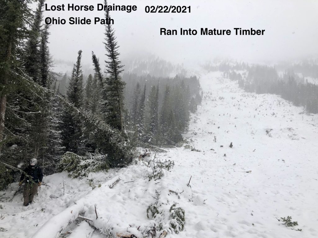
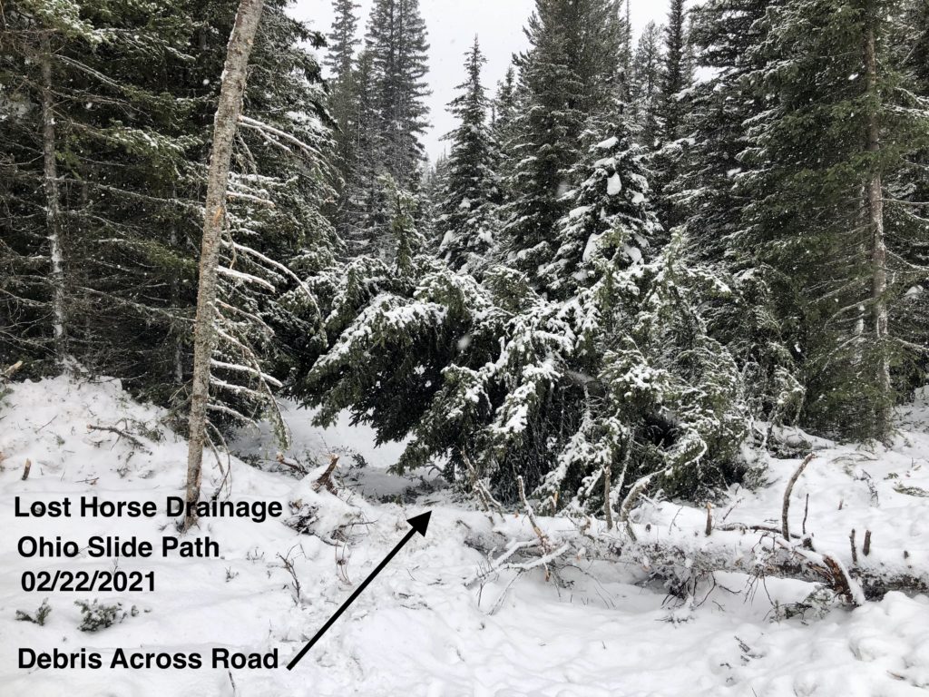
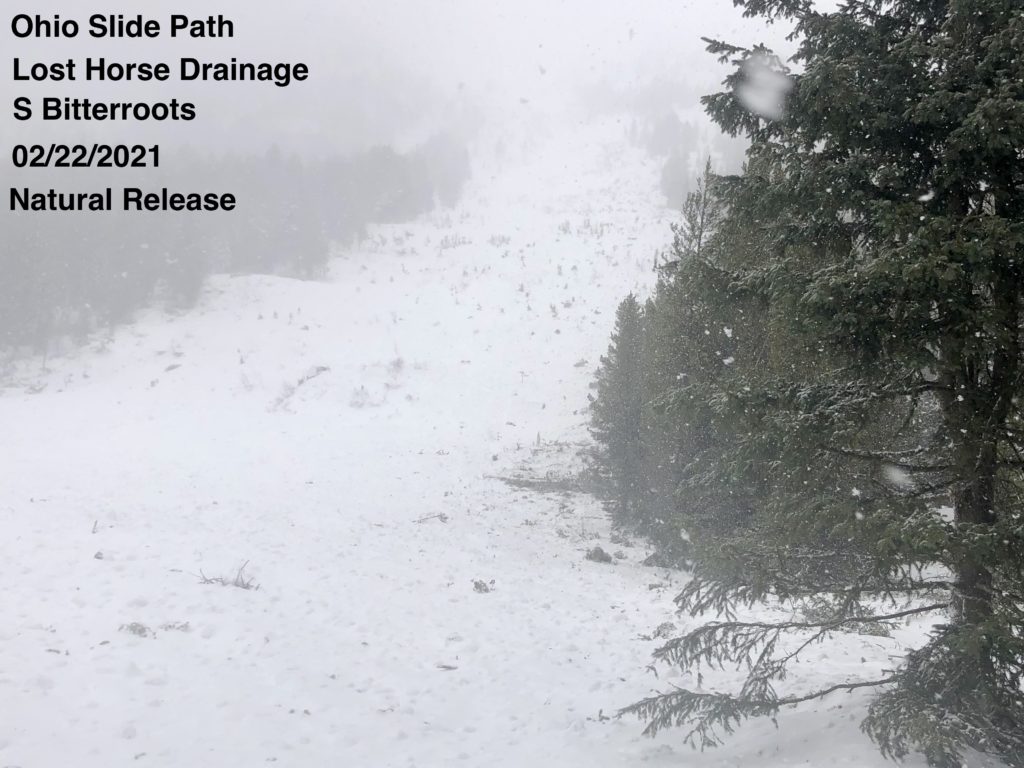
The southern and central Bitterroot, the Rattlesnake, and the southern Missions and the Swans all had natural avalanche activity during or in the wake of the storm.
Observations yesterday showed that avalanches continue to be likely in many areas.
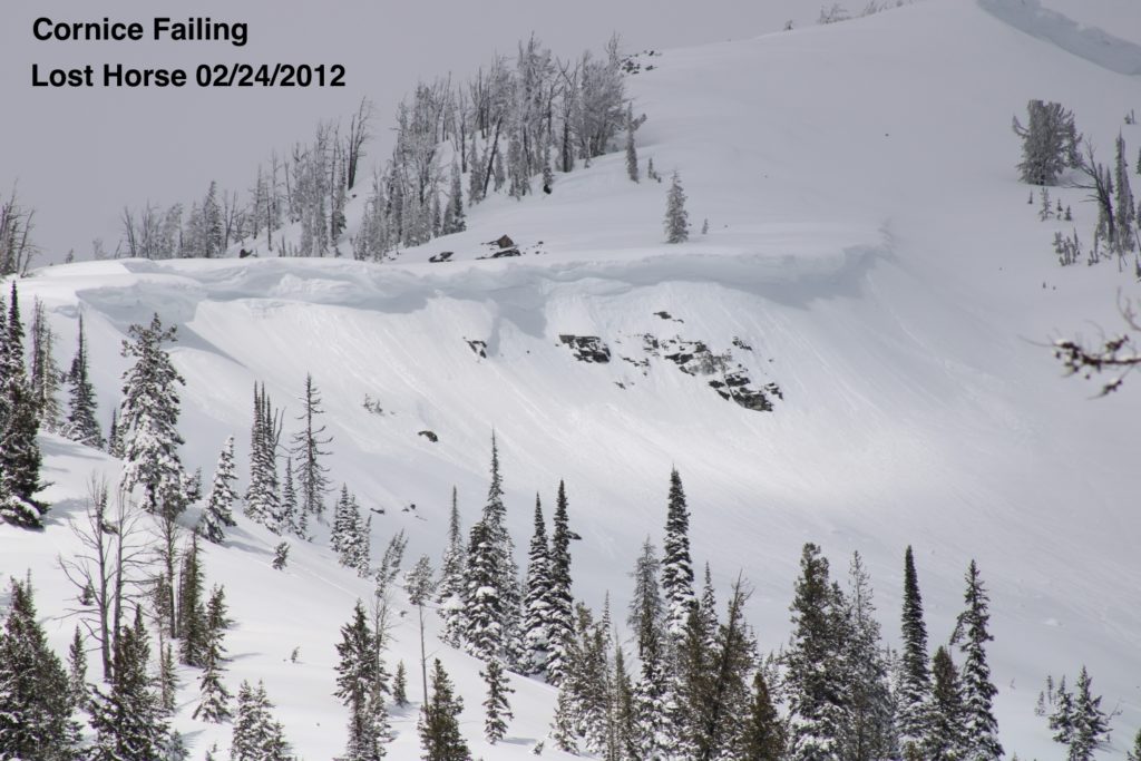
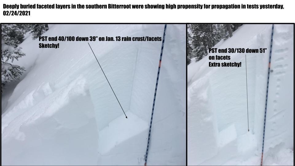
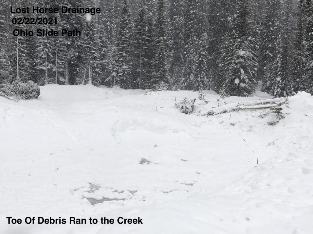
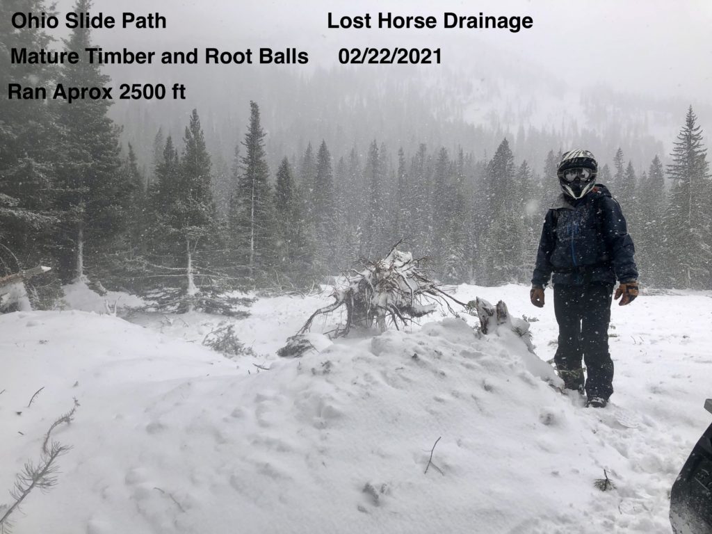
Persistent slabs are the problem that could create the most destructive avalanches. Multiple persistent weak layers exist in the snowpack, some up to 6 feet deep. These were propagating in tests yesterday and played a role in many of the avalanches over the past few days. The January 13 rain crust/facet layer continues to be an issue in spots. Depth hoar and basal facets exist at mid elevations and shallow spots in the southern and central Bitterroot and the Rattlesnake. Advanced facets in the upper snowpack of the Rattlesnake are very reactive. Buried surface hoar can be found in various locations. Over time, with more depth, these will heal, but for the time being give them space and avoid slopes over 30º. The snowpack has been loaded, is stressed, and more loading will commence today. Persistent slabs can be unpredictable, especially as they get buried deeper. The R4 D4 slide in Lost Horse shows what these are capable of.
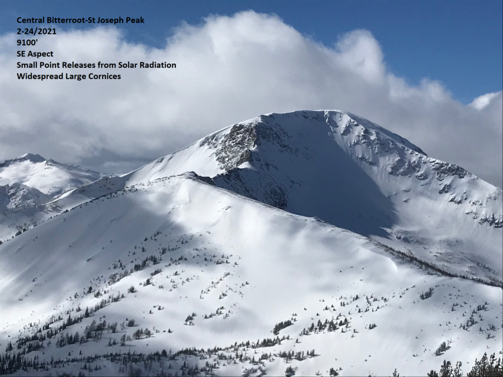
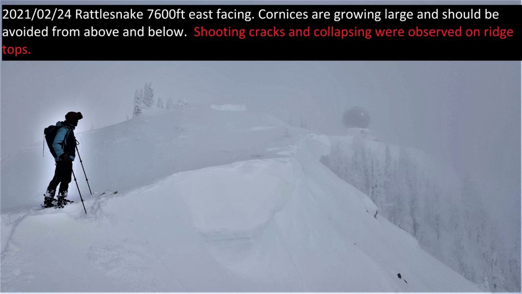
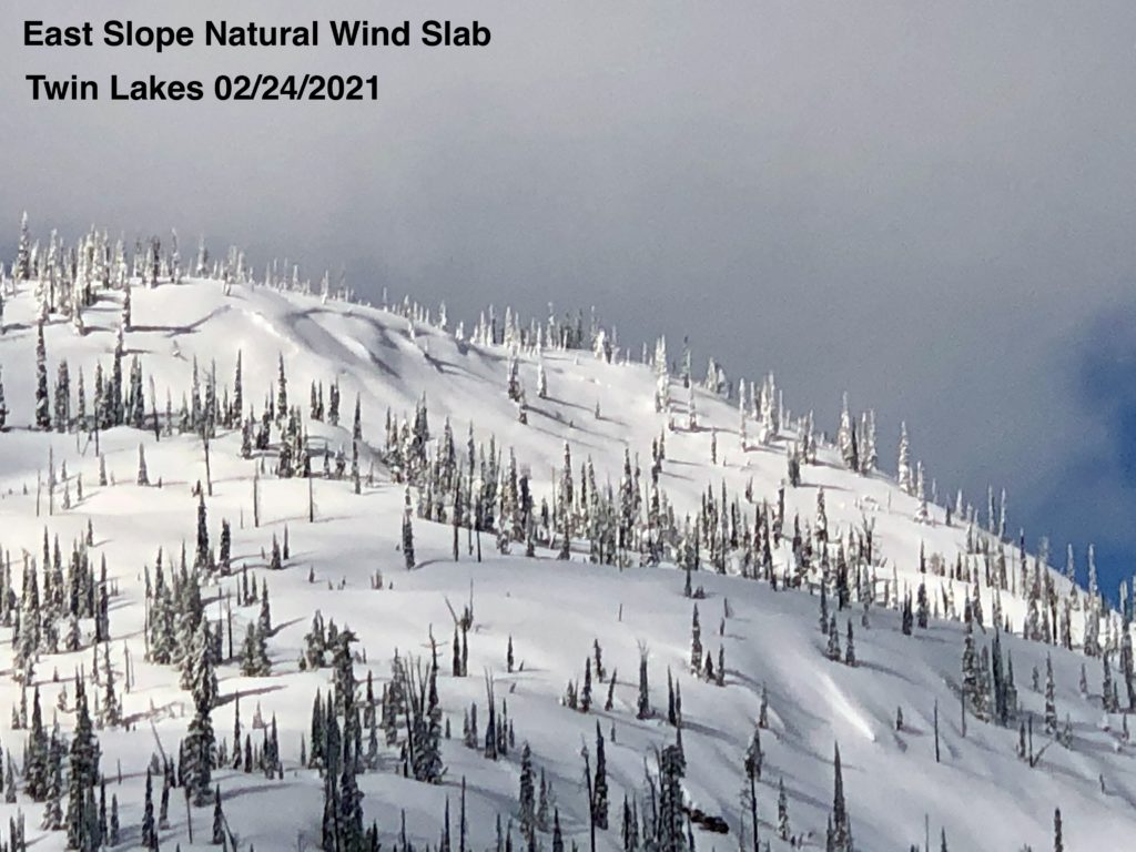
Significant winds loaded all aspects with windslab due to local terrain effects. The last 4 to 8 inches of snow fell with little wind in much of the forecast area burying windslab that may still be reactive and deep. New slabs are being created by moderate winds with extreme gusts and today’s snowfall. Shooting cracks were observed in multiple areas yesterday indicating unstable conditions. Cornices are huge and ready to fall.
Strong sun yesterday affected southern aspects creating wet snow and roller balls. Crusts were forming by late afternoon with cooling temperatures. Cold over night temperatures may have resulted in near surface facets in moist areas. This is something to keep an eye on as it gets buried.
There is fantastic powder skiing on low angle slopes right now. That is what I am going to be enjoying throughout the storm cycle that lasts till Sunday. The steep slopes will be there after the current instabilities heal.
The Bottom Line
Travel in avalanche terrain is not recommended. Avoid being under run-out zones, avalanches may be remotely triggered, and run to historic limits. You can trigger an avalanche remotely from the side, below, or above you. Expect the avalanche danger to be elevated as snow and winds continue through Sunday.
Upcoming Education Events
Please visit our education page for an up-to-date list of regional educational events and course offerings. Below are a few select events and opportunities to check out.
- March 3rd, 6-7:30 PM MST | FREE Online 1.5-hr Avalanche Awareness Session | Missoulaavalanche.org event | Delivered by A3 Pro instructors | Get more details and register HERE
Special Announcements
You’ve prayed, hoped, and danced for snow all winter, and it’s finally here! Western Montana’s mountains are busier than ever before, with new and veteran backcountry users enjoying the new snow. The West Central Montana Avalanche Foundation wants to ensure everyone has the information needed to safely enjoy the mountains and return home. To celebrate winter’s return and support west-central Montana’s avalanche forecasting and education programs, we bring you Loving La Niña! This virtual fundraising event includes two outstanding gear packages and two ways to enter to win. Please click HERE for more information about this exciting event. Together, we can save lives and continue creating the most fun, safe, and responsible backcountry community possible. Spread the word, and spread the love for La Niña!
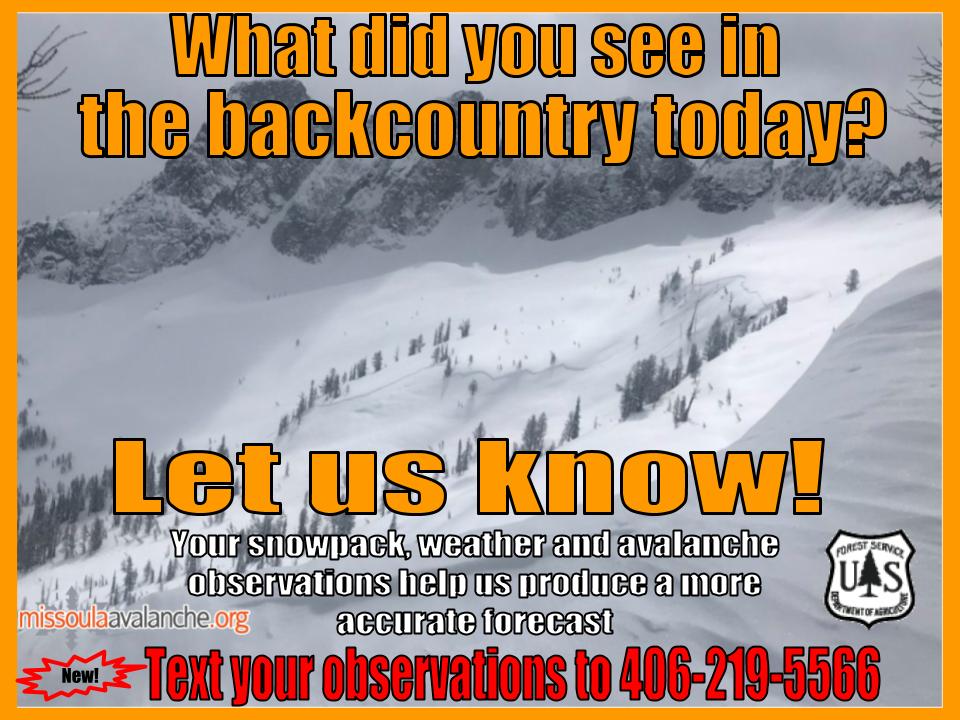
Public observations
We’ve been receiving excellent public observations. These are immensely helpful for us and a great resource for others to learn about conditions in specific locations. Keep them coming. Submit them here, or text to 406-219-5566 if you don’t have time to fill out the online form.
Ski and ride safe.


