Posted:
Feb 27, 2021 @ 6:52 am

The avalanche danger in the west central Montana backcountry is CONSIDERABLE.

Good Morning. This is Jeff Carty with the West Central Montana Avalanche Center advisory on Saturday, February 27, 2021. This advisory is sponsored by Spark R&D. This advisory does not apply to operating ski areas and expires at midnight tonight. The USDA Forest Service is solely responsible for its content.

Snowpack and Weather

Mountain temps are currently 10º to 22º F and will rise to the upper 20s today. The last 48hrs of weather brought us up to 1.2” of SWE and light to moderate winds.  A few inches of snow is forecast today, with some areas picking up more or less due to local snow showers. Moderate winds are out of the west. Precipitation will continue till this evening.

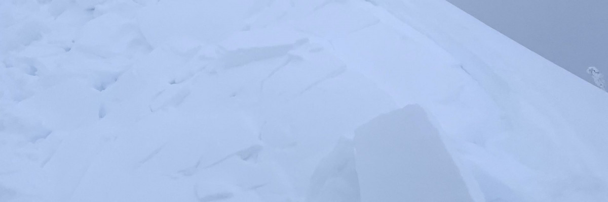
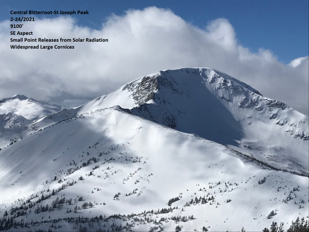
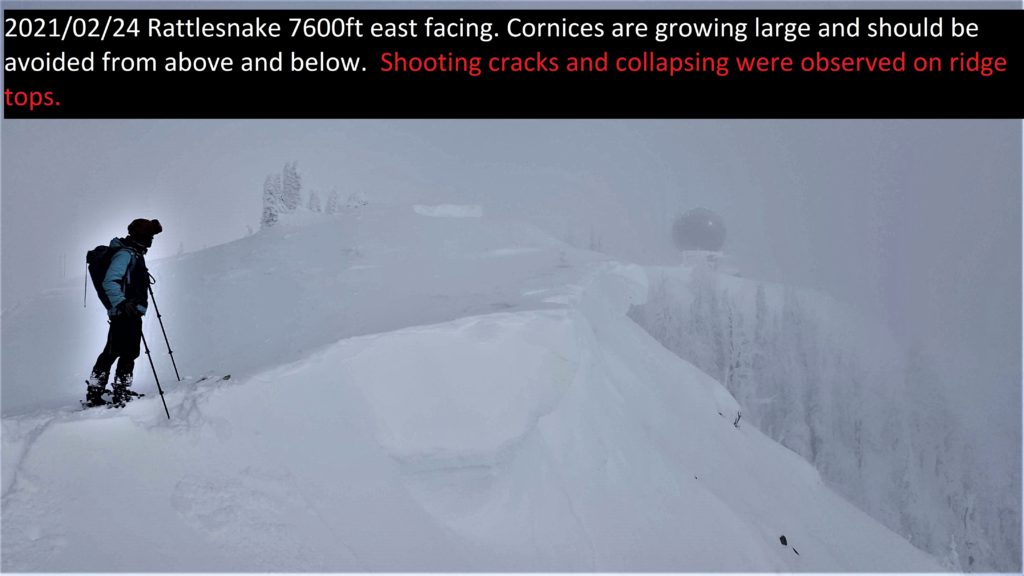
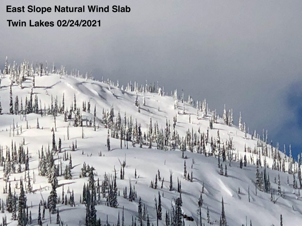
The snow has continued to fall. Coupled with the wind it has created touchy wind slab conditions. A wind slab avalanche, with an 8-foot crown, released on the backside of Point 6 in the Rattlesnake Wilderness yesterday morning. This depth included wind loading from the storm earlier this week, indicating that wind slab created by Monday and Tuesday’s high winds are capable of failing with the current loading. Given the extent of loading on all aspects from the previous storm and subsequent snowfall, deep wind slab may be difficult to detect.  The best way to manage this hazard is to avoid slopes over 32º and stay out from under steeper slopes, even small ones could harbor deep wind slab. Cornices are very touchy currently and could fall naturally. As wind and snow continue leeward slopes will be loaded further, increasing touchiness.

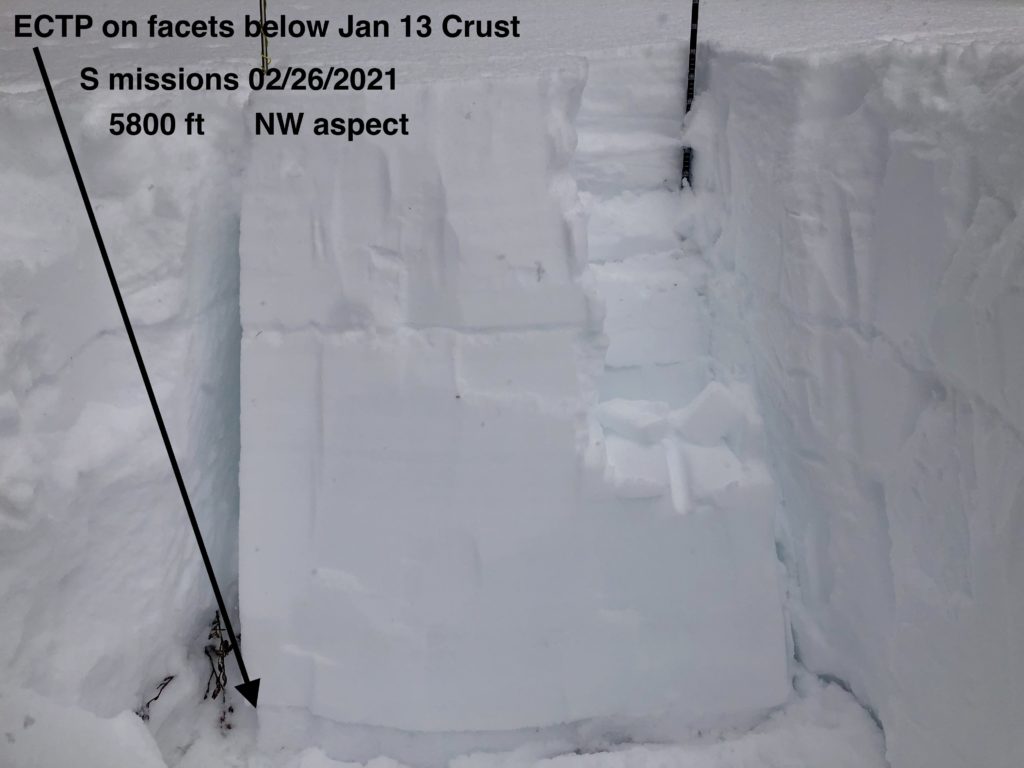
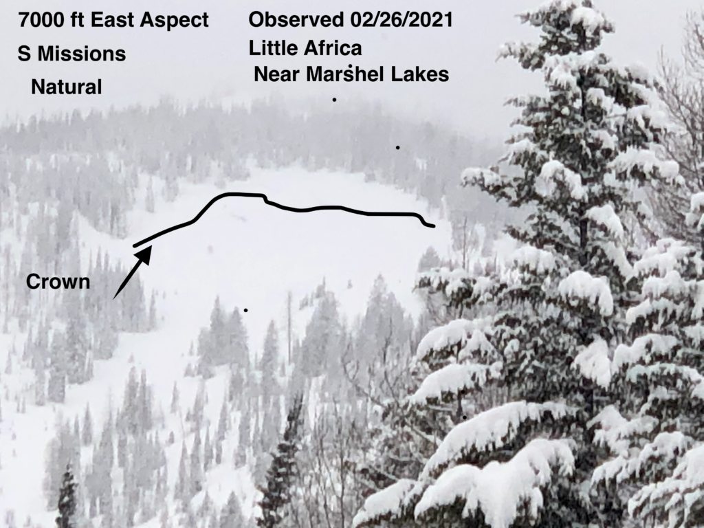
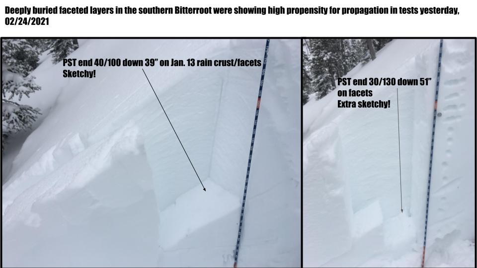
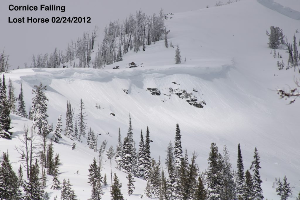
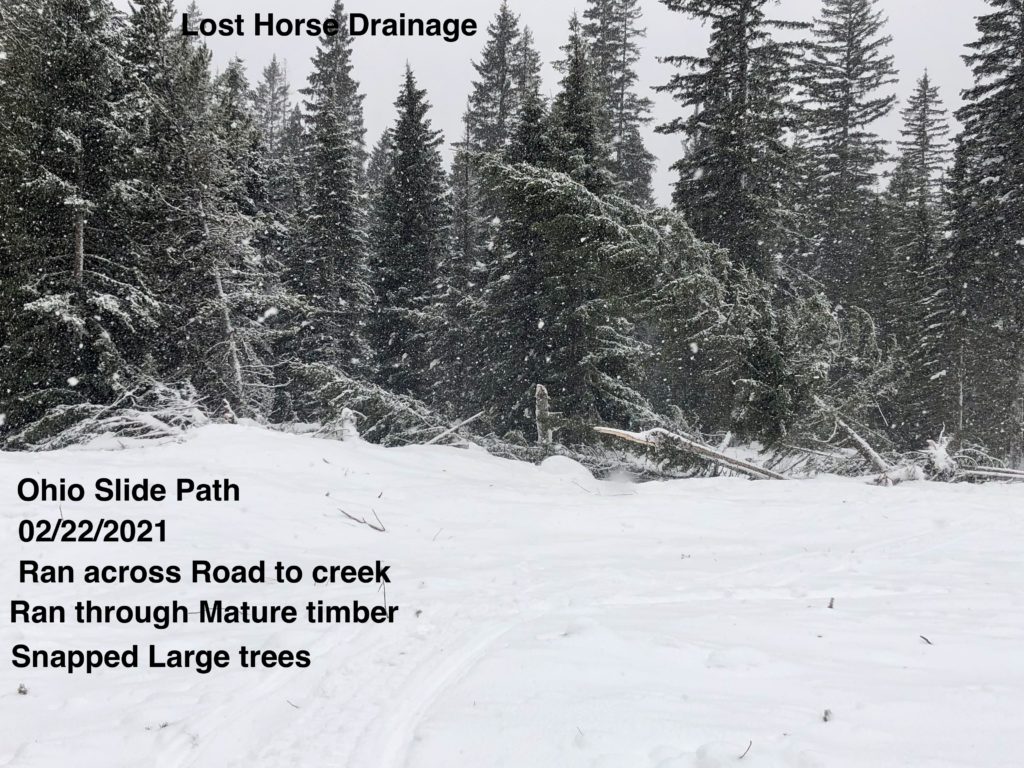
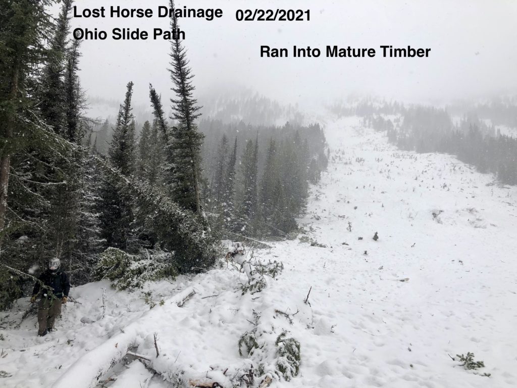
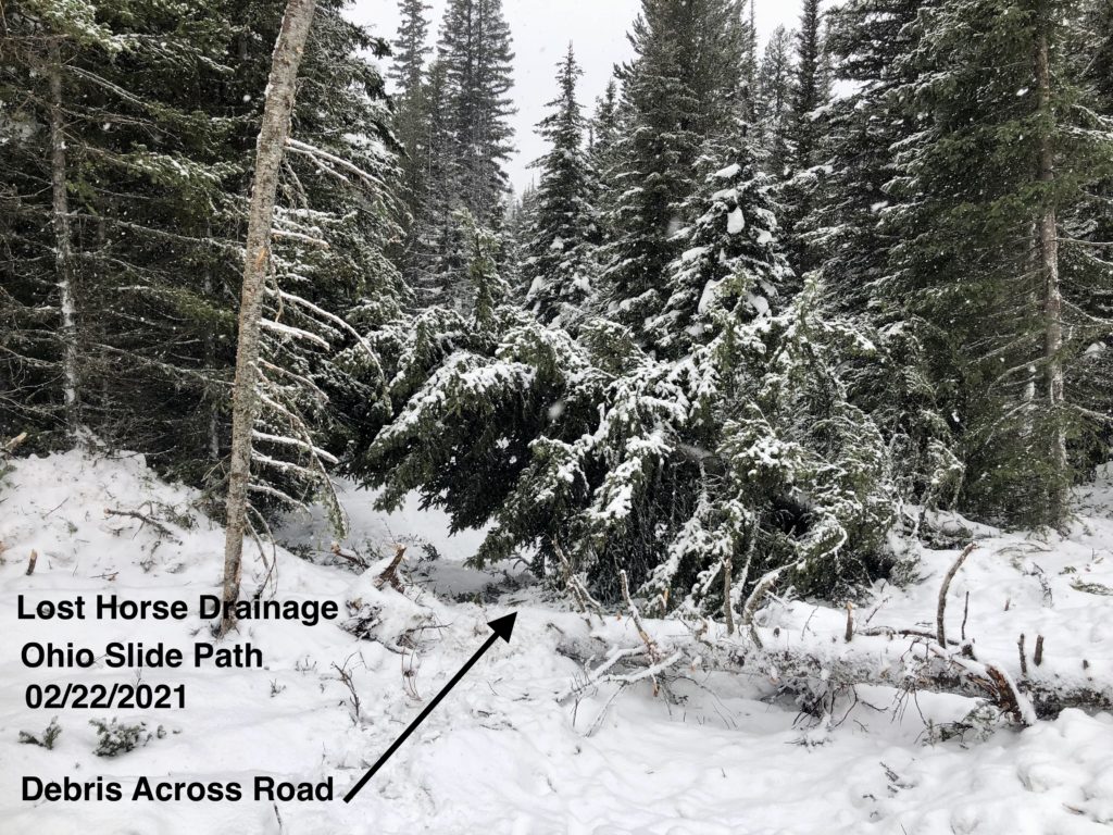
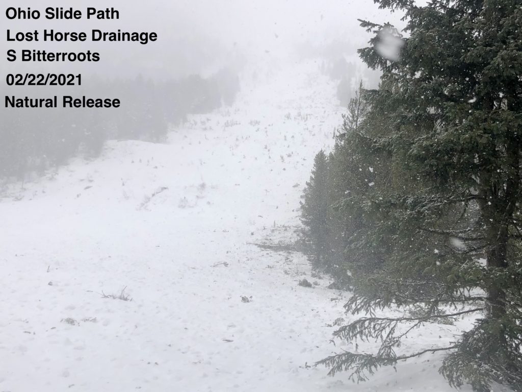
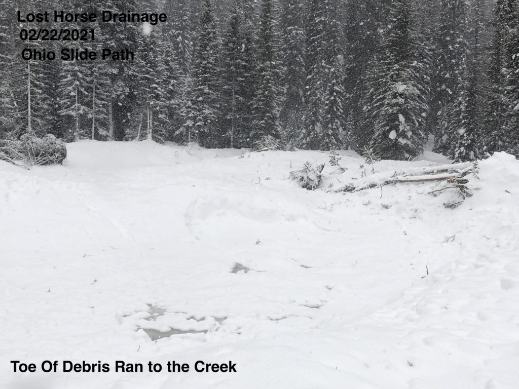
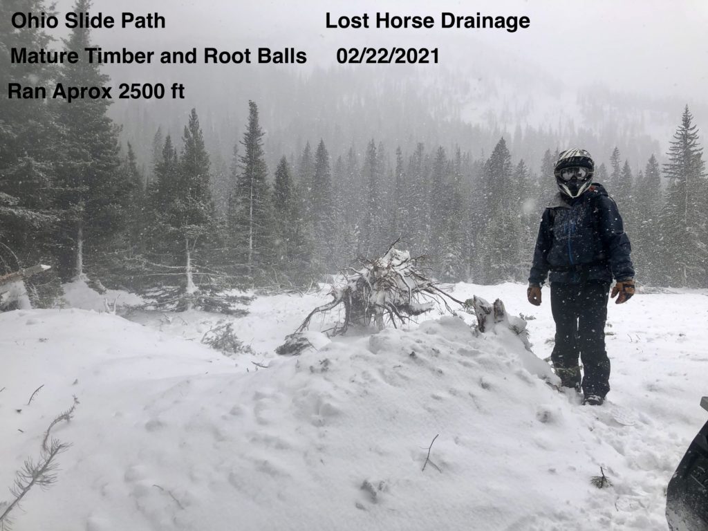
Persistent slabs are the problem that could create the most destructive avalanches. Multiple persistent weak layers exist in the snowpack, some up to 6 feet deep. These were propagating in tests yesterday and played a role in many of the avalanches over the past week. The January 13 rain crust/facet layer continues to be an issue in spots. Depth hoar and basal facets exist at mid-elevations and shallow spots in the southern and central Bitterroot and the Rattlesnake. Advanced facets on north aspects in the Rattlesnake are reactive. Buried surface hoar can be found in various locations.  The snowpack has been loaded and is stressed. Loading will continue today. Persistent slabs can be unpredictable, especially as they get buried deeper. The R4 D4 slide in Lost Horse shows what these are capable of.

The continued snowfall is adding depth to the snowpack, which will help these persistent weak layers bond, and increase stability. Fair weather and warm temperatures next week will also help. In the short term, the loading is stressing the snowpack and weak layers. For the time being, give them space, avoid slopes over 32º, and enjoy the fresh powder.

The Bottom Line

Travel in avalanche terrain is not recommended. Careful terrain and snowpack assessment are required today. Avoid being under run-out zones, avalanches may be remotely triggered, and run to historic limits. You can trigger an avalanche remotely from the side, below, or above you. Expect the avalanche danger to be elevated as snow and winds continue.

Carry a beacon, shovel, and probe. Remember to reassess conditions throughout the day and stay alert for signs of instability. Dig a pit. Look for red flags.

Upcoming Education Events

Please visit our education page for an up-to-date list of regional educational events and course offerings. Below are a few select events and opportunities to check out.

    • March 3rd, 6-7:30 PM MST | FREE Online 1.5-hr Avalanche Awareness Session | Missoulaavalanche.org event | Delivered by A3 Pro instructors | Get more details and register HERE

Special Announcements

You’ve prayed, hoped, and danced for snow all winter, and it’s finally here! Western Montana’s mountains are busier than ever before, with new and veteran backcountry users enjoying the fresh snow. To celebrate the snowfall and help ensure everyone has the information needed to enjoy the mountains and return home safely, we bring you Loving La Niña! This virtual fundraising event includes two outstanding gear packages and two ways to enter to win. Please click HERE for more information about this exciting event. Together, we can save lives and continue creating the most fun, safe, and responsible backcountry community possible. Spread the word, and spread the love for La Niña!

Public observations

We’ve been receiving excellent public observations. These are immensely helpful for us and a great resource for others to learn about conditions in specific locations. Keep them coming. Submit them here, or text to 406-219-5566 if you don’t have time to fill out the online form.

Ski and ride safe.

READ FULL ADVISORY  

Problem 1 - Wind slabs and cornices

  • TYPE

    wind-slabs

    Wind Slabs

    Release of a cohesive layer of snow (a slab) formed by the wind.  Wind typically erodes snow from the upwind sides of terrain features and deposits snow on the downwind side.  Wind slabs are often smooth and rounded and sometimes sound hollow, and can range from soft to hard. Wind slabs that form over a persistent weak layer (surface hoar, depth hoar, or near-surface facets) may be termed Persistent Slabs or may develop into Persistent Slabs.

  • SIZE

    3-4

    1-2 (Small-Large)

    The potential size of avalanche resulting from this problem.

  • LIKELIHOOD

    Likelihood-5

    Likely

    The likelihood of an avalanche resulting from this problem.

  • ADDED DANGER

    Increased Slope Danger

    Increased/Added Danger

    There is an increased risk of avalanches on these slopes:

    N - North
    NE - Northeast
    E - East
    SE - Southeast
    S - South
    SW - Southwest
    NW - Northwest

Strong to extreme winds and heavy precipitation affected all elevations during the storm earlier this week. Due to localized terrain effects, and cross loading, winds slabs were deposited on all aspects. These may still be reactive and could fail with continued loading. The potential for very deep hard slab avalanches exists as evidenced by the 8′ foot crown on point 6 yesterday. Areas that slid earlier this week have been refilled with fresh wind slab, and may be ready to slide again.

Westerly winds are building fresh wind slabs today. Human triggered avalanches are likely.

Watch for stiff, hollow sounding drifts and shooting cracks.

Cornices are huge, growing, and very unstable. Give them a wide berth.

Windslab avalanches and cornice fall may step down to deeper faceted layers.

Avoid steep wind loaded slopes, stay aware of steep pockets of wind slab above you as you travel.


Problem 2 - Persistent Slabs

  • TYPE

    persistent-slabs

    Persistent Slabs

    Release of a cohesive layer of soft to hard snow (a slab) in the middle to upper snowpack, when the bond to an underlying persistent weak layer breaks.  Persistent layers include: surface hoar, depth hoar, near-surface facets, or faceted snow. Persistent weak layers can continue to produce avalanches for days, weeks or even months, making them especially dangerous and tricky. As additional snow and wind events build a thicker slab on top of the persistent weak layer, this avalanche problem may develop into a Persistent, Deep-Slab.

  • SIZE

    7-8

    3-4 (Very Large)

    The potential size of avalanche resulting from this problem.

  • LIKELIHOOD

    Likelihood-3

    Possible

    The likelihood of an avalanche resulting from this problem.

  • ADDED DANGER

    Increased Slope Danger

    Increased/Added Danger

    There is an increased risk of avalanches on these slopes:

    N - North
    NE - Northeast
    E - East
    SE - Southeast
    S - South
    SW - Southwest
    W - West
    NW - Northwest

Faceted layers are found in multiple locations in the forecast area. These are the low likelihood/high consequence layers that have been a concern for a couple of months. The D4 R4 avalanche in Lost Horse that failed Sunday evening tells us that the tipping point has been reached and is indicative of the types of avalanches possible with the current structure and loading. The likelihood of these high consequence avalanches has risen.

Basal facets and depth hoar are present up to 7500′ and in shallow windswept areas throughout the forecast area. North aspects are more faceted. These underlie a deep consolidated snowpack that continues to be loaded. Multiple collapses on these facets in the past week reveal weak structure and an unstable snowpack.

Facets at the January 13th rain crust and buried facets at other layers also exist in the snowpack.

This video demonstrates the weak structure that can be found in certain areas in the Rattlesnake.

Shallow slides in windslab or upper facet layers may step down to deeper faceted layers.

Persistent slabs may fail naturally or be triggered remotely from above, below, or from the side.

Avoid avalanche terrain and provide very wide margins around runout zones.

VIDEO

FORECAST & OUTLOOK

Snow showers will persist today with some locations picking up a few inches while others will only pick up a trace. Snow showers end by tonight. Lows will likely be in the single digits. A moderating and drying trend is expected to begin Sunday as the flow aloft becomes more westerly to southwesterly. Gusty westerly winds between 30 and 40 mph are expected on Sunday and Monday in the higher terrain. High temperatures are expected to climb above freezing in mid-elevations with the potential for 40s by the end of the week.

This information is the sole responsibility of the Forest Service and does not apply to operating ski areas. The avalanche danger rating expires at midnight tonight but the information can help you make a more informed decision regarding travel in avalanche terrain for the next few days.

Our advisory area includes National Forest System lands in the Bitterroot Mountains from Lost Trail Pass north to Granite Pass, the Rattlesnake Mountains north of Missoula and the Southern Swan and Mission Mountains near Seeley Lake, MT. Avalanche information for the Lookout Pass/St. Regis Basin area is available from the Idaho Panhandle Avalanche Center.