
The avalanche danger in the west central Montana backcountry is MODERATE. Evaluate snow and terrain carefully.
Good Morning. This is Travis Craft with the West Central Montana Avalanche Center advisory on Tuesday, March 2, 2021. This advisory is sponsored by the Trail Head. This advisory does not apply to operating ski areas and expires at midnight tonight. The USDA Forest Service is solely responsible for its content.
Snowpack and Weather
Temperatures range from 20 to 28 degrees this morning. Today expect gusty winds in the 40’s and potential for light snow accumulations.
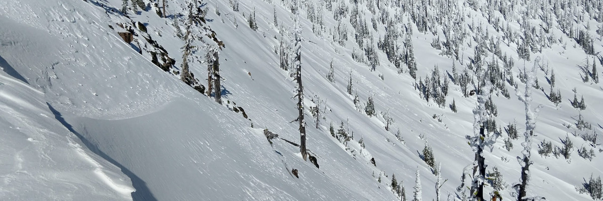
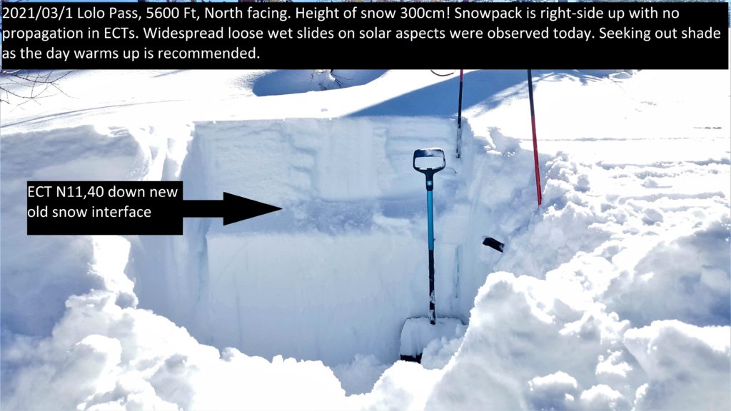
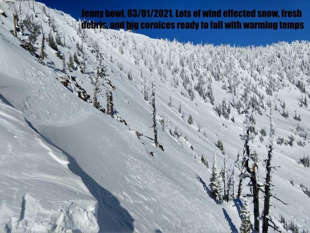
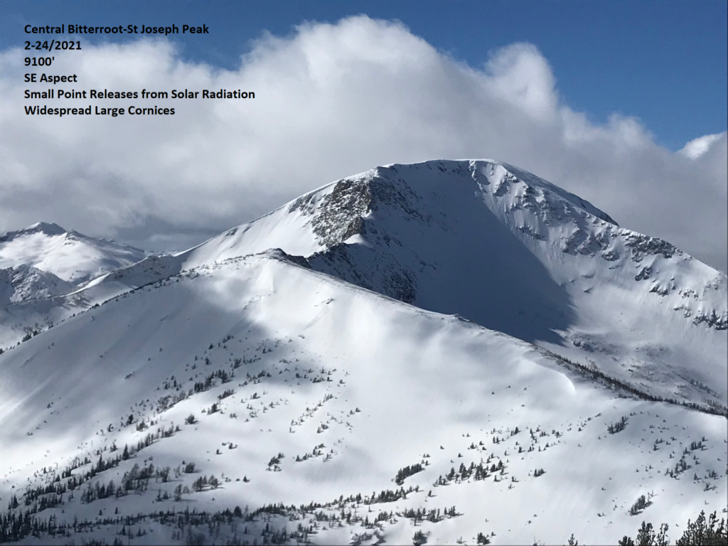
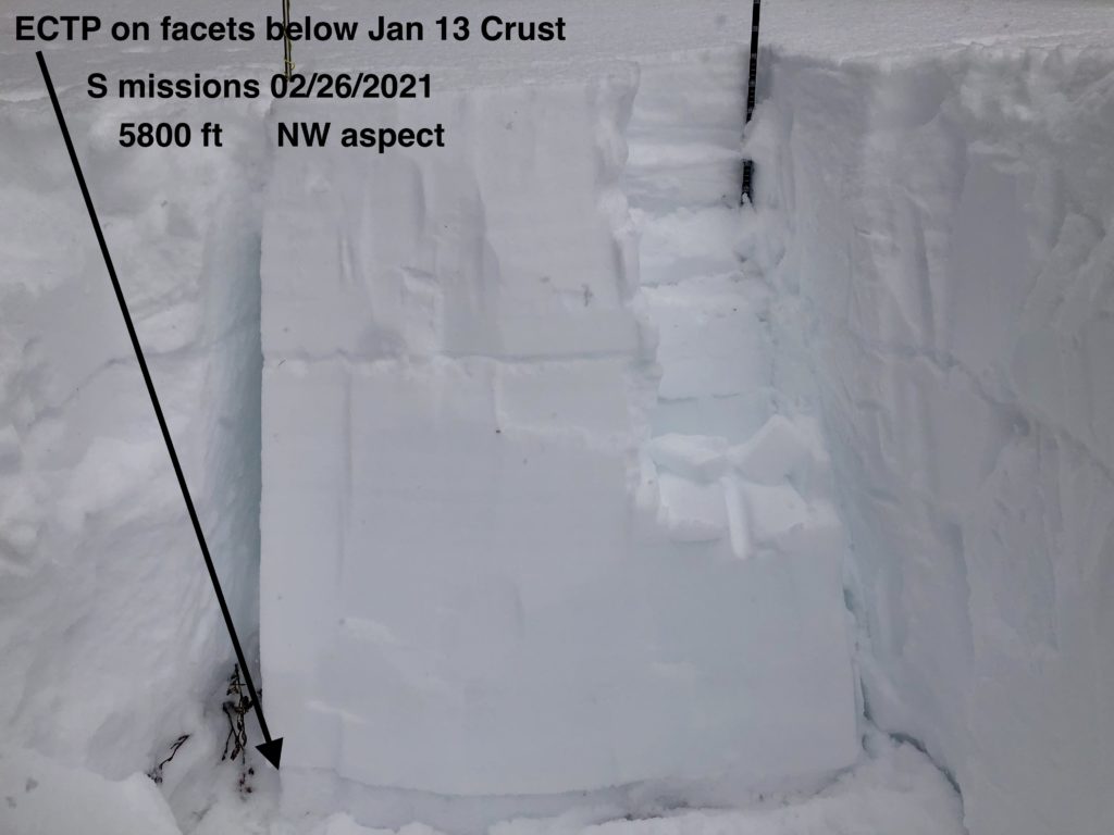
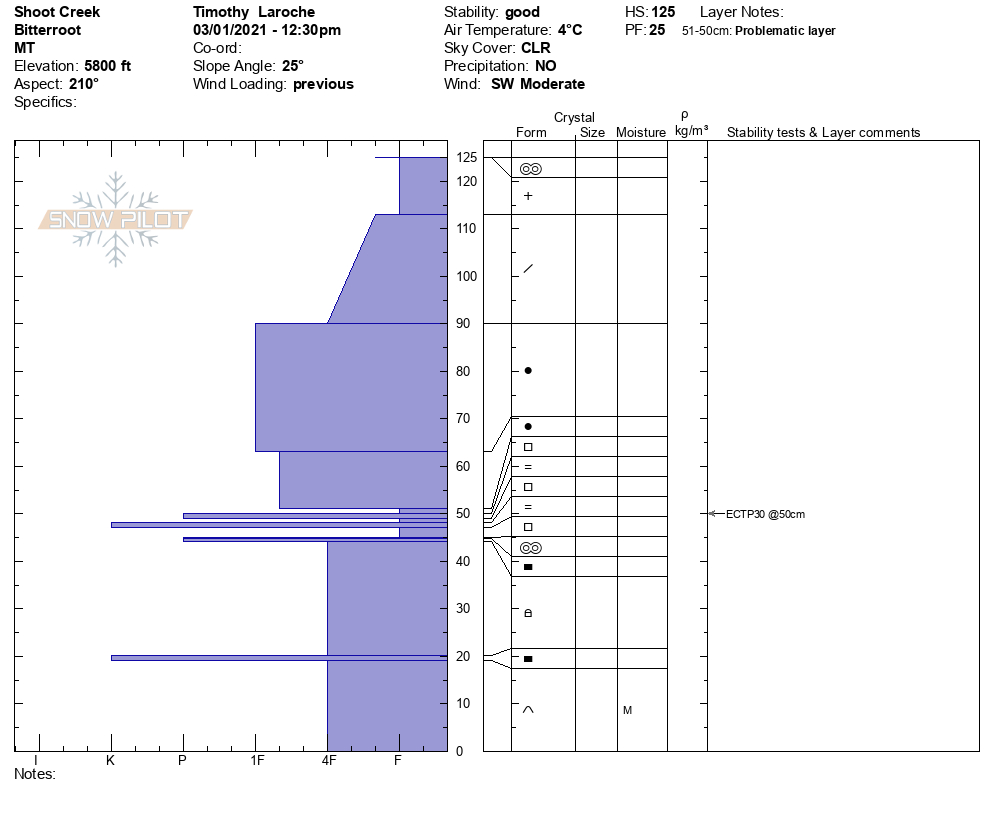
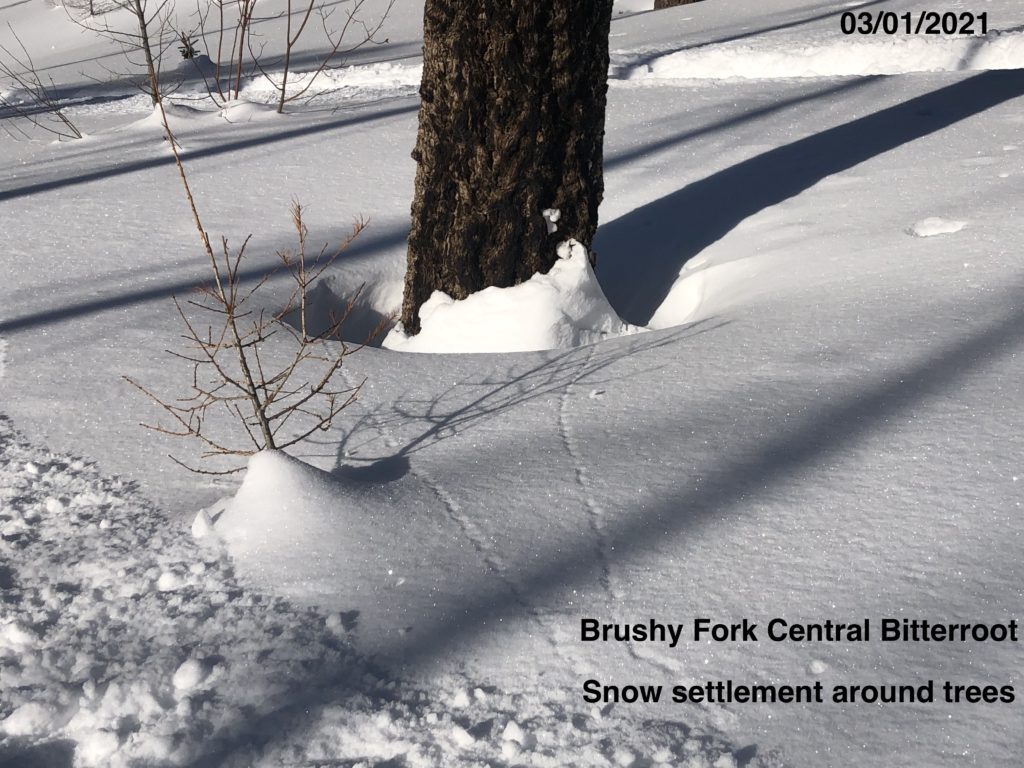
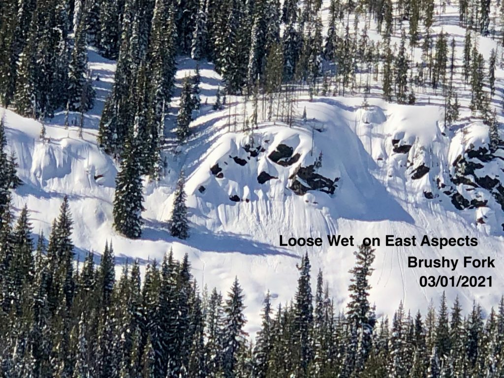
On Friday, there was a natural avalanche in Lost Horse 8.5 miles up the drainage on a South facing aspect that slid, depositing mature timber on the road. There were reports of natural wind slab avalanches in the Rattlesnake. Yesterday, we found reactive facets on the Jan 13 crust in shallow snowpacks in the Brushy Fork. The facets were not reactive in the Rattlesnake in pit tests. This shows us that the likelihood of triggering these avalanches is decreasing, but the consequences are high. The type of avalanche you can trigger will likely be unsurvivable. We observed cornice failure with warming temperatures near Lost Trail Pass. Throughout the advisory area, we saw loose wet releases on steep solar exposed slopes. When roller balls start coming out, it is time to head to shady aspects.
Terrain is the way to combat avalanche problems. Choose slopes less than 30 degrees that are simple and not connected to larger terrain. If you choose slopes above 35 degrees, you increase the likelihood of triggering one of the weak layers deeper in our snowpack, and the consequences will be almost unsurvivable.
Bottom Line
Avoid slopes over 30 degrees. Avoid traveling under large cornices and give them a wide berth on ridges. If roller balls show up move to shadier aspects or head home.
Carry a beacon, shovel, and probe. Reassess conditions throughout the day and stay alert for signs of instability. Dig pits. Look for red flags.
Upcoming Education Events
Please visit our education page for an up-to-date list of regional educational events and course offerings. Below are a few select events and opportunities to check out.
- March 3rd, 6-7:30 PM MST | FREE Online 1.5-hr Avalanche Awareness Session | Missoulaavalanche.org event | Delivered by A3 Pro instructors | Get more details and register HERE
Special Announcements
You’ve prayed, hoped, and danced for snow all winter, and it’s finally here! Western Montana’s mountains are busier than ever before, with new and veteran backcountry users enjoying the fresh snow. To celebrate the snowfall and help ensure everyone has the information needed to enjoy the mountains and return home safely, we bring you Loving La Niña! This virtual fundraising event includes two outstanding gear packages and two ways to enter to win. Please click HERE for more information about this exciting event. All proceeds benefit west-central Montana’s avalanche forecasting and education programs. Together, we can save lives and continue creating the most fun, safe, and responsible backcountry community possible. Spread the word, and spread the love for La Niña!
Public Observations
Thank you to everyone who has taken the time to send in a public observation. Please keep sharing what you find and see while out in the backcountry. This online forum is a great resource to glean information about current conditions.
You can now text us your observations to (406) 219-5566 when you don’t have time to fill out the observations page. Texted observations won’t get posted on the website, but will be used in the development of the forecast.
Ski and ride safe.


