
The avalanche danger in the west central Montana backcountry is considerable this morning rising to High this afternoon. Avoid traveling in avalanche terrain today. Very dangerous avalanche conditions exist.
Good Morning. This is Travis Craft with the West Central Montana Avalanche Center advisory on Friday, March 5, 2021. This advisory is sponsored by the Trail Head. This advisory does not apply to operating ski areas and expires at midnight tonight. The USDA Forest Service is solely responsible for its content.
Weather and Snowpack
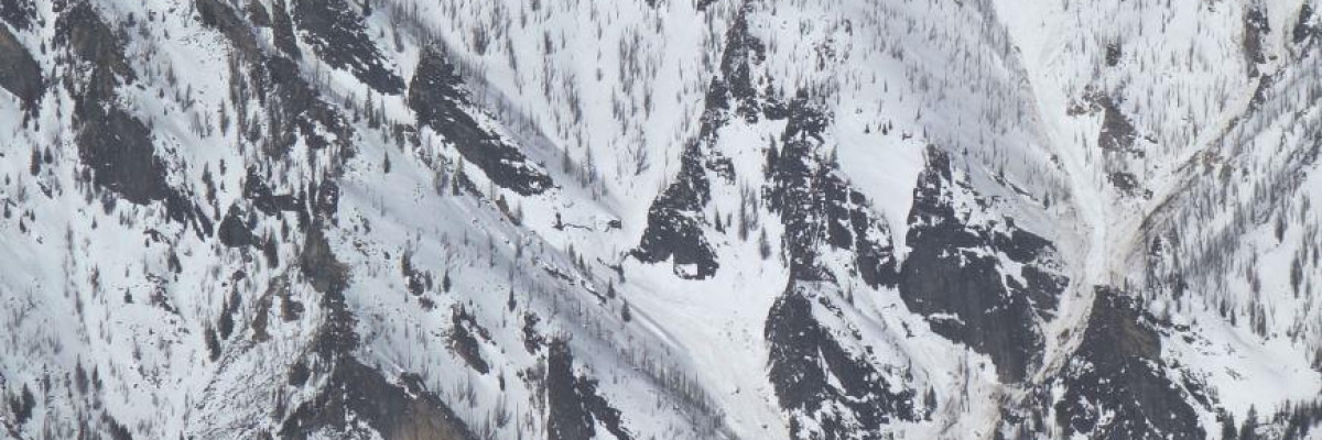
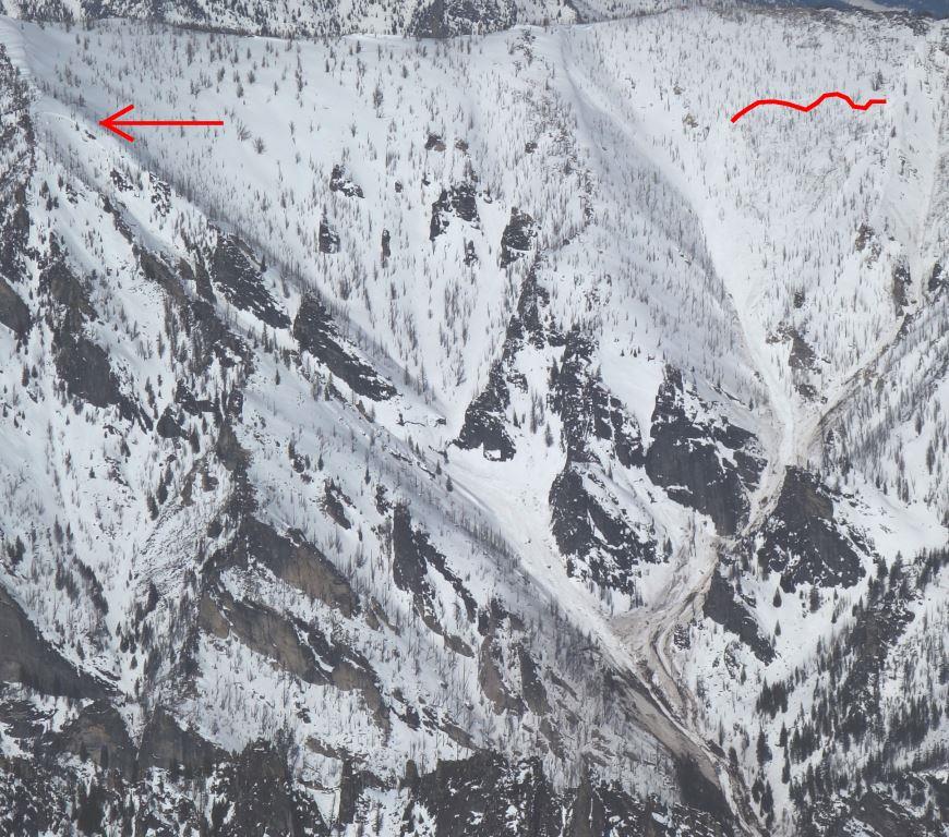
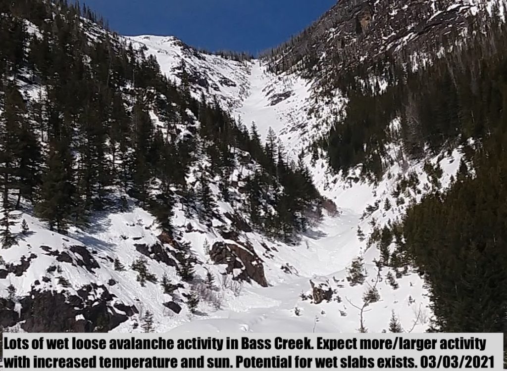
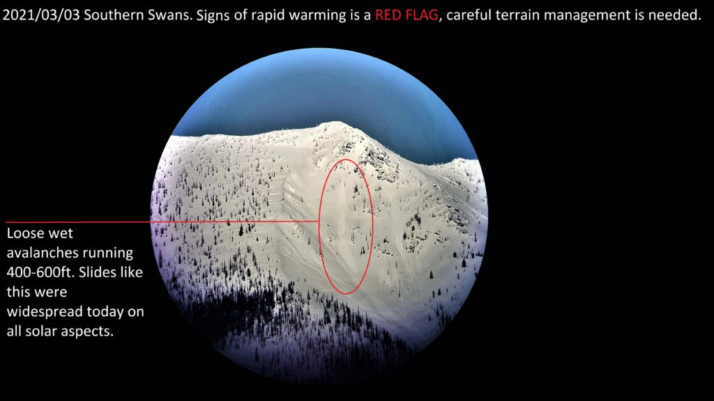
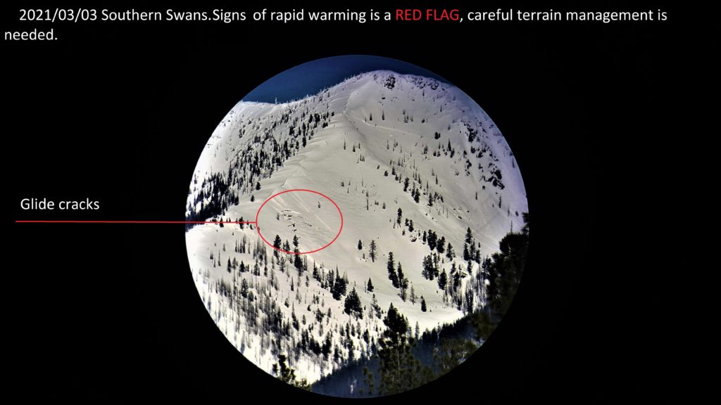
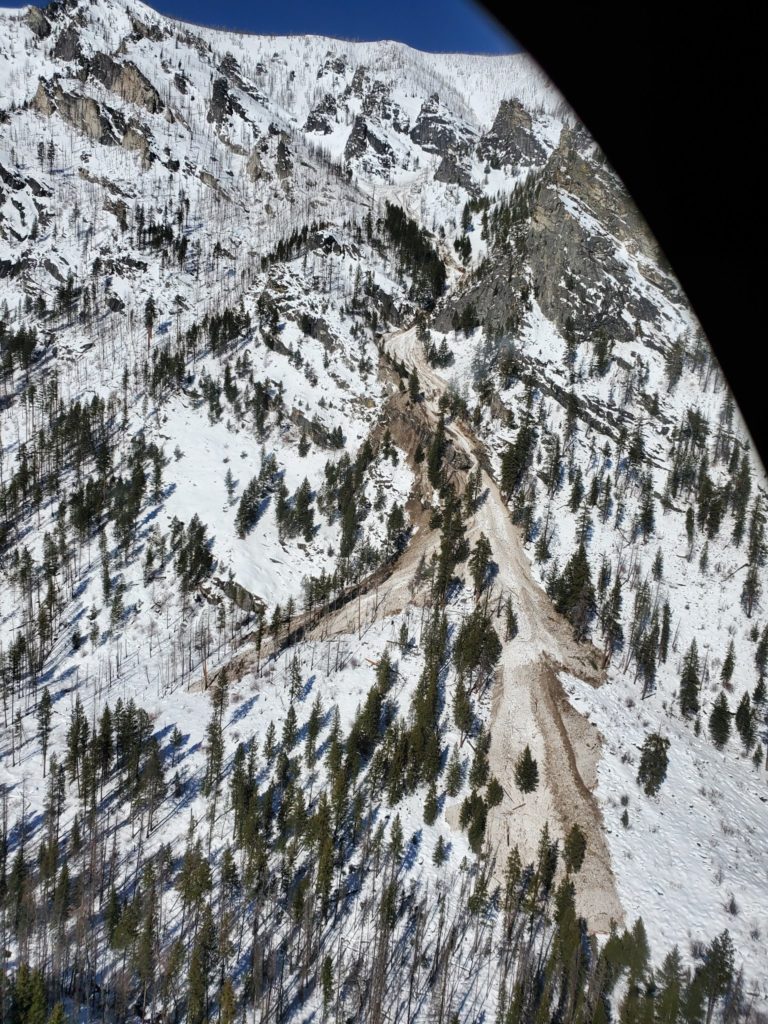
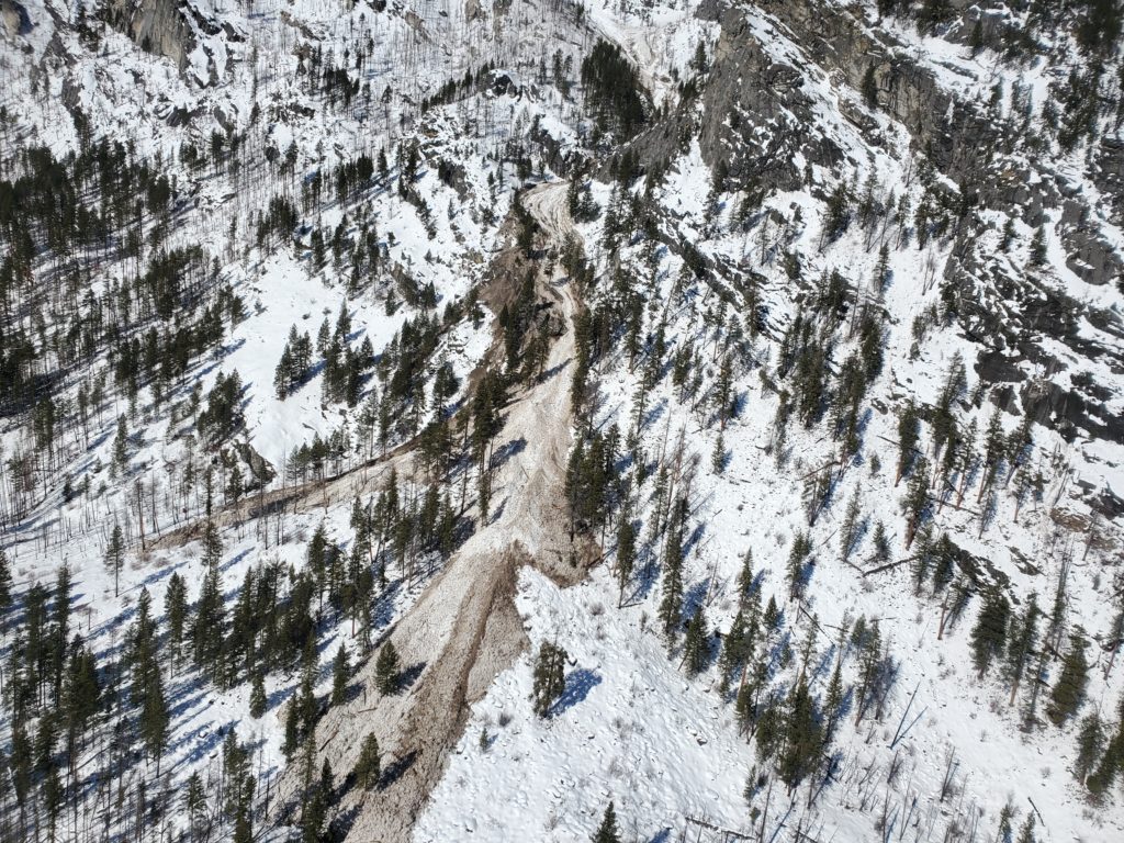
Mountain temperatures range from 19 to 33 degrees this morning. Winds are expected to be 10 mph gusting into the 20’s out of the SW. Mountain temperatures are expected to rise into the 40’s at higher elevations. Today is the last day of warming before a cold front enters our area tomorrow. The snowpack did not refreeze in the Rattlesnake. In the Bitterroot at higher elevations the snowpack had a light refreeze. Warm temperatures today will create wet snow avalanches. Wet slab avalanches are unpredictable. Over the last 2 days we have reports of large wet slab avalanches in the central Bitterroot and southern Bitterroot. Sawtooth Creek on a South facing slope at 7500 ft. In the central Bitterroot on a South facing slope at 8000 ft.
There are more problems than I can list today. Wet Slab avalanches, wet loose avalanches, cornices, persistent weak layers, and glide cracks. Wet slab avalanches are very unpredictable and produce large unsurvivable avalanches. Today avoid avalanche terrain. Travel on ridges and enjoy the sunshine. Do not cross under avalanche run out zones. Recent avalanches have all been large and run almost the full path of slides reaching valley floors.
Bottom Line
The amount of avalanche problems today and the unpredictability of wet slab avalanches, glide avalanches and cornice failure combined with our persistent weak layers means , today travel in avalanche terrain is not recommended. Avoid runout zones. Avalanches can run long distances and through mature timber. Give cornices a wide birth on ridges. Avoid glide cracks. Wet avalanche problems are notoriously unpredictable.
Carry a beacon, shovel, and probe. Reassess conditions throughout the day and stay alert for signs of instability.
Upcoming Education Events
Please visit our education page for an up-to-date list of regional educational events and course offerings. Below are a few select events and opportunities to check out.
- March 10th, 6-7:30 PM MST | FREE Online 1.5-hr Avalanche Awareness Session | Missoulaavalanche.org event | Delivered by A3 Pro instructors | Get more details and register HERE
Special Announcements
The mountains are busier than ever before, with new and veteran backcountry users enjoying the goods. To celebrate the snowfall and help ensure everyone has the information needed to enjoy the mountains and return home safely, we bring you Loving La Niña! This virtual fundraising event includes two outstanding gear packages and two ways to enter to win. Please click HERE for more information about this exciting event. All proceeds benefit west-central Montana’s avalanche forecasting and education programs. Together, we can save lives and continue creating the most fun, safe, and responsible backcountry community possible. Spread the word, and spread the love for La Niña!
Public Observations
Thank you to everyone who has taken the time to send in a public observation. Please keep sharing what you find and see while out in the backcountry. This online forum is a great resource to glean information about current conditions.
You can now text us your observations to (406) 219-5566 when you don’t have time to fill out the observations page. Texted observations won’t get posted on the website, but will be used in the development of the forecast.
Ski and ride safe.


