
The avalanche danger in the west central Montana backcountry is moderate. Evaluate snow and terrain carefully.
Good Morning. This is Travis Craft with the West Central Montana Avalanche Center advisory on Saturday, March 6, 2021. This advisory is sponsored by the Trail Head. This advisory does not apply to operating ski areas and expires at midnight tonight. The USDA Forest Service is solely responsible for its content.
Weather and Snowpack
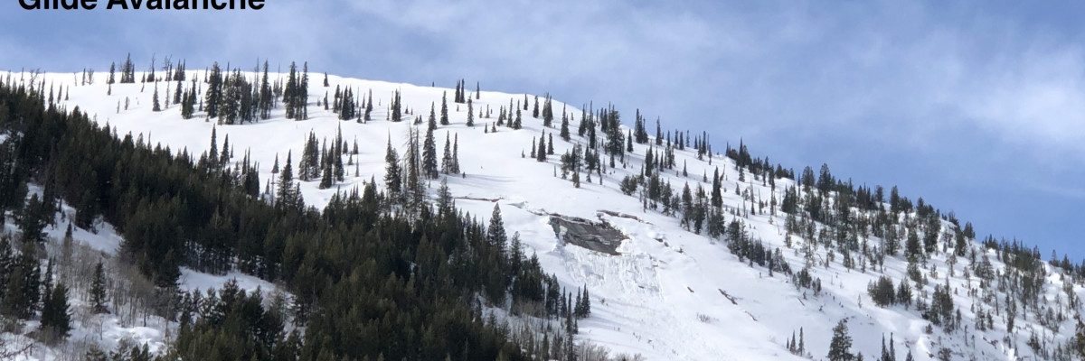
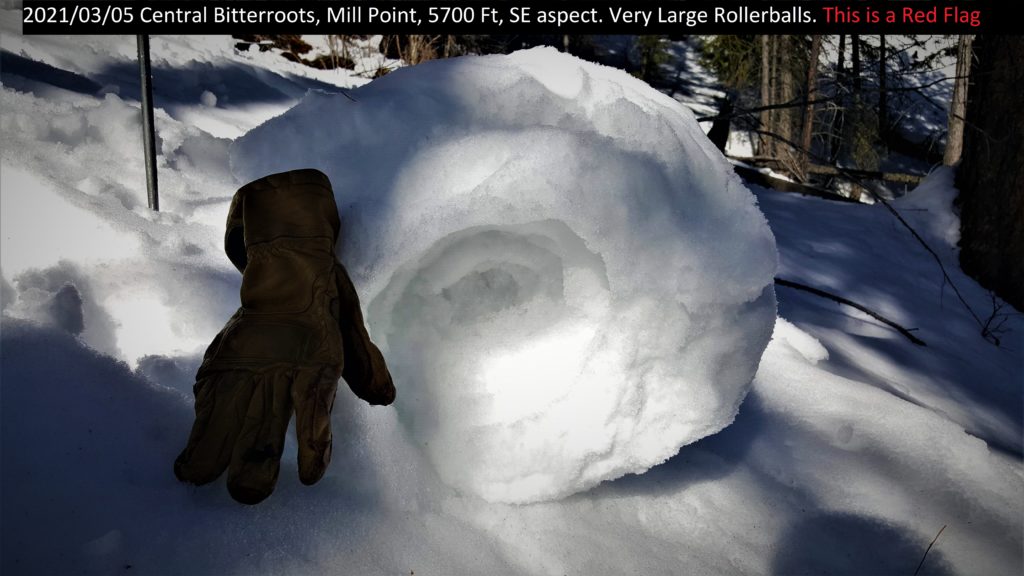
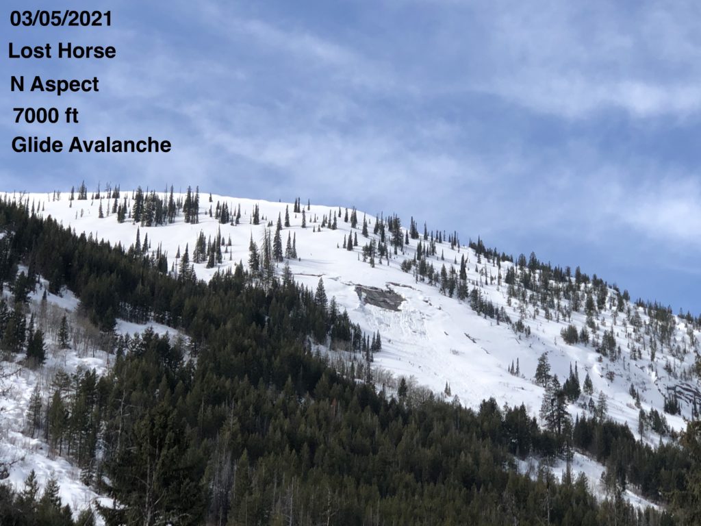
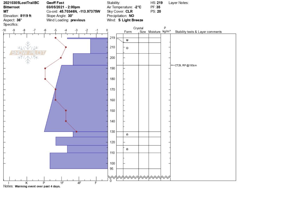
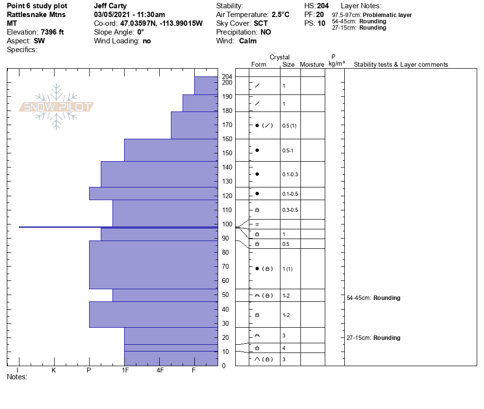
Temperatures range from 22 to 38 degrees this morning. Temperatures froze overnight in all locations except in the Rattlesnake at higher elevations. This will lock up low elevation and mid-elevation snowpacks. Winds are predicted to be gusty into the 20’s today out of the SW. Winds will help keep the snowpack cool. Cloud cover is expected with the front moving in today. Yesterday, we found N slopes above 7000 ft to be dry. Expect to find a melt-freeze crust today on all other aspects as you travel, getting thinner as you gain elevation. Facets failed in tests above 7000 ft in the Central Bitterroot. Rollerballs were observed from Lost Trail Pass to the Rattlesnake on multiple aspects except for true North. In Lost Horse, we observed several Glide avalanches that failed in the previous days. The Rattlesnake pit tests show the snowpack is gaining strength.
Today will have variable conditions. The avalanche danger is MODERATE. Be mindful of changing conditions as you change aspect and gain elevation. Avoid traveling under glide cracks. Pay attention to the snow surface. Is it wet or dry? How thick is the crust? Investigate layers you find in the snow and see if they are reactive in pit tests. Look for rollerballs and move to a different aspect if you see them. Be on the lookout for small areas of wind drifted snow on ridges and terrain features.
Bottom Line
Do not let your guard down. Investigate the snowpack today and see how it changes with aspect and elevation. Choose slopes less than 30 degrees. The persistent weak layers are gaining strength but cannot be ruled out. Seek shaded slopes that are low angle.
Carry a beacon, shovel, and probe. Reassess conditions throughout the day and stay alert for signs of instability. Dig pits. Look for red flags.
Upcoming Education Events
Please visit our education page for an up-to-date list of regional educational events and course offerings. Below are a few select events and opportunities to check out.
- March 10th, 6-7:30 PM MST | FREE Online 1.5-hr Avalanche Awareness Session | Missoulaavalanche.org event | Delivered by A3 Pro instructors | Get more details and register HERE
Special Announcements
The mountains are busier than ever before, with new and veteran backcountry users enjoying the goods. To celebrate the snowfall and help ensure everyone has the information needed to enjoy the mountains and return home safely, we bring you Loving La Niña! This virtual fundraising event includes two outstanding gear packages and two ways to enter to win. Please click HERE for more information about this exciting event. All proceeds benefit west-central Montana’s avalanche forecasting and education programs. Together, we can save lives and continue creating the most fun, safe, and responsible backcountry community possible. Spread the word, and spread the love for La Niña!
Public Observations
Thank you to everyone who has taken the time to send in a public observation. Please keep sharing what you find and see while out in the backcountry. This online forum is a great resource to glean information about current conditions.
You can now text us your observations to (406) 219-5566 when you don’t have time to fill out the observations page. Texted observations won’t get posted on the website, but will be used in the development of the forecast.
Ski and ride safe.


