Posted:
Mar 9, 2021 @ 6:32 am

The avalanche danger in the west-central Montana backcountry is MODERATE. Evaluate snow and terrain carefully.

Good Morning. This is Travis Craft with the West Central Montana Avalanche Center advisory on Tuesday, March 9, 2021. This advisory is sponsored by the Big Sky Brewing Company. This advisory does not apply to operating ski areas and expires at midnight tonight. The USDA Forest Service is solely responsible for its content.

Weather and Snowpack

Temperatures range from 20 to 26 degrees this morning. Winds will be light in the northern half of the advisory area today. The southern portion of the advisory area will have winds gusting in the 20’s out of the west. 3 to 6 new inches of snow fell in the last 24 hours. 

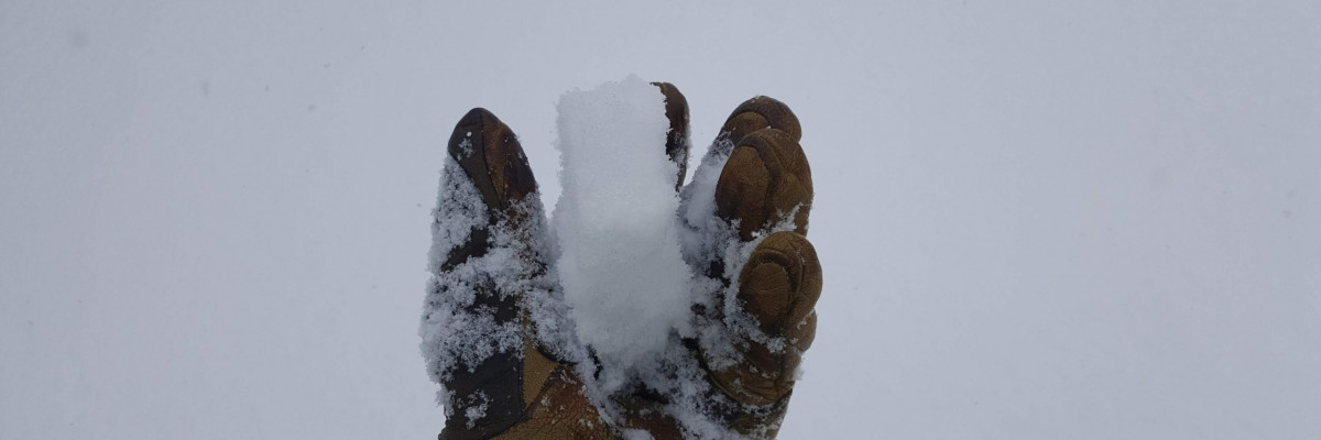
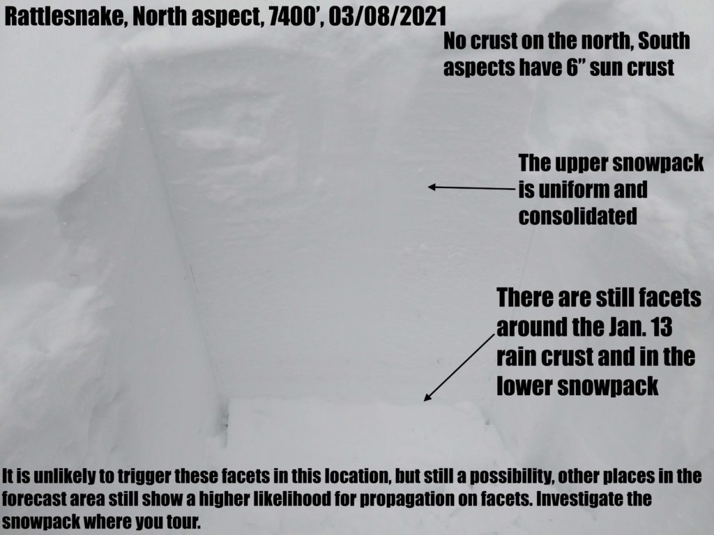
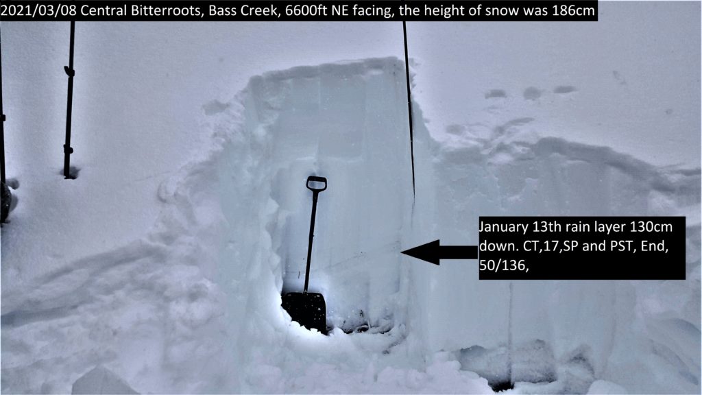
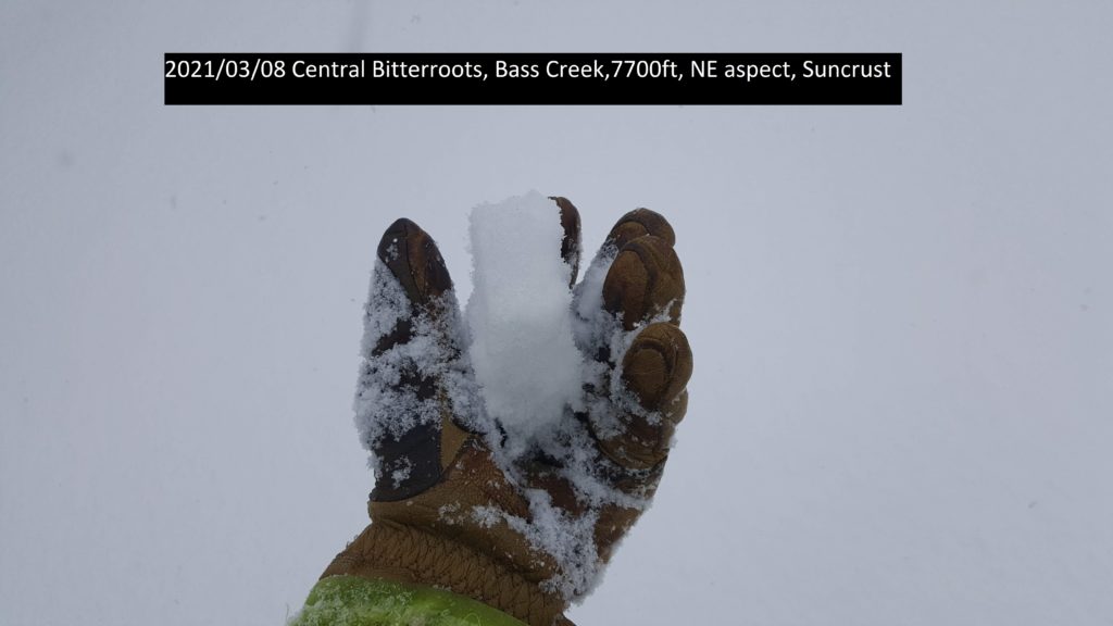
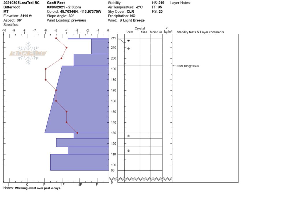
Yesterday winter returned to our region. You can find a melt-freeze crust on all aspects except due North slopes. Any aspect that saw sun last week will have a crust that gets thinner as you gain elevation. Yesterday, from Lost Trail pass to the southern Missions, we found loose dry avalanches triggered easily on the crust with the new snow. The facets in our snowpack are gaining strength but are still showing failures in our pits. See video

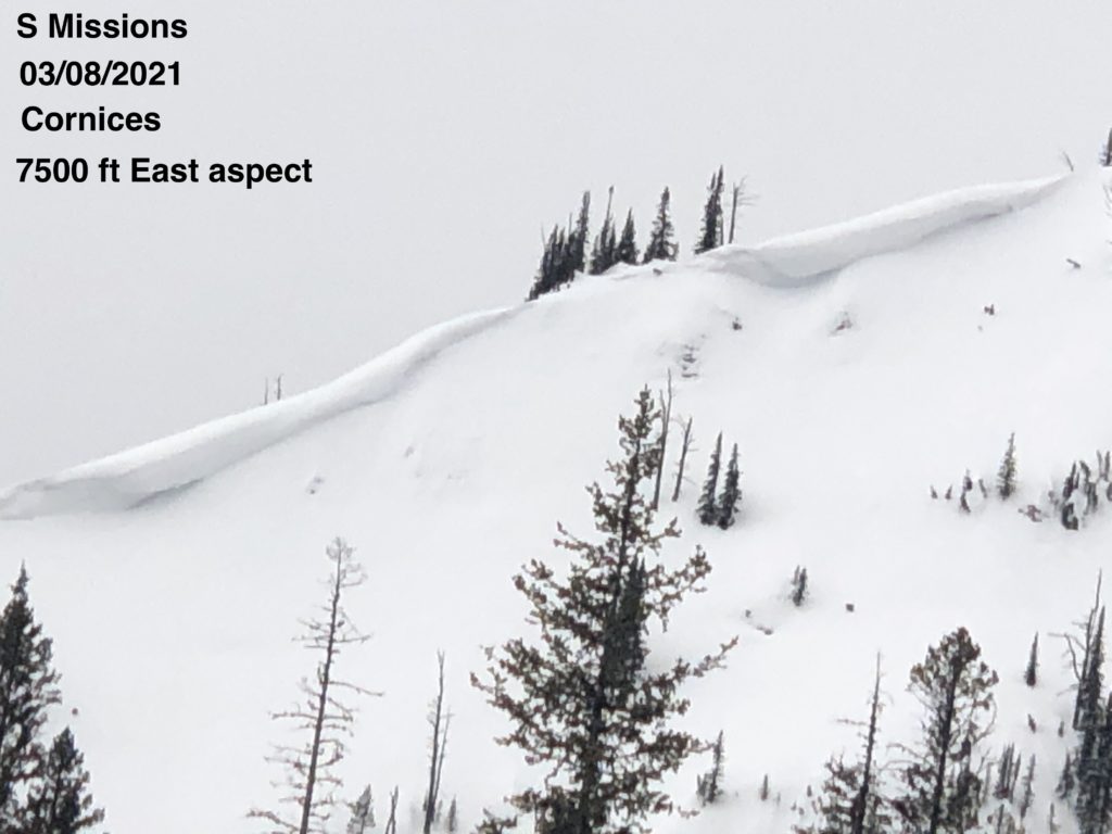
You are most likely to trigger these layers at mid-elevations on north-facing slopes and in shallower snowpacks at high elevations near rocks and ridges. Winds will increase today. Look for small wind slabs on leeward terrain to be sensitive to human triggers today. Give cornices a wide berth on ridges. Glide cracks are out and should be avoided because they can fail unexpectedly.

Bottom Line

Pay attention to how the new snow is bonding to old snow surfaces. Pay attention to aspect and elevation when traveling today. True North slopes will have dry snow but are the most likely to trigger our persistent weak layers. Choose less than 30 degree slopes with dry snow. Avoid shallow start zones on ridges. Before committing to a steep slope ask yourself: What are the consequences of triggering a slide?  How big of a slide can I trigger?

Carry a beacon, shovel, and probe. Reassess conditions throughout the day and stay alert for signs of instability. Dig pits. Look for red flags.

Upcoming Education Events 

Please visit our education page for an up-to-date list of regional educational events and course offerings. Below are a few select events and opportunities to check out.

Special Announcements

We want to reiterate our most sincere thanks to everyone who participated in Loving La Niña! Your contributions support avalanche forecast information and ensure free education programs throughout west-central Montana. We are honored to put these proceeds to work and provide the information needed for having fun and staying safe in the backcountry.

Supporting west-central Montana’s avalanche forecasting and education programs is made possible through your generosity and our gracious sponsors’ help. Together, we can save lives and continue creating the most fun, safe, and responsible backcountry community possible. Again, thank you for your continued support. We couldn’t do it without you!

Public Observations

Thank you to everyone who has taken the time to send in a public observation. Please keep sharing what you find and see while out in the backcountry. This online forum is a great resource to glean information about current conditions.

You can now text us your observations to (406) 219-5566 when you don’t have time to fill out the observations page. Texted observations won’t get posted on the website, but will be used in the development of the forecast.

Ski and ride safe.


READ FULL ADVISORY  

Problem 1 - New Snow

  • TYPE

    loose-dry

    Loose Dry

    Release of wet unconsolidated snow or slush. These avalanches typically occur within layers of wet snow near the surface of the snowpack, but they may quickly gouge into lower snowpack layers. Like Loose-Dry Avalanches,they start at a point and entrain snow as they move downhill, forming a fan-shaped avalanche. They generally move slowly, but can contain enough mass to cause significant damage to trees, cars or buildings. Other names for loose-wet avalanches include point-release avalanches or sluffs. Loose-wet avalanches can trigger slab avalanches that break into deeper snow layers.

  • SIZE

    2-3

    1 (Small)

    The potential size of avalanche resulting from this problem.

  • LIKELIHOOD

    Likelihood-4

    Possible/Likely

    The likelihood of an avalanche resulting from this problem.

  • ADDED DANGER

    Increased Slope Danger

    Increased/Added Danger

    There is an increased risk of avalanches on these slopes:

    N - North
    NE - Northeast
    E - East
    SE - Southeast
    S - South
    SW - Southwest
    W - West
    NW - Northwest

New snow is not yet consolidated and was readily sluffing on steep slopes yesterday.

These are small slides but could knock a rider off their feet. Terrain traps such as gullies can concentrate the depth and strength of these slides, obstacles such as cliffs or rocks will increase the likelihood of trauma.

Problem 2 - Persistent Weak Layers

  • TYPE

    persistent-slabs

    Persistent Slabs

    Release of a cohesive layer of soft to hard snow (a slab) in the middle to upper snowpack, when the bond to an underlying persistent weak layer breaks.  Persistent layers include: surface hoar, depth hoar, near-surface facets, or faceted snow. Persistent weak layers can continue to produce avalanches for days, weeks or even months, making them especially dangerous and tricky. As additional snow and wind events build a thicker slab on top of the persistent weak layer, this avalanche problem may develop into a Persistent, Deep-Slab.

  • SIZE

    5-6

    2-3 (Large)

    The potential size of avalanche resulting from this problem.

  • LIKELIHOOD

    Likelihood-3

    Possible

    The likelihood of an avalanche resulting from this problem.

  • ADDED DANGER

    Increased Slope Danger

    Increased/Added Danger

    There is an increased risk of avalanches on these slopes:

    N - North
    NE - Northeast

The Jan 13. crust still has facets that are are reactive in pit tests. There is still weak snow near the base of the snowpack in shallow spots near rocks and ridges. You are most likely to trigger these layers on true North aspects 6000 ft and above. Other places to avoid are shallow start zones on ridges at higher elevations. Avoid slopes with rock outcrops where the snowpack is shallower. These layers should not be trusted. If you trigger these layers, the consequence is high and most likely unsurvivable. See video.

VIDEO

Observations 03/08/2021

Observations Central Bitterroot, Rattlesnake, S. Missions, and Lost Trail Pass,

FORECAST & OUTLOOK

  • Danger Trend

    same

    Same Danger

  • Area Forecast

    Light Snow

Light snow today. Light winds in the North part of the advisory area and winds in the 20’s out of the West in the southern region. See the forecast.

This information is the sole responsibility of the Forest Service and does not apply to operating ski areas. The avalanche danger rating expires at midnight tonight but the information can help you make a more informed decision regarding travel in avalanche terrain for the next few days.

Our advisory area includes National Forest System lands in the Bitterroot Mountains from Lost Trail Pass north to Granite Pass, the Rattlesnake Mountains north of Missoula and the Southern Swan and Mission Mountains near Seeley Lake, MT. Avalanche information for the Lookout Pass/St. Regis Basin area is available from the Idaho Panhandle Avalanche Center.