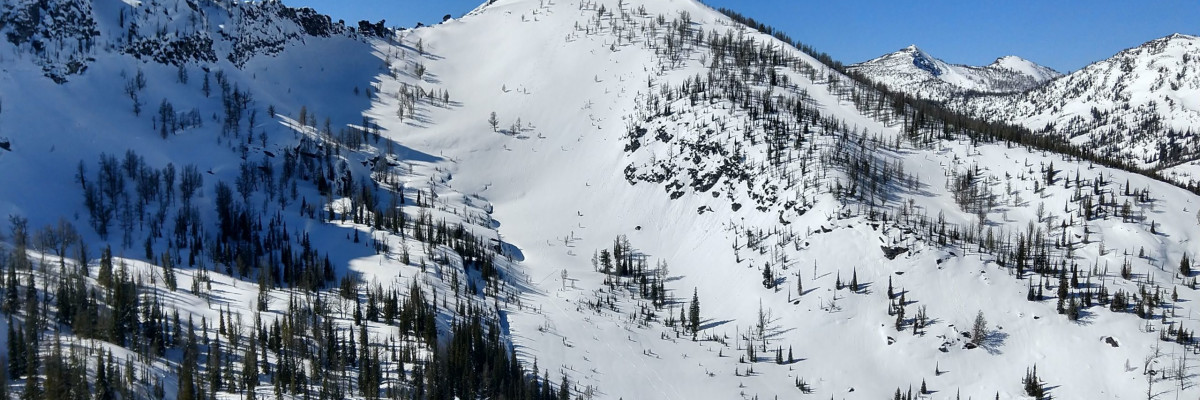

The avalanche danger in the west central Montana backcountry is MODERATE on north facing slopes above 6500 ft, and will increase to moderate on southern aspects this afternoon with warming. Evaluate snow and terrain carefully.
Good Morning. This is Jeff Carty with the West Central Montana Avalanche Center advisory on Saturday, March 13, 2021. This advisory is sponsored by the Black Coffee Roasting Company. This advisory does not apply to operating ski areas and expires at midnight tonight. The USDA Forest Service is solely responsible for its content.
Weather and Snowpack
Temperatures range from 14 to 22 degrees this morning and will rise to 45º above 6000′. Winds will be light out of the northeast. Today will be sunny again with temperatures climbing higher than yesterday, and freezing level rising to 8000′.
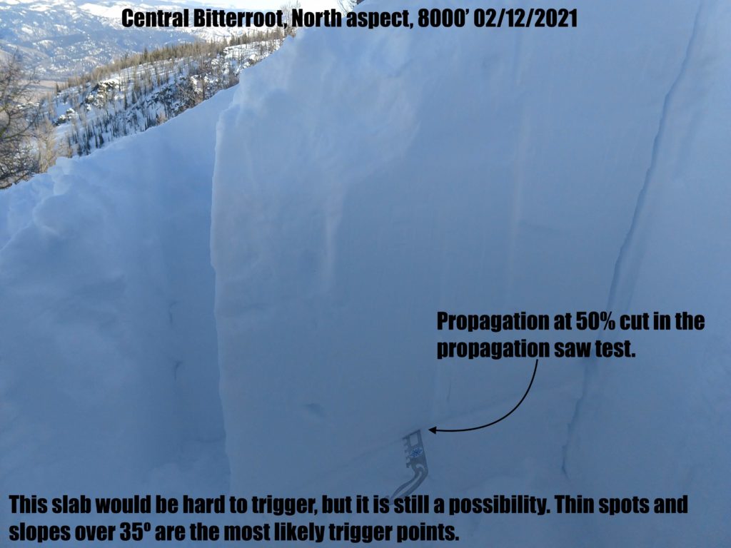
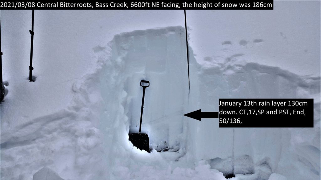
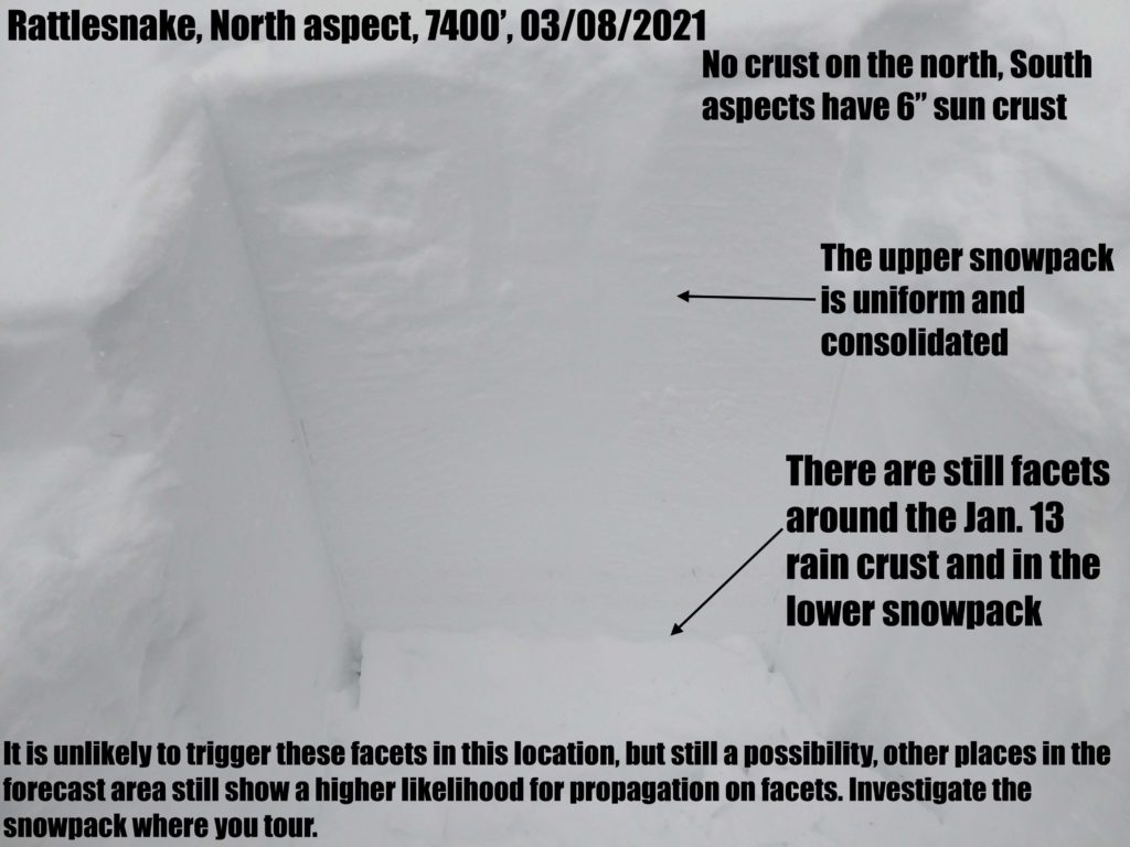
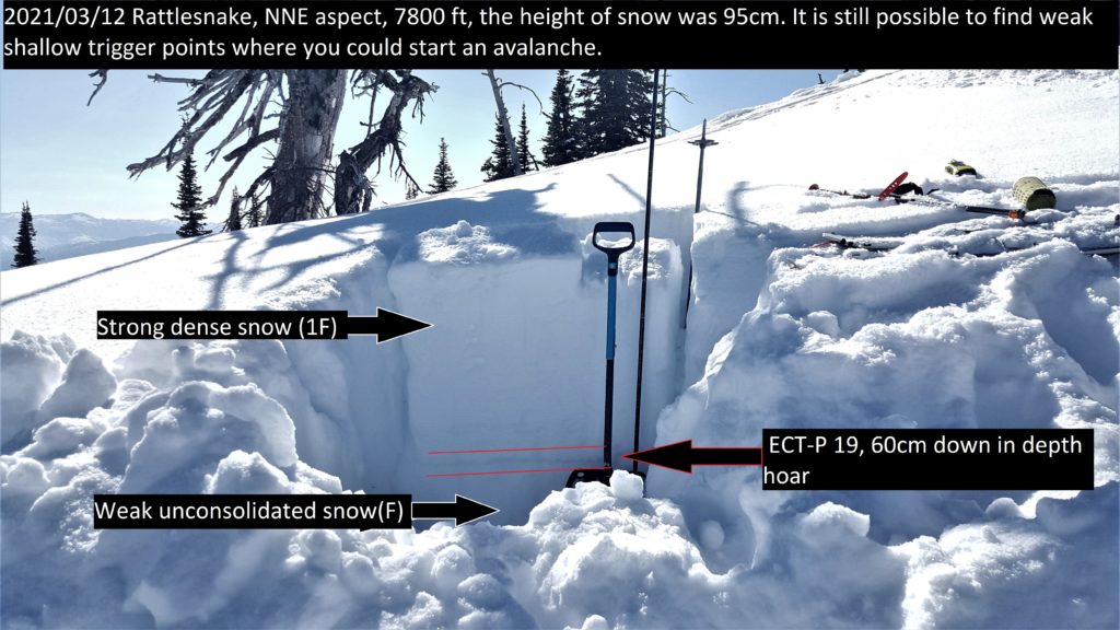
North aspects remain dry despite warm days and sun warming on all other aspects. The most notable outcome of this is that the persistent weak layers continue to persist on north faces. Facets around the Jan 13 rain crust are still propagating in stability tests. While the likelihood of triggering these layers is slowly decreasing it is possible to trigger a slab. It would take the right combination of trigger point and slope steepness: thin, and greater than 35º. If you found it, the avalanche would be unsurvivable with depths of 3 to 4 feet. Due to the depths of these faceted layers, they may not react to the extended column test. The propagation saw test is a good alternative that will give an indication of propagation potential. Shallow areas with multiple faceted layers can still be found in isolated areas throughout the forecast area. Windswept zones in upper elevations are the most likely places. If the snowpack is thin and you can push your pole through to softer snow move to a different slope.
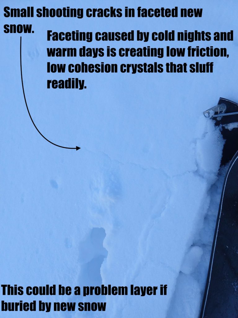
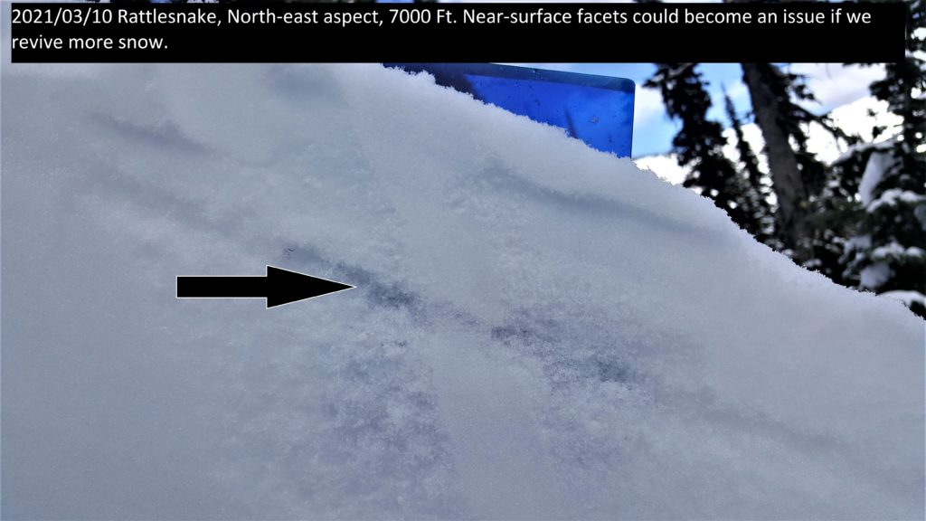
The 6 inches of snow we received in the past week is faceting quickly with warm days and cold nights. The result of this is that sluffs are running fast and far on north aspects. In places, these can be deep enough to knock a rider off their feet or push them into terrain traps. Practice sluff management by skiing out of their way after a couple of turns and avoid gullies that increase depth and limit escape options. If we get a load of snow on top of these near surface facets or the surface hoar that is growing, they will likely be problem layers.
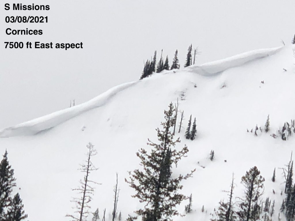
Cornices and glide cracks will be with us for the rest of the season. These are two unpredictable avalanche problems. Cornices were sagging and dripping yesterday. With continued warmth and sun the likelihood of cornice fall increases. Give them a wide berth and stay out from underneath. Large cornice fall could trigger lingering persistent slabs. Glide cracks can slowly open as the snowpack creeps downhill, accelerating as with warming. They can also fail unexpectedly creating full depth avalanches. Stay off slopes where they are present.
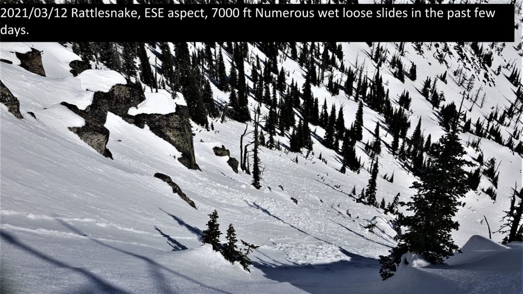
Today with elevated temperatures and clear skies, watch for loose wet activity on sun-exposed terrain. There is potential for more activity than previous days with freezing levels rising to 8000′.
Bottom Line
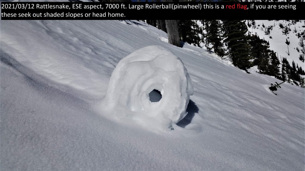
Persistent slab avalanches are possible on north aspects greater than 35º. Sluffs are running long distances on north aspects. Wet loose avalanches are likely in the afternoon on southern aspects. Avoid traveling under large cornices and give them a wide berth on ridges. If roller balls show up, move to shadier aspects or head home. Avoid glide cracks.
Carry a beacon, shovel, and probe. Reassess conditions throughout the day and stay alert for signs of instability. Dig pits. Look for red flags.
Upcoming Education Events
Please visit our education page for an up-to-date list of regional educational events and course offerings. Below are a few select events and opportunities to check out.
- March 17th, 6-7:30 PM MST | FREE Online Avalanche Awareness Session | Missoulaavalanche.org event | Delivered by A3 Pro instructors | Get more details and register HERE
- March 20th | Avalanche Rescue Course | Provided by A3 Pro instructors | Get more details and register HERE
Public Observations
Thank you to everyone who has taken the time to send in a public observation. Please keep sharing what you find and see while out in the backcountry. This online forum is a great resource to glean information about current conditions.
You can now text us your observations to (406) 219-5566 when you don’t have time to fill out the observations page. Texted observations won’t get posted on the website, but will be used in the development of the forecast.
Ski and ride safe.


