Posted:
Jan 14, 2016 @ 6:46 am

There is high avalanche danger in the southern Missions, southern Swans & central Bitterroot. Natural and human-triggered avalanches are likely.  Overall, in the west central Montana backcountry, the avalanche danger is considerable. Natural avalanches are possible and human-triggered avalanches are likely.

Good Morning, this is Dudley Improta with the West Central Montana Avalanche Center’s advisory for January 14, 2016. This danger rating is the sole responsibility of the U.S. Forest Service, does not apply to operating ski areas and expires at midnight tonight.

Weather and Snowpack

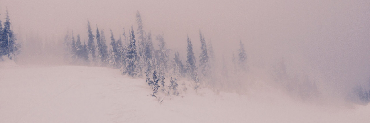
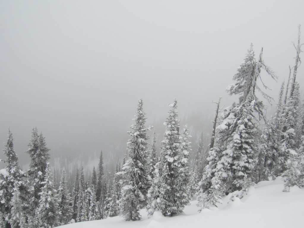
Generally, the area received about 6 inches of snow last night. The southern Missions and southern Swans have accumulated up to 16 inches of new snow. The central Bitterroot received 10 inches. Snow is forecast to continue to accumulate throughout the day; west central Montana is under a winter weather advisory until 11am MST.

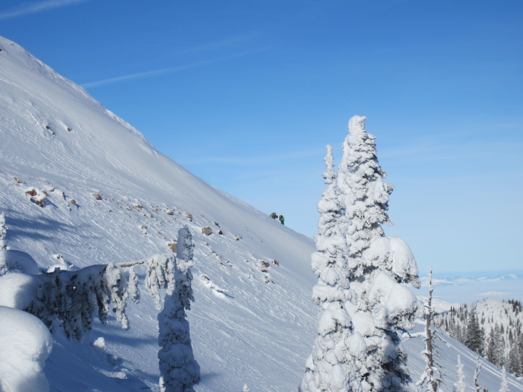
Westerly mountain winds are blowing in the high 20 mph range and gusting into the 30’s. Mountain temperatures are in the low to mid 20’s F .  Continued snow is forecast for today.

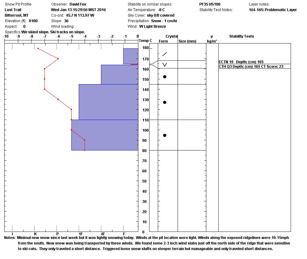
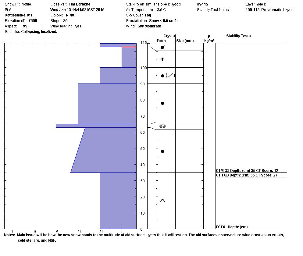
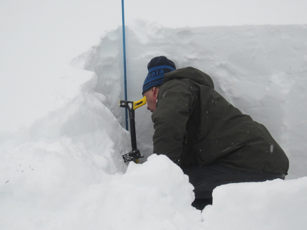
The new snow fell on a myriad of surfaces, depending on aspect. We toured the Rattlesnake and found cold snow capped by a wind crust on west and east facing slopes. On the south aspect there was a sun crust overlying surface facets. David Fox and Geoff Fast found a buried surface hoar layer 6 inches from the surface at Lost Trail; keep that in mind if you’re in the southern Bitterroots.

Storm slabs, wind slabs and large loose sluffs will be problems today. Stong westerly and southwesterly winds have loaded lee slopes; wind-loaded slopes are probably the most touchy, but I would avoid all steep slopes today. Travel on or under steep slopes is not recommended.

We received preliminary information about an avalanche accident in the St. Regis Basin yesterday. The accident happened in the afternoon and involved 3 skiers.  Early information indicates Search and Rescue and helicopter assistance from Two Bear Air Rescue was initiated. There were injuries sustained but no fatalities. The St. Regis Basin area is covered by the Idaho Panhandle National Forest Avalanche Center.

Weather Forecast and Avalanche Outlook

Snow and wind will continue throughout the day. After a brief interlude, another system is expected to produce more snow tonight through Friday night. And, yet another system is forecast for Saturday. We will be out Friday and issue another advisory Saturday morning. For now, I would  expect the avalanche danger to remain elevated.

Other Info

There are some openings left in Level 1 avalanche classes. Check our education page for all avalanche education opportunities.

Public observations can be important to the avalanche advisory and to riders and skiers.  If you would like to send us snow observations use our public observations form or e-mail us at  [email protected] .

Steve will issue the next advisory Saturday morning, January 16.

Ride and ski safe.

READ FULL ADVISORY  

Problem 1 - Storm Slabs

  • TYPE

    storm-slabs

    Storm Slabs

    Release of a soft cohesive layer (a slab) of new snow which breaks within the storm snow or on the old snow surface. Storm-slab problems typically last between a few hours and few days. Storm-slabs that form over a persistent weak layer (surface hoar, depth hoar, or near-surface facets) may be termed Persistent Slabs or may develop into Persistent Slabs.

  • SIZE

    4-5

    2 (Large)

    The potential size of avalanche resulting from this problem.

  • LIKELIHOOD

    Likelihood-5

    Likely

    The likelihood of an avalanche resulting from this problem.

New snow has accumulated; 6 inches overall, up to 15 inches in the southern Missions, 10 inches in the Central Bitterroot. Travel on or under steep slopes is not recommended.

Problem 2 - Wind Slabs

  • TYPE

    wind-slabs

    Wind Slabs

    Release of a cohesive layer of snow (a slab) formed by the wind.  Wind typically erodes snow from the upwind sides of terrain features and deposits snow on the downwind side.  Wind slabs are often smooth and rounded and sometimes sound hollow, and can range from soft to hard. Wind slabs that form over a persistent weak layer (surface hoar, depth hoar, or near-surface facets) may be termed Persistent Slabs or may develop into Persistent Slabs.

  • SIZE

    4-5

    2 (Large)

    The potential size of avalanche resulting from this problem.

  • LIKELIHOOD

    Likelihood-5

    Likely

    The likelihood of an avalanche resulting from this problem.

  • ADDED DANGER

    Increased Slope Danger

    Increased/Added Danger

    There is an increased risk of avalanches on these slopes:

    N - North
    NE - Northeast
    E - East
    SE - Southeast
    NW - Northwest

The new snow was accompanied by stong winds primarily out of the west and southwest. However, all steep slopes are suspect. Travel on or under steep slopes is not recommended.

Problem 3 - Loose Dry

  • TYPE

    loose-dry

    Loose Dry

    Release of wet unconsolidated snow or slush. These avalanches typically occur within layers of wet snow near the surface of the snowpack, but they may quickly gouge into lower snowpack layers. Like Loose-Dry Avalanches,they start at a point and entrain snow as they move downhill, forming a fan-shaped avalanche. They generally move slowly, but can contain enough mass to cause significant damage to trees, cars or buildings. Other names for loose-wet avalanches include point-release avalanches or sluffs. Loose-wet avalanches can trigger slab avalanches that break into deeper snow layers.

  • SIZE

    4-5

    2 (Large)

    The potential size of avalanche resulting from this problem.

  • LIKELIHOOD

    Likelihood-5

    Likely

    The likelihood of an avalanche resulting from this problem.

Storm slabs and wind slabs are inherently more dangerous than loose snow avalanches; but with the new snow accumulation sluffs could be quite large and consequential.

FORECAST & OUTLOOK

Snow will continue throughout the day. After a brief interlude, another system is expected to produce more snow tonight through Friday night. And, yet another system is forecast for Saturday.  We will be out Friday and issue another advisory Saturday morning. For now, I would  expect the avalanche danger to remain elevated.

This information is the sole responsibility of the Forest Service and does not apply to operating ski areas. The avalanche danger rating expires at midnight tonight but the information can help you make a more informed decision regarding travel in avalanche terrain for the next few days.

Our advisory area includes National Forest System lands in the Bitterroot Mountains from Lost Trail Pass north to Granite Pass, the Rattlesnake Mountains north of Missoula and the Southern Swan and Mission Mountains near Seeley Lake, MT. Avalanche information for the Lookout Pass/St. Regis Basin area is available from the Idaho Panhandle Avalanche Center.