Posted:
Jan 28, 2017 @ 6:31 am

The current avalanche danger is Moderate on wind loaded terrain for the northern portion of the advisory area. Small to large human triggered avalanches are possible in areas where windloading has occurred. On all other terrain and for the rest of the advisory area the avalanche danger is low.

Good morning, this is Logan King with the West Central Montana Avalanche Center’s avalanche advisory for Saturday January 28, 2017.  This danger rating does not apply to operating ski areas, expires at midnight tonight and is the sole responsibility of the U.S. Forest Service.

Weather and Snowpack

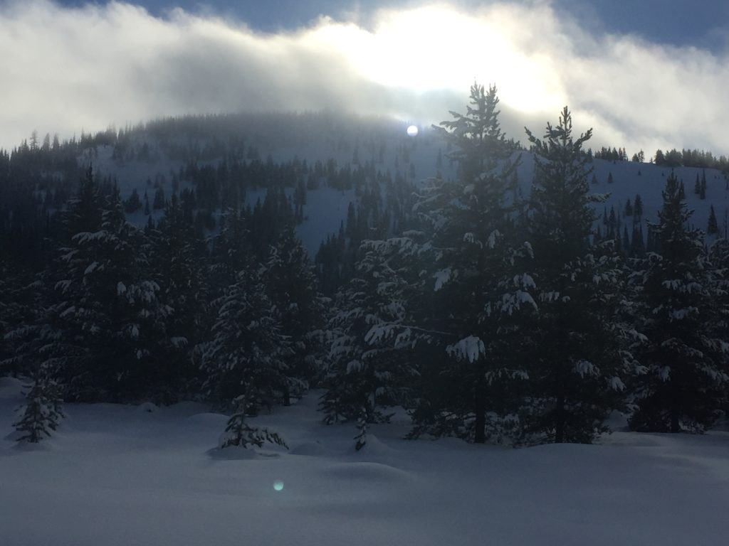
This morning mountain temperatures range from 11-20 degrees. Currently winds at Point 6 are 17mph and gusting to 21mph from the west. Winds are gusting to 12mph from the SSW at Deer Mountain in the southern Bitterroot. No snow accumulated overnight across the advisory area.

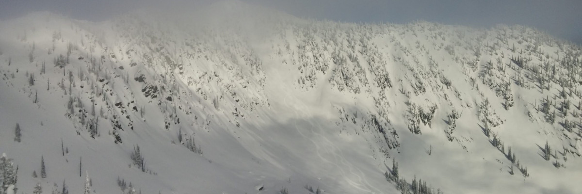
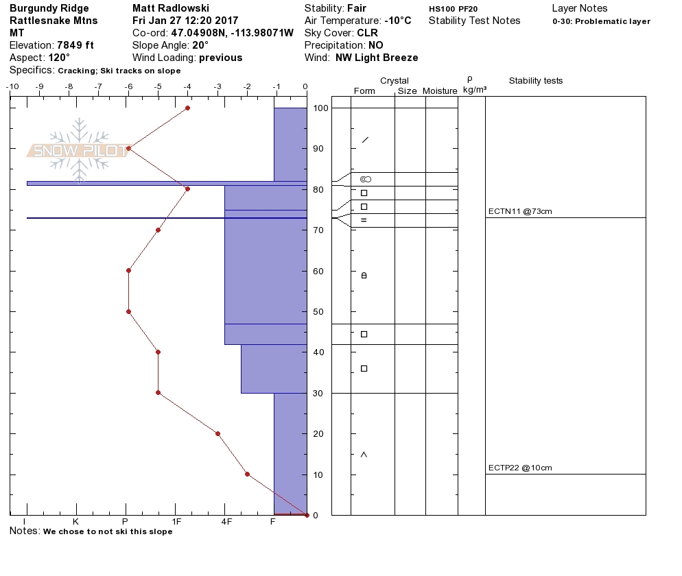
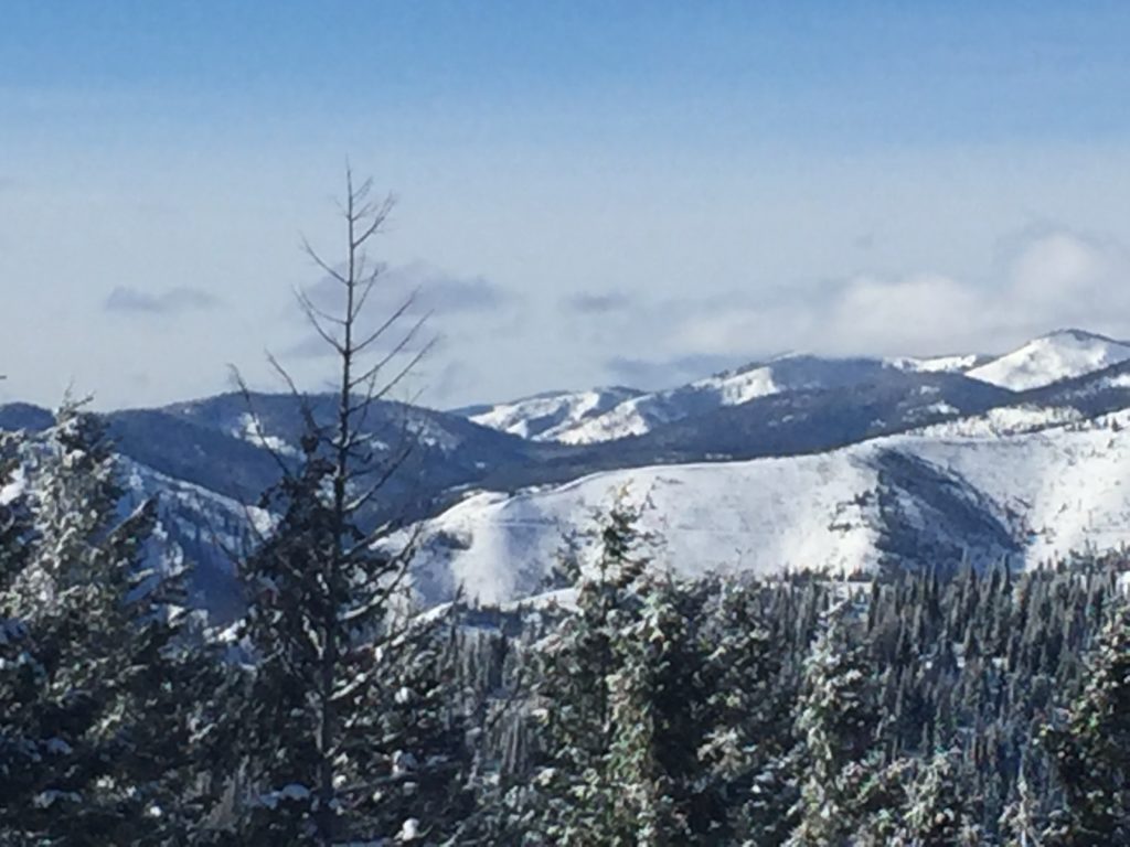
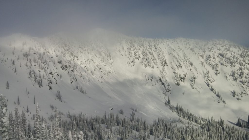
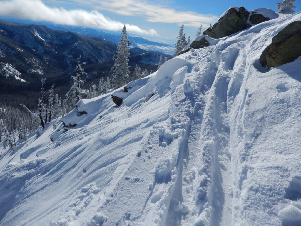
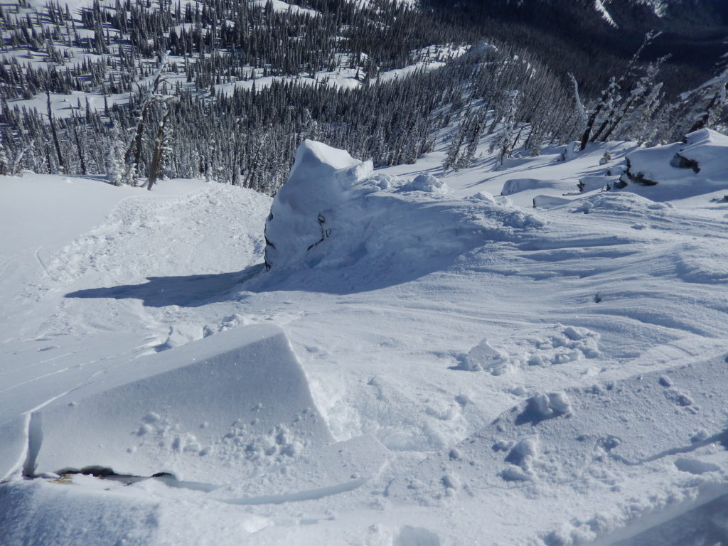
Travis and Matt were in the Rattlesnake yesterday and found the primary concern to be windslabs that have developed over the last couple of days. With the new low density snow for transport and good winds, soft windslabs have formed on lee terrain and will be sensitive to human triggers. We also received a public observation of a small windslab that was kicked of in the Rattlesnake yesterday. Windslab growth has been more concentrated in the northern part of the advisory area and will be a more widespread problem in the Rattlesnake and Southern Swan and Southern Mission ranges.

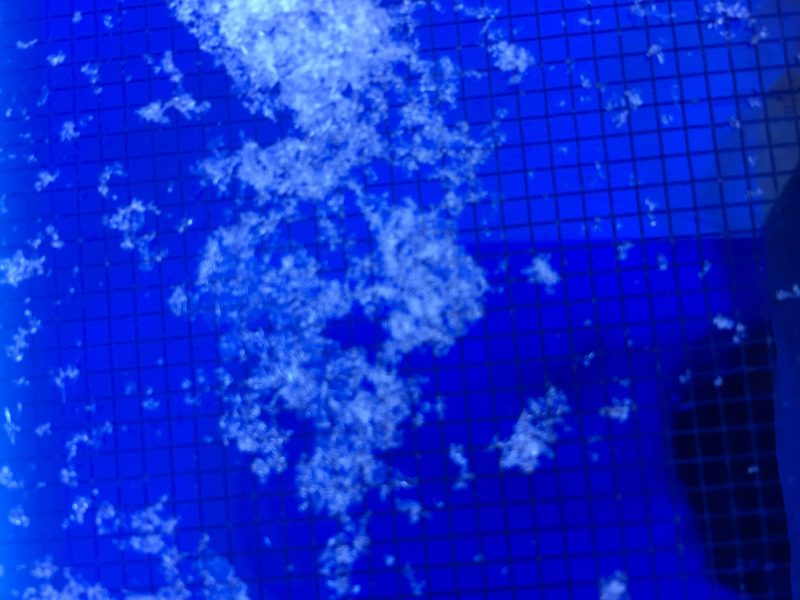
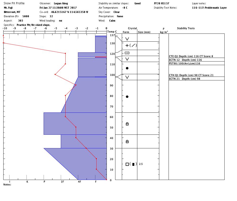
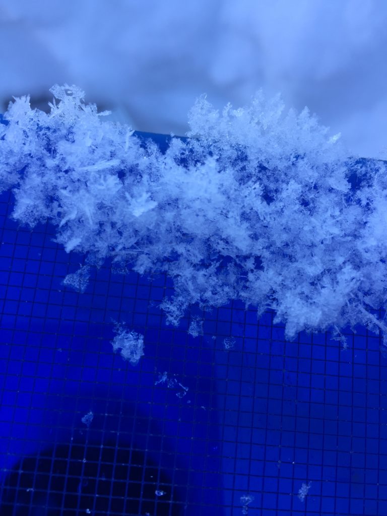
I toured around Mt. Fuji yesterday and found widespread surface hoar growth and two layers of buried surface hoar. The buried surface hoar had light snow sitting on top of it but will be suspect if the snow overlying it has more cohesive qualities (video). Travis also found persistent weak layers to be a concern with the basal facets being reactive and propagate yesterday in areas where the snowpack is shallow (video). Be wary of the persistent weak layers near likely trigger points, such as shallow or rocky areas and cooler aspect where the facet growth is more prominent.

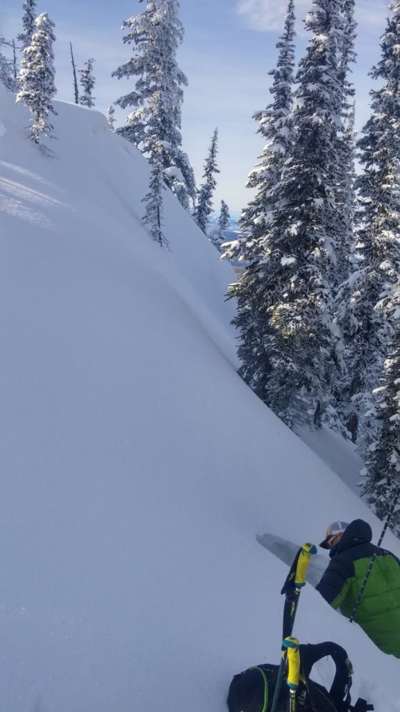
Observers near Lost Trail yesterday found the light snow on the surface continued to create small loose snow avalanches and sluffs. Keep in mind the consequences of these small loose snow slides in areas with terrain traps.


Avalanche and Weather Outlook

The weather today will be similar to yesterday with the possibility of intermittent snow flurries with minimal accumulations. The avalanche danger will remain the same throughout the day today.

If you are out in the backcountry, please feel free to share your observations on our public observations page, they are a great resource and are very helpful in producing the advisory.  I will issue the next advisory on Tuesday January 31, 2017.

Ski and ride safe.

READ FULL ADVISORY  

Problem 1 - Windslabs

  • TYPE

    wind-slabs

    Wind Slabs

    Release of a cohesive layer of snow (a slab) formed by the wind.  Wind typically erodes snow from the upwind sides of terrain features and deposits snow on the downwind side.  Wind slabs are often smooth and rounded and sometimes sound hollow, and can range from soft to hard. Wind slabs that form over a persistent weak layer (surface hoar, depth hoar, or near-surface facets) may be termed Persistent Slabs or may develop into Persistent Slabs.

  • SIZE

    3-4

    1-2 (Small-Large)

    The potential size of avalanche resulting from this problem.

  • LIKELIHOOD

    Likelihood-3

    Possible

    The likelihood of an avalanche resulting from this problem.

  • IMAGE

Soft windslabs have formed over the last few days and are susceptible to human triggers.

Problem 2 - Persistent Slabs

  • TYPE

    persistent-slabs

    Persistent Slabs

    Release of a cohesive layer of soft to hard snow (a slab) in the middle to upper snowpack, when the bond to an underlying persistent weak layer breaks.  Persistent layers include: surface hoar, depth hoar, near-surface facets, or faceted snow. Persistent weak layers can continue to produce avalanches for days, weeks or even months, making them especially dangerous and tricky. As additional snow and wind events build a thicker slab on top of the persistent weak layer, this avalanche problem may develop into a Persistent, Deep-Slab.

  • SIZE

    3-4

    1-2 (Small-Large)

    The potential size of avalanche resulting from this problem.

  • LIKELIHOOD

    Likelihood-2

    Unlikely/Possible

    The likelihood of an avalanche resulting from this problem.

  • IMAGE

Basal facets can fail in areas of shallow snow and multiple layers of buried surface hoar will be suspect with any significant load.

Problem 3 - Loose Dry

  • TYPE

    loose-dry

    Loose Dry

    Release of wet unconsolidated snow or slush. These avalanches typically occur within layers of wet snow near the surface of the snowpack, but they may quickly gouge into lower snowpack layers. Like Loose-Dry Avalanches,they start at a point and entrain snow as they move downhill, forming a fan-shaped avalanche. They generally move slowly, but can contain enough mass to cause significant damage to trees, cars or buildings. Other names for loose-wet avalanches include point-release avalanches or sluffs. Loose-wet avalanches can trigger slab avalanches that break into deeper snow layers.

  • SIZE

    1-2

    < 1 (Small)

    The potential size of avalanche resulting from this problem.

  • LIKELIHOOD

    Likelihood-5

    Likely

    The likelihood of an avalanche resulting from this problem.

Surface snow continues to move and will be a concern on steep slopes with terrain traps.

VIDEO

FORECAST & OUTLOOK

Weather with be mostly clear with a possibility of light snow flurries.

This information is the sole responsibility of the Forest Service and does not apply to operating ski areas. The avalanche danger rating expires at midnight tonight but the information can help you make a more informed decision regarding travel in avalanche terrain for the next few days.

Our advisory area includes National Forest System lands in the Bitterroot Mountains from Lost Trail Pass north to Granite Pass, the Rattlesnake Mountains north of Missoula and the Southern Swan and Mission Mountains near Seeley Lake, MT. Avalanche information for the Lookout Pass/St. Regis Basin area is available from the Idaho Panhandle Avalanche Center.