
The current avalanche danger is CONSIDERABLE in the west central Montana backcountry on all slopes. Dangerous avalanche conditions exist. Careful snowpack evaluation, cautious route-finding, and conservative decision-making are essential. Human triggered avalanches are likely today.
Good morning, this is Travis Craft with the West Central Montana Avalanche Center’s avalanche advisory for January 01, 2019. This danger rating does not apply to operating ski areas, expires at midnight tonight and is the sole responsibility of the U.S. Forest Service.
Weather and Snowpack
Mountain temperatures range from -7 F to 8 F. In the Bitterroot winds are 3 mph with gusts of 7 mph out of the SW. In the northern part of the advisory area, winds are calm(here is link for wind data). The region received a trace to 1 inch of new snow in the last 24 hours.
The forecast area has a weak snowpack. The weak layers in our snowpack are easily triggered by humans. Do not travel below or above runout zones. These layers have proven they are responsive to remote triggers(Public Observations). The recipe for an avalanche is present throughout our region. Give yourself a wide margin for error.
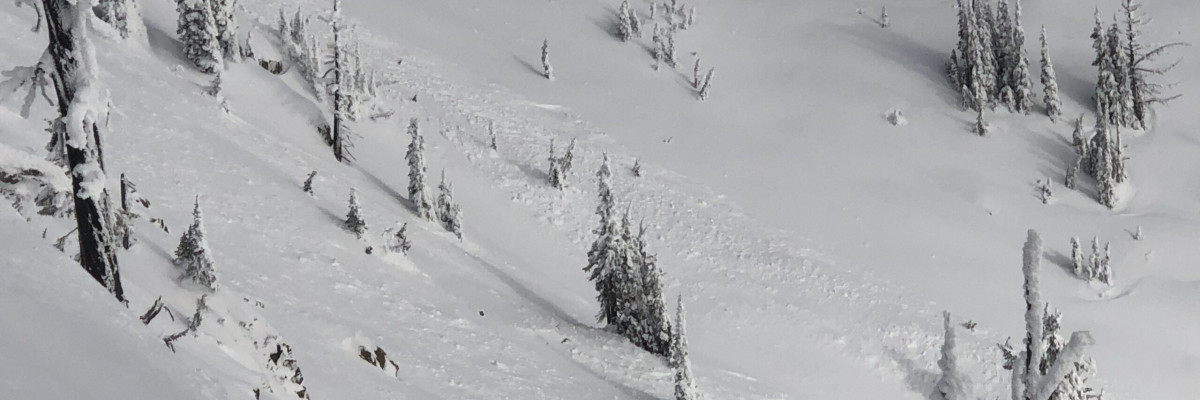
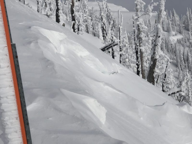
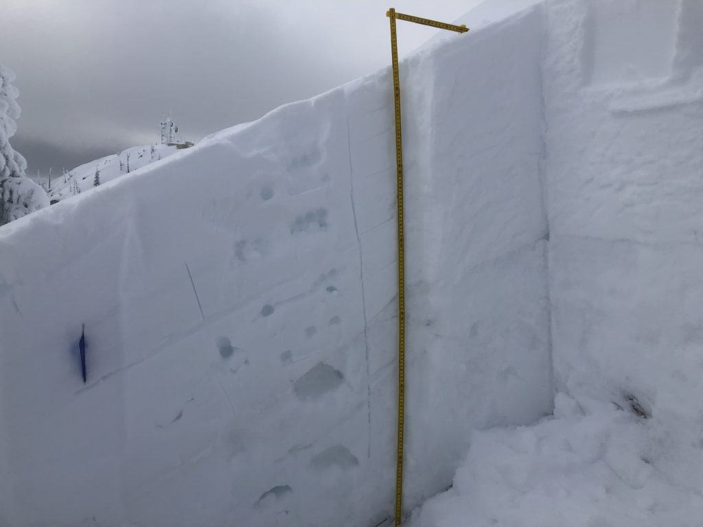
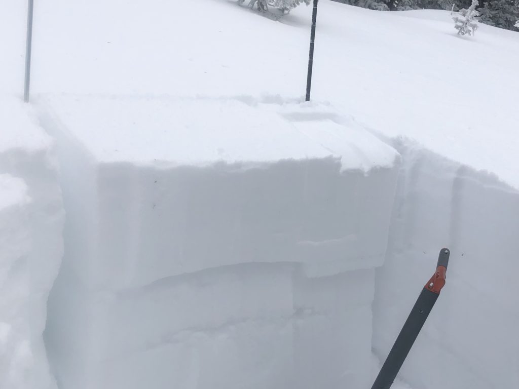
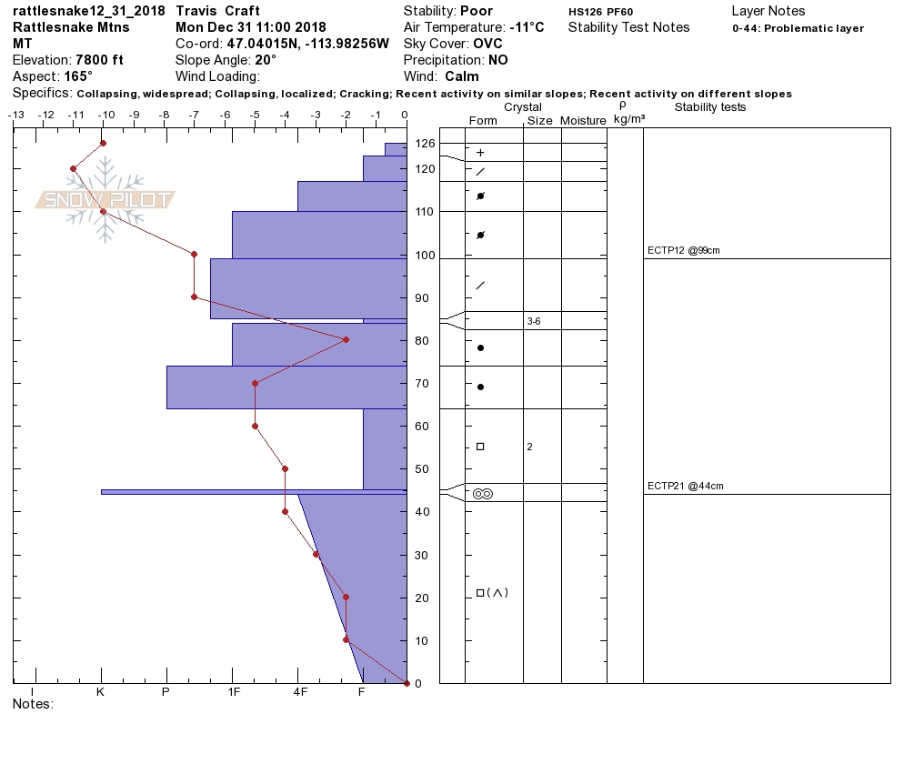
The primary avalanche problem is persistent slabs. The snowpack is giving red flags. We are still getting localized and widespread collapsing when touring. These red flags are sure signs of snowpack instabilities. This means there are dangerous avalanche conditions present. The weak layers are propagating in our snow pit tests.
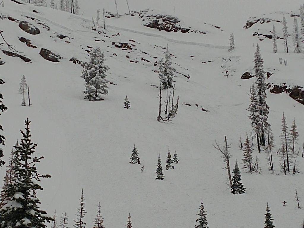
The second avalanche concern is wind slabs. The last storm had strong winds with plenty of snow available for transport to leeward slopes. We saw several natural releases 6 inches deep on several different aspects due to the shift of winds during the previous storm. Identify wind drifted terrain and avoid it. The slabs on wind drifted terrain will be sensitive to human triggers.
The bottom line is dangerous avalanche conditions exist throughout our forecast area. Recreate on terrain less than 30 degrees and give yourself a large margin for error. This is not the time to push into steep terrain. I dug several pits yesterday. I had one pit that did not have unstable results. As I was coming over the ridge to dig, I got collapsing and shooting cracks. A stable result in my pit plays a very small role in my decision-making process, and the red flag data coming over the ridge tells me we have unstable conditions no matter what my pit tells me(video).
Avalanche and Weather Outlook
The next chance for precipitation is the end of the weekend. See the forecast here. Look for the snowpack to still be sensitive to human triggers with the predicted weather.
If you get out into the mountains, please share what you see on our public observations page. They are not only helpful to your community but extremely helpful to us.
Ski and ride safe.


