
The avalanche danger for the west central Montana backcountry is MODERATE. It is still possible to trigger a large avalanche in shallow spots on steep slopes. Evaluate snow and terrain carefully.
Good morning, this is Travis Craft with the West Central Montana Avalanche Center’s avalanche advisory for December 17, 2019. This danger rating does not apply to operating ski areas, expires at midnight tonight, and is the sole responsibility of the U.S. Forest Service.
Weather and Snowpack
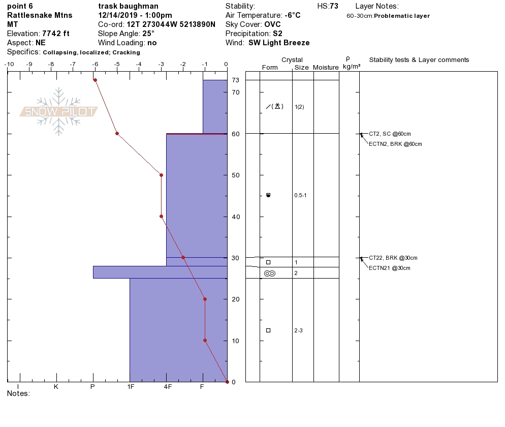
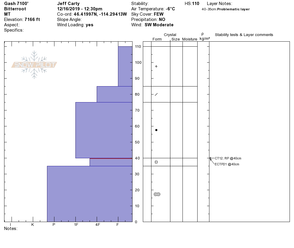
Mountain temperatures range from 9 F to 20 F in the region. In the Bitterroot, winds are 9 mph with gusts of 18 out of the SSE. In the northern part of the advisory area, winds are 10 mph and gusting 25 mph out of the SW. Snotels are reporting between .1 and .3 inches of SWE for the last 24 hours for a trace to 2 inches of new snow. Over the weekend, the storms dropped 12 to 24 inches of new snow and strong winds. The snowpack is adjusting to the new load and has put a large consolidated slab on our poor snowpack structure above 6500 feet. We received many observations over the weekend.
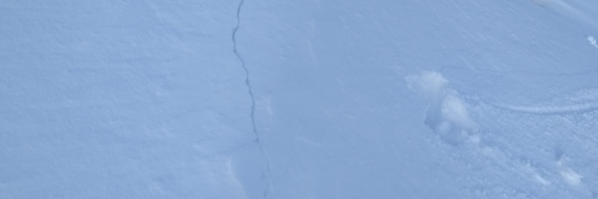
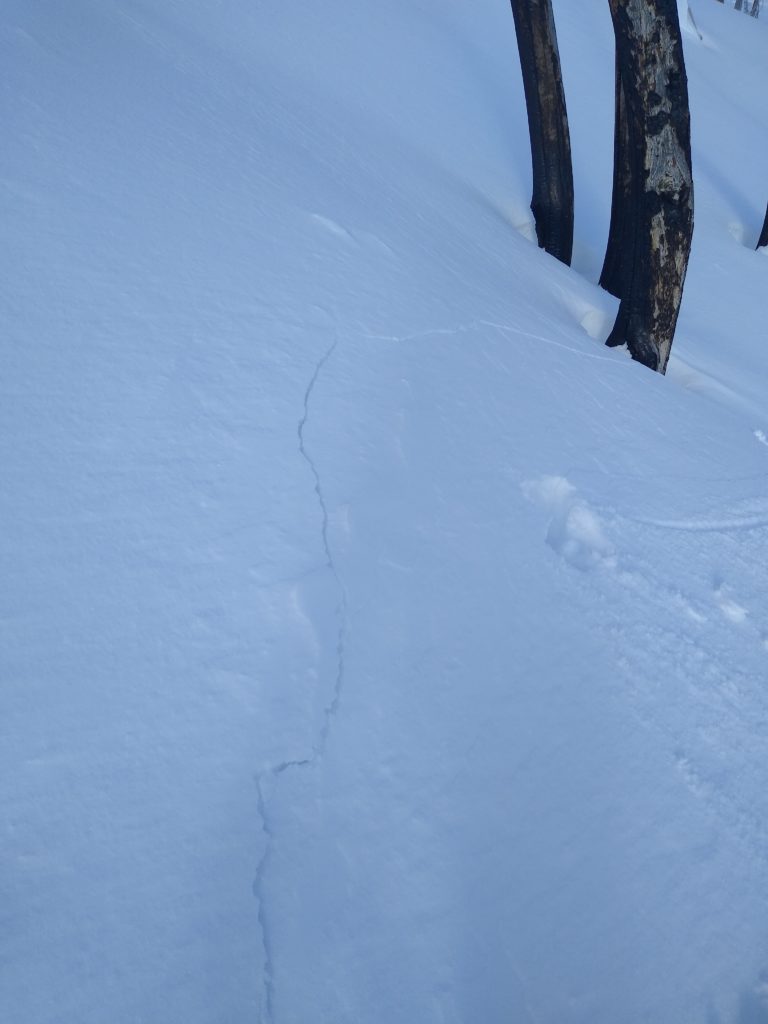
The primary avalanche problem is persistent slabs. There is a multitude of weak layers comprising the snowpack depending on the range of mountains, basin to basin and ridge to ridge. The new snow over the weekend has buried the facet crust combinations and facets at the ground(in the southern portion of the forecast region) deeper in our snowpack. The slab size above the weak layers is roughly 3 feet now(Public Observation). We are still getting propagation in our stability tests in shallower snowpacks. Red flags are diminishing but were found yesterday in the central Bitterroot(shooting cracks, localized collapse).
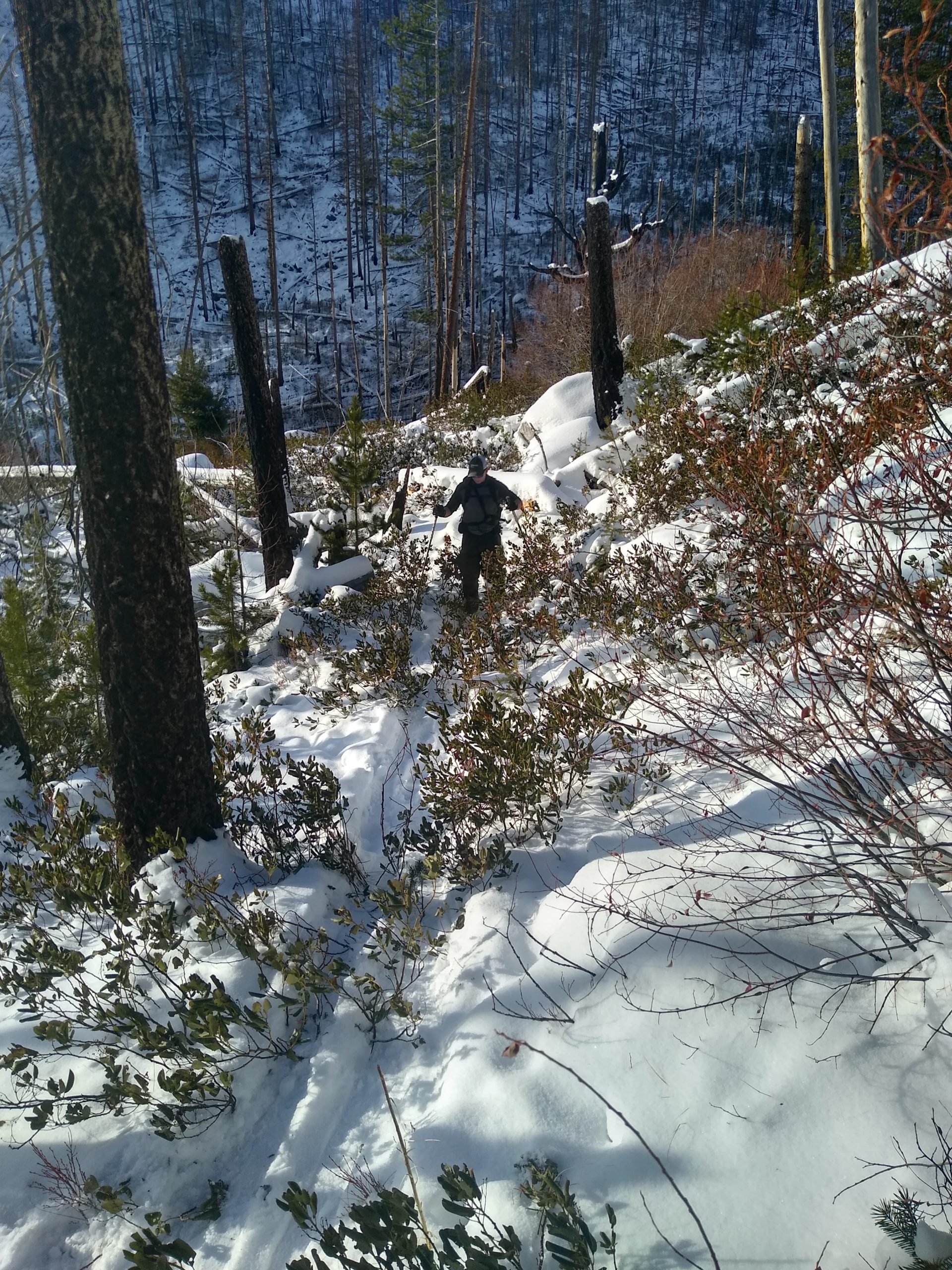
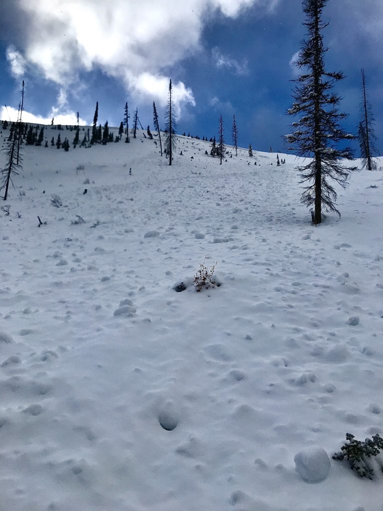
The bottom line is that the snowpack is gaining strength. Caution is the name of the game. Possible trigger points exist in shallow mid-elevation snowpacks and higher elevation start zones. Be diligent in terrain selection and snowpack evaluation: avoid shallow rocky sections and steep rollovers. Dig a snow pit. Look for red flags. There is good riding to be had on lower angle, more uniform slopes. This public observation is an excellent example of showing caution with our current snowpack situation. Remember, a stable pit result plays a minimal role in my decision-making process vs. an unstable result in a stability test plays a significant role.
Avalanche and Weather Outlook
The next chance for snow will be Thursday. The avalanche danger will stay the same with no new snow. Pay attention to red flags and shifts in the weather. I will post the next avalanche forecast Thursday, December 19, 2019.
As always, if you make it out, please, feel free to share what you find on our public observations page.
Ski and ride safe.


