

The avalanche danger for the West Central Montana backcountry is CONSIDERABLE in terrain above 6500 feet and is MODERATE in non-wind loaded terrain below 6500 feet. Approach avalanche terrain with caution as triggering an avalanche would be unsurvivable.
Good morning, this is Todd Glew with the West Central Montana Avalanche Center’s avalanche advisory for January 14, 2020. This danger rating does not apply to operating ski areas, expires at midnight tonight, and is the sole responsibility of the U.S. Forest Service.
Weather and Snowpack
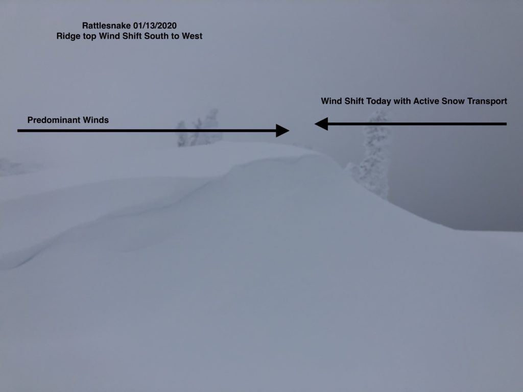
Mountain temperatures currently range from the single digits to teens with light winds out of the SW. Snotel sites report .1-.3 inches of SWE in the past 24 hours or about 2-4 inches of new snow accompanied by wind.
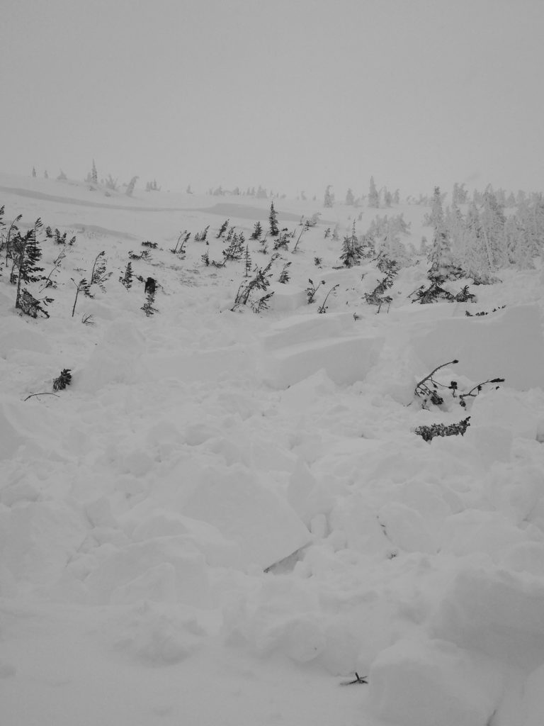
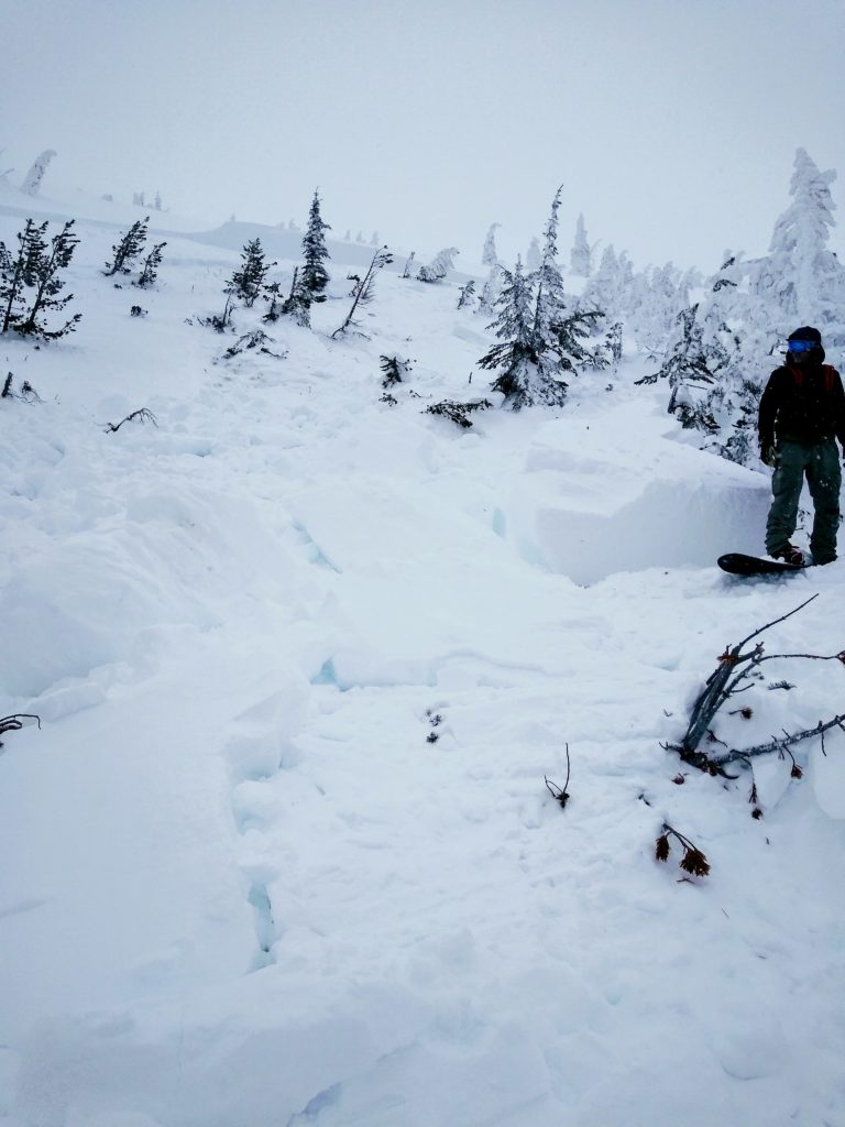
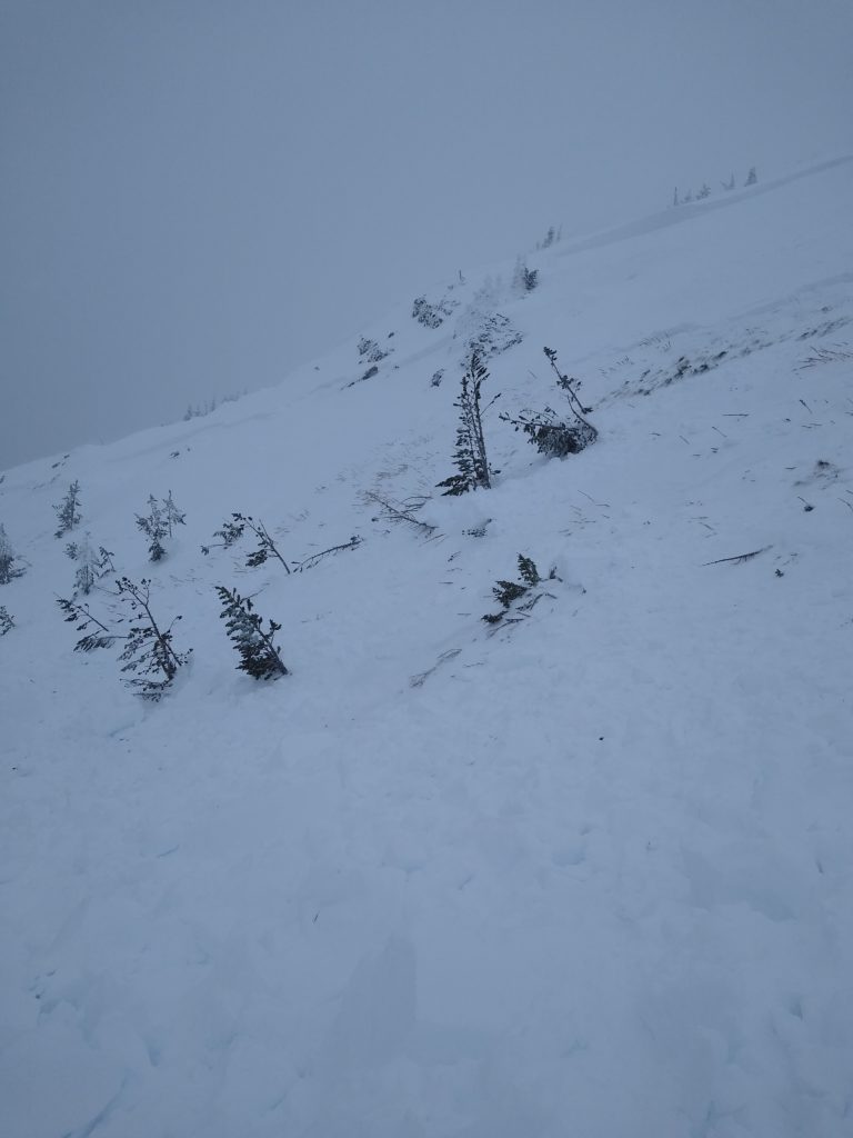
The best way to describe our snowpack is untrustworthy. Since the New Year, we have been bombarded with snow and wind. This has put a tremendous amount of stress on the underlying weak snowpack. We have multiple faceted weak layers buried below a thick and heavy slab of snow. Numerous avalanches this past week have produced impressive results. These include:
- A natural slide in the Southern Missions that propagated across a ridge line, over 500′ wide, and stepped down 3-4 feet to buried surface hoar
- A skier triggered 2+ feet deep avalanche that ran on a 32º slope in the central Bitterroot.
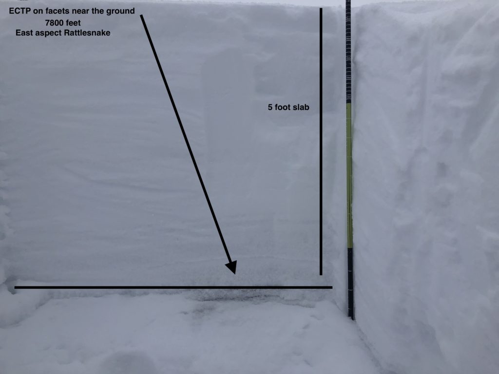
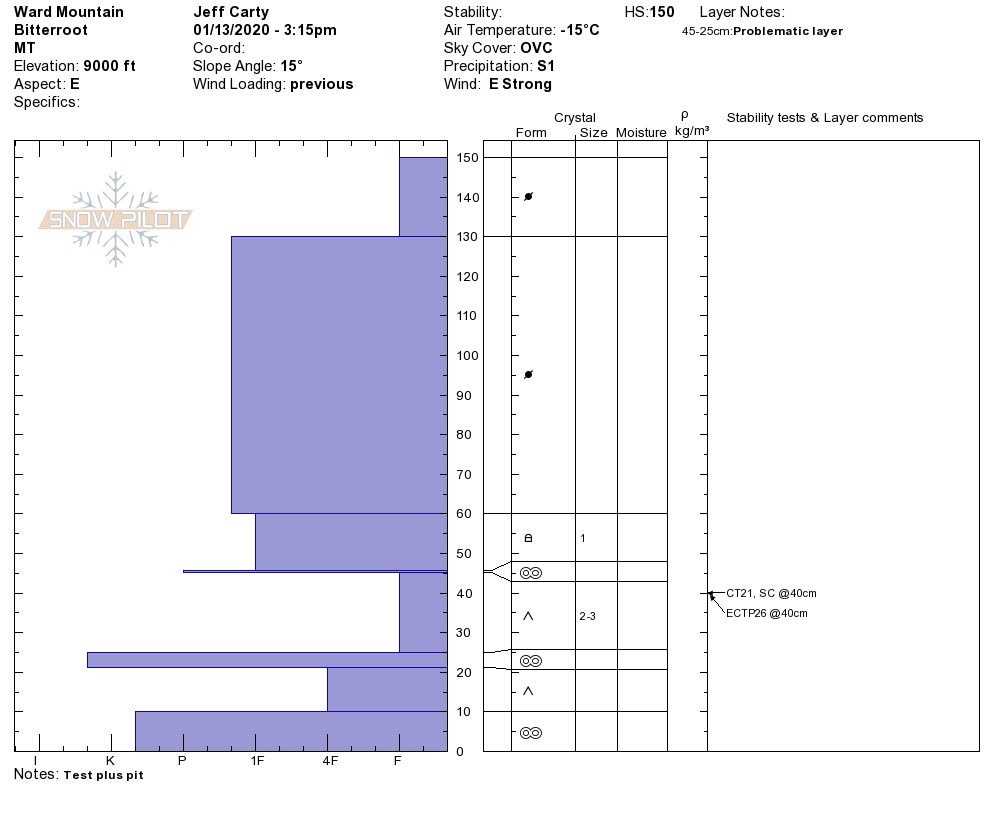
- A ski cut triggered slide at Lost Trail, over 100′ wide that ran at ground on basal facets. This slab was around 4 feet thick.
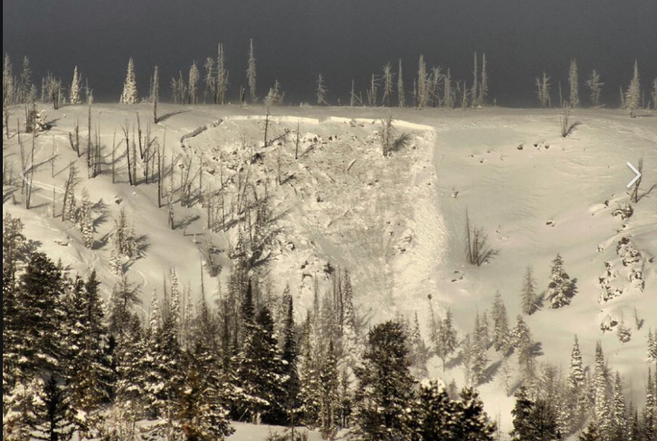
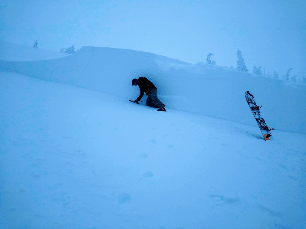
- A skier triggered slide in the southern Missions. 500′ wide with a 7′ crown at the deepest part. It stepped down twice, to a crust/facet layer 18″ from the ground and then to ground. It was triggered from under 30º on the 8-foot thick section, and the upper bed surface was 31º. It was not preceded by whumphing and took place on a slope with trees that did not have flagging.
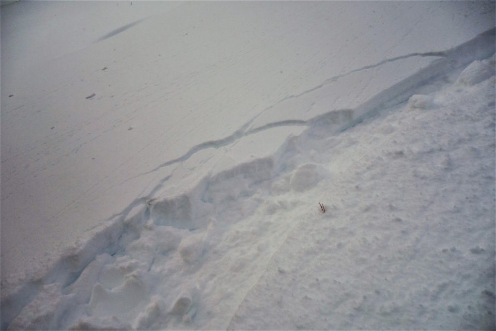
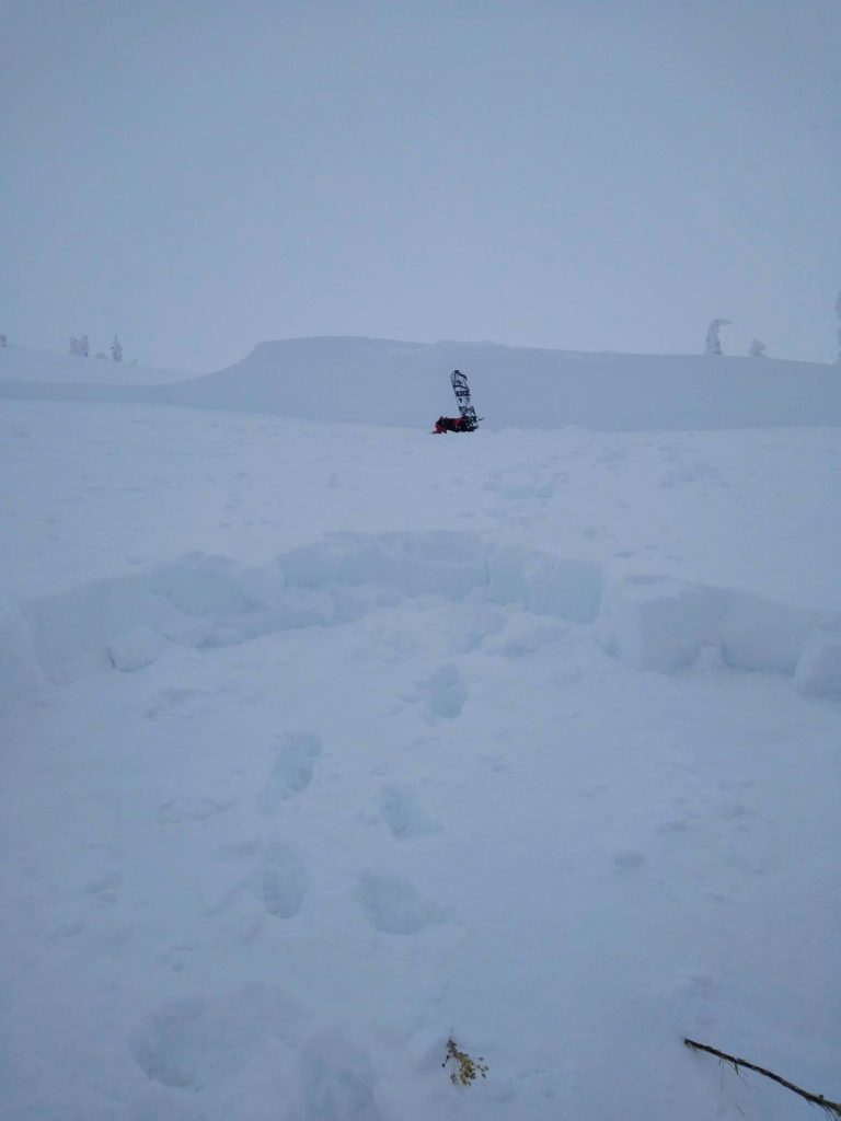
This is just a list of reported avalanches. Numerous avalanches have occurred since the New Year, but are hard to identify due to poor visibility, wind and snow covering up avalanche activity. Triggering a large avalanche is still a concern.
Our primary concern is persistent slab avalanches. This avalanche problem is most pronounced in upper elevation terrain above 6500 ft on slopes over 30 degrees in steepness. Avoid runout zones of avalanche paths as remotely triggering an avalanche is a concern. This avalanche problem is becoming harder to predict as red flags such as cracking and collapsing are becoming less frequent. If you get caught in a persistent slab avalanche, it will be unsurvivable.
Our secondary concern is wind slab avalanches. Yesterday the winds were whipping from multiple directions creating wind slabs. Today snow and winds are forecasted, creating fresh wind slabs. Be on the lookout for stiff feeling snow, cracking, and collapsing in your travels. These are signs of wind effected snow. Wind slabs are bulbous and pillowy and are found on the leeward side of ridges or in cross-loaded terrain. Any small wind slab has the potential to step-down, creating a deadly persistent slab avalanche.
Bottom line: Give the snowpack some time to heal up. We have a complex and dangerous snowpack that makes me shudder when thinking about being near upper elevation wind-loaded avalanche terrain. A mentor of mine told me not to try and outsmart a persistent slab avalanche problem, and you may have a long life in the mountains.
Avalanche and Weather Outlook
Today we are expecting increasing winds out of the W with 5-9 inches of snow through this evening. See the forecast here.
Any new snow and wind will make the avalanche danger rise. Pay attention to red flags such as cracking, collapsing, wind transported snow, and recent avalanches.
Any and all observations are greatly appreciated. If you get out in the mountains please send us information here. Thank you very much to those of you who have been sending in observations as it is very helpful.
Ski and ride safe.
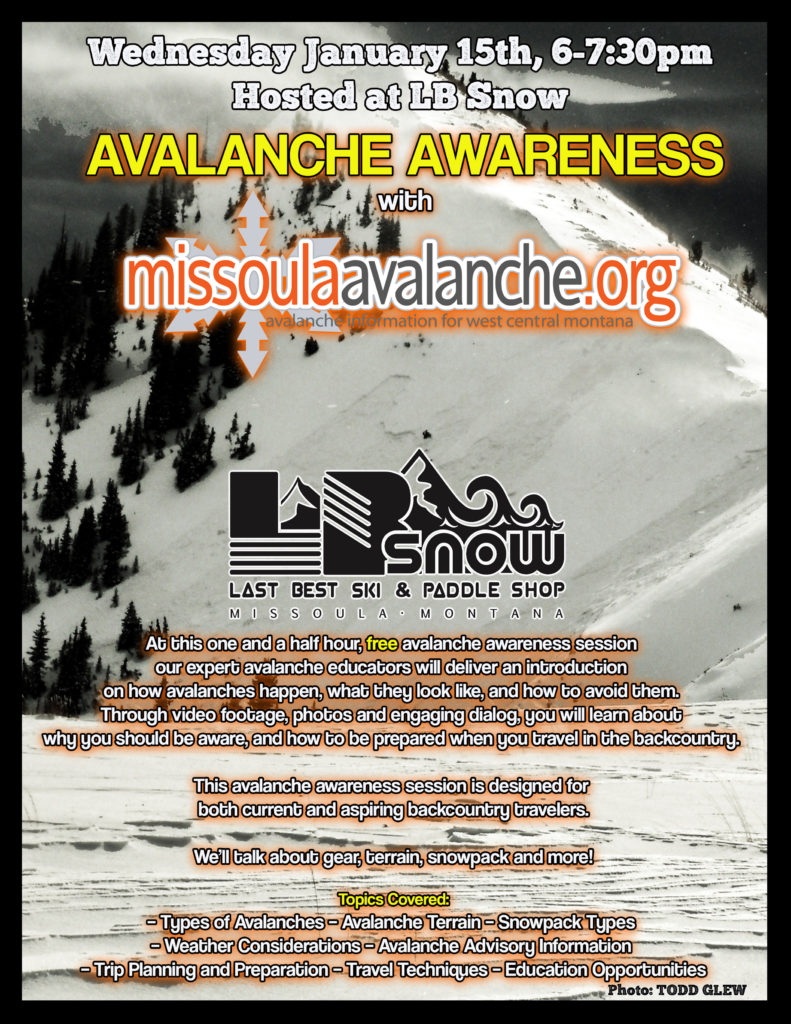
Education Opportunities:
Tomorrow January 15th, our friends at LB Snow will be hosting us for an Avalanche Awareness Talk from 6-7:30pm. Feel free to swing by and brush up on your avalanche knowledge. More details can be found here.
Want to learn more about avalanches? We still have spaces available on Avalanche Courses throughout the winter. Take a look here for a full list of courses.


