
The avalanche danger for the West Central Montana backcountry is MODERATE. Approach avalanche terrain with caution as triggering a massive avalanche is possible.
Good morning, this is Todd Glew with the West Central Montana Avalanche Center’s avalanche advisory for January 18, 2020. This danger rating does not apply to operating ski areas, expires at midnight tonight, and is the sole responsibility of the U.S. Forest Service.
Weather and Snowpack
Mountain temperatures are currently in the single digits to teens with wind chill values below 0 F. Ridge top winds are predominantly out of the WSW with averages in the teens with gusts up to 20 mph. A skiff of snow has fallen overnight in favored locations.
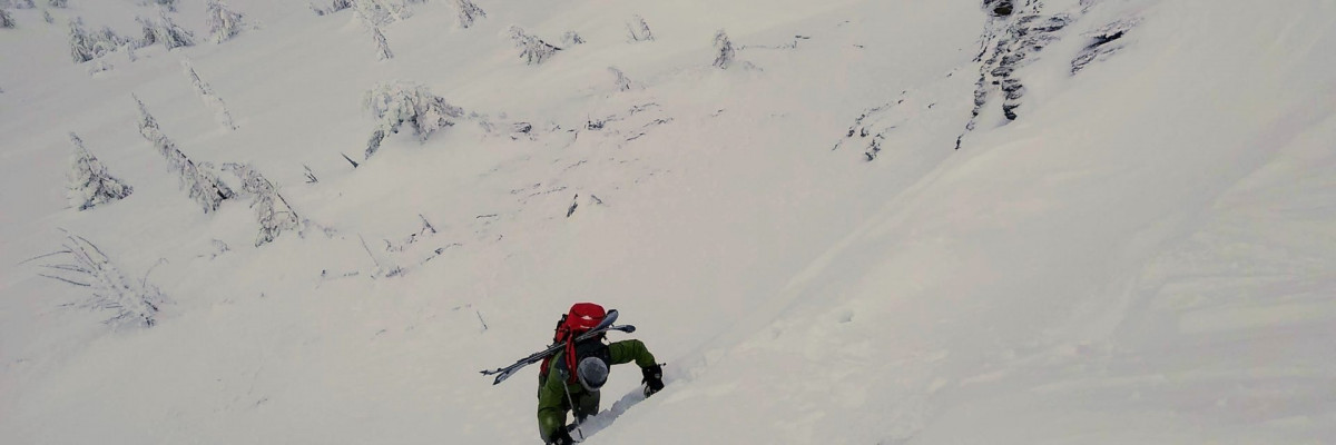
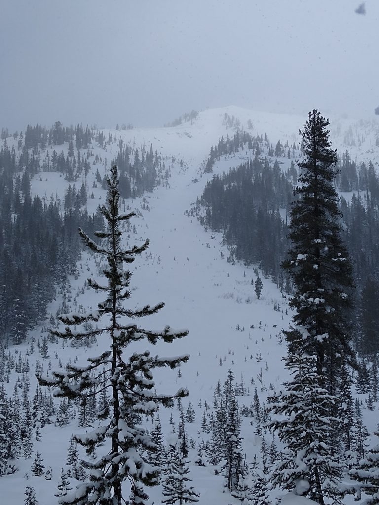
We are in the midst of a break in the action with snowfall. Since the New Year, we have received a tremendous amount of new snow that made avalanche conditions spike. During the past few days, snow has tapered off, giving the snowpack a chance to adjust. The snowpack is starting to stabilize but the green light is not on just yet. There is a possibility of triggering a catastrophic avalanche, so play your cards wisely.
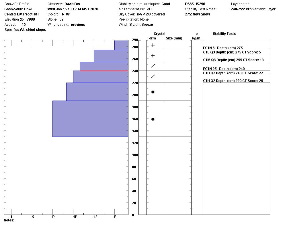
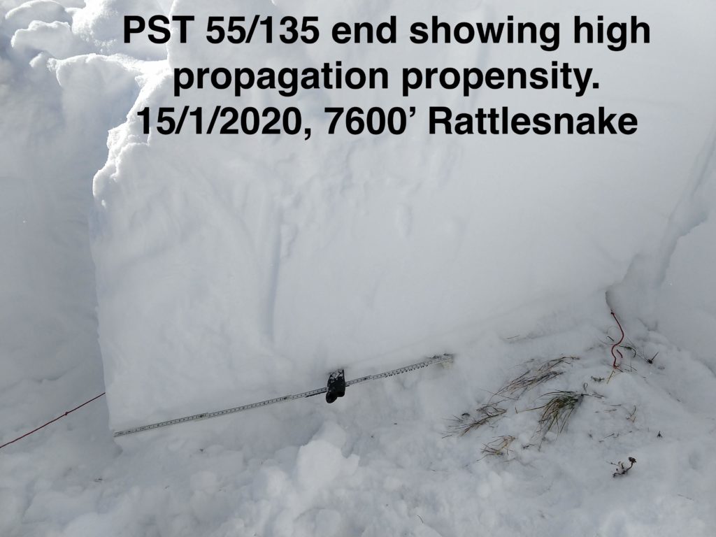
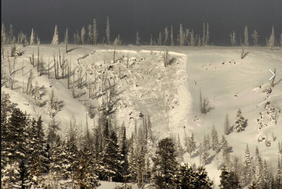
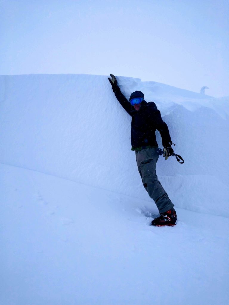
Our primary concern is persistent slab avalanches. Since the New Year, we have had numerous natural and human triggered avalanches failing on buried weak layers. The last report of a persistent slab avalanche was from 1-14-20 in the Southern Bitterroot. Signs are pointing towards a strengthening snowpack, but it is still possible to trigger a persistent slab avalanche.
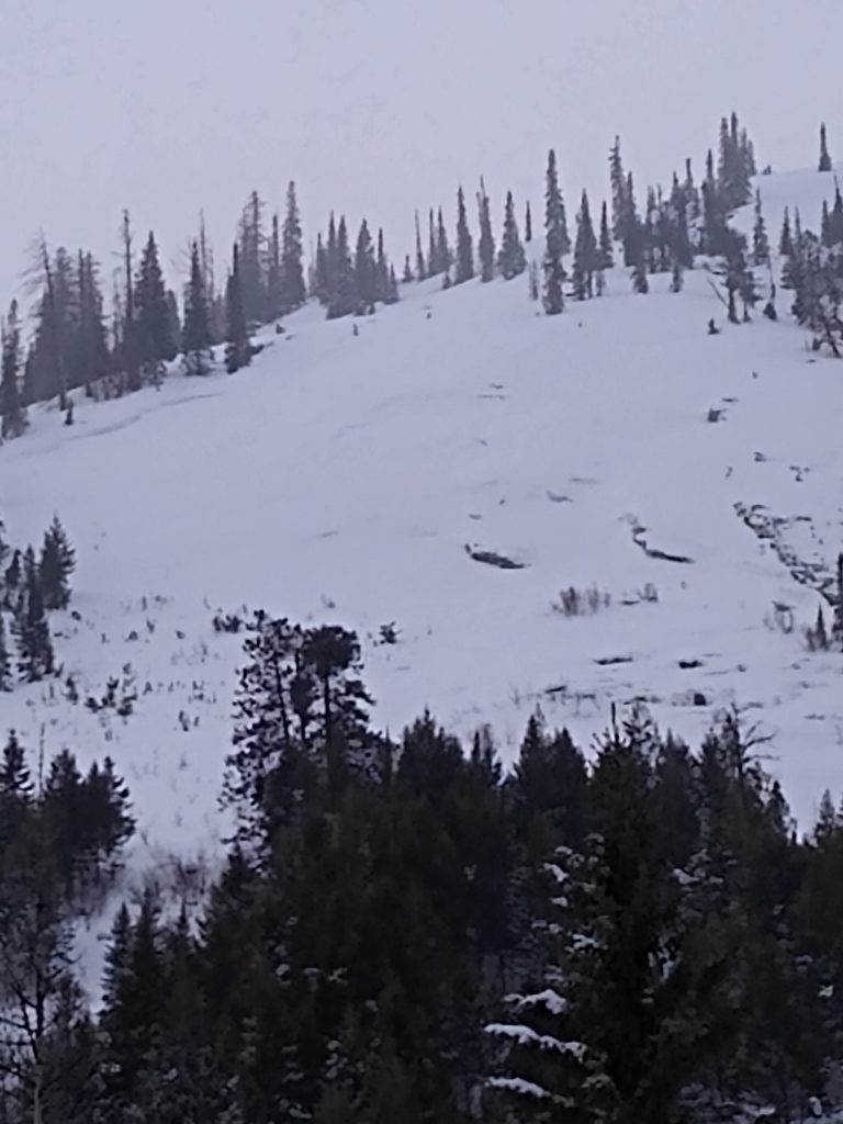
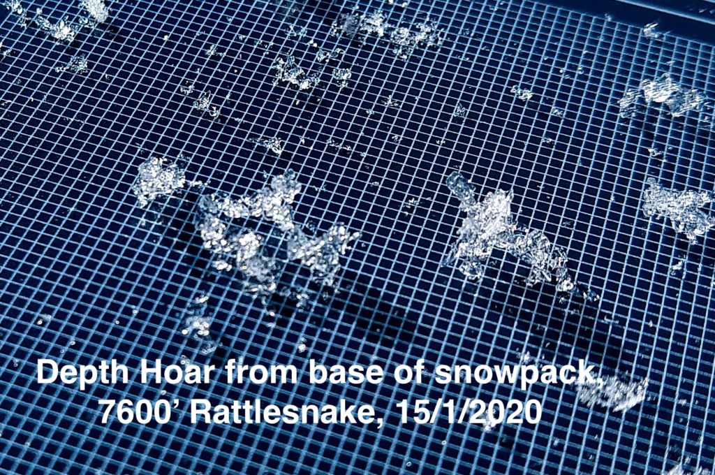
Snowpit scores in some areas are showing that the weak layers are gaining strength. We are no longer experiencing red flags, which can trick you into thinking the snowpack is safe. Therefore, you must do your homework and dig snow pits to look for instabilities. There is a possibility of triggering a persistent slab avalanche, and likely spots would be thinner rocky areas or on rollovers. Another likely trigger spot would be an area with a thinner snowpack, about 3-4 feet deep. Deciding to ski or ride in avalanche terrain safely takes into account many factors to deem the slope is stable. If you make the wrong call, it would be catastrophic, do not blow it.
Bottom Line: Do not just jump into steep, complex terrain. First, check out some lower consequence slopes around 30 degrees. Dig multiple snow pits to the ground, look for buried weak layers such as depth hoar, surface hoar, and crusts in the lower portion of the snowpack. If you find any of these layers, see how they are reacting. Just remember if you do trigger an avalanche failing on a buried weak layer, it could release the entire season snowpack.
Avalanche and Weather Outlook
Today mountain temperatures are expected to be 20-30F with winds in the teens and gusts up to 30mph on the highest ridge tops. There will be snow showers with up to a couple inches of snow by this evening. A ridge of high pressure is moving in on Sunday and Monday with warming temperatures. Our next chance of light snow is expected on Tuesday.
Any observations are much appreciated. If you get out in the mountains, please send us your observations here. Thank you very much to those of you who have been sending in observations, as it is incredibly beneficial.
Ski and ride safe.
Education Opportunities:
Want to learn more about avalanches? We still have spaces available on Avalanche Courses throughout the winter. If you have taken a Level 1 avalanche course and want to get more avalanche knowledge. We still have spaces on our Level 2 avalanche course next weekend located at Yurtski in the Swan Range! Take a look here for a full list of courses.


