Posted:
Jan 21, 2020 @ 6:45 am

The avalanche danger for the west central Montana backcountry is stout MODERATE in areas with a shallow snowpack. Areas with a thick base are less touchy.

Good morning, this is Jeff Carty with the West Central Montana Avalanche Center’s avalanche advisory for January 21, 2020. This danger rating does not apply to operating ski areas, expires at midnight tonight, and is the sole responsibility of the U.S. Forest Service.

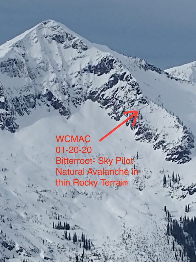
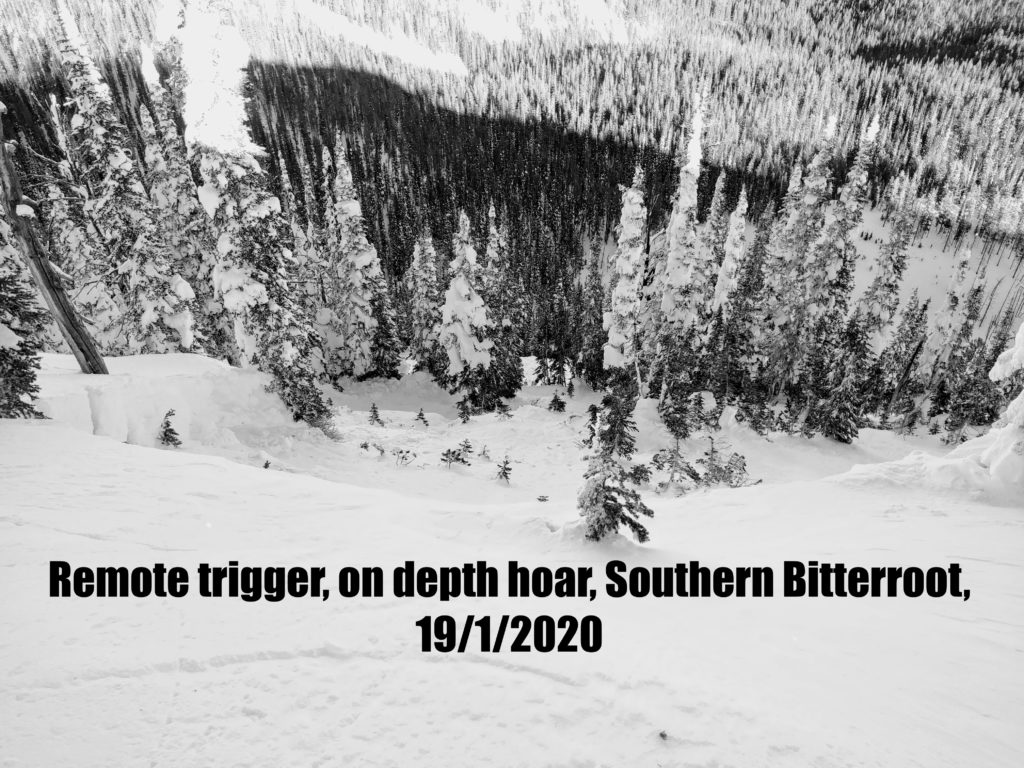
In areas of shallower snowpack, roughly 5 feet or less, there is a higher likelihood of triggering avalanches on the persistent weak layers at the base of the snowpack. A remotely triggered slide Sunday near Lost Trail ski area tells us these layers are still active. This ran on depth hoar, near the ground with a four-foot slab, in trees. 

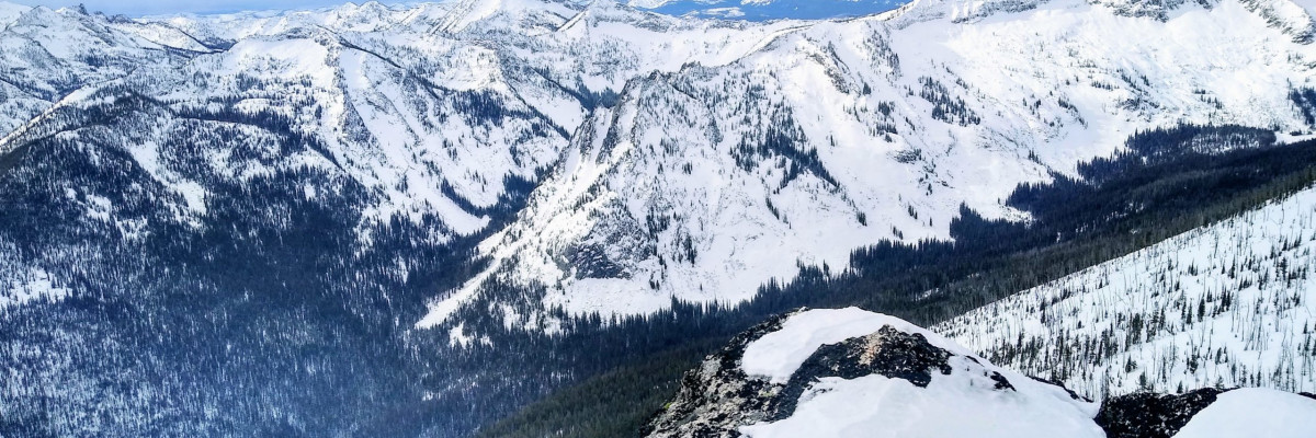
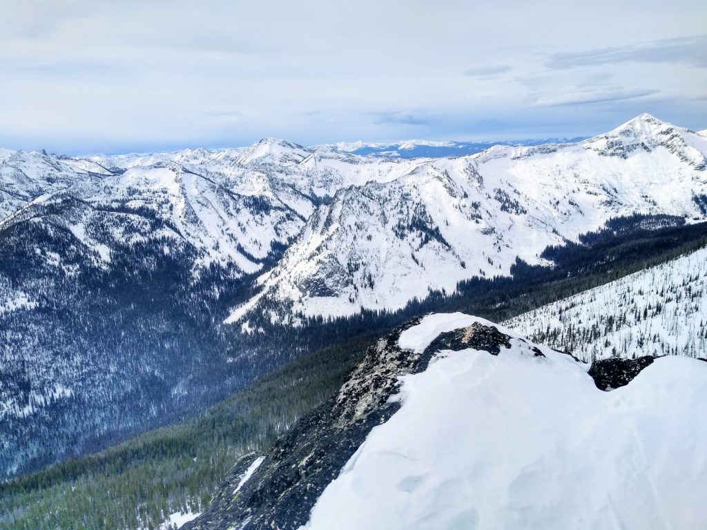
The southern Bitterroot has the shallowest snowpack in the forecast area and, as a result, has the highest avalanche likelihood. Mid elevation slopes throughout the forecast area where the snowpack is thinner may have similar probability.  

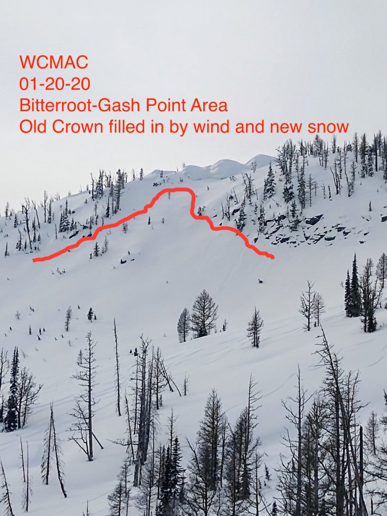
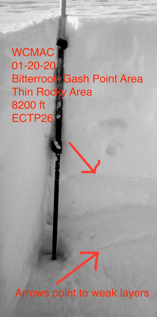
In areas with a thick base, such as the central Bitterroot and Seeley lake zone, the snowpack has stabilized, and the likelihood of triggering an avalanche is getting lower. In some places, the snowpack is up to 7 feet deep. However, the possibility to trigger a slide in these areas may still exist, especially near rock outcroppings and thin areas.

Freezing levels are forecast to rise to 5500 feet today and may create a thaw instabilities, increasing the likelihood of avalanches. Take extra caution if you notice dripping trees, rollerballs, or packable snow.

With the freezing level forecast to rise to 6500 feet Wednesday night, and precipitation throughout the week, expect avalanche danger to increase. Conditions such as this may reawaken the depth hoar layer and result in large avalanches.

Always carry your safety equipment — beacon, probe, and shovel.

If you want to increase your competence in avalanche terrain, check out our education page.

Join us for an avalanche awareness talk from 7:00 to 8:00 pm Wednesday the 22nd at Trailhead

Your avalanche, snowpack, and weather observations help us keep the public informed and assist us when generating the advisory. Please help us continue to better understand the snowpack, and submit your observations here.

Ski and ride safe

READ FULL ADVISORY  

Problem 1 - Persistent slab

  • TYPE

    persistent-slabs

    Persistent Slabs

    Release of a cohesive layer of soft to hard snow (a slab) in the middle to upper snowpack, when the bond to an underlying persistent weak layer breaks.  Persistent layers include: surface hoar, depth hoar, near-surface facets, or faceted snow. Persistent weak layers can continue to produce avalanches for days, weeks or even months, making them especially dangerous and tricky. As additional snow and wind events build a thicker slab on top of the persistent weak layer, this avalanche problem may develop into a Persistent, Deep-Slab.

  • SIZE

    5-6

    2-3 (Large)

    The potential size of avalanche resulting from this problem.

  • LIKELIHOOD

    Likelihood-3

    Possible

    The likelihood of an avalanche resulting from this problem.

  • ADDED DANGER

    Increased Slope Danger

    Increased/Added Danger

    There is an increased risk of avalanches on these slopes:

    N - North
    NE - Northeast
    E - East
    SE - Southeast
    S - South
    SW - Southwest
    W - West
    NW - Northwest

Depth hoar that developed during the early season is still lurking, at the base of the snowpack, throughout the forecast area.
In deeper areas, this is rounding out, is much less reactive, and harder to trigger due to its depth.
In shallow areas it is possible to trigger slides on this layer from above, below, and adjacent to avalanche slopes.
These slides could be very large and not likely survivable.
Approach avalanche slopes with caution. Check the depth of your snowpack throughout tours. Be suspect of thin zones. Avoid convexities and rocky areas. Avoid run out zones.
Planner slopes without terrain traps are good choices.

Problem 2 - Wet loose

  • TYPE

    loose-wet

    Loose Wet

    Release of wet unconsolidated snow or slush. These avalanches typically occur within layers of wet snow near the surface of the snowpack, but they may quickly gouge into lower snowpack layers. Like Loose-Dry Avalanches,they start at a point and entrain snow as they move downhill, forming a fan-shaped avalanche. They generally move slowly, but can contain enough mass to cause significant damage to trees, cars or buildings. Other names for loose-wet avalanches include point-release avalanches or sluffs. Loose-wet avalanches can trigger slab avalanches that break into deeper snow layers.

  • SIZE

    1-2

    < 1 (Small)

    The potential size of avalanche resulting from this problem.

  • LIKELIHOOD

    Likelihood-4

    Possible/Likely

    The likelihood of an avalanche resulting from this problem.

  • ADDED DANGER

    Increased Slope Danger

    Increased/Added Danger

    There is an increased risk of avalanches on these slopes:

    N - North
    NE - Northeast
    E - East
    SE - Southeast
    S - South
    SW - Southwest
    W - West
    NW - Northwest

Rising temperatures and precipitation starting late today will result in above freezing temperatures to about 5500′, possibly higher.
Loose wet avalanches are likely.
Watch for roller balls, dripping trees, and packable snow.
Wet loose snow avalanches are a sign of instability and indicate loosening bonds within the snowpack, meaning that existing persistent slab instabilities may become more touchy. Be conservative with your terrain choices if these are occurring.
Wet loose avalanches may step down to persistent weak layers.

Overall a warm weather pattern continues into next weekend. Light, nearly continuous

precipitation will continue through most of the week with the heaviest amounts tonight and then Thursday night to a lesser degree. Snow levels will peak above 5,500 feet Wednesday night

causing some light rain or drizzle on the mid-slopes and dense snow with low snow ratios at the higher elevations. Most of the precipitation will be focused in the Bitterroots with

amounts decreasing quickly east of the Bitterroot divide.

FORECAST & OUTLOOK

Overall a warm weather pattern continues into next weekend. Light, nearly continuous precipitation will continue through most of the week with the heaviest amounts tonight and then Thursday night to a lesser degree. Snow levels will peak above 5,500 feet Wednesday night causing some light rain or drizzle on the mid-slopes and dense snow with low snow ratios at the higher elevations. Most of the precipitation will be focused in the Bitterroots with amounts decreasing quickly east of the Bitterroot divide.

This information is the sole responsibility of the Forest Service and does not apply to operating ski areas. The avalanche danger rating expires at midnight tonight but the information can help you make a more informed decision regarding travel in avalanche terrain for the next few days.

Our advisory area includes National Forest System lands in the Bitterroot Mountains from Lost Trail Pass north to Granite Pass, the Rattlesnake Mountains north of Missoula and the Southern Swan and Mission Mountains near Seeley Lake, MT. Avalanche information for the Lookout Pass/St. Regis Basin area is available from the Idaho Panhandle Avalanche Center.