Posted:
Jan 28, 2020 @ 7:00 am

The avalanche danger for the West Central Montana backcountry is MODERATE. Approach avalanche terrain with caution as triggering a large avalanche is possible.

Good morning, this is Todd Glew with the West Central Montana Avalanche Center’s avalanche advisory for January 28, 2020. This danger rating does not apply to operating ski areas, expires at midnight tonight, and is the sole responsibility of the U.S. Forest Service.

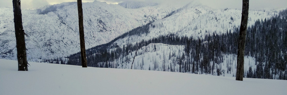
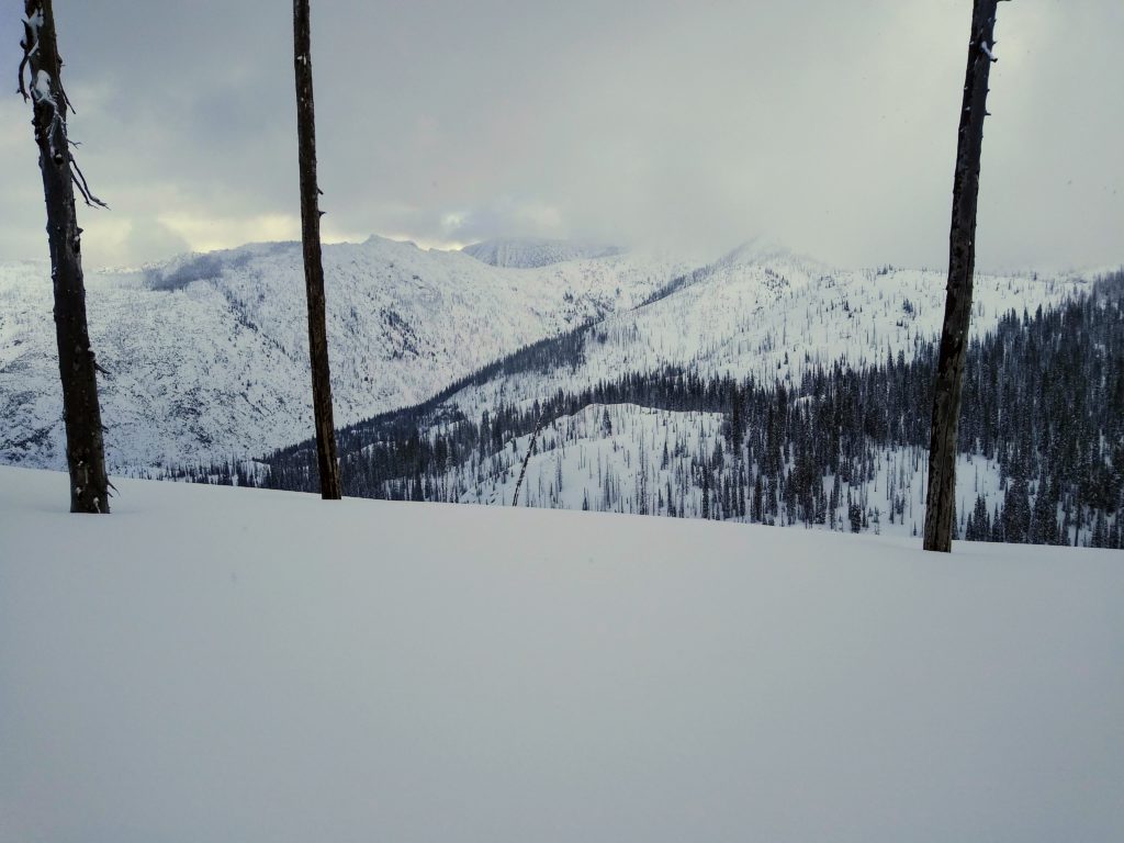
Weather and Snowpack

Mountain temperatures are currently in the high teens to mid 20’s F. Winds are light out of the WSW, with ridgetop winds gusting into the 20’s. During the past 24 hours, favored locations have picked up .2-.3 inches of SWE, equating to a few inches of snow. 

This season has been rather scary in regards to our avalanche problems. We have been plagued by persistent weak layers buried in our snowpack, with the possibility of triggering an avalanche that may take out the entire seasons snowpack. Based on recent observations, it seems that our snowpack is gaining strength. We are starting to see a more stable snowpack in many locations, while others we are not. The chances of triggering a large avalanche are decreasing, but the consequences are not. Play your cards wisely if you decide to hop into avalanche terrain. 

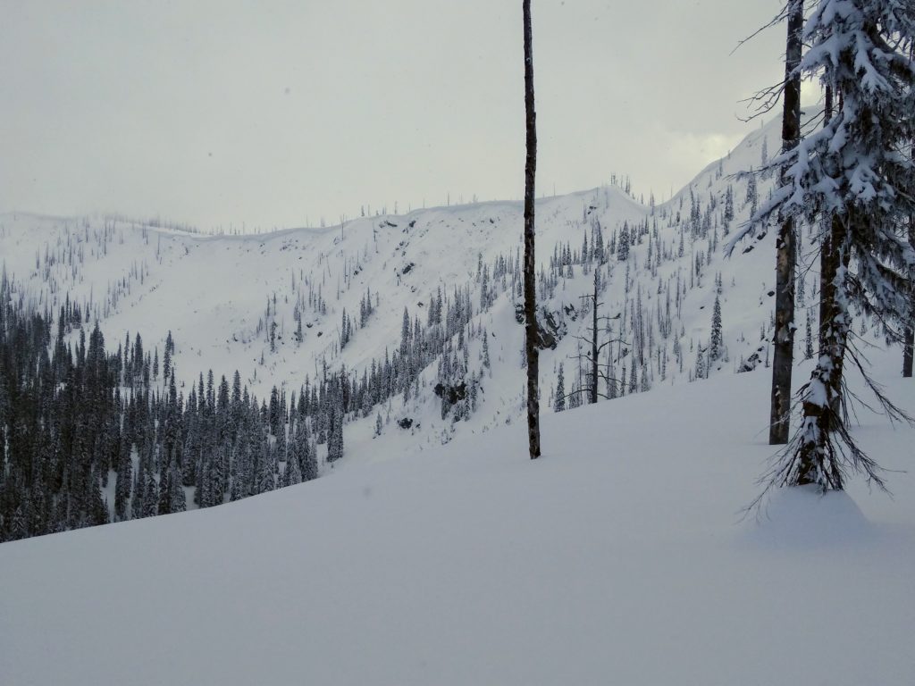
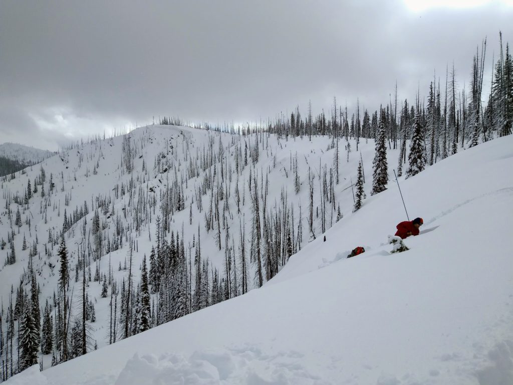
Our primary concern is wind slab avalanches. With a decent amount of new snow today accompanied by wind, be on the lookout for active snow transport. The new snow and wind may cause wind drifts, which look like bulbous or pillowy like features found on the leeward side of ridges or in cross-loaded terrain. This type of avalanche problem will most likely be found in open terrain or near ridge tops. Use caution when approaching steep terrain as wind slabs are most sensitive during and or soon after being transported. Another thing to keep in mind is that we have a widespread slick melt-freeze crust buried just below the surface of the snow. The melt-freeze crust could work as a good sliding surface, making wind slabs more reactive and much larger. Keep a close eye on how the new snow is reacting today. 

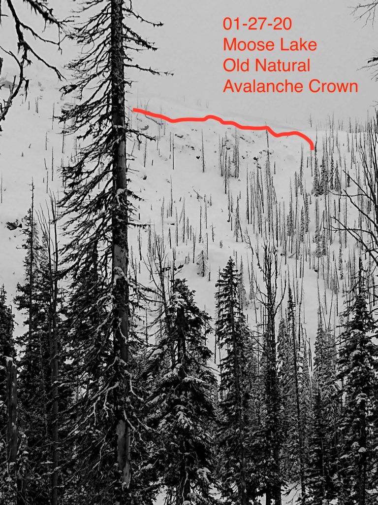
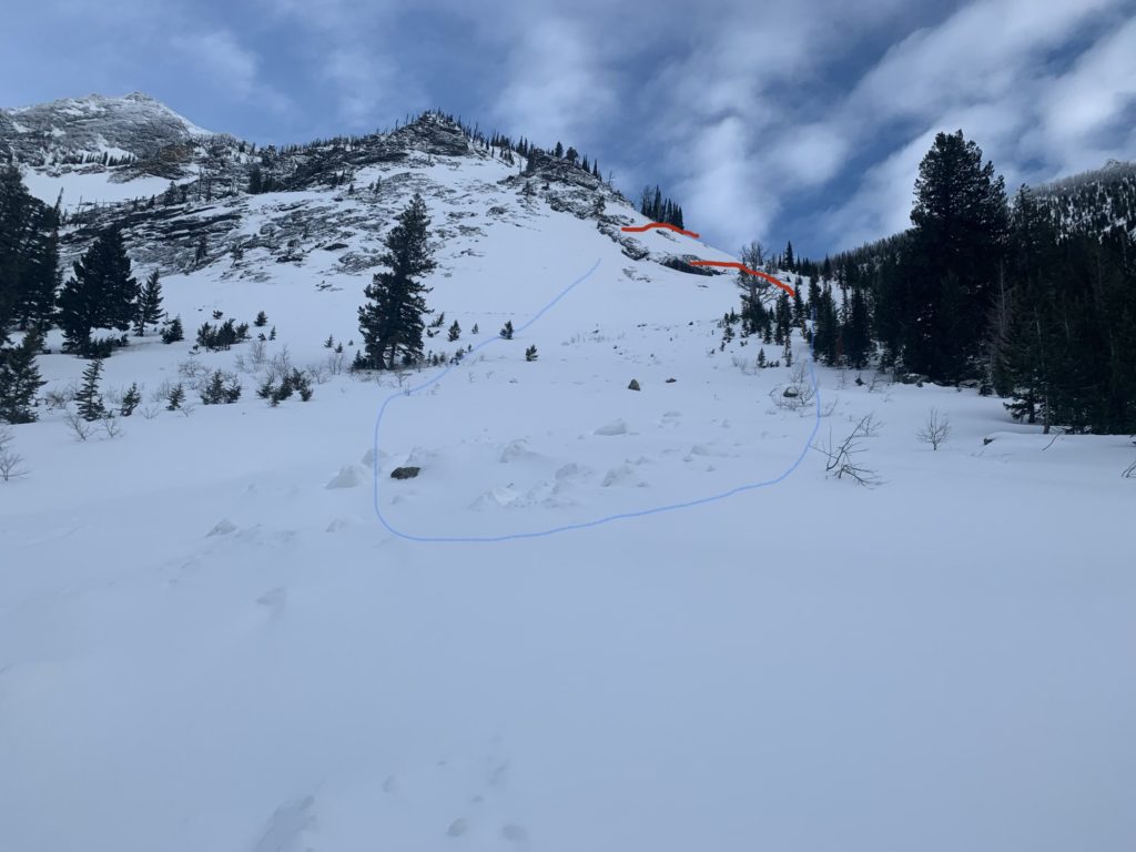
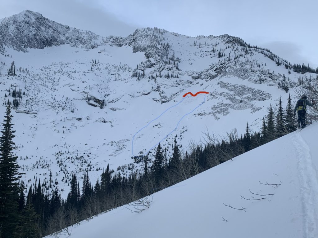
Our secondary concern in persistent slab avalanches. Throughout the winter, we have had numerous human and natural triggered persistent slab avalanches. During the past few days, observations have been showing that our buried weak layers are beginning to heal. We are not fully there yet in all locations, but things are moving in the right direction. A likely spot to trigger a persistent slab avalanche would be in areas with a shallow snowpack (3-4 feet or less). Other places you are most likely to trigger this type of avalanche would be in thin rocky terrain, around cliff bands, or on convexities. Remember, if you do trigger a persistent slab avalanche, it may break to the ground, taking out the entire seasons snowpack. 

Bottom line: Today is a storm day, so pay attention to any changes with the new snow. Look out for red flags such as cracking, collapsing, recent avalanches, and wind transported snow. Approach avalanche terrain with caution as triggering a large avalanche would take out the entire seasons snowpack.

Avalanche and Weather Outlook

Today through this evening, the mountains are expected to get up to a foot of new snow accompanied by moderate winds. Mountain temperatures will range from 24 to 37 F, with SW winds in the teens and gusts up to 31MPH. Snow is expected to taper off on Wednesday, followed by more snow later this week and a cold front later this weekend. Stay tuned.

Expect avalanche conditions to rise during or shortly after any rapid changes in regards to wind and new snow. Our snowpack is beginning to heal but could be reactivated by new snow and wind. 

Any observations are appreciated. If you get out in the mountains, please send us your observations here. Thank you very much to those of you who have been sending in observations, as it is incredibly beneficial.

Ski and ride safe.

 Education Opportunities:

Want to learn more about avalanches? We still have spaces available on Avalanche Courses throughout the winter. Take a look here for a full list of courses.

READ FULL ADVISORY  

Problem 1 - Wind Drifted Snow

  • TYPE

    wind-slabs

    Wind Slabs

    Release of a cohesive layer of snow (a slab) formed by the wind.  Wind typically erodes snow from the upwind sides of terrain features and deposits snow on the downwind side.  Wind slabs are often smooth and rounded and sometimes sound hollow, and can range from soft to hard. Wind slabs that form over a persistent weak layer (surface hoar, depth hoar, or near-surface facets) may be termed Persistent Slabs or may develop into Persistent Slabs.

  • SIZE

    3-4

    1-2 (Small-Large)

    The potential size of avalanche resulting from this problem.

  • LIKELIHOOD

    Likelihood-4

    Possible/Likely

    The likelihood of an avalanche resulting from this problem.

New snow and wind today will make the chances of triggering a new snow avalanche rise. Be on the lookout for rapid snowfall accompanied by wind. Pay attention to where the snow is being transported and use test slopes to see how it is reacting.

Problem 2 - Loose Dry

  • TYPE

    loose-dry

    Loose Dry

    Release of wet unconsolidated snow or slush. These avalanches typically occur within layers of wet snow near the surface of the snowpack, but they may quickly gouge into lower snowpack layers. Like Loose-Dry Avalanches,they start at a point and entrain snow as they move downhill, forming a fan-shaped avalanche. They generally move slowly, but can contain enough mass to cause significant damage to trees, cars or buildings. Other names for loose-wet avalanches include point-release avalanches or sluffs. Loose-wet avalanches can trigger slab avalanches that break into deeper snow layers.

  • SIZE

    3-4

    1-2 (Small-Large)

    The potential size of avalanche resulting from this problem.

  • LIKELIHOOD

    Likelihood-4

    Possible/Likely

    The likelihood of an avalanche resulting from this problem.

  • ADDED DANGER

    Increased Slope Danger

    Increased/Added Danger

    There is an increased risk of avalanches on these slopes:

    N - North
    NE - Northeast
    E - East
    SE - Southeast
    S - South
    SW - Southwest
    W - West
    NW - Northwest

With new snow on the way today, pay attention to how the new snow is bonding to the old snow surface. Is it sticking to it well, or is it easily sluffing? Loose dry avalanches can quickly pick up speed and fan out, entraining a lot of snow. This type of avalanche can be problematic, especially in steep terrain. We have a widespread slick ice crust, which may work as an excellent sliding surface for loose dry avalanches. Stay alert. 

Problem 3 - Persistent Slab Avalanches

  • TYPE

    persistent-slabs

    Persistent Slabs

    Release of a cohesive layer of soft to hard snow (a slab) in the middle to upper snowpack, when the bond to an underlying persistent weak layer breaks.  Persistent layers include: surface hoar, depth hoar, near-surface facets, or faceted snow. Persistent weak layers can continue to produce avalanches for days, weeks or even months, making them especially dangerous and tricky. As additional snow and wind events build a thicker slab on top of the persistent weak layer, this avalanche problem may develop into a Persistent, Deep-Slab.

  • SIZE

    5-6

    2-3 (Large)

    The potential size of avalanche resulting from this problem.

  • LIKELIHOOD

    Likelihood-2

    Unlikely/Possible

    The likelihood of an avalanche resulting from this problem.

  • ADDED DANGER

    Increased Slope Danger

    Increased/Added Danger

    There is an increased risk of avalanches on these slopes:

    N - North
    NE - Northeast
    E - East
    SE - Southeast
    S - South
    SW - Southwest
    W - West
    NW - Northwest

We are concerned about weak layers buried in the middle of our snowpack or near the ground. Recently observations are showing signs that our snowpack is beginning to heal, but not in all locations. The chances of triggering a persistent slab avalanche are decreasing, but the consequences are not. Take caution if you are getting into steep and complex terrain or skiing in areas with a thin snowpack.

VIDEO

Observations Bitterroot 01/27/2020

Observations 01/27/2020

FORECAST & OUTLOOK

Snowy day with up to a foot of new snow expected through this evening.

This information is the sole responsibility of the Forest Service and does not apply to operating ski areas. The avalanche danger rating expires at midnight tonight but the information can help you make a more informed decision regarding travel in avalanche terrain for the next few days.

Our advisory area includes National Forest System lands in the Bitterroot Mountains from Lost Trail Pass north to Granite Pass, the Rattlesnake Mountains north of Missoula and the Southern Swan and Mission Mountains near Seeley Lake, MT. Avalanche information for the Lookout Pass/St. Regis Basin area is available from the Idaho Panhandle Avalanche Center.