
The avalanche danger for the southern Bitterroot and Rattlesnake mountain ranges is MODERATE. It is possible to trigger a persistent slab avalanche. In the central Bitterroot, southern Missions, and southern Swan mountain ranges, the avalanche danger is LOW.
Good morning, this is Travis Craft with the West Central Montana Avalanche Center’s avalanche advisory for February 04, 2020. Today’s advisory is sponsored by ON X Maps. This danger rating does not apply to operating ski areas, expires at midnight tonight, and is the sole responsibility of the U.S. Forest Service.
Weather and Snowpack
Mountain temperatures range from 3 F to 12 F in the region. In the Bitterroot, winds are 7 mph with gusts of 14 out of the WSW. In the northern part of the advisory area, winds are 16 mph and gusting 21 mph out of the West. Snotels are reporting between 0 and .2 inches of SWE for the last 24 hours for a trace to 2 inches of new snow.
Rattlesnake and southern Bitterroot
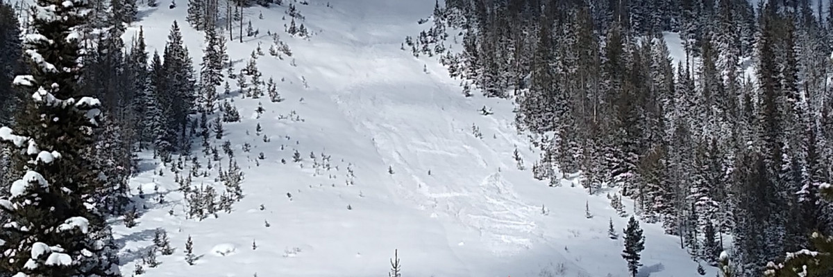
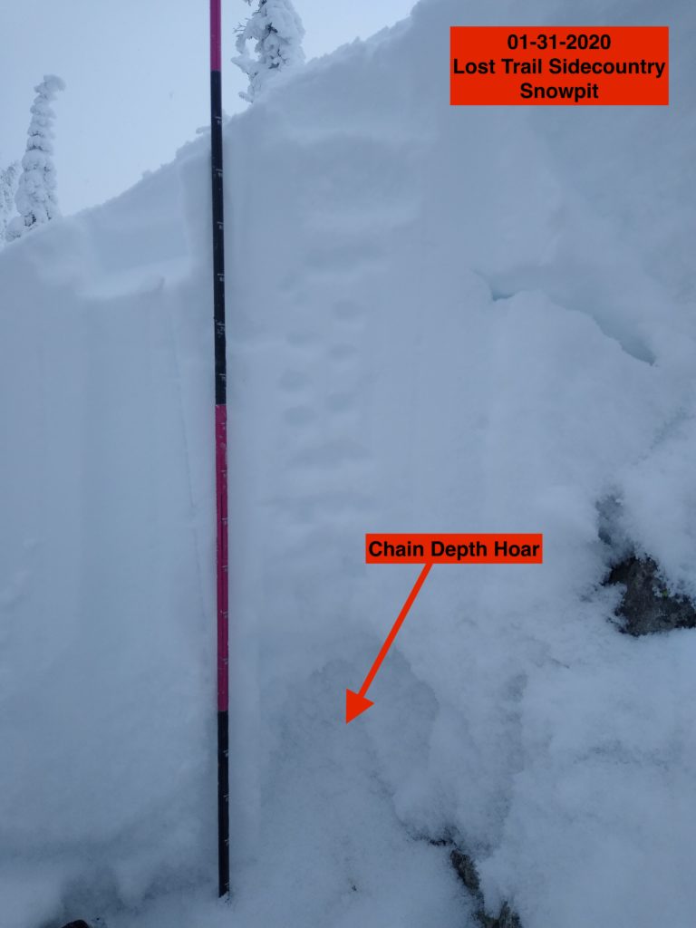
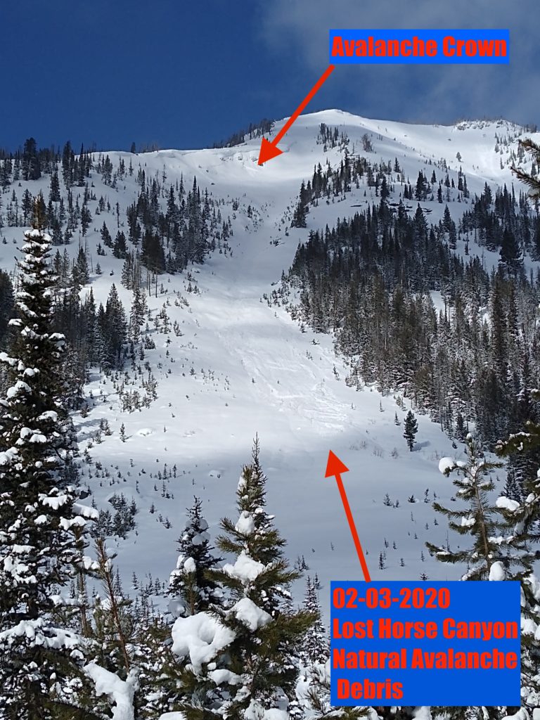
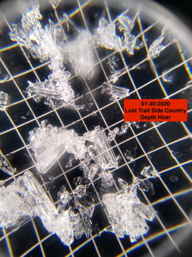
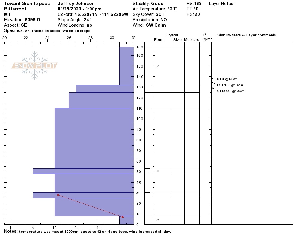
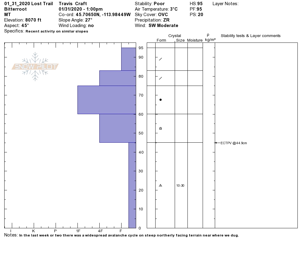
The Rattlesnake and southern Bitterroot have the shallowest snowpacks. In these two areas, we are getting propagations on the depth hoar near the ground.
The primary avalanche problem is persistent slabs. The depth hoar near the ground is still reactive in pit tests. Dig a pit. Avoid likely trigger points (e.g., cliff bands, rocky areas, and steep convexities). The likelihood of triggering this layer is going down, but the consequences are high.
Southern Missions, southern Swans, and central Bitterroot
The southern Missions, southern Swan and central Bitterroot have deeper snowpacks. The basal facets or depth hoar has become dormant in these ranges. We are not getting propagations in pit tests. The last reported avalanche was over a week ago.
Normal caution is the avalanche problem. Continue to practice safe travel protocols in case you find an exception to a generally stable snowpack. Travel one at a time in avalanche terrain, carry a beacon, shovel, and probe, and stay alert for signs of instability.
Bottom line: Overall the snowpack is healing. In the Rattlesnake and southern Bitterroot, avalanche danger is heightened in shallow snowpacks on steep slopes. Avoid likely trigger points (e.g., cliff bands, rocky areas, and steep convexities). The likelihood of triggering the weak layers near the ground is going down, but the consequences are high. Dig a pit. Check snow depths. Avoid shallow rocky areas and cliff bands. Carry a beacon, shovel, and probe. Practice safe travel by exposing only one person to a slope at a time. Pay attention to red flags: recent avalanches, shooting cracks, collapsing, and warming temperatures.
Avalanche and Weather Outlook
Over the weekend, we had an extreme wind event and warm temperatures. There are a variety of old snow surfaces left in the aftermath of this event. Tonight a Northwest flow enters our area. This weather pattern will lead to continued moisture and precipitation through the weekend. See the forecast. New loading and winds will elevate the danger rating. Look for the new snow to take time to bond to old snow surfaces.
I will issue the next advisory on Thursday, February 6, 2020.
Any observations are appreciated. If you get out in the mountains, please send us your observations here. Thank you very much to those of you who have been sending in observations, as it is incredibly beneficial.
Ski and ride safe.
Education Opportunities:
Want to learn more about avalanches? We still have spaces available on Avalanche Courses throughout the winter. Take a look here for a full list of courses.


