Posted:
Feb 15, 2020 @ 6:31 am

Today’s avalanche danger is rated CONSIDERABLE on wind loaded slopes and MODERATE on all other slopes in the southern Bitterroot. Avalanche danger is MODERATE on wind loaded slopes and LOW on all other slopes in the Central Bitterroot, Rattlesnake, and Seeley Lake areas.

Good morning, this is Andrew Schauer with the West Central Montana avalanche advisory for Saturday, February 15, 2020. Today’s advisory is sponsored by LB Snow. This advisory does not apply to operating ski areas, expires at midnight tonight, and is the sole responsibility of the U.S. Forest Service.

Weather and Snowpack

After a brief break in the action, the faucet is turning back on throughout our advisory area. In the last 24 hours, we received 4-8 inches of new snow in the Bitterroot, with a trace to 2 inches in the Rattlesnake and Seeley Lake areas. This morning, winds are blowing 10-20 mph out of the west and southwest, and mountain temperatures are in the low 20’s. Today we can expect to see 2-4 inches of new snow, with slightly higher totals in the Seeley Lake area. Mountain temperatures will get into the high 20’s to low 30’s and winds will be 15-25 mph out of the west with gusts reaching 50 mph. Snow will pick up this afternoon through tomorrow, and we will see 6-10″ of new snow by tomorrow morning, with higher totals at higher elevations.

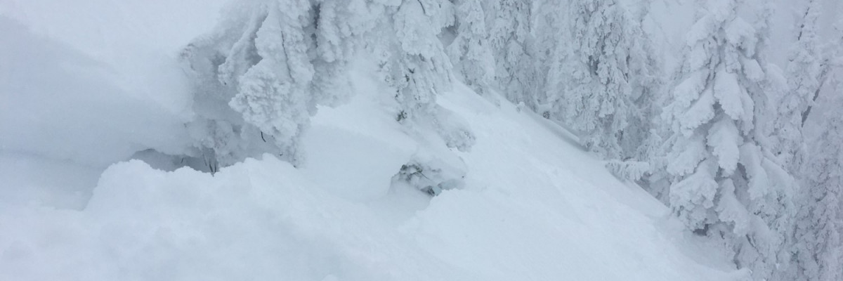
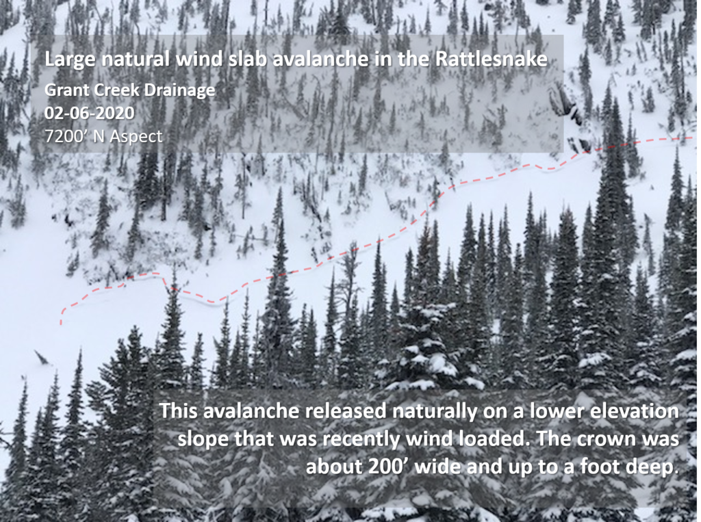
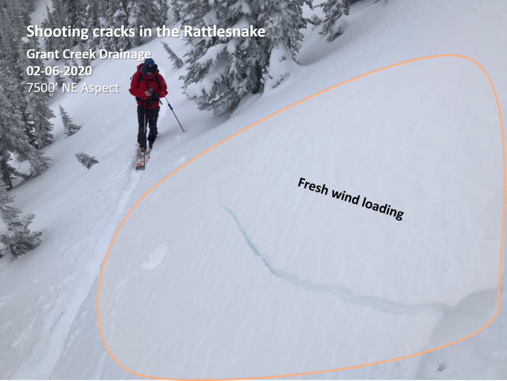
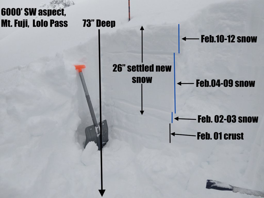
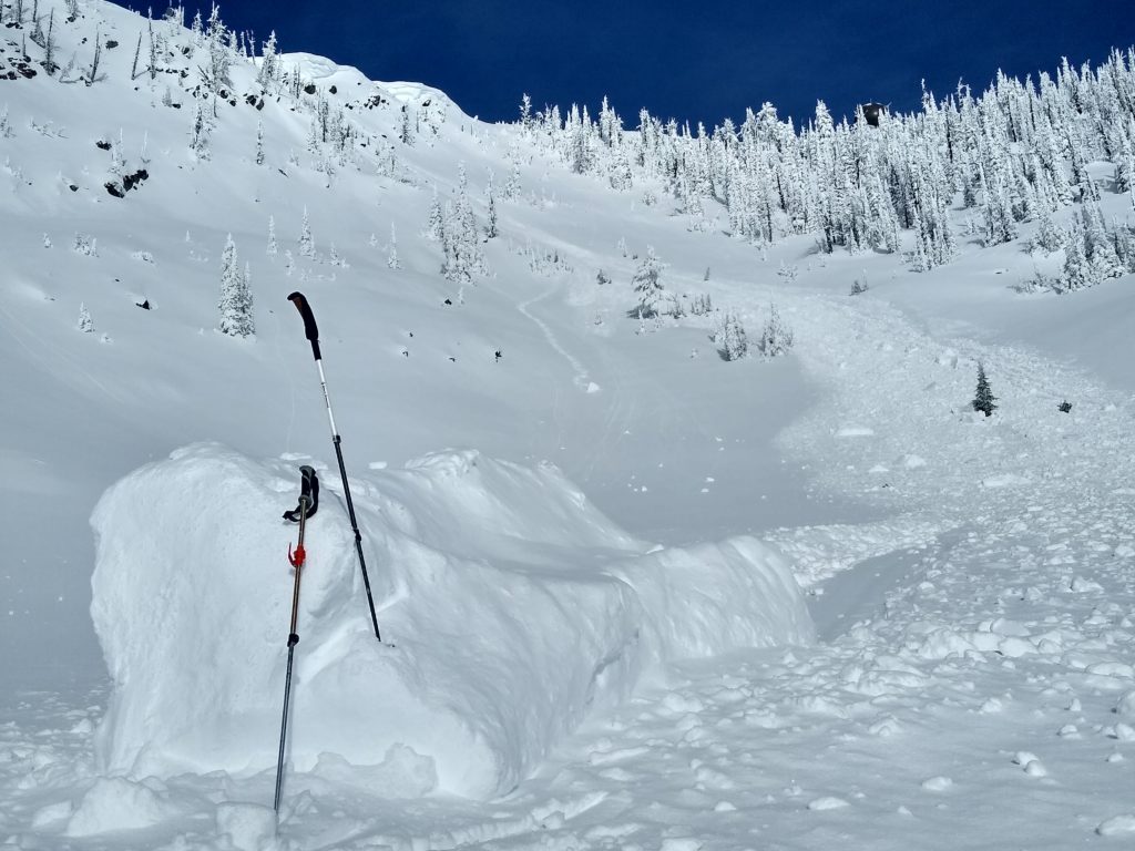
As the storm unfolds, our primary concern will be triggering fresh wind slabs, which can be found on steep, wind-loaded slopes. These avalanches can be up to 3’ deep, and will be big enough to bury a person (video, photo, photo). The best way to manage a wind slab problem is to avoid steep, wind-loaded terrain. You can recognize a fresh wind slab by sticking your pole in the snow, or hopping off your sled to look for dense snow that is deeper than the storm totals in the area. Cornices and wind-affected surfaces are also good indicators of unstable wind slabs. A wind slab will be easy to identify in a snow pit, and it will be likely to propagate in a stability test. You do not need to dig deep to identify this problem since it will only exist in the upper 2-3 feet of the snowpack.

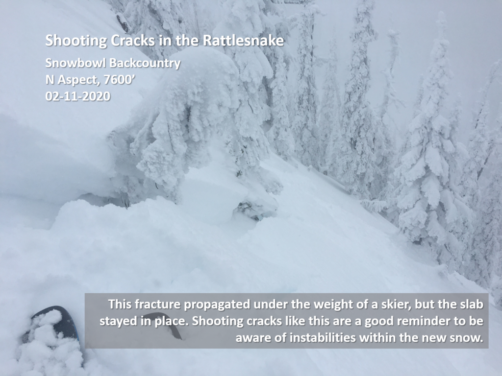
With more snow stacking up, we will also be dealing with a storm slab problem. Storm slabs will be up to a foot deep, and can be recognized by looking for shooting cracks or recent avalanche activity. While these avalanches may not always be large, they can still be dangerous in consequential terrain. If a storm slab is reactive, it will be possible to identify the problem by doing a quick stability test.

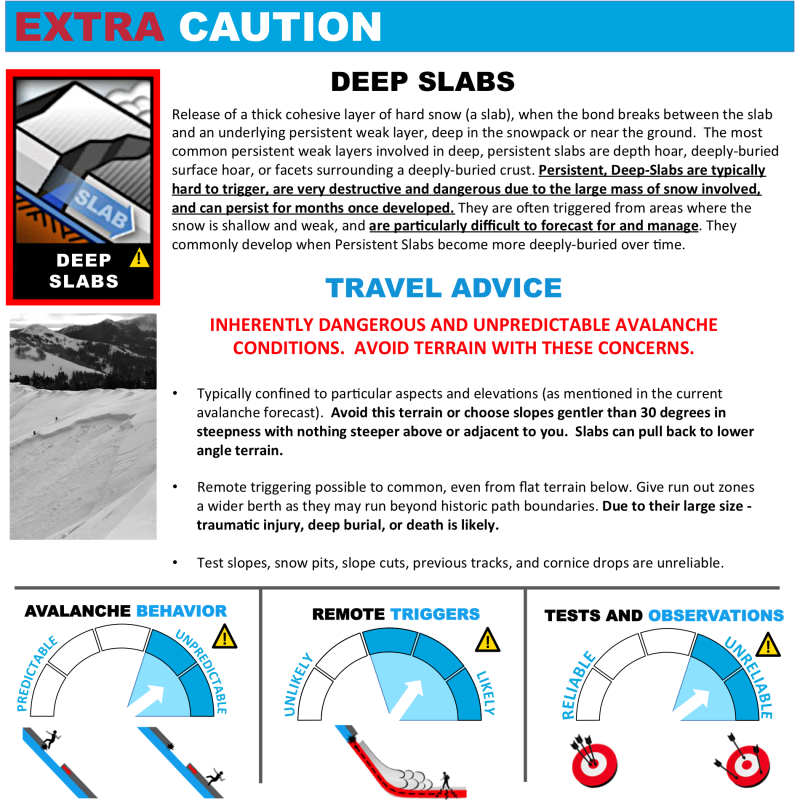
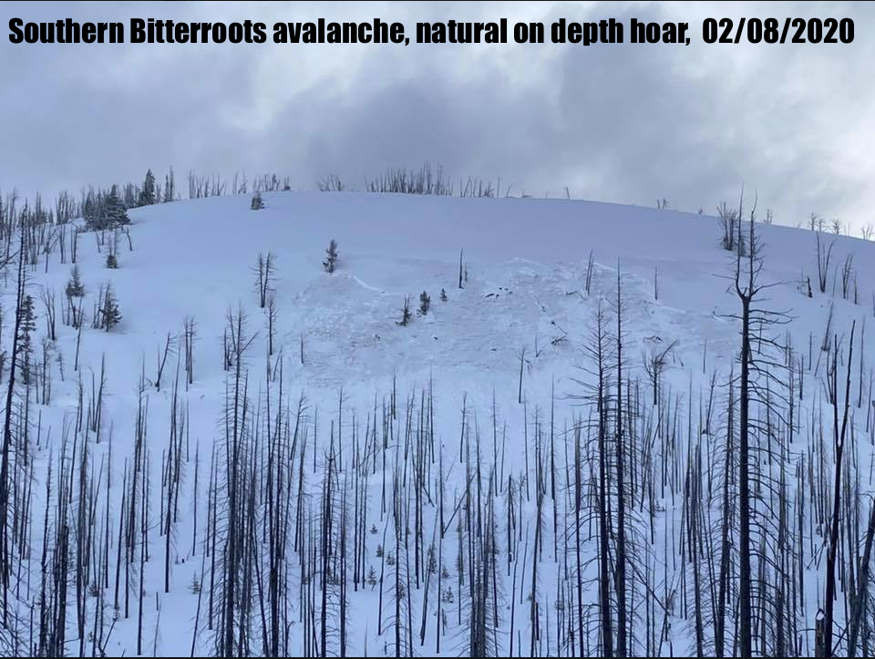
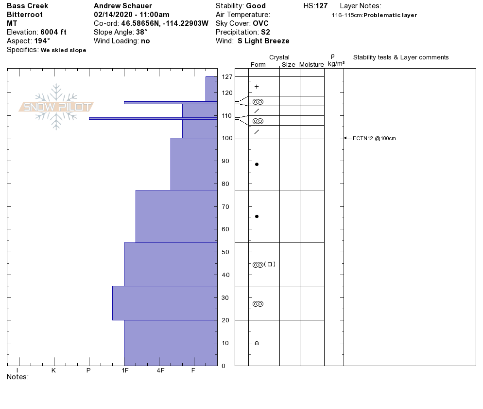
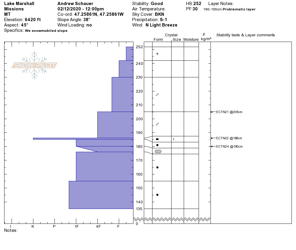
Jeff was in the southern Bitterroot yesterday, and he found weak, faceted snow near the ground that was still failing in stability tests. This layer is not present in the rest of our advisory area. It has now been one week since the last reported avalanche that failed on this weak layer (photo), and it is becoming less likely to trigger an avalanche deeper in the snowpack. However, new snow and moderate winds will apply a load that will push this weak layer closer to its breaking point. Translation: we have a deep persistent slab problem in the Southern Bitterroot. Before committing to steep terrain, take the time to dig a pit and look for that weak, sugary snow near the ground. Keep in mind these deep weak layers will not always fail in stability tests, and you might not see any red flags like collapsing or shooting cracks before triggering a large avalanche. If you notice poor structure, stick to slopes less than 30 degrees that are not connected to steeper terrain. Avoid slopes that have been previously scoured, areas with rocks poking out of the snow, and slopes that have avalanched earlier this season.

The Bottom Line

With more snow and wind in the forecast today, it is important to take the time to dig a pit and do a quick test before committing to avalanche terrain. Stick to slopes that have not been recently wind loaded, and keep an eye out for red flags like recent avalanches, shooting cracks, and collapsing in the snowpack. If you are planning on getting out in the Southern Bitterroot, be sure identify and avoid slopes with weak, sugary snow deep in the snowpack.


Your observations are extremely helpful! If you get out, please take a minute to fill out the observation form on our website (missoulaavalanche.org), or shoot us a quick email at [email protected].

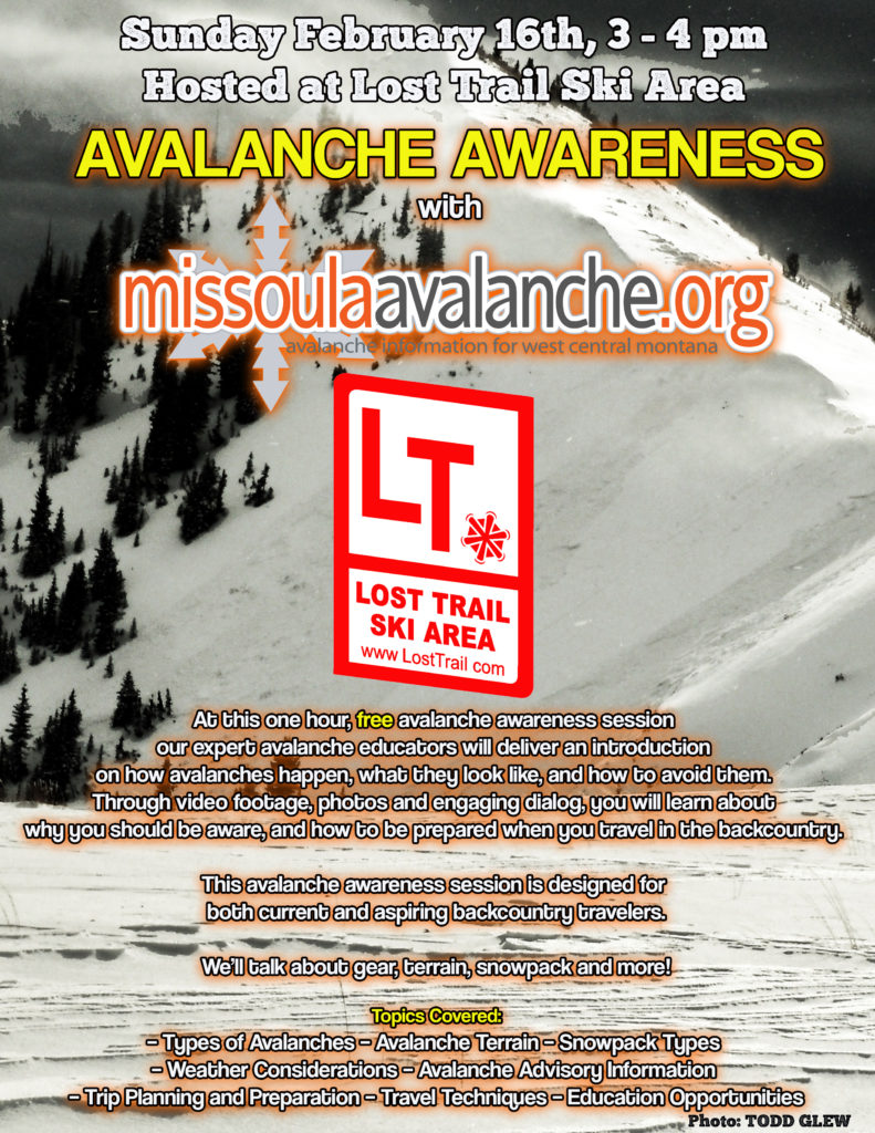
We offer a variety of avalanche courses throughout the winter. Our education calendar is posted on our website. We will be running two avalanche awareness lectures at Lost Trail this Sunday, Feb 16 (details).

READ FULL ADVISORY  

Problem 1 - Wind Slab

  • TYPE

    wind-slabs

    Wind Slabs

    Release of a cohesive layer of snow (a slab) formed by the wind.  Wind typically erodes snow from the upwind sides of terrain features and deposits snow on the downwind side.  Wind slabs are often smooth and rounded and sometimes sound hollow, and can range from soft to hard. Wind slabs that form over a persistent weak layer (surface hoar, depth hoar, or near-surface facets) may be termed Persistent Slabs or may develop into Persistent Slabs.

  • SIZE

    3-4

    1-2 (Small-Large)

    The potential size of avalanche resulting from this problem.

  • LIKELIHOOD

    Likelihood-5

    Likely

    The likelihood of an avalanche resulting from this problem.

  • ADDED DANGER

    Increased Slope Danger

    Increased/Added Danger

    There is an increased risk of avalanches on these slopes:

    N - North
    NE - Northeast
    E - East
    SE - Southeast
    S - South

It will be easy to trigger an avalanche in steep, wind-loaded terrain. These wind slabs will become more sensitive with more snow and wind. Avoid steep, wind-loaded slopes, which are easily identified by poking around with a ski pole or hopping off of your snowmobile. Look out for shooting cracks and recent avalanches. Stick to slopes that have not been recently wind loaded. The riding will be better, and you won’t trigger a wind slab avalanche.

Problem 2 - Storm Slab

  • TYPE

    storm-slabs

    Storm Slabs

    Release of a soft cohesive layer (a slab) of new snow which breaks within the storm snow or on the old snow surface. Storm-slab problems typically last between a few hours and few days. Storm-slabs that form over a persistent weak layer (surface hoar, depth hoar, or near-surface facets) may be termed Persistent Slabs or may develop into Persistent Slabs.

  • SIZE

    3-4

    1-2 (Small-Large)

    The potential size of avalanche resulting from this problem.

  • LIKELIHOOD

    Likelihood-3

    Possible

    The likelihood of an avalanche resulting from this problem.

  • ADDED DANGER

    Increased Slope Danger

    Increased/Added Danger

    There is an increased risk of avalanches on these slopes:

    N - North
    NE - Northeast
    E - East
    SE - Southeast
    S - South
    SW - Southwest
    W - West
    NW - Northwest

New snow will become more reactive as storm totals stack up. Keep an eye out for red flags like shooting cracks and recent avalanche activity. Dig a quick pit to see how well the new snow is bonding to the old snow surface, and look for instabilities within the new snow.

Problem 3 - Deep Persistent Slab

  • TYPE

    deep-persistent-slabs

    Deep Persistent Slabs

    Release of a thick cohesive layer of hard snow (a slab), when the bond breaks between the slab and an underlying persistent weak layer, deep in the snowpack or near the ground.  The most common persistent weak layers involved in deep, persistent slabs are depth hoar, deeply-buried surface hoar, or facets surrounding a deeply-buried crust. Persistent, Deep-Slabs are typically hard to trigger, are very destructive and dangerous due to the large mass of snow involved, and can persist for months once developed. They are often triggered from areas where the snow is shallow and weak, and are particularly difficult to forecast for and manage. They commonly develop when Persistent Slabs become more deeply-buried over time.

  • SIZE

    5-6

    2-3 (Large)

    The potential size of avalanche resulting from this problem.

  • LIKELIHOOD

    Likelihood-1

    Unlikely

    The likelihood of an avalanche resulting from this problem.

  • ADDED DANGER

    Increased Slope Danger

    Increased/Added Danger

    There is an increased risk of avalanches on these slopes:

    N - North
    NE - Northeast
    E - East
    SE - Southeast
    S - South
    SW - Southwest
    W - West
    NW - Northwest

Deep persistent slab avalanches are only a problem in the southern Bitterroot. These will be pushed closer to their limit with more snow and wind on the way. Dig a pit and avoid slopes with weak, sugary snow near the ground. Keep in mind these deep persistent weak layers do not always show up in stability tests, and they will not always present red flags like cracking and collapsing before the slope avalanches. Deep persistent slab avalanches are tricky, and the best way to manage the problem is to identify poor snow structure and avoid steep slopes, or slopes connected to steeper terrain.

VIDEO

FORECAST & OUTLOOK

In the last 24 hours, we received 4-8 inches of new snow in the Bitterroot, with a trace to 2 inches in the Rattlesnake and Seeley Lake areas. This morning, winds are blowing 10-20 mph out of the west and southwest, and mountain temperatures are in the low 20’s. Today we can expect to see 2-4 inches of new snow, with slightly higher totals in the Seeley Lake area. Mountain temperatures will get into the high 20’s to low 30’s and winds will be 15-25 mph out of the west with gusts reaching 50 mph. Snow will pick up this afternoon through tomorrow, and we will see 6-10″ of new snow by tomorrow morning, with higher totals at higher elevations. Check out the forecast here.

This information is the sole responsibility of the Forest Service and does not apply to operating ski areas. The avalanche danger rating expires at midnight tonight but the information can help you make a more informed decision regarding travel in avalanche terrain for the next few days.

Our advisory area includes National Forest System lands in the Bitterroot Mountains from Lost Trail Pass north to Granite Pass, the Rattlesnake Mountains north of Missoula and the Southern Swan and Mission Mountains near Seeley Lake, MT. Avalanche information for the Lookout Pass/St. Regis Basin area is available from the Idaho Panhandle Avalanche Center.