Posted:
Feb 22, 2020 @ 6:42 am

The avalanche danger is low for the west central Montana backcountry. Low danger does not mean no avalanche danger. Use normal caution to travel in avalanche terrain today.

Good morning, this is Travis Craft with the West Central Montana avalanche advisory for February 22, 2020. Today’s advisory is sponsored by Krispy Kreme. This advisory does not apply to operating ski areas, expires at midnight tonight, and is the sole responsibility of the U.S. Forest Service.

Weather and Snowpack

Mountain temperatures range from 17 F to 26 F in the region. In the Bitterroot, winds are 7 mph with gusts of 17 out of the SSW. In the northern part of the advisory area, winds are 20 mph and gusting 33 mph out of the WSW. No new snow overnight.

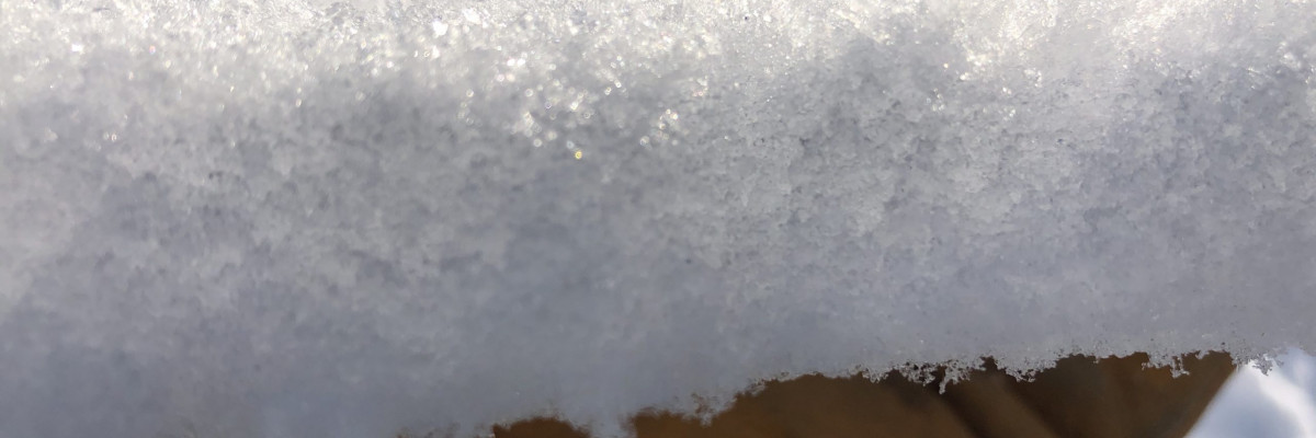
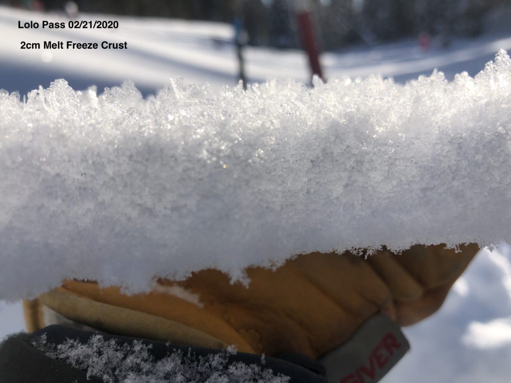
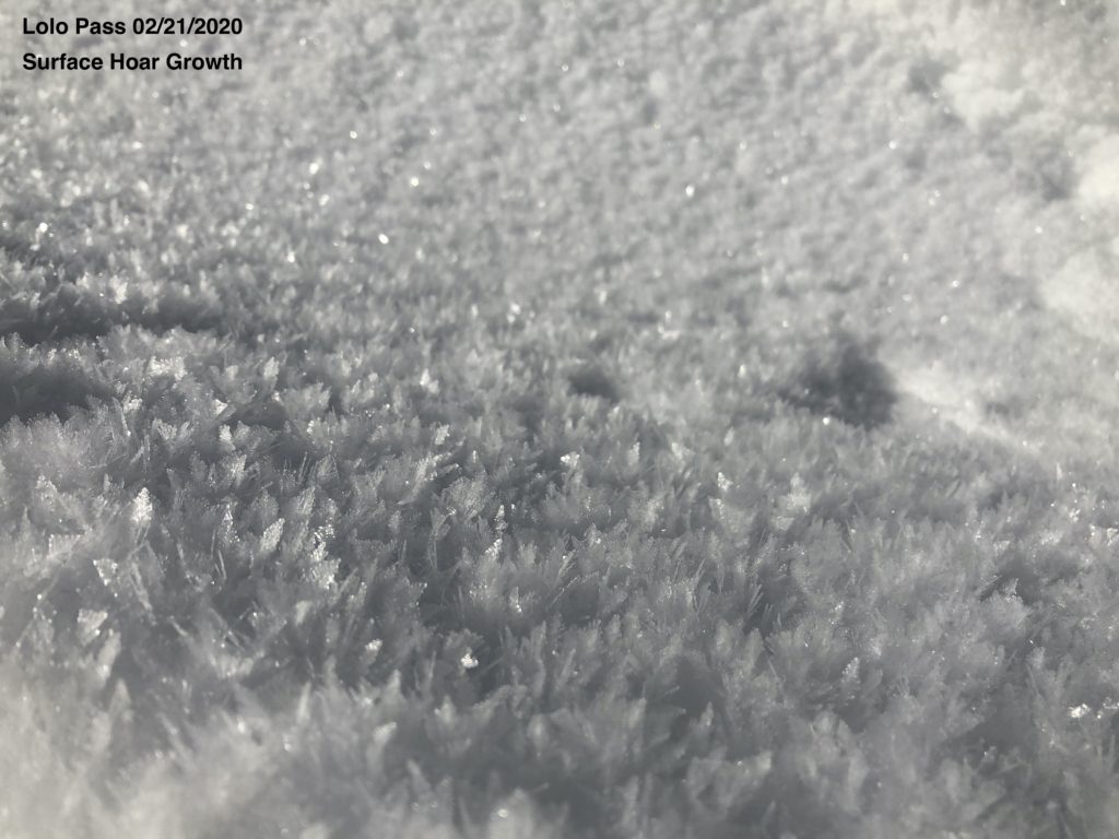
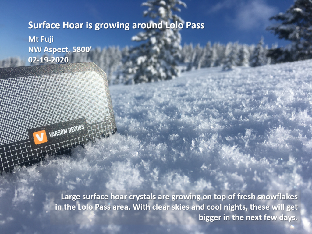
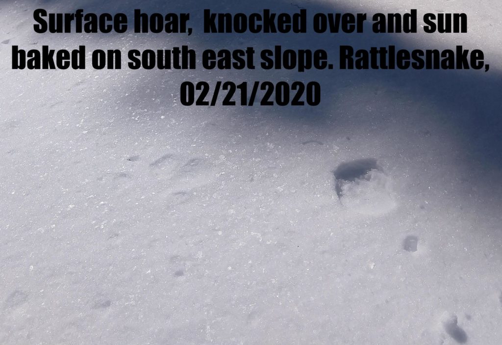
The weather has been mild during the day, creating crusts on sun-exposed slopes. Temperatures have been dropping at night to single digits growing surface hoar. These temperature swings have created near-surface facets below the melt-freeze crust. The surface hoar, crust, and facet combination are worrisome once they become buried later this weekend.

Overnight temperatures did not drop into single digits. Expect clouds to increase today slowly. Low does not mean no avalanche danger. Dig a pit before committing to any steep slope, pay attention to changing weather, and look for red flags.

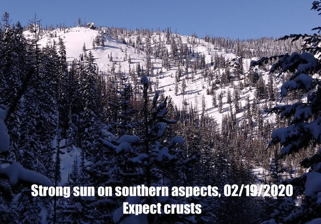
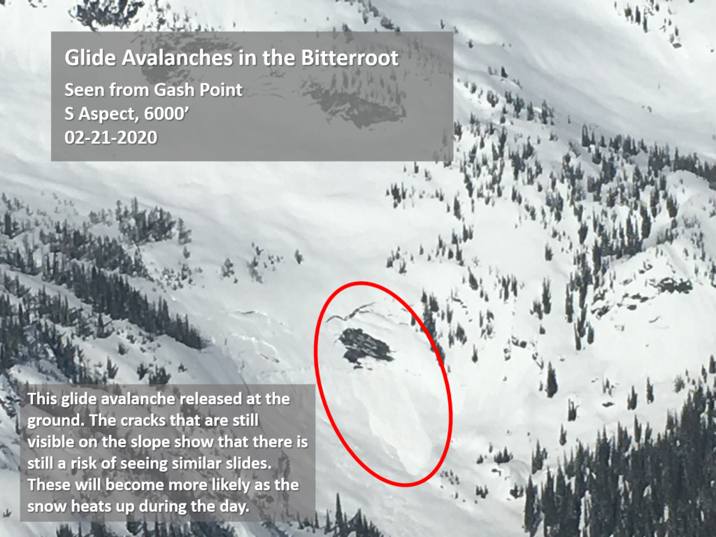
The primary avalanche problem is loose wet on steep, south-facing slopes. As cloud cover builds today, it should keep these slides small. If you see rollerballs on a slope, it is time to seek shadier less sun-exposed slopes.

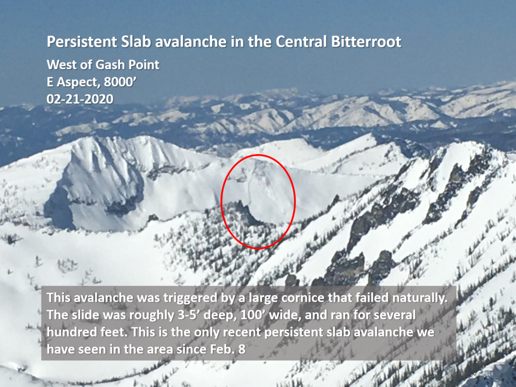
In the southern Bitterroot, persistent slab avalanches are an avalanche problem. There is a thick layer of depth hoar buried under 1.5-2m of snow that still needs to be treated with caution. If you are trying to get on steeper slopes, find a shallow place to dig and look for weak, sugary snow at the ground. If you find it, pick another slope to ride. These avalanches are unlikely to fail in stability tests. However, if you find the right spot on the slope, it is still possible to trigger a very large avalanche.

Bottom Line

Use normal caution to travel in avalanche terrain today. Continue to practice safe travel protocols in case you find an exception to a generally stable snowpack. Travel one at a time in avalanche terrain, carry a beacon, shovel, and probe, and stay alert for signs of instability. Dig a pit. Look for red flags. Pay attention to weather changes that will increase avalanche danger. 

Your observations are extremely helpful! If you get out, please take a minute to fill out the observation form on our website (missoulaavalanche.org), or shoot us a quick email at [email protected].

We offer a variety of avalanche courses throughout the winter. Our current schedule is listed on the Missoulaavalanche.org avalanche education page. If you are interested in enrolling, you can find info here, or email us with questions.

Ski and ride safe.


READ FULL ADVISORY  

Problem 1 - Loose Wet

  • TYPE

    loose-wet

    Loose Wet

    Release of wet unconsolidated snow or slush. These avalanches typically occur within layers of wet snow near the surface of the snowpack, but they may quickly gouge into lower snowpack layers. Like Loose-Dry Avalanches,they start at a point and entrain snow as they move downhill, forming a fan-shaped avalanche. They generally move slowly, but can contain enough mass to cause significant damage to trees, cars or buildings. Other names for loose-wet avalanches include point-release avalanches or sluffs. Loose-wet avalanches can trigger slab avalanches that break into deeper snow layers.

  • SIZE

    2-3

    1 (Small)

    The potential size of avalanche resulting from this problem.

  • LIKELIHOOD

    Likelihood-2

    Unlikely/Possible

    The likelihood of an avalanche resulting from this problem.

  • ADDED DANGER

    Increased Slope Danger

    Increased/Added Danger

    There is an increased risk of avalanches on these slopes:

    S - South

Cloud cover should build today, keeping these slides small and confined to steep south-facing terrain. If you see rollerballs, seek shadier, less sunny aspects.

Problem 2 - Persistent Slab

  • TYPE

    persistent-slabs

    Persistent Slabs

    Release of a cohesive layer of soft to hard snow (a slab) in the middle to upper snowpack, when the bond to an underlying persistent weak layer breaks.  Persistent layers include: surface hoar, depth hoar, near-surface facets, or faceted snow. Persistent weak layers can continue to produce avalanches for days, weeks or even months, making them especially dangerous and tricky. As additional snow and wind events build a thicker slab on top of the persistent weak layer, this avalanche problem may develop into a Persistent, Deep-Slab.

  • SIZE

    5-6

    2-3 (Large)

    The potential size of avalanche resulting from this problem.

  • LIKELIHOOD

    Likelihood-1

    Unlikely

    The likelihood of an avalanche resulting from this problem.

In the southern Bitterroot, there is depth hoar at the bottom of the snowpack. Avoid likely trigger points (near cliff bands and rocks) where it is more likely to trigger this layer. Check the depth of the snowpack if it is less than 4 feet deep, choose a different slope.

VIDEO

Observations 02/22/2020

Observations 02/21/2020

FORECAST & OUTLOOK

Weather change on Sunday as a cold front moves into the forecast area. Today, clouds slowly build later in the day. Look for snow to start accumulating on Sunday night. See the forecast.

This information is the sole responsibility of the Forest Service and does not apply to operating ski areas. The avalanche danger rating expires at midnight tonight but the information can help you make a more informed decision regarding travel in avalanche terrain for the next few days.

Our advisory area includes National Forest System lands in the Bitterroot Mountains from Lost Trail Pass north to Granite Pass, the Rattlesnake Mountains north of Missoula and the Southern Swan and Mission Mountains near Seeley Lake, MT. Avalanche information for the Lookout Pass/St. Regis Basin area is available from the Idaho Panhandle Avalanche Center.