
The avalanche danger for the west central Montana backcountry is considerable on wind loaded slopes. All other slopes the danger is moderate. New snow and wind have created dangerous avalanche conditions on leeward slopes. Use caution on all other slopes before committing to them.
Good morning, this is Travis Craft with the West Central Montana avalanche advisory for February 25, 2020. Today’s advisory is sponsored by Krispy Kreme. This advisory does not apply to operating ski areas, expires at midnight tonight, and is the sole responsibility of the U.S. Forest Service.
Weather and Snowpack
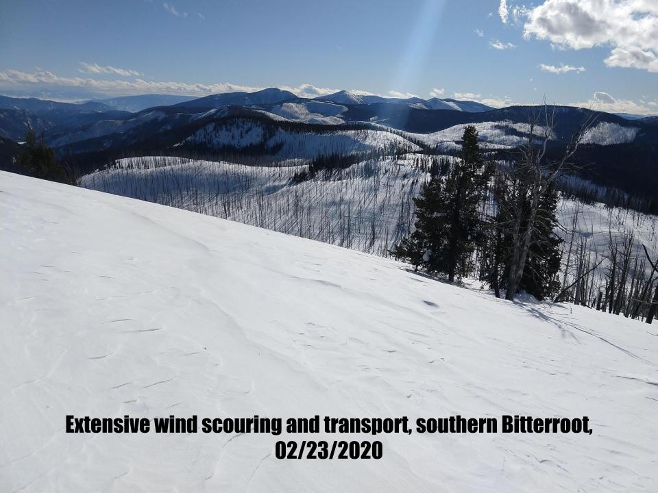
Mountain temperatures range from 12 F to 22 F in the region. In the Bitterroot, winds are 9 mph with gusts of 14 out of the WSW. In the northern part of the advisory area, winds are 14 mph and gusting 18 mph out of the WSW. Overnight we have received 4 to 6 new inches of snow. The storm totals are 6 to 20 inches of new snow in the last 48 hours. The Seeley lake area and Bitterroot were favored in this last storm cycle.
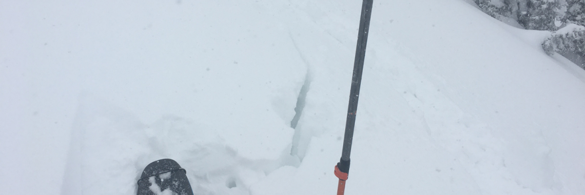
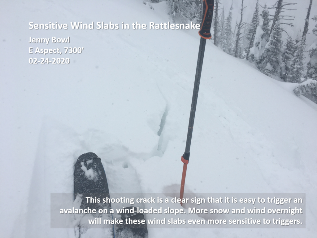
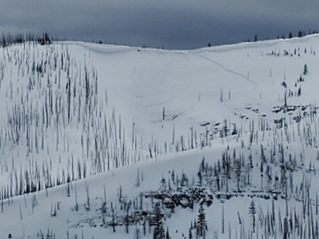
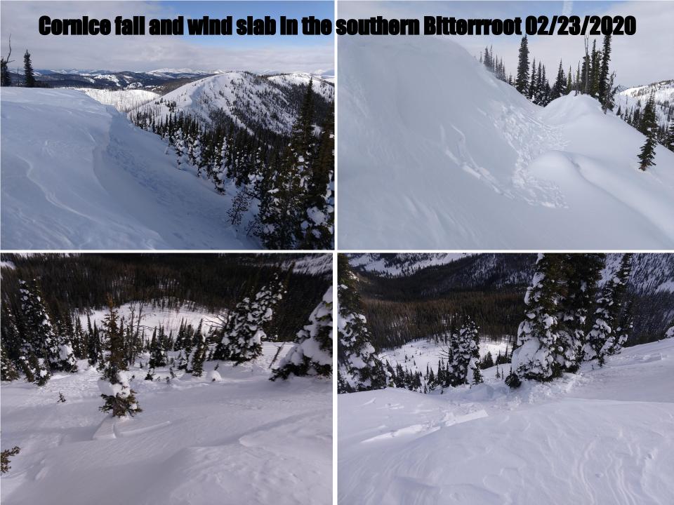
The primary avalanche problem is wind drifted snow on leeward slopes. Yesterday near the Bitterroot divide and Granite pass, I found 3 to 4 foot slabs on leeward slopes. Jeff and Andrew found 1 foot wind slabs in the Rattlesnake. I saw two natural wind slab avalanches yesterday that were big enough to carry and bury a person. Look for small to large wind slabs on leeward slopes. Watch for blowing snow and rounded, textured, drifts. Shooting cracks are a sign of unstable wind slabs. These slabs, if triggered, could step down into deeper layers into the snowpack.
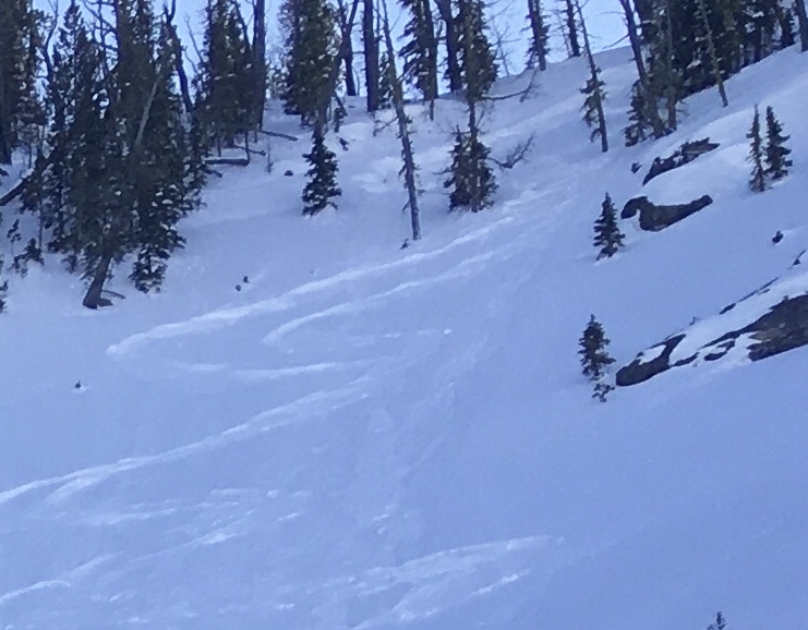
The second avalanche concern is new snow. New snow fell on a variety of old snow surfaces. Dig a pit to see how the new snow is bonding to old snow surfaces. Look for red flags. I saw several natural small loose snow avalanches yesterday. Use small test slopes to see how the new snow is bonding before committing to terrain over 30 degrees.
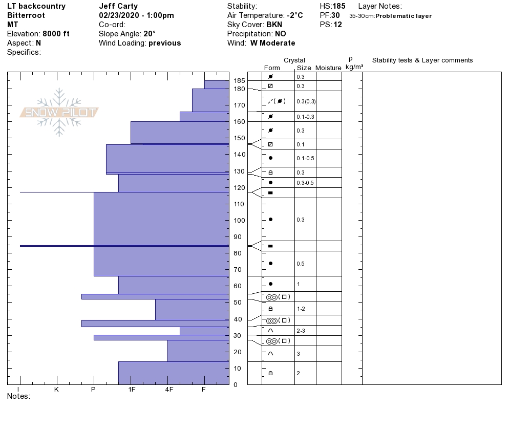
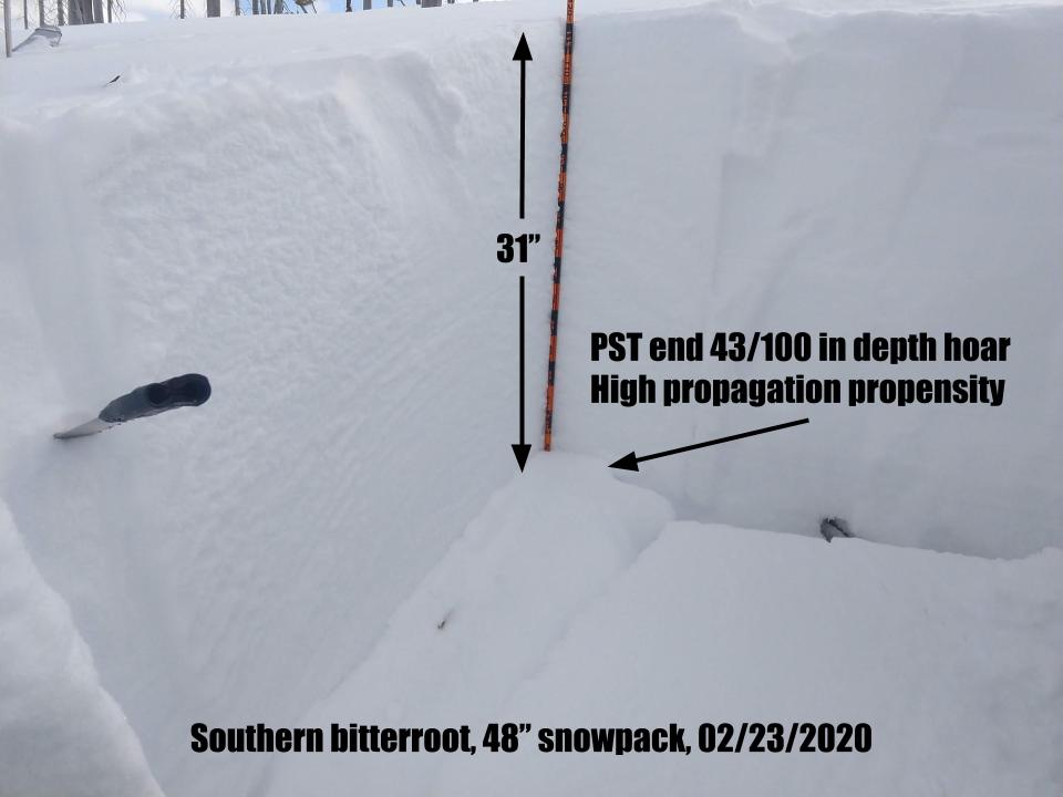
The final avalanche problem is persistent slab avalanches. The new load of snow has stressed the weak layers in our snowpack. There are facets in our snowpack. Dig a pit to the crust from 02/02/2020. Needles and debris can identify this crust from the wind event on February 02/01/2020. There is another melt-freeze crust closer to the surface with facets underneath it. Perform pit tests to see how reactive these layers are. There were slides triggered on facets in the top 1 to 3 feet of the snowpack over the weekend(Public Observations). Jeff was in the southern Bitterroot over the weekend. The depth hoar and structure is suspect. Avoid slopes where this structure is present. Depth hoar is a fickle beast and can not be trusted. If you want to commit to avalanche terrain, do your homework. Dig in a shallow spot (2 m or less), and look for weak, sugary snow at the ground. If you find it, choose another slope to ski or ride.
Bottom Line
Complex avalanche conditions require choosing simple terrain. Choose sheltered lower angle less than 30 degrees slopes today before committing to any steeper slopes. Dig a pit and look for stripes in the snow to identify weak layers. Perform a pit test to see how reactive these layers are. Choose a shallow spot to see if you have weak sugary snow at the bottom of the snowpack if you do choose another slope. Travel one at a time in avalanche terrain, carry a beacon, shovel, and probe, and stay alert for signs of instability. Look for red flags. Use small test slopes to see how the new snow is bonding.
Education
Your observations are extremely helpful! If you get out, please take a minute to fill out the observation form on our website (missoulaavalanche.org), or shoot us a quick email at [email protected].
We offer a variety of avalanche courses throughout the winter. Go to our course offerings page on our website. Check out the list and get yourself enrolled in one of our many courses this winter!
Ski and ride safe.


