
The avalanche danger is MODERATE in the west central Montana backcountry. Use caution when choosing slopes to ride on today.
Good morning, this is Travis Craft with the West Central Montana avalanche advisory for February 29, 2020. Today’s advisory is sponsored by Gull boats and R.V. This advisory does not apply to operating ski areas, expires at midnight tonight, and is the sole responsibility of the U.S. Forest Service.
Weather and Snowpack
Mountain temperatures are below freezing in the region. In the Bitterroot, winds are 17 mph with gusts of 28 out of the West. In the northern part of the advisory area, winds are 29 mph and gusting 46 mph out of the West. Overnight a trace to 2 inches of new snow fell.
We are shifting back to winter with a cold front pushing into the area this morning, dropping temperatures, moderate to strong winds, and light accumulations of snow. New snow and wind will increase the avalanche danger.
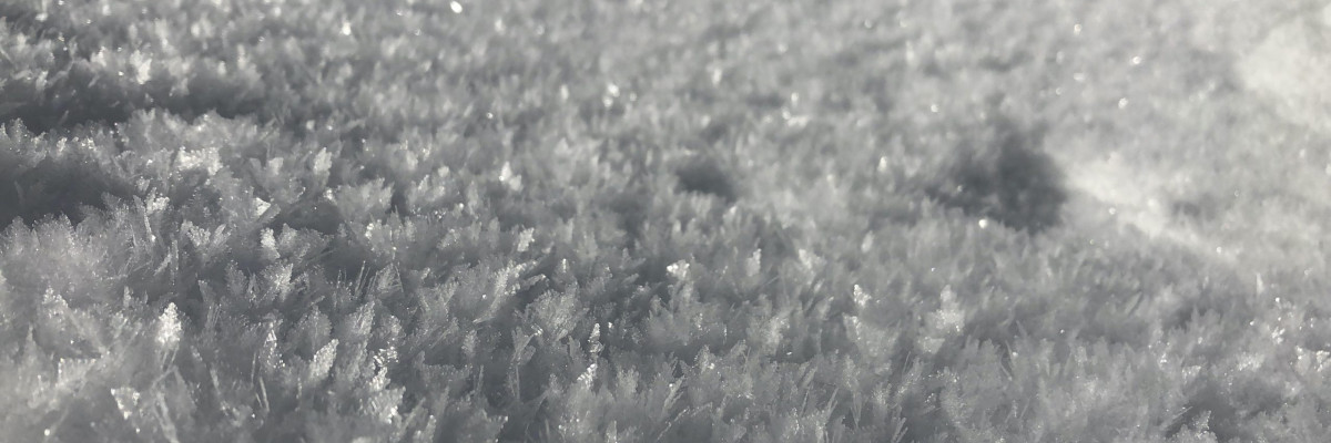
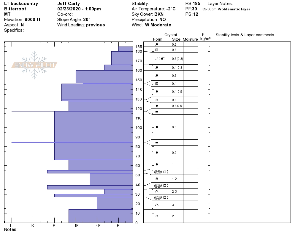
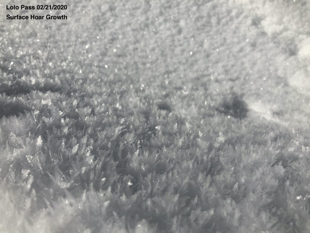
The primary avalanche problem is persistent slabs. Yesterday, Andrew was able to find buried surface hoar on shaded north-facing slopes near Lolo pass. The buried surface hoar propagated easily in pit tests. This layer is buried about a foot deep. Overall this layer is very spotty in its distribution. Dig a pit and look for a thin stripe of snow and perform a pit test.
In the southern Bitterroot, depth hoar at the bottom of the snowpack can not be trusted. Choose a shallow spot to dig. If you find weak sugary snow at the bottom of your pit, choose a different slope where this structure is not present.
Bottom Line
Today, we shift back into winter after a balmy day of warm temperatures. Changing weather equals changing avalanche conditions. New snow will be landing on a variety of old snow surfaces. Use small test slopes to see how the new snow is bonding. Look for small wind slabs to form on leeward slopes and be sensitive to human triggers. Dig a pit 4 feet deep and look for stripes in the snowpack. Perform a pit test to evaluate these layers. Travel one at a time in avalanche terrain, carry a beacon, shovel, and probe, and stay alert for signs of instability. Look for red flags. Give cornices a wide berth.
Education
Your observations are extremely helpful! If you get out, please take a minute to fill out the observation form on our website (missoulaavalanche.org), or shoot us a quick email at [email protected].
We offer a variety of avalanche courses throughout the winter. Go to our course offerings page on our website. Check out the list and get yourself enrolled in one of our many courses this winter!
Ski and ride safe.


