Posted:
Mar 12, 2020 @ 6:23 am

Up to 6” of new snow with moderate winds will make avalanches possible on wind-loaded slopes. For today, the avalanche danger will be MODERATE on wind-loaded slopes and LOW elsewhere in West Central Montana.

Good morning, this is Andrew Schauer with the West Central Montana avalanche advisory for Thursday, March 12, 2020. Today’s advisory is sponsored by ZillaState. This advisory does not apply to operating ski areas, expires at midnight tonight, and is the sole responsibility of the U.S. Forest Service.

Weather and Snowpack

In the past 24 hours, a small system dropped 6” of snow in the southern Missions, 4” in the Rattlesnake, and a trace in the rest of the advisory area. Winds have been 10-20 mph out of the west with gusts up to 48 mph. As of 5 AM, mountain temperatures are in the high teens to low 20’s. Today, winds will blow 10-15 mph out of the west with gusts to 25, and mountain temperatures will be in the low 20’s to upper 30’s. Clouds will move in this afternoon as a low pressure system brings cold temperatures tonight through the weekend.

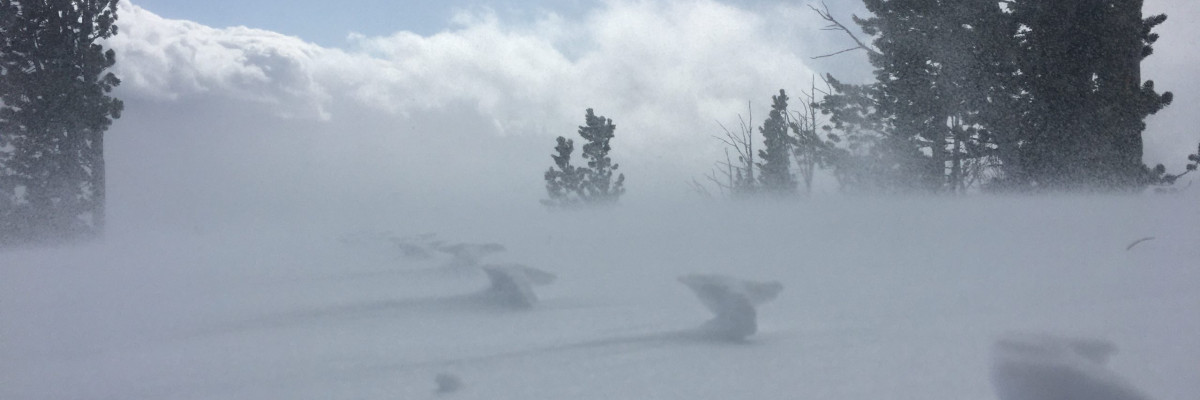
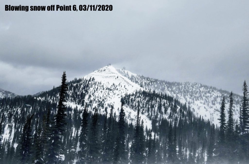
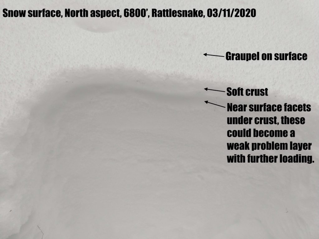
Up to 6” of new snow last night with moderate to strong winds will make it possible for a human to trigger wind slabs up to a foot deep today. These avalanches will be most likely near Seeley Lake, which received the most snow in the past 24 hours. Yesterday, Todd and I toured in the Bitterroot and found stable conditions, but strong winds were already transporting snow. Jeff recorded a similar observation in the Rattlesnake. With low snow totals last night, wind slabs will be smaller and less likely in these areas today. However, even small avalanches can present a dangerous hazard in consequential terrain. Look for freshly drifted snow and avoid wind-loaded slopes, especially above terrain traps like cliffs, trees, or gullies.

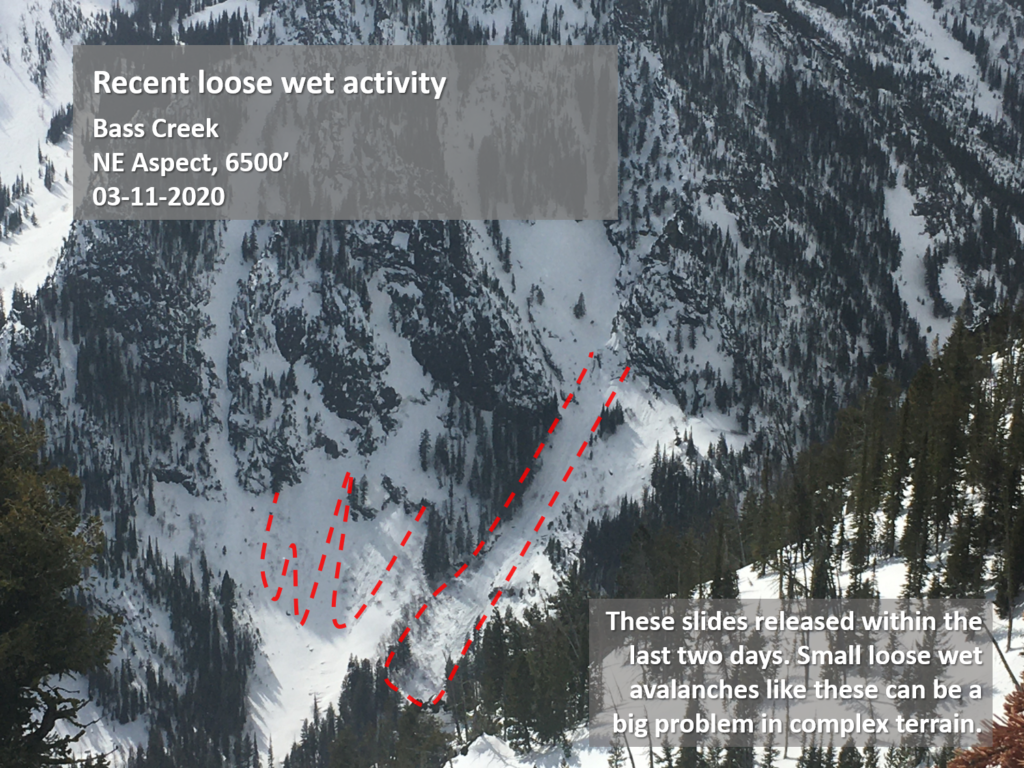
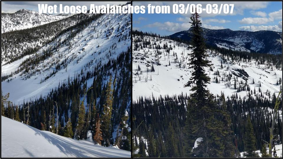
It will also be important to keep an eye on solar aspects, especially at lower elevations. Loose wet avalanches (photo) will be possible as temperatures rise throughout the day. Pay attention to changing snow conditions. If you notice you are punching through heavy, wet snow, it is time to move to shaded slopes or head home for the day.

The Bottom Line

New snow and moderate winds have built reactive wind slabs on leeward slopes. For today it will be important to identify and avoid wind loaded slopes. As the snow heats up during the day, be aware of the increasing likelihood of loose wet avalanches, especially if you notice pinwheels, rollerballsor if you are sinking up past your boots in heavy, wet snow.

Your observations are extremely helpful! If you get out, please take a minute to fill out the observation form on our website (missoulaavalanche.org), or shoot us a quick email at [email protected].

We still have several avalanche courses remaining this season. If you are interested in enrolling, you can find info at the course offerings page on our website or email us with questions.

READ FULL ADVISORY  

Problem 1 - Wind Slab

  • TYPE

    wind-slabs

    Wind Slabs

    Release of a cohesive layer of snow (a slab) formed by the wind.  Wind typically erodes snow from the upwind sides of terrain features and deposits snow on the downwind side.  Wind slabs are often smooth and rounded and sometimes sound hollow, and can range from soft to hard. Wind slabs that form over a persistent weak layer (surface hoar, depth hoar, or near-surface facets) may be termed Persistent Slabs or may develop into Persistent Slabs.

  • SIZE

    3-4

    1-2 (Small-Large)

    The potential size of avalanche resulting from this problem.

  • LIKELIHOOD

    Likelihood-3

    Possible

    The likelihood of an avalanche resulting from this problem.

  • ADDED DANGER

    Increased Slope Danger

    Increased/Added Danger

    There is an increased risk of avalanches on these slopes:

    N - North
    NE - Northeast
    E - East
    SE - Southeast
    S - South

It will be possible to trigger wind slabs up to a foot deep, especially in the Seeley Lake area. Avoid leeward slopes with fresh drifts of wind-loaded snow.

Problem 2 - Loose Wet

  • TYPE

    loose-wet

    Loose Wet

    Release of wet unconsolidated snow or slush. These avalanches typically occur within layers of wet snow near the surface of the snowpack, but they may quickly gouge into lower snowpack layers. Like Loose-Dry Avalanches,they start at a point and entrain snow as they move downhill, forming a fan-shaped avalanche. They generally move slowly, but can contain enough mass to cause significant damage to trees, cars or buildings. Other names for loose-wet avalanches include point-release avalanches or sluffs. Loose-wet avalanches can trigger slab avalanches that break into deeper snow layers.

  • SIZE

    1-2

    < 1 (Small)

    The potential size of avalanche resulting from this problem.

  • LIKELIHOOD

    Likelihood-2

    Unlikely/Possible

    The likelihood of an avalanche resulting from this problem.

  • ADDED DANGER

    Increased Slope Danger

    Increased/Added Danger

    There is an increased risk of avalanches on these slopes:

    SE - Southeast
    S - South
    SW - Southwest
    W - West

Small loose wet avalanches may be possible to trigger this afternoon with warming temps. This will be a bigger concern if the clouds do not move in. Pay attention to signs of increasing instability, such as rollerballs, pinwheels, and sinking up past your boots in wet, sloppy snow.

FORECAST & OUTLOOK

In the past 24 hours, a small system dropped 6” of snow in the southern Missions, 4” in the Rattlesnake, and a trace in the rest of the advisory area. Winds have been 10-20 mph out of the west with gusts up to 48 mph. As of 5 AM, mountain temperatures are in the high teens to low 20’s. Today, winds will blow 10-15 mph out of the west with gusts to 25, and mountain temperatures will be in the low 20’s to upper 30’s. Clouds will move in this afternoon as a low pressure system brings cold temperatures tonight through the weekend. Our next chance for snow will be Friday night into Saturday morning. You can find a more detailed forecast here.

This information is the sole responsibility of the Forest Service and does not apply to operating ski areas. The avalanche danger rating expires at midnight tonight but the information can help you make a more informed decision regarding travel in avalanche terrain for the next few days.

Our advisory area includes National Forest System lands in the Bitterroot Mountains from Lost Trail Pass north to Granite Pass, the Rattlesnake Mountains north of Missoula and the Southern Swan and Mission Mountains near Seeley Lake, MT. Avalanche information for the Lookout Pass/St. Regis Basin area is available from the Idaho Panhandle Avalanche Center.