
The avalanche danger is LOW in the west central Montana backcountry. The snowpack is generally stable. There may be unstable snow in isolated terrain features.
This is Travis Craft with the West Central Montana Avalanche Center’s avalanche advisory for December 08, 2020. This advisory does not apply to operating ski areas, expires at midnight tonight, and is the sole responsibility of the U.S. Forest Service.
Weather and Snowpack
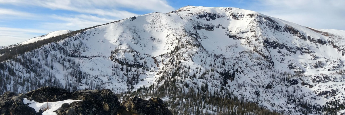
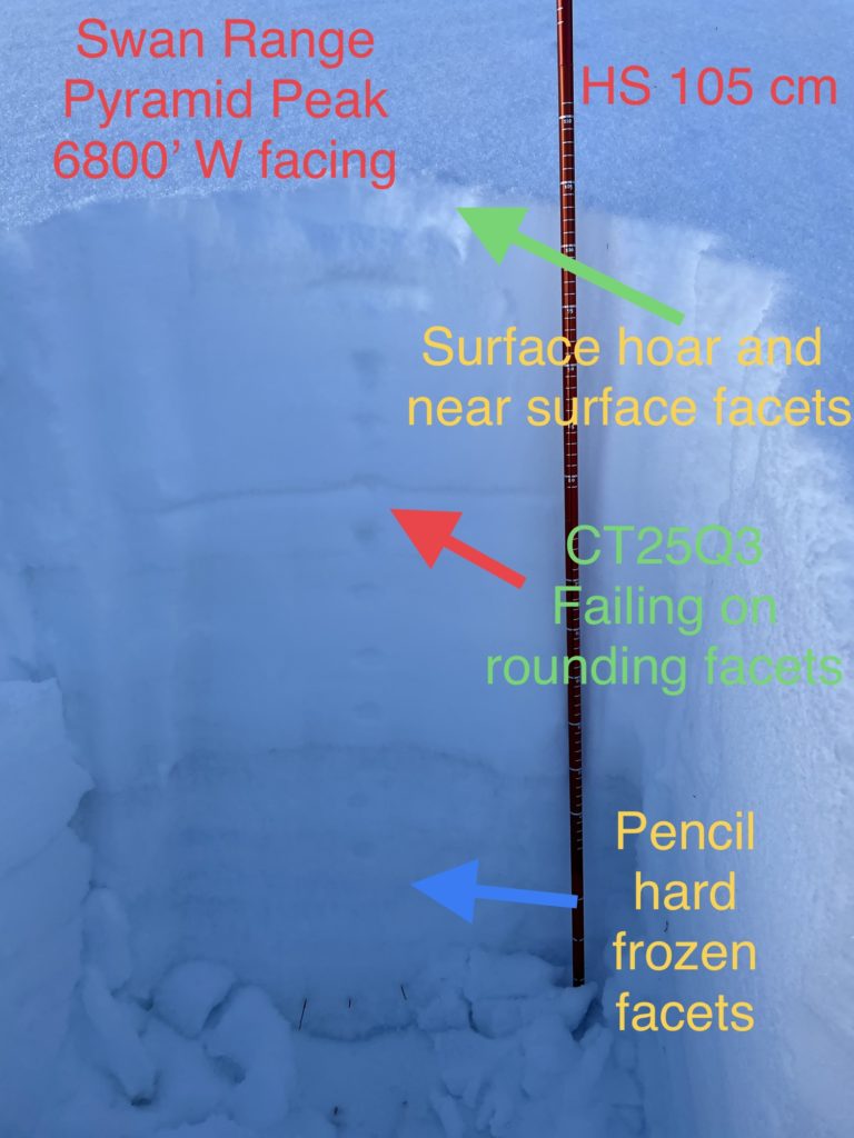
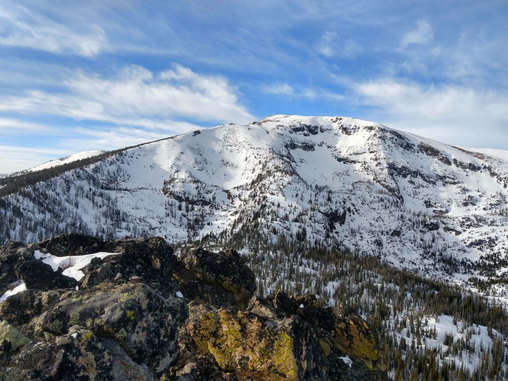
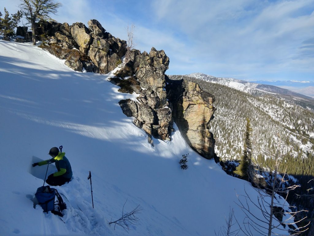
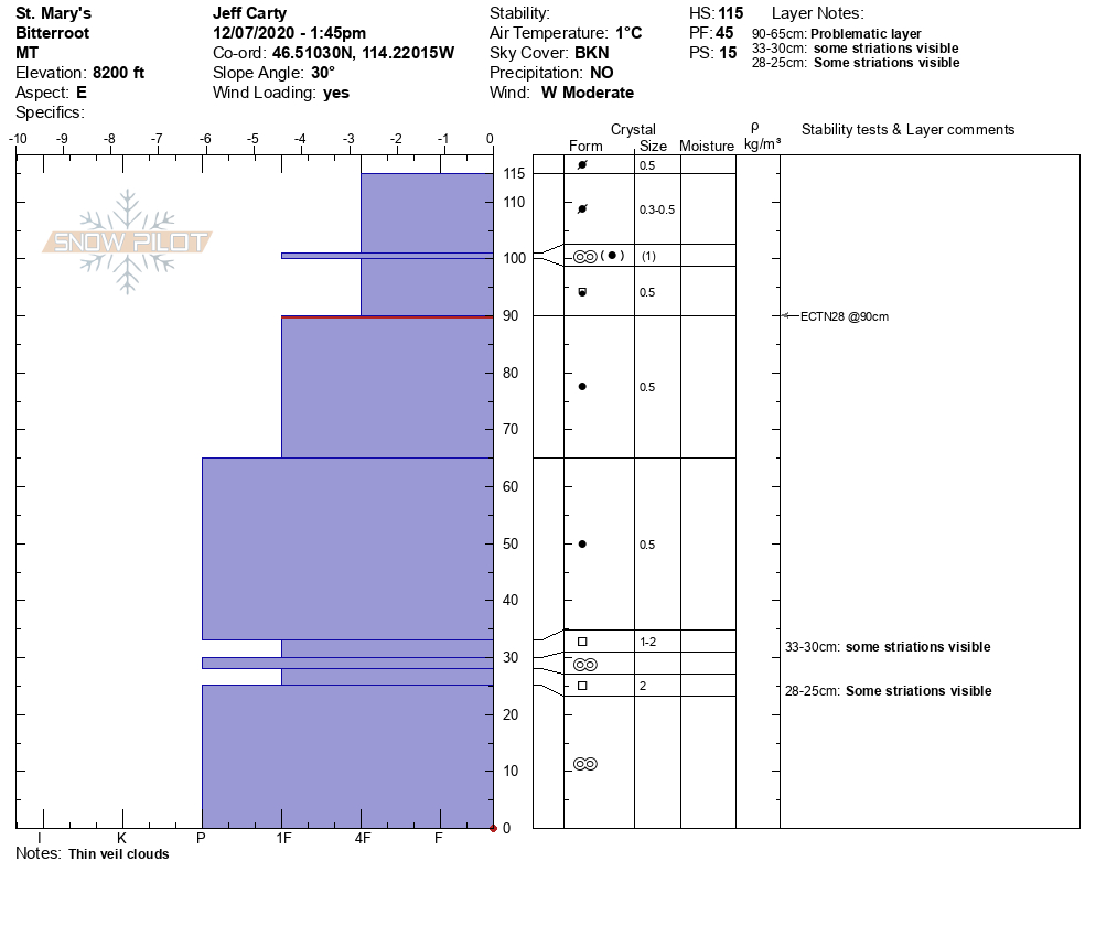
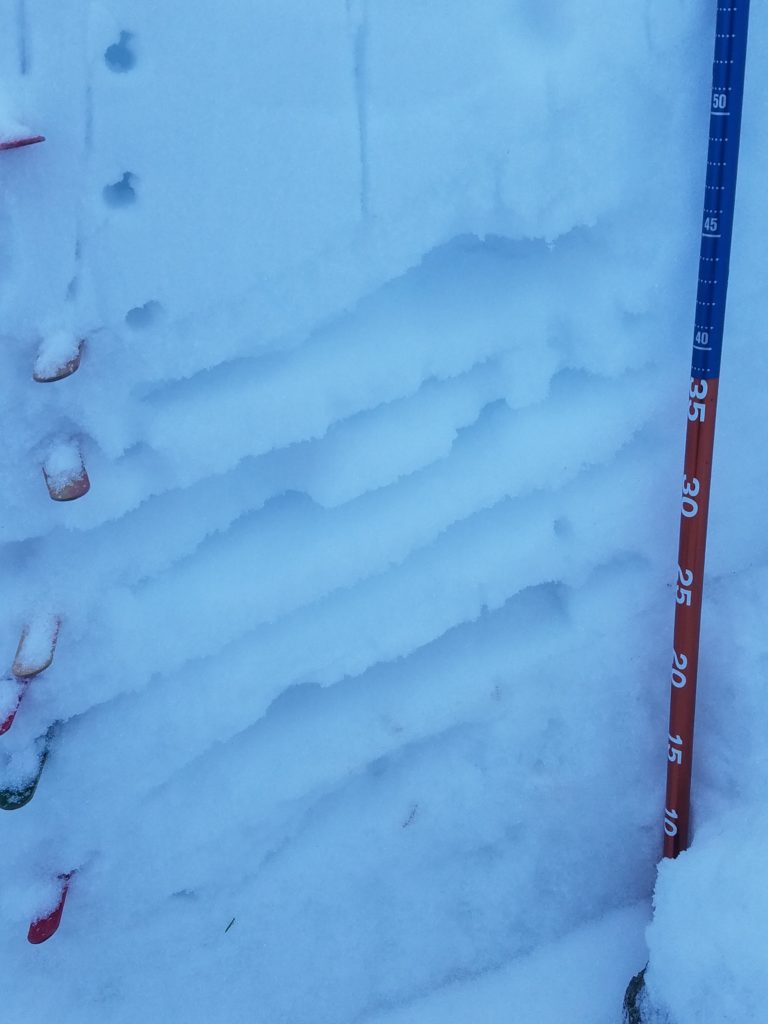
Throughout the advisory area, we have been dealing with inversions. Valleys have been cold, and higher elevations have been warmer. This has produced faceted rotten snow at mid-elevation slopes from 6000 ft to 6500 ft. The layers near the ground are currently gaining strength from 6500 ft to 9000 ft.
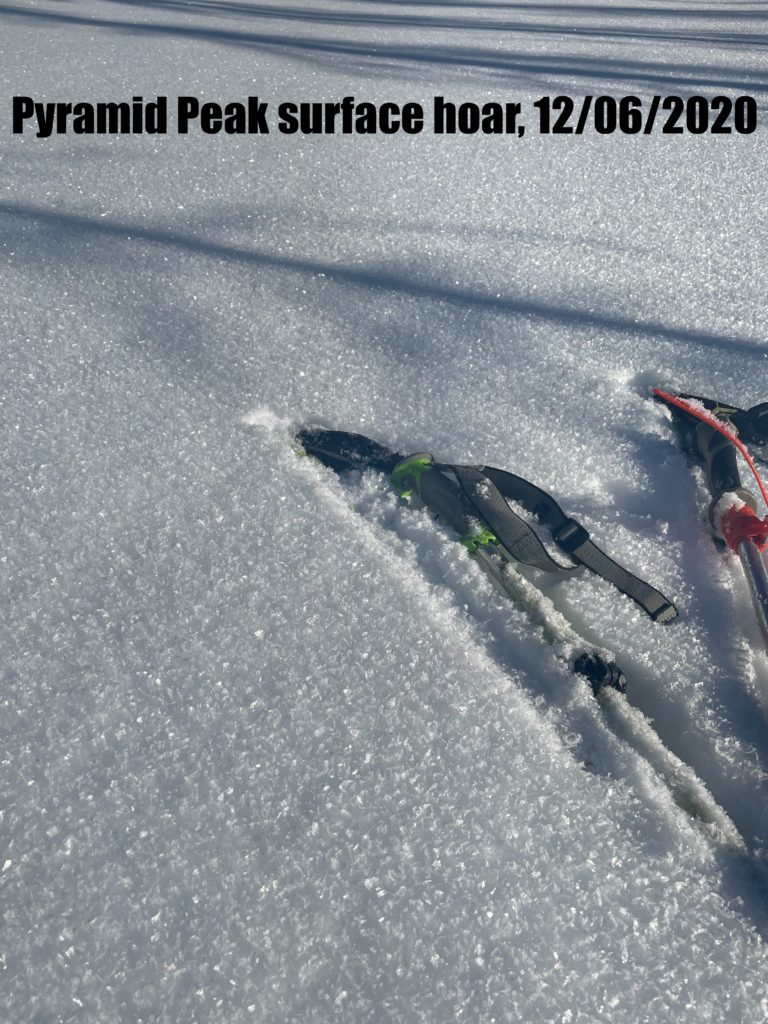
The snowpack is generally stable. Throughout the advisory area, stability tests and red flags support this trend of decreasing avalanche danger. The bottom layers in our snowpack are not reactive in our tests. The primary concern with the next loading events will be pockets of surface hoar in sheltered shady aspects. Once surface hoar is buried, it becomes a persistent weak layer in the snowpack. The other concern will be faceted weak old snow surfaces.
Bottom Line
West and southwest winds gusting to the high twenties today will help keep the temperatures from producing loose wet avalanche problems. Wednesday, look for the inversions to break and precipitation to enter the forecast area. Changing weather creates changing avalanche conditions. The new snow or rain, depending on the elevations, will be falling on weak old snow surfaces.
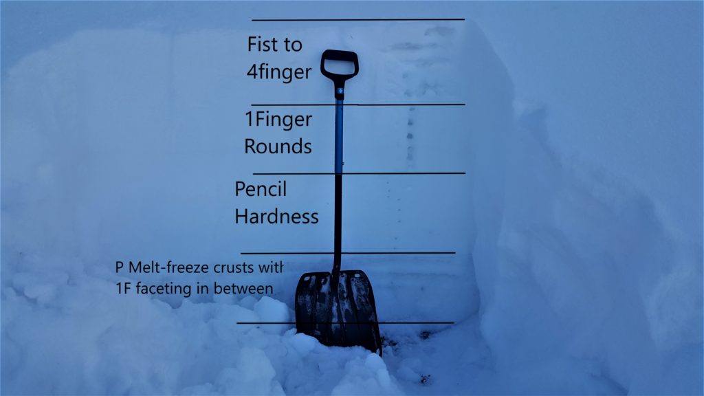
Practice safe travel protocols. Travel one at a time in avalanche terrain, carry a beacon, shovel, and probe, and stay alert for signs of instability. Dig a pit. Look for red flags.
Upcoming Education Events:
Visit our education page for an up to date list of regional educational events and course offerings. Below are a few select events and opportunities to check out this week.
- Wednesday, December 9, 6–7:30 pm MST, FREE Online 1.5-hr Avalanche Awareness Session. Register Here
Special Announcements:
Due to COVID-19, the West Central Montana Avalanche Foundation could not host our biggest annual fundraiser in person this year. While we look forward to having an in-person event again in the future, the Pray for Snow online auction has arrived. The auction is open now and ends on Tuesday, December 15th at 10 pm MST. All proceeds benefit the West Central Montana Avalanche Center and provide free educational opportunities for all backcountry user groups. Please help us spread the word and show your support by participating HERE
The avalanche center forecasts a 1420 square mile area stretching from Lost Trail to Seeley Lake; we can’t see it all weekly. Your snowpack and conditions observations help fill in the gaps and produce a more accurate forecast. If you get out, please take a minute to fill out the online observation form.
Ski and ride safe.


