
The avalanche danger is MODERATE in the Rattlesnake and southern Bitterroot and LOW in the central Bitterroot, Lolo, and Seeley Lake zone. Low danger does not mean no avalanche danger, isolated instabilities exist.
Good Morning. This is Jeff Carty with the West Central Montana Avalanche Center advisory on Saturday, January 30th, 2021. This advisory is sponsored by the Rocky Mountaineers. This advisory does not apply to operating ski areas and expires at midnight tonight. The USDA Forest Service is solely responsible for its content.
Weather and Snowpack
A bit of snow trickled in, 1-3” in most areas, but up to 12″ the southern Bitterroot. Winds have been relatively mild and westerly. Mountain temperatures this morning are 20ºF to 29ºF. Freezing temps rose to around 6000’ yesterday bringing heavy snow to lower elevations.
The southern Bitterroot won this round of snowfall with 10″ to 12” in the last 72hrs. It fell on widespread surface hoar. Tests were showing low strength yesterday, but not propagation. However, it was collapsing and cracking during travel. As the new snow consolidates into a slab it may transmit propagation further. Avalanches are possible and the hazard is moderate in the southern Bitterroot. Restricting travel to slopes under 30º is advised until the reactivity of the new snow is clear. Watch for collapsing and cracking, and propagation in stability tests.
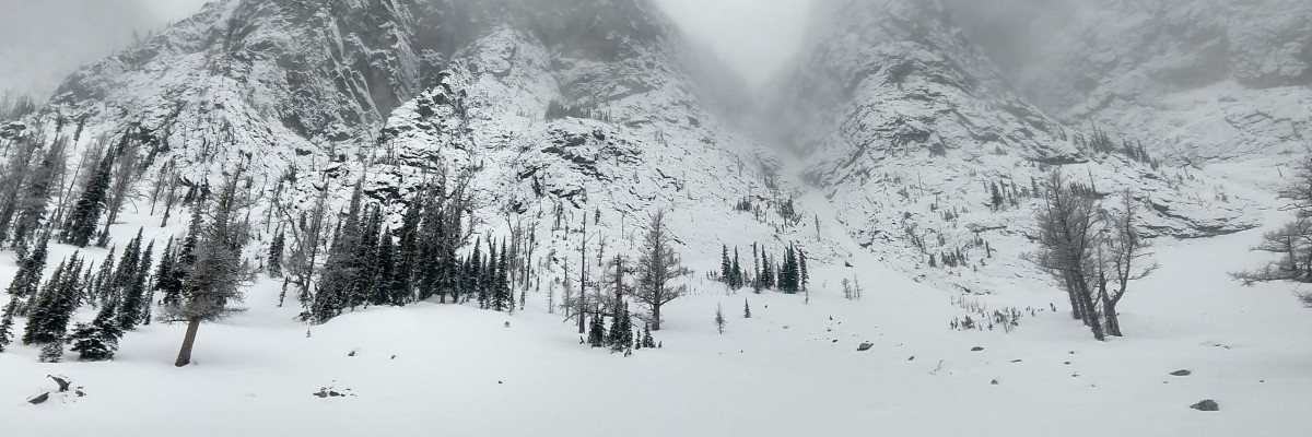
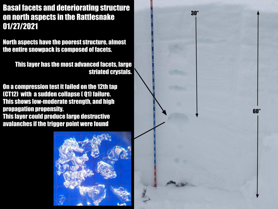
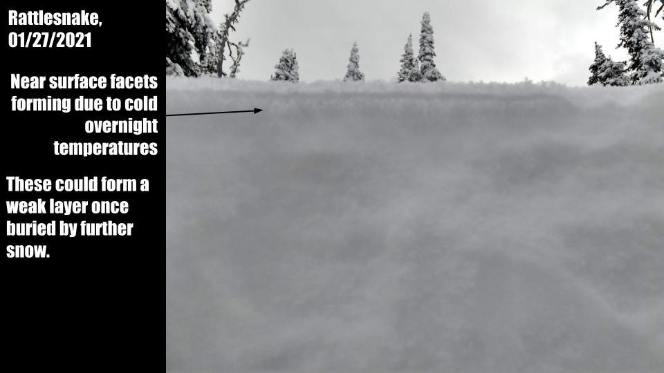
The Rattlesnake remains at moderate hazard. The snowpack structure in this range has been slowly deteriorating due to the growth of facets and depth hoar. North and east aspects have the most concerning structure, but all aspects have issues. Collapsing and cracking yesterday on two different aspects and elevations are indicative of weak trigger points that could initiate propagation and result in avalanches if the slope is steep enough. While it is not likely to trigger these layers, it is possible. Given the depth and stiffness of the slab, the resulting avalanche could be very destructive.
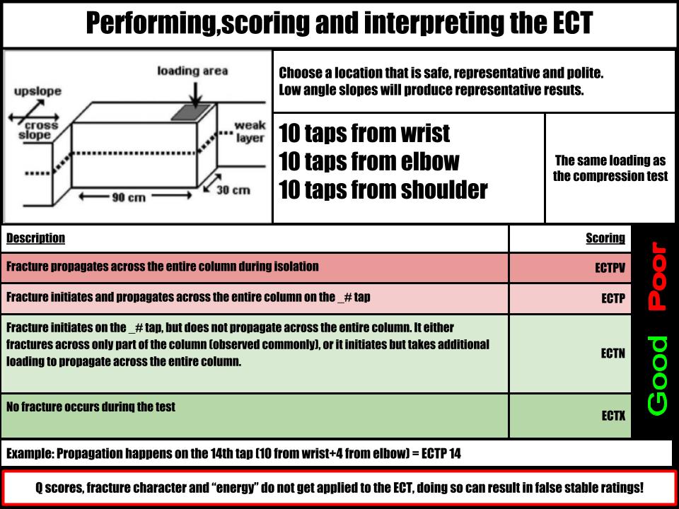
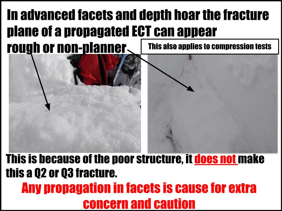
Layers such as this can be tricky to assess. As persistent weak layers get buried deeper, they become unpredictable. They may not give warning signs such as cracking or whumphing, can avalanche despite being skied repeatedly, and as they get deeper can produce false stable results on extended column tests. The propagation saw test is a good second test for deep faceted layers if you are not seeing propagation in the ECT. The best approach is to avoid slopes over 30º.
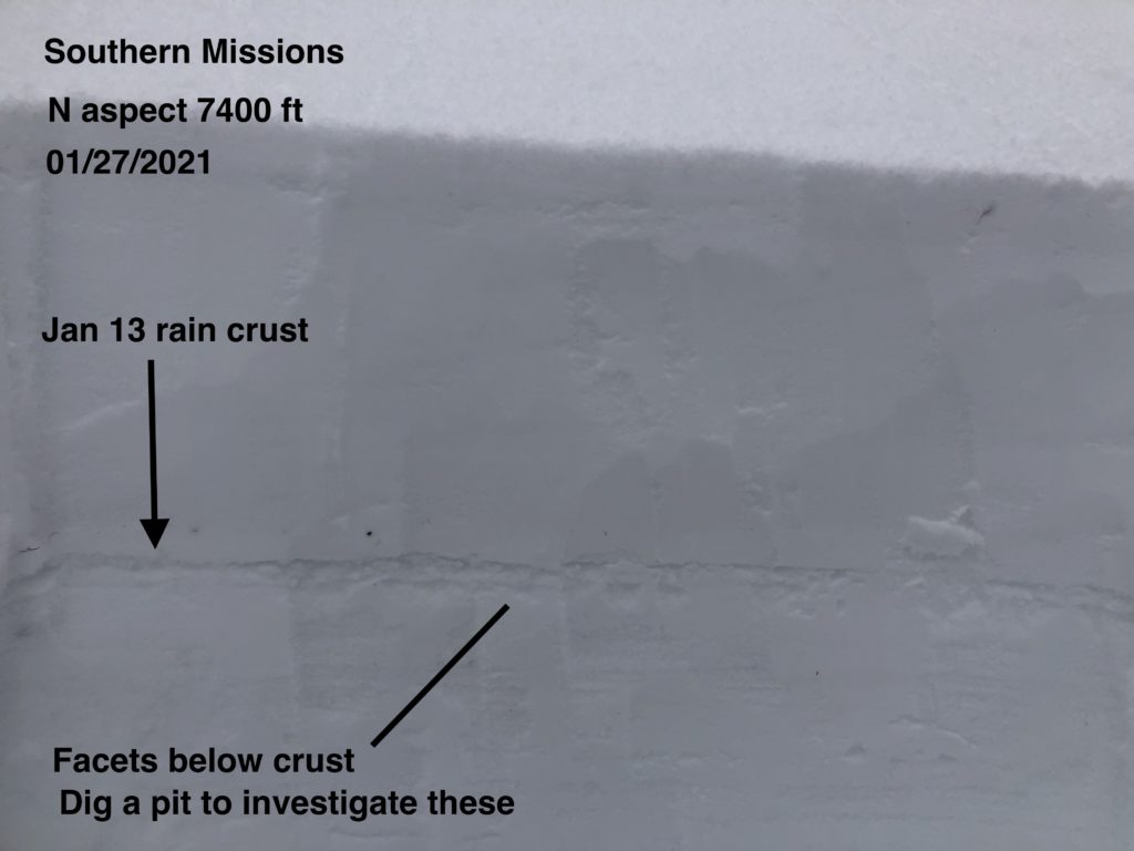
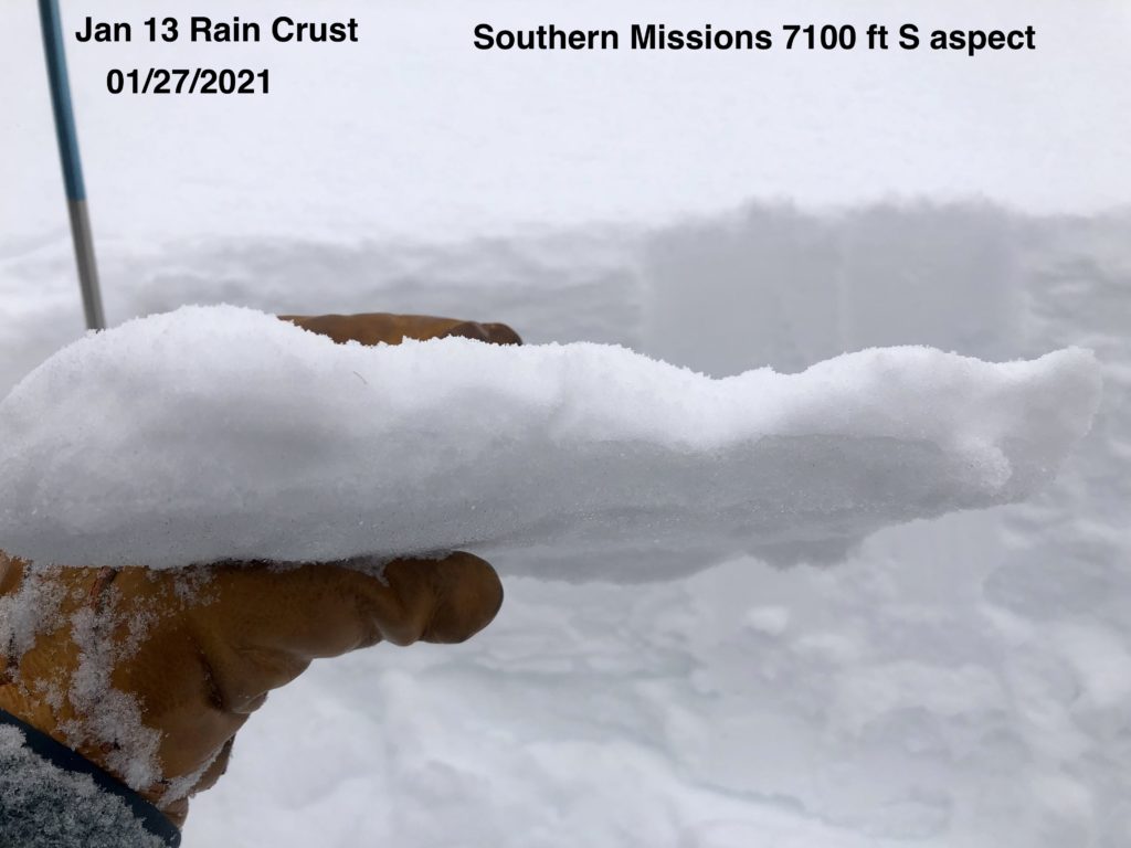
Elsewhere in the forecast area, there has been minimal change, and avalanche hazard is low. The bit of new snow was nice for a light refresh but was not enough to cause avalanche concerns. In certain areas, it may have been transported to leeward aspects, but wind slab will remain small and isolated. Overall it is unlikely to trigger an avalanche. However, due to spatial variability, isolated instabilities are present. For instance, we found propagation in low strength near surface facets under the rain crust on a north aspect at 6800’ in Bass Creek yesterday. Diligent hazard assessment is required despite the low rating. Suspect areas are shallow snowpacks, generally under 4 feet in depth, where persistent weak layers exist. These can be found at mid elevations and on wind scoured slopes. Cornices have been growing and are a hazard, there was evidence of cornice fall in Bass Creek yesterday. Terrain traps will increase the consequences of these problems.
Bottom Line
In the southern Bitterroot, avalanches are possible due to 12” of new snow overlying surface hoar. In the Rattlesnake, it is possible to trigger an avalanche on faceted snow. Elsewhere in the forecast area generally stable conditions exist. Due to spatial variability, isolated instabilities are present. Avoid slopes with weak sugary snow. Do multiple pits investigating the layers in your pit wall. Avoid cornices and wind loaded terrain. Choose simple terrain that does not expose you to terrain traps. Avoid likely trigger points on slopes.
Travel one at a time in avalanche terrain, carry a beacon, shovel, and probe. Remember to reassess conditions throughout the day and stay alert for signs of instability. Dig a pit. Look for red flags.
Upcoming Education Events
- February 6th | Motorized Avalanche Rescue Course | Delivered by the Mountain Riding Lab | Get more details and register HERE
- February 7th | Motorized Avalanche Rescue Course | Delivered by the Mountain Riding Lab | Get more details and register HERE
Public Observations
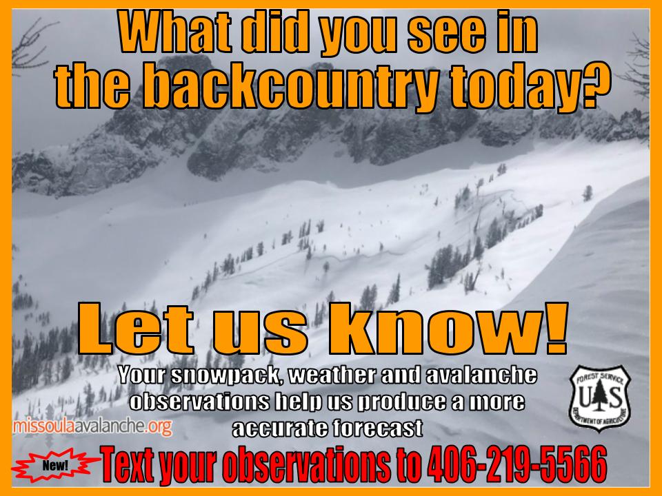
Thank you to everyone who has taken the time to send in a public observation. Please keep sharing what you find and see while out in the backcountry. This online forum is a great resource to glean information about current conditions.
You can now text us your observations to (406) 219-5566 when you don’t have time to fill out the observations page. Texted observations won’t get posted on the website, but will be used in the development of the forecast.
Ski and ride safe.


