Posted:
Mar 31, 2020 @ 6:35 am

With new snow overnight and more on the way, human triggered avalanches are likely and the avalanche danger is rated CONSIDERABLE today in West Central Montana.

Good morning, this is Andrew Schauer with the final West Central Montana avalanche advisory for the season on Tuesday, March 31, 2020. Today’s advisory is sponsored by all of you who made donations and participated in our fundraising events this season. Thank you all, this operation would not be possible without your support. This advisory does not apply to operating ski areas, expires at midnight tonight, and is the sole responsibility of the U.S. Forest Service.

Weather and Snowpack

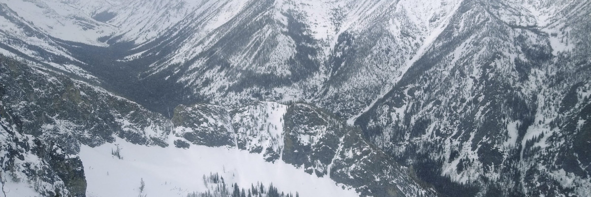
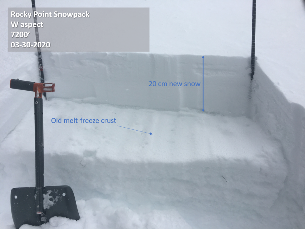
Winter is still hanging on in West Central Montana. As of 5 am, we have received 8” of new snow in the Bitterroot equaling .6” snow water equivalent (SWE). Storm totals are lower in the Rattlesnake and Seeley Lake areas, with 4” of new snow equaling .4” SWE. Winds are 12-20 mph out of the west, with gusts to 38 mph. Mountain temperatures are in the mid- to upper 20’s F this morning, and will rise to the mid- 30’s during the day. Snow continues today, with another 5-8” expected in Bitterroot and 4-6″ in the Rattlesnake and near Seeley Lake by tomorrow morning.  Winds will blow 15-20 mph out of the southwest with gusts in the high 40’s. Light snowfall will continue through tomorrow.

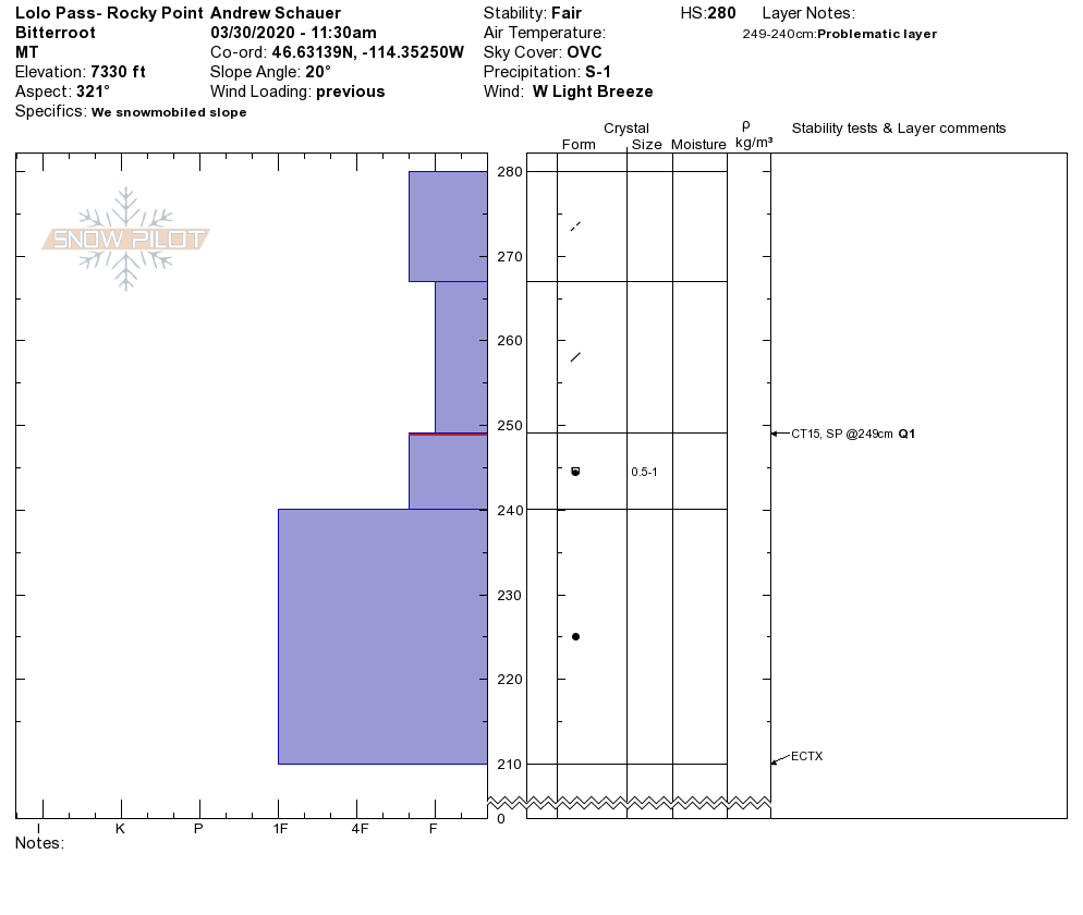
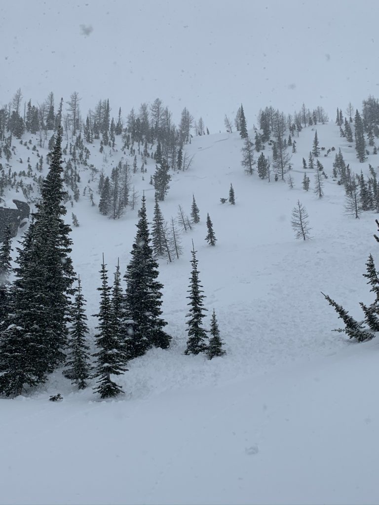
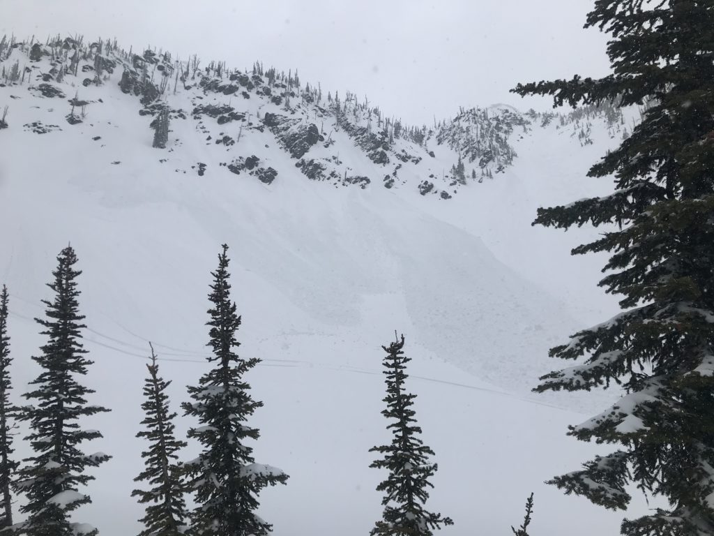
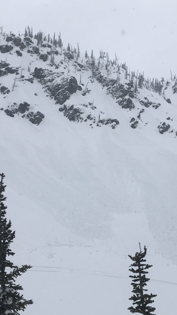
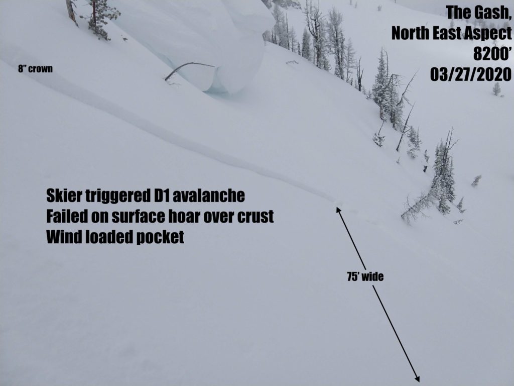
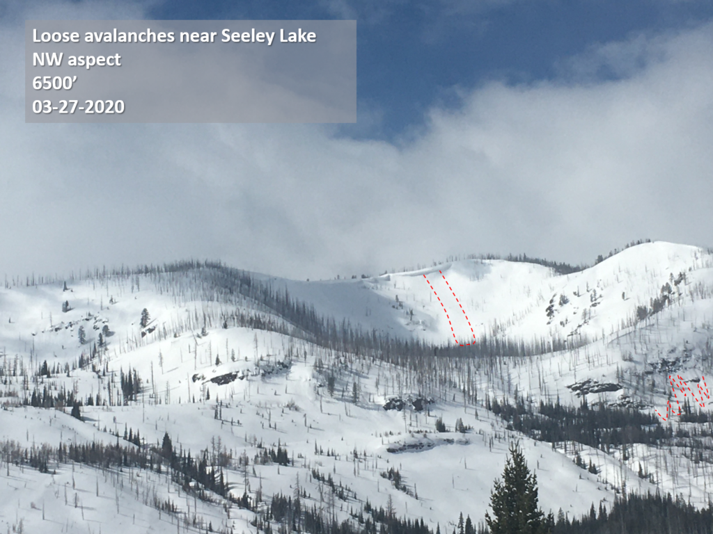
With nearly a foot of new snow in the past 24 hours, and more on the way, it will be easy for a person to trigger storm slab avalanches up to 12” deep throughout the advisory area today. These will propagate the widest on northerly aspects that developed weak snow at the surface over the past two weeks. We have received reports of avalanches failing at this interface over the past few days at Gash Point (photo, details) as well as the Rattlesnake (details).

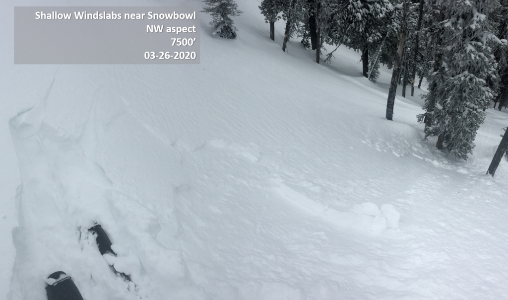
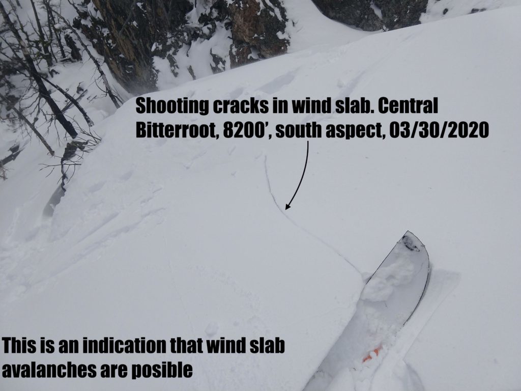
Moderate winds are drifting snow into sensitive wind slabs up to 2 feet deep. A fresh wind slab will be more dense than unaffected storm snow, and will usually fail in a stability test. Be on the lookout for clear indicators of these avalanches like shooting cracks and recent avalanche activity. If you are noticing these clear signs of instability, choose low-angle terrain.

Dry loose avalanches will be likely in steep terrain on all aspects today. While it is unlikely that these avalanches will be big enough to bury somebody, they can have serious consequences in dangerous terrain. Avoid exposure to terrain traps like cliffs and gullies today, and be aware that these avalanches will run far and fast on slopes that had developed crusts prior to the storm.

The Bottom Line

Today is not the day to push it into steep terrain. While all of this new snow will dramatically improve riding conditions across the advisory area, it will also make it very easy to trigger an avalanche big enough to bury you. Be thorough in your snowpack assessment, and pay attention to clear signs of instability like recent avalanches and shooting cracks. Be conservative with your terrain choices today, and give the snowpack a few days to adjust to the new snow once the storm passes.

We will continue posting observations periodically throughout the spring.  If you get out, please take a minute to fill out the observation form on our website (missoulaavalanche.org), or shoot us a quick email at [email protected].

Please take a moment to read this message from Missoula Avalanche, Greater than the Sum of Our Parts.

READ FULL ADVISORY  

Problem 1 - Storm Slab

  • TYPE

    storm-slabs

    Storm Slabs

    Release of a soft cohesive layer (a slab) of new snow which breaks within the storm snow or on the old snow surface. Storm-slab problems typically last between a few hours and few days. Storm-slabs that form over a persistent weak layer (surface hoar, depth hoar, or near-surface facets) may be termed Persistent Slabs or may develop into Persistent Slabs.

  • SIZE

    3-4

    1-2 (Small-Large)

    The potential size of avalanche resulting from this problem.

  • LIKELIHOOD

    Likelihood-5

    Likely

    The likelihood of an avalanche resulting from this problem.

  • ADDED DANGER

    Increased Slope Danger

    Increased/Added Danger

    There is an increased risk of avalanches on these slopes:

    N - North
    NE - Northeast
    E - East
    SE - Southeast
    S - South
    SW - Southwest
    W - West
    NW - Northwest

New snow is falling on a variety of old surfaces. These storm slabs will fail on any aspect, but they are going to propagate the widest on sheltered north-facing slopes that developed persistent weak layers during the most recent dry spell. Dig multiple test pits to see how the new snow is bonding to the old surface, perform stability tests to look for propagation, and be on the lookout for shooting cracks and recent avalanche activity.

Problem 2 - Wind Slab

  • TYPE

    wind-slabs

    Wind Slabs

    Release of a cohesive layer of snow (a slab) formed by the wind.  Wind typically erodes snow from the upwind sides of terrain features and deposits snow on the downwind side.  Wind slabs are often smooth and rounded and sometimes sound hollow, and can range from soft to hard. Wind slabs that form over a persistent weak layer (surface hoar, depth hoar, or near-surface facets) may be termed Persistent Slabs or may develop into Persistent Slabs.

  • SIZE

    3-4

    1-2 (Small-Large)

    The potential size of avalanche resulting from this problem.

  • LIKELIHOOD

    Likelihood-5

    Likely

    The likelihood of an avalanche resulting from this problem.

  • ADDED DANGER

    Increased Slope Danger

    Increased/Added Danger

    There is an increased risk of avalanches on these slopes:

    N - North
    NE - Northeast
    E - East
    SE - Southeast
    S - South

It will be easy to trigger an avalanche on wind-loaded slopes today. Avoid traveling below cornices, and be extra cautious on steep terrain near ridgelines. Wind slabs may be easily identified in test pits, and will present warning signs like shooting cracks.

Problem 3 - Loose Dry

  • TYPE

    loose-dry

    Loose Dry

    Release of wet unconsolidated snow or slush. These avalanches typically occur within layers of wet snow near the surface of the snowpack, but they may quickly gouge into lower snowpack layers. Like Loose-Dry Avalanches,they start at a point and entrain snow as they move downhill, forming a fan-shaped avalanche. They generally move slowly, but can contain enough mass to cause significant damage to trees, cars or buildings. Other names for loose-wet avalanches include point-release avalanches or sluffs. Loose-wet avalanches can trigger slab avalanches that break into deeper snow layers.

  • SIZE

    2-3

    1 (Small)

    The potential size of avalanche resulting from this problem.

  • LIKELIHOOD

    Likelihood-5

    Likely

    The likelihood of an avalanche resulting from this problem.

  • ADDED DANGER

    Increased Slope Danger

    Increased/Added Danger

    There is an increased risk of avalanches on these slopes:

    N - North
    NE - Northeast
    E - East
    SE - Southeast
    S - South
    SW - Southwest
    W - West
    NW - Northwest

Loose dry avalanches will be likely in steep terrain today. For the most part, these will not be large enough to bury a person, but they will be big enough to knock you off your feet and take you for a ride. Avoid traveling above terrain traps like cliffs and gullies. Be aware that these avalanches will slide far and fast on slopes that had developed crusts prior to the storm.

VIDEO

FORECAST & OUTLOOK

  • Danger Trend

    increasing

    Increasing Danger

  • Area Forecast

    Snow today

A slow-moving upper-level trough will bring more snow today. We will receive 4-8″ of snow in the mountains throughout the day, and snow will continue through tomorrow. Mountain temps will reach the mid- 30’s F, and winds will be 15-20 out of the southwest with gusts to 47 mph. You can find more detailed weather information here.

This information is the sole responsibility of the Forest Service and does not apply to operating ski areas. The avalanche danger rating expires at midnight tonight but the information can help you make a more informed decision regarding travel in avalanche terrain for the next few days.

Our advisory area includes National Forest System lands in the Bitterroot Mountains from Lost Trail Pass north to Granite Pass, the Rattlesnake Mountains north of Missoula and the Southern Swan and Mission Mountains near Seeley Lake, MT. Avalanche information for the Lookout Pass/St. Regis Basin area is available from the Idaho Panhandle Avalanche Center.