Posted:
Jan 5, 2021 @ 6:24 am

The avalanche danger is Considerable today in the west central Montana Backcountry. Winds and new snow are creating dangerous avalanche conditions.

Good Morning. This is Travis Craft with the West Central Montana Avalanche Center advisory on Tuesday, January 5th, 2021.This advisory is sponsored by the Trail Head. This advisory does not apply to operating ski areas, expires at midnight tonight, and is the sole responsibility of the U.S. Forest Service.

Weather and Snowpack

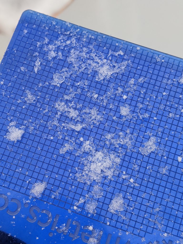
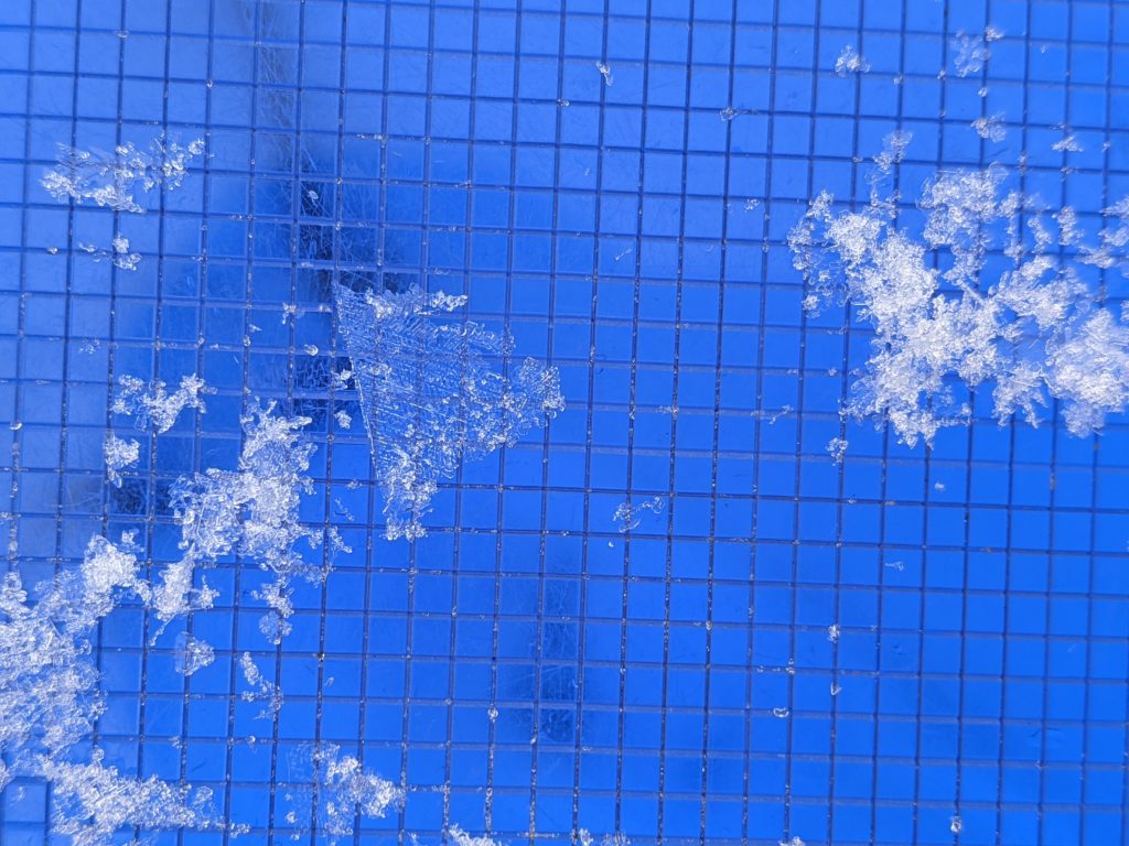
Mountain temperatures range from 22 degrees to 30 degrees F this morning. The advisory area has received 3 to 8 new inches of snow. Winds are ranging from 20 to 30 mph, prime wind speeds for snow transport to leeward slopes.

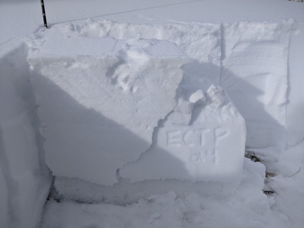
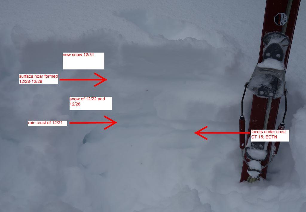
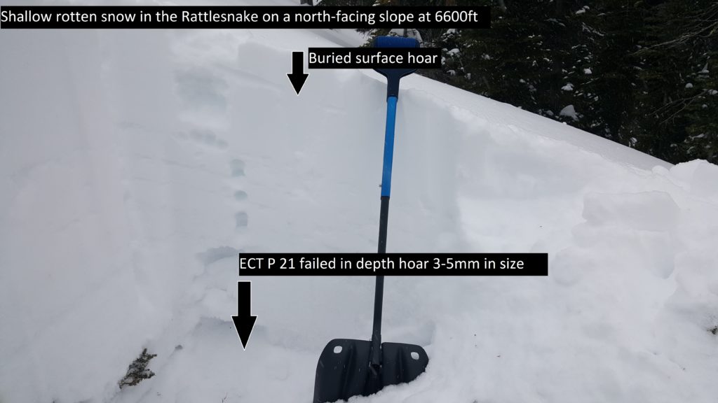
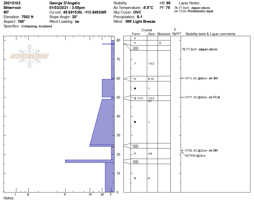
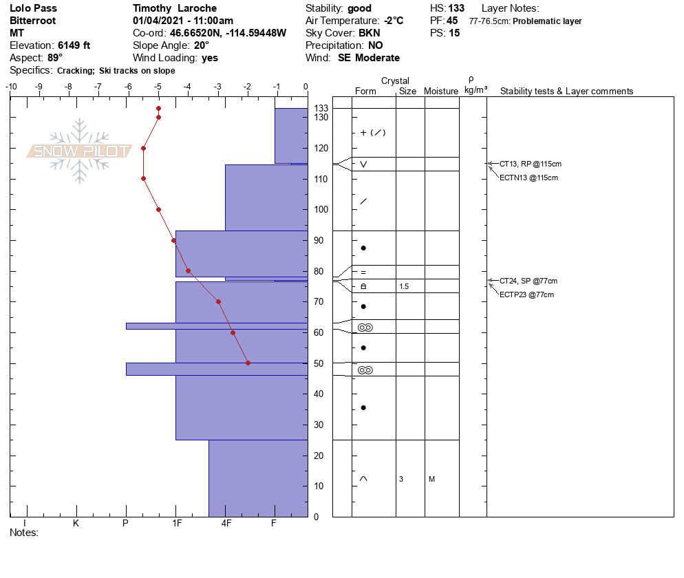
We have a snowpack that can produce avalanches. Pit tests from the Rattlesnake, Lost Trail Pass, and Lolo Pass show that we have weak layers in the top third of the snowpack and near the bottom of our snowpack throughout the advisory area. New snow and winds are putting stress on these layers.

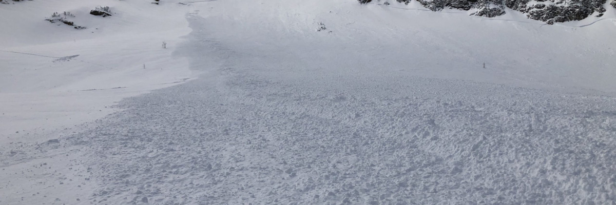
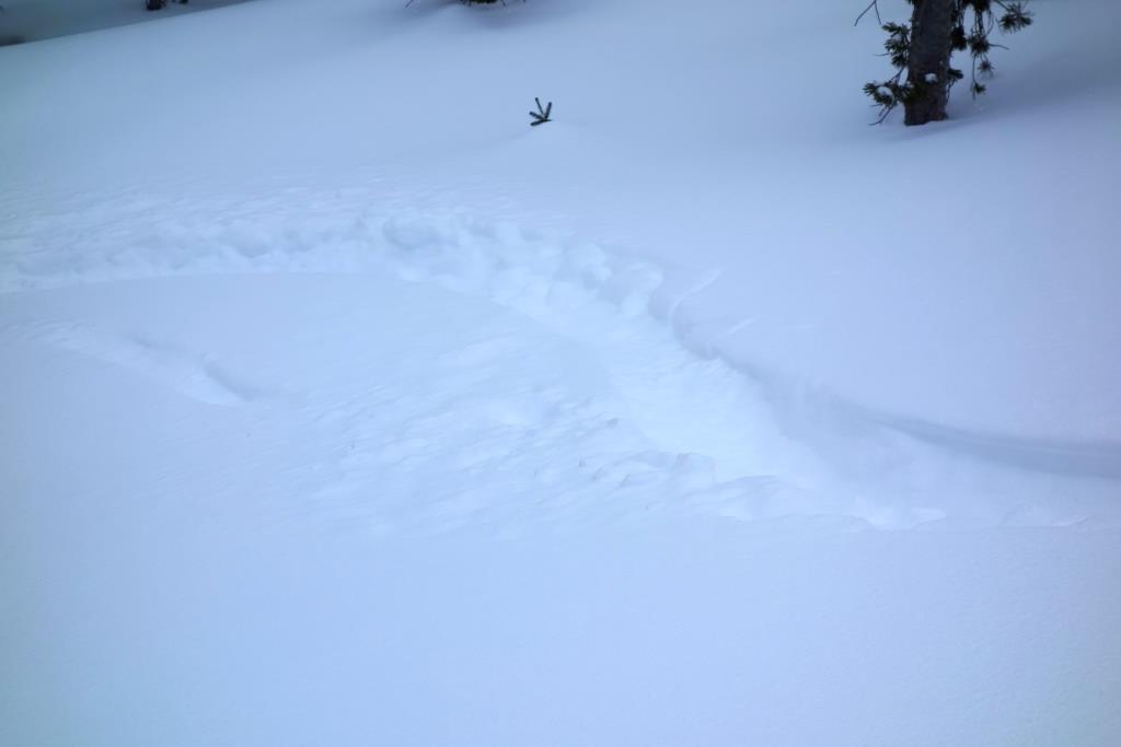
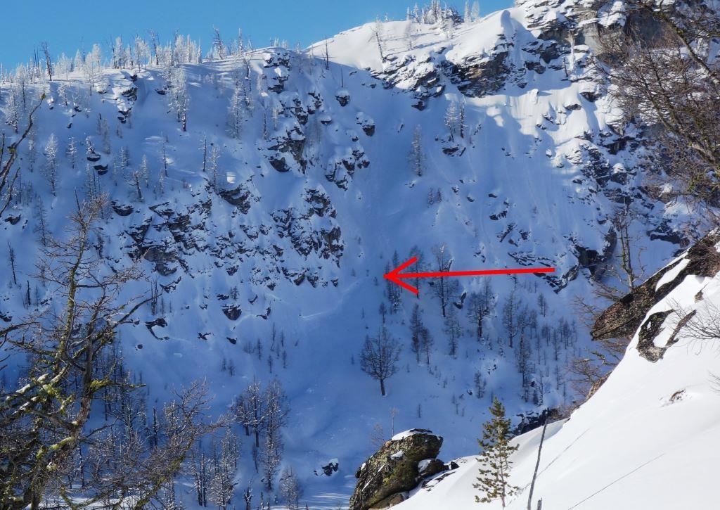
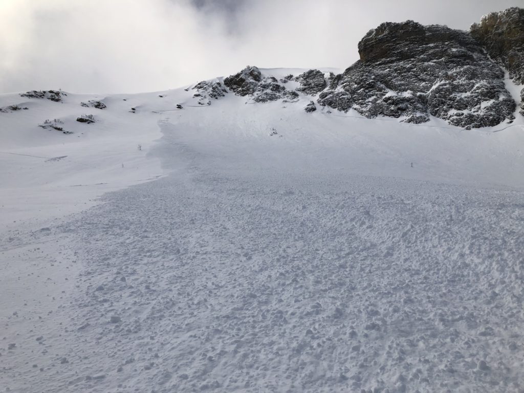
On January 3, 2021, at approximately 3:33 PM MST, a skier triggered an avalanche on the SE face of Big Jo in the Bitterroot Range. The skier was caught and carried 250 ft. This avalanche is clear evidence that new snow and winds are putting stress on the snowpack, and it is possible to trigger avalanches. This public observation is a great learning experience for everyone. It shows what our current snowpack can produce. We are thankful for this observation and the outcome.

Bottom Line

Look for sheltered, simple low angle terrain today. New snow and winds are stressing our weak layers. Keep it simple today. Avoid wind loaded terrain. Travel one at a time in avalanche terrain, carry a beacon, shovel, and probe. Remember to reassess conditions throughout the day and stay alert for signs of instability. Dig a pit. Look for red flags.

Upcoming Education Events:

Please visit our education page for an up to date list of regional educational events and course offerings. Below are a few select events and opportunities to check out this week.

  • Wednesday, January 6th, 6–7:30 pm MST, FREE Online 1.5-hr Avalanche Awareness Session | Missoulaavalanche.org + SheJumps event | Delivered by A3 Pro female instructors | Register Here

Public Observations

Thank you to everyone who has taken the time to send in a public observation. Please keep sharing what you find and see while out in the backcountry. This forum is a great resource to glean information about current conditions. Here is the link to Public Observations.

Ski and ride safe.

READ FULL ADVISORY  

Problem 1 - Wind Drifted Snow

  • TYPE

    wind-slabs

    Wind Slabs

    Release of a cohesive layer of snow (a slab) formed by the wind.  Wind typically erodes snow from the upwind sides of terrain features and deposits snow on the downwind side.  Wind slabs are often smooth and rounded and sometimes sound hollow, and can range from soft to hard. Wind slabs that form over a persistent weak layer (surface hoar, depth hoar, or near-surface facets) may be termed Persistent Slabs or may develop into Persistent Slabs.

  • SIZE

    4-5

    2 (Large)

    The potential size of avalanche resulting from this problem.

  • LIKELIHOOD

    Likelihood-5

    Likely

    The likelihood of an avalanche resulting from this problem.

Look for active loading of slopes from the wind. Avoid wind loaded zones. These slabs will be very sensitive to triggers today.

Problem 2 - Persistent Slabs

  • TYPE

    persistent-slabs

    Persistent Slabs

    Release of a cohesive layer of soft to hard snow (a slab) in the middle to upper snowpack, when the bond to an underlying persistent weak layer breaks.  Persistent layers include: surface hoar, depth hoar, near-surface facets, or faceted snow. Persistent weak layers can continue to produce avalanches for days, weeks or even months, making them especially dangerous and tricky. As additional snow and wind events build a thicker slab on top of the persistent weak layer, this avalanche problem may develop into a Persistent, Deep-Slab.

  • SIZE

    5-6

    2-3 (Large)

    The potential size of avalanche resulting from this problem.

  • LIKELIHOOD

    Likelihood-4

    Possible/Likely

    The likelihood of an avalanche resulting from this problem.

Faceted layers can be found throughout the forecast area. Shallower snowpacks have worse structure than deeper areas and are more suspect. In some places, persistent slabs are up to 40 inches thick and becoming low likelihood, high consequence problems. In other areas problem layers are in the upper foot of snowpack.

The problem facets tend to be concentrated around crusts. Look for these and soft sugary snow above and below as you assess the snowpack.

The extended column test (ECT) and the propagation saw test (PST) are best for assessing the stability of these layers.

Where facets are found stick to low angle slopes and avoid traveling under steep terrain as remotely triggered avalanches are possible

Problem 3 - New Snow

  • TYPE

    storm-slabs

    Storm Slabs

    Release of a soft cohesive layer (a slab) of new snow which breaks within the storm snow or on the old snow surface. Storm-slab problems typically last between a few hours and few days. Storm-slabs that form over a persistent weak layer (surface hoar, depth hoar, or near-surface facets) may be termed Persistent Slabs or may develop into Persistent Slabs.

  • SIZE

    3-4

    1-2 (Small-Large)

    The potential size of avalanche resulting from this problem.

  • LIKELIHOOD

    Likelihood-3

    Possible

    The likelihood of an avalanche resulting from this problem.

New snow will need time to bond to old snow surfaces. Use small test slopes to see how the new snow is bonding.

Observations for Jan 05 2021 Advisory.

FORECAST & OUTLOOK

Small accumulations of snow today and winds in the 20’s. Another system moves into the area tomorrow night. See the forecast.

This information is the sole responsibility of the Forest Service and does not apply to operating ski areas. The avalanche danger rating expires at midnight tonight but the information can help you make a more informed decision regarding travel in avalanche terrain for the next few days.

Our advisory area includes National Forest System lands in the Bitterroot Mountains from Lost Trail Pass north to Granite Pass, the Rattlesnake Mountains north of Missoula and the Southern Swan and Mission Mountains near Seeley Lake, MT. Avalanche information for the Lookout Pass/St. Regis Basin area is available from the Idaho Panhandle Avalanche Center.