
The avalanche danger is moderate in the west central Montana backcountry today. Human triggered avalanches are possible today.
Good Morning. This is Travis Craft with the West Central Montana Avalanche Center advisory on Thursday, January 7th, 2021. This advisory is sponsored by the Trail Head. This advisory does not apply to operating ski areas, expires at midnight tonight, and is the sole responsibility of the U.S. Forest Service.
Weather and Snowpack
Mountain temperatures range from 22 degrees to 28 degrees F this morning. Winds are primarily calm, gusting to 12 mph out of the West. The forecast area has received 1 to 2 inches of new snow.
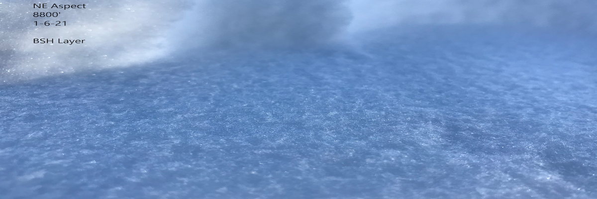
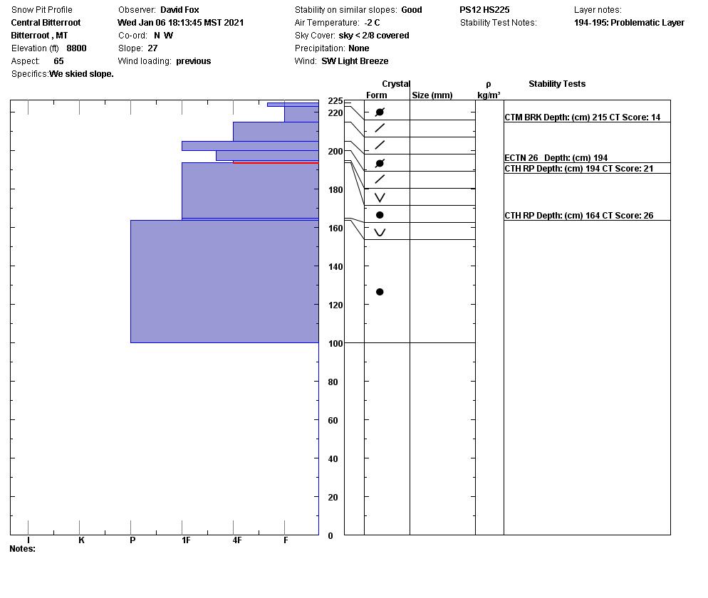
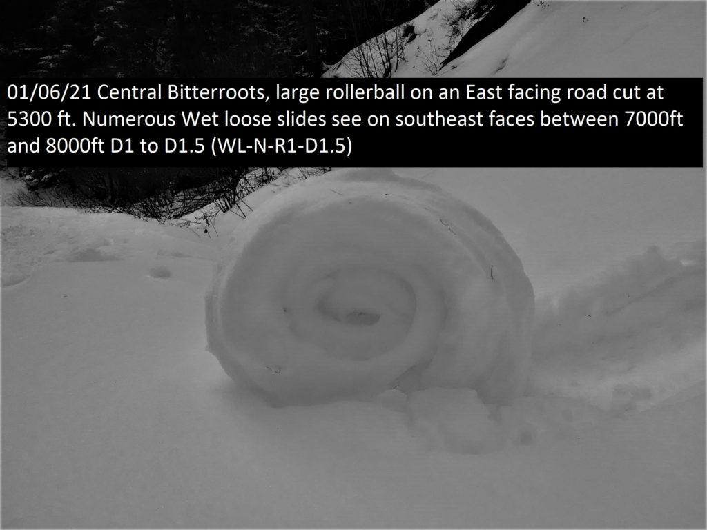
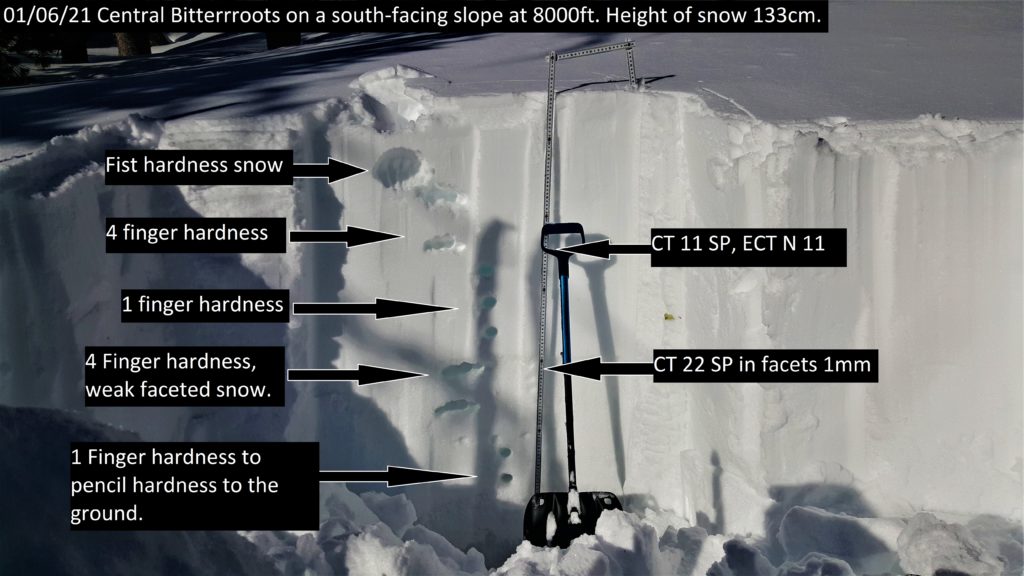
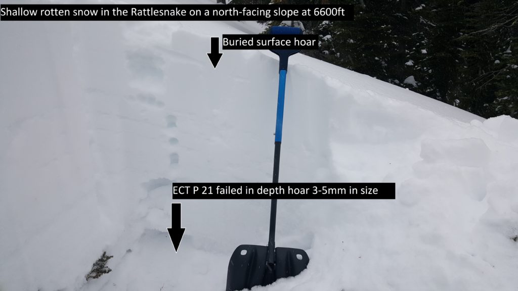
Warm temperatures yesterday produced roller balls and loose wet slides on sun-exposed slopes to 8000 ft. Pit tests showed that the snowpack is slowly healing and less reactive.
There are layers of concern in the top third of the snowpack and in the bottom third. Persistent weak layers are problems that stay with us for a long time. The structure of our snowpack should not be trusted. An unstable result in a pit test plays a large role in my decision-making process, and a stable result plays a small role.
Bottom Line
Choose simple terrain that does not expose you to terrain traps. Avoid likely trigger points on slopes. Dig a pit and look for stripes in the snow to identify weak layers. Perform a pit test to see how reactive these layers are. Choose a shallow spot to see if you have weak sugary snow at the bottom of the snowpack if you do choose another slope.Travel one at a time in avalanche terrain, carry a beacon, shovel, and probe. Remember to reassess conditions throughout the day and stay alert for signs of instability. Dig a pit. Look for red flags.
Upcoming Education Events:
Please visit our education page for an up to date list of regional educational events and course offerings. Below are a few select events and opportunities to check out.
- January 26th-31st | Women’s Avalanche Level 1 Course | Missoulaavalanche.org + SheJumps event | Delivered by A3 Pro female instructors | Get more details and register HERE
- January 26th-31st | Motorized AIARE 1 Course | Delivered by the Mountain Riding Lab | Get more details and register HERE
- February 6th | Motorized Avalanche Rescue Course | Delivered by the Mountain Riding Lab | Get more details and register HERE
- February 7th | Motorized Avalanche Rescue Course | Delivered by the Mountain Riding Lab | Get more details and register HERE
Public Observations
Thank you to everyone who has taken the time to send in a public observation. Please keep sharing what you find and see while out in the backcountry. This forum is a great resource to glean information about current conditions. Here is the link to Public Observations.
Ski and ride safe.


