
The avalanche danger is MODERATE in the west central Montana backcountry today. Human triggered avalanches are possible today.
Good Morning. This is Travis Craft with the West Central Montana Avalanche Center advisory on Thursday, January 09, 2021. This advisory is sponsored by the Trail Head. This advisory does not apply to operating ski areas, expires at midnight tonight, and is the sole responsibility of the U.S. Forest Service.
Weather and Snowpack
Mountain temperatures range from 19 degrees to 26 degrees F this morning. Winds are primarily calm. The advisory area has received no new snow.
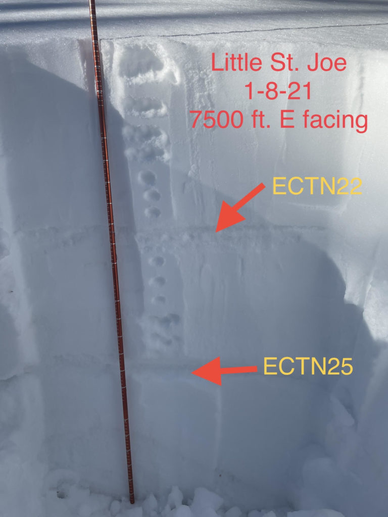
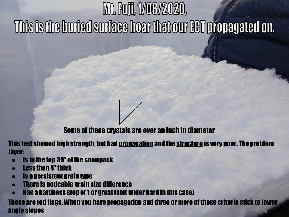
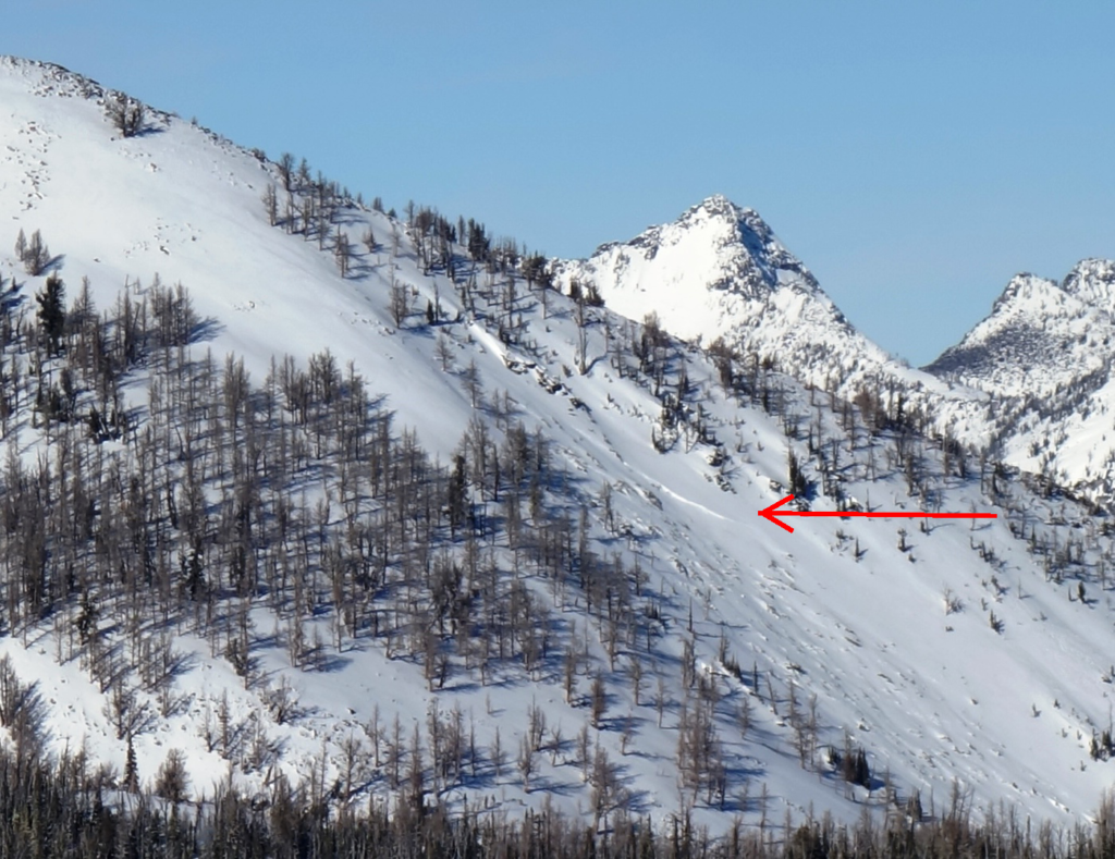
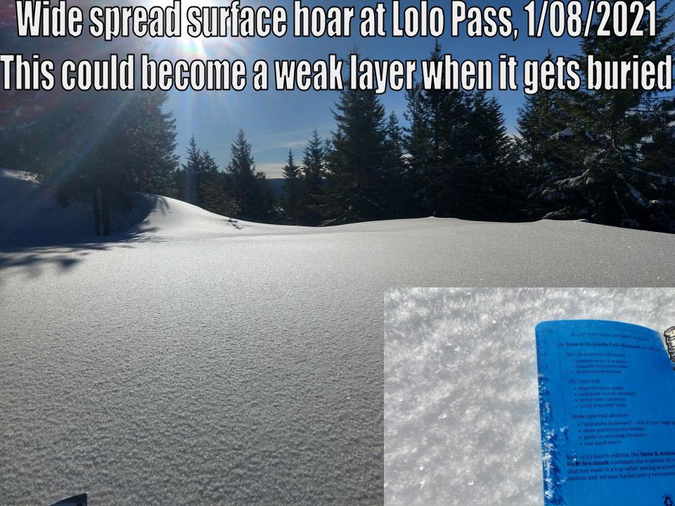
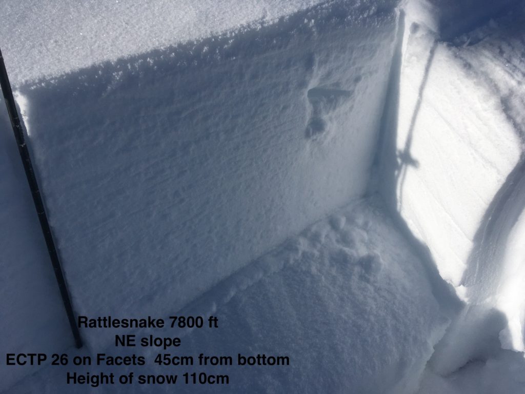
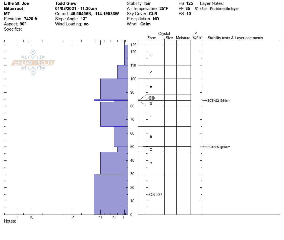
There is wide variability in the advisory area snowpack today. Snowpack in the central Bitterroot above 8000 ft, is 5 to 6 feet deep. At elevations below 8000 ft, you can find snowpack depths of two feet. On south slopes, faceting is occurring and creating depth hoar. This is noticeable when you get off your skis or machine and punch through the snow to the ground. You can find a layer of buried surface hoar in the top third of the snowpack. Pit tests indicate that this layer can be reactive. There are facets in shallow snowpacks that are less than 4 feet deep. These layers are found near the ground and are propagating in pit tests. Today’s primary concern is variability in the depth and distribution of persistent weak layers.
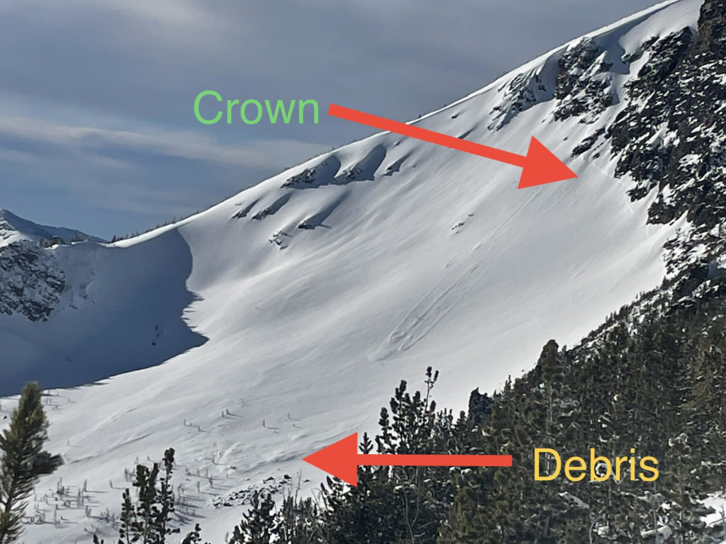
The snowpack requires careful analysis today. Persistent weak layers are very unpredictable. You can be the first person on a slope and trigger the avalanche, or you may be the 10th person on a slope and hit the trigger point. Here is a video. I like to think of avalanche problems as dragons in the snowpack. The likelihood of triggering an avalanche translates to how likely I am to awakening the dragon in its snow cave. For example, 5 new inches of snow have fallen, and there are no persistent weak layers in the snowpack. The dragons of concern would be loose snow sluffs. Recreating in the snow will wake these dragons. However, they are small baby dragons, and I can manage them through proper terrain choices. Today, our snowpack has multiple dragons (video). We have a layer of buried surface hoar in the upper third of the snowpack. If I wake this dragon up, it could bury and kill me. The other dragon is the facets near the ground in shallow snowpacks. It is harder to wake this dragon, but this dragon is big, and if I wake it up, it will bury and kill me.
Bottom Line
To avoid waking up dragons, stick to simple low angle slopes. Slopes less than 30 degrees are less likely to produce avalanches. Choose simple terrain that does not expose you to terrain traps. Avoid likely trigger points on slopes. Dig a pit and look for stripes in the snowpack to identify weak layers of concern. Perform a pit test to see how reactive these layers are. Choose a shallow spot to see if you have weak sugary snow at the bottom of the snowpack. If you do, choose another slope.
Today, I do not trust the structure of the snowpack. An unstable result in a pit test plays a large role in my decision-making process, and a stable result plays a small part. Travel one at a time in avalanche terrain, carry a beacon, shovel, and probe. Remember to reassess conditions throughout the day and stay alert for signs of instability. Dig a pit. Look for red flags.
Upcoming Education Events:
Please visit our education page for an up to date list of regional educational events and course offerings. Below are a few select events and opportunities to check out.
- January 26th-31st | Women’s Avalanche Level 1 Course | Missoulaavalanche.org + SheJumps event | Delivered by A3 Pro female instructors | Get more details and register HERE
- January 26th-31st | Motorized AIARE 1 Course | Delivered by the Mountain Riding Lab | Get more details and register HERE
- February 6th | Motorized Avalanche Rescue Course | Delivered by the Mountain Riding Lab | Get more details and register HERE
- February 7th | Motorized Avalanche Rescue Course | Delivered by the Mountain Riding Lab | Get more details and register HERE
Public Observations
Thank you to everyone who has taken the time to send in a public observation. Please keep sharing what you find and see while out in the backcountry. This online forum is a great resource to glean information about current conditions.
Remember, you can submit your observations through the observation page anonymously. When submitted anonymously, the forecasters review the observation and utilize it when generating the forecast. The information does not appear on the public observation page.
Ski and ride safe.


