
Moderate avalanche danger will rise to conciderable in the west central Montana backcountry today with the arrival of the storm.
Good Morning. This is Jeff Carty with the West Central Montana Avalanche Center advisory on Tuesday, January 12th, 2021. This advisory is sponsored by LB Snow. This advisory does not apply to operating ski areas, expires at midnight tonight, and is the sole responsibility of the U.S. Forest Service.
Weather and Snowpack
Mountain temperatures range from 24 º to 35º F this morning. Winds are moderate. The advisory area has received no new snow.
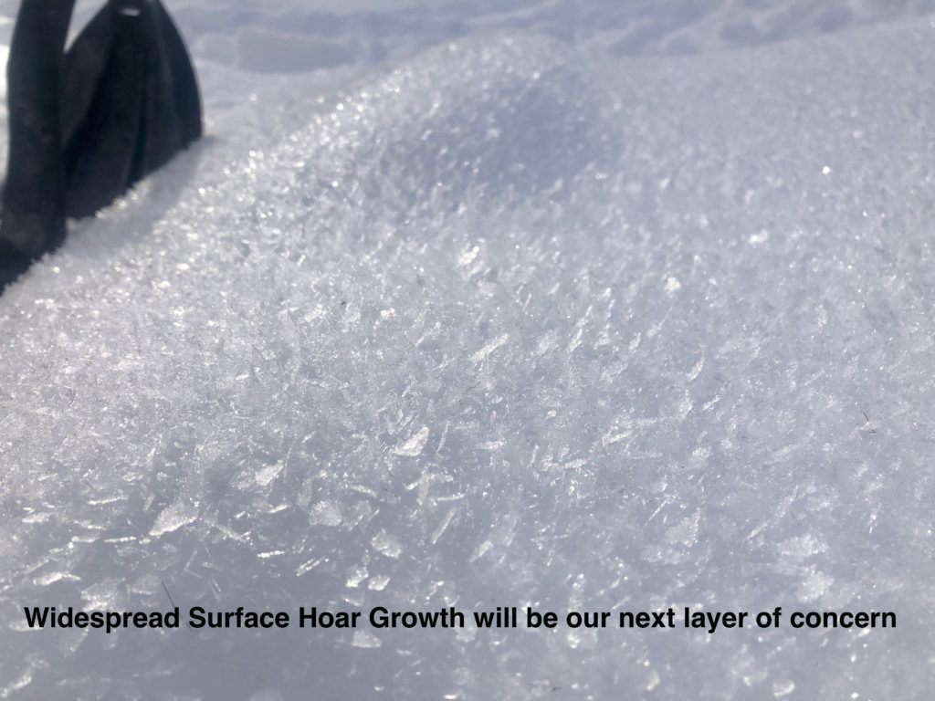
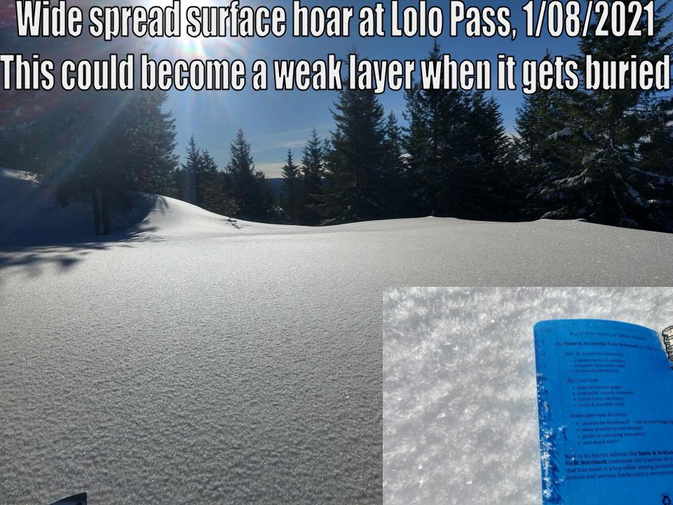
We are on track for an atmospheric river to pass over us today and tomorrow. Up to 9″ of snow, the potential for rain above 5000’ and winds to 43mph are forecast today. Up to 3” of SWE are expected by tomorrow night. Avalanche hazard will increase with the storm. Of particular concern is the effect of warm temps, heavy snow, and rain on mid-elevations where the snowpack has the worst structure. Wind slab will be growing throughout the day as well. Widespread surface hoar will likely create problems once the storm deposits enough snow to create a slab.
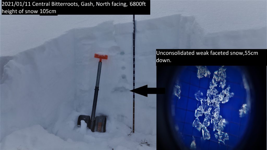
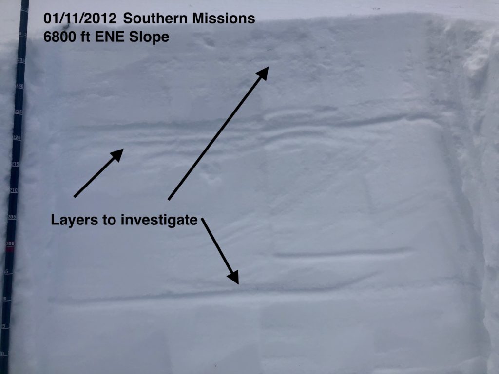
Variable is the best way to describe the snowpack throughout the forecast area. Minutely variable. Wide-ranging conditions can be found in very close proximity making stability assessments challenging. Yesterday at Gash Point the 6’ deep snowpack at 7300’ on the north aspect was well consolidated with no concerning layers. 500’ lower at 6800’ on the same aspect the snowpack was 3’ deep, comprised entirely of facets. It has truly terrible structure that cannot be trusted. Shallow mid-elevation and wind-scoured areas have similar faceting throughout the forecast area.
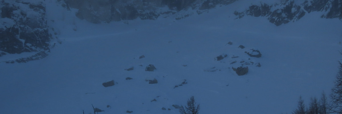
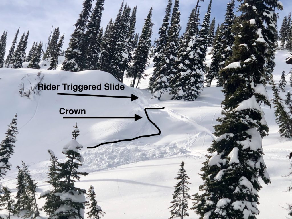
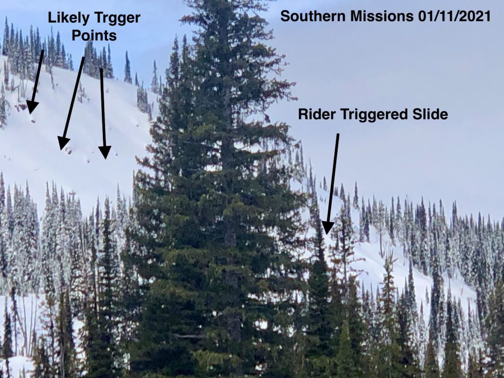
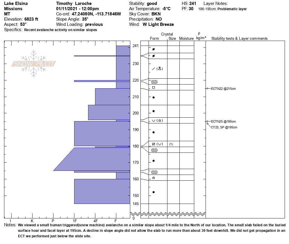
In the southern Missions yesterday, a small human triggered avalanche ran on buried surface hoar, but extended column tests (ECT) adjacent to the slide were not propagating. A similar buried surface hoar problem exists throughout the forecast area.
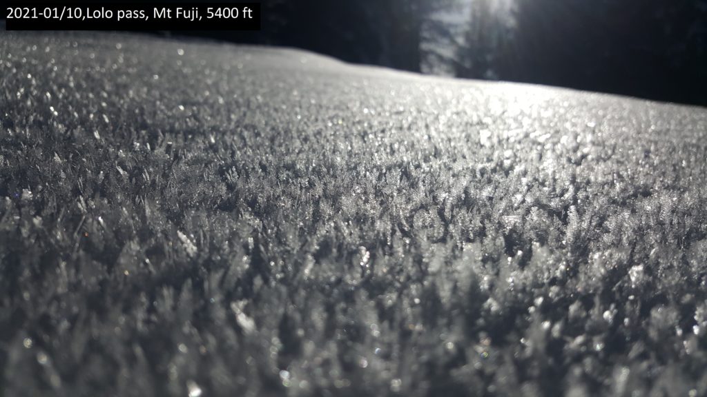
The north aspect of Mt. Fuji over the weekend was showing increased strength and consolidation, while the south face has developed depth hoar and failing in tests.
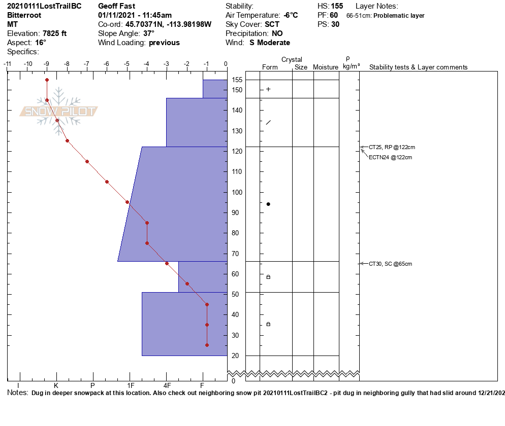
In the southern Bitterroot yesterday, small wind slabs were touchy, and faceted layers remain a concern.
What this means is you need to be really heads up. Deeper faceted layers will not give warning signs if they fail. Slight changes of aspect and elevation can result in drastically different snowpack and stability. One pit and stability test will not suffice to give you a good handle on problem layers.
The best way to deal with the myriad of current problems is to investigate the snowpack often and only commit to lines if you can be certain of the distribution of problem layers. Avoid anything with soft facets or propagation. As the storm roles in today dial it back to low angle slopes.
The Rattlesnake may have the shallowest snowpack in the area and as a result the worst structure. Some spots are touchier than others but the whole zone requires caution. Staying under 30º is wise.
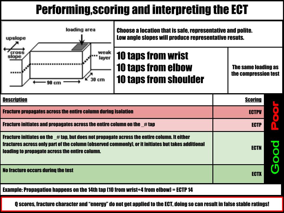
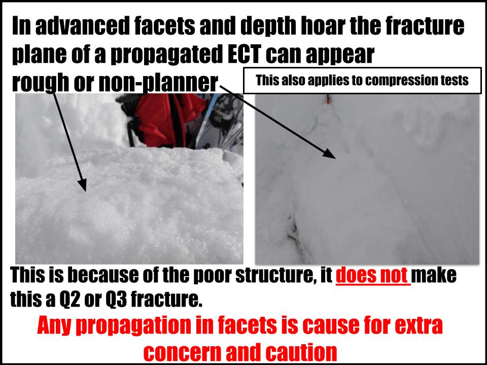
Assessing instability in facets can be challenging, and it is easy to fall into decision making traps, especially if it is a problem you are unfamiliar with. Please see this extended column test refresher for some tips.
The Bottom Line
Stability will deteriorate with snow, wind, rising temperatures, and potentially rain at mid-elevations today. Avalanches will become likely. Various facet, surface hoar, and windslab layers exist throughout the snowpack. In some places, depth hoar and advanced facets are low likelihood/ high consequence problems. Careful, and frequent snowpack assessment is required with the variable snowpack. Sticking to lower angle slopes is the best plan. Expect the avalanche hazard to rise Wednesday.
Travel one at a time in avalanche terrain, carry a beacon, shovel, and probe. Remember to reassess conditions throughout the day and stay alert for signs of instability. Dig a pit. Look for red flags.
Upcoming Education Events:
Please visit our education page for an up to date list of regional educational events and course offerings. Below are a few select events and opportunities to check out.
- Wednesday, January 13th, 6–7:30 PM MST | FREE Online 1.5-hr Avalanche Awareness Session | Missoulaavalanche.org
Virtual Webcast | Delivered by A3 Pro instructors | Get more details and register HERE
- January 26th-31st | Women’s Avalanche Level 1 Course | Missoulaavalanche.org + SheJumps event | Delivered by A3 Pro female instructors | Get more details and register HERE
- January 26th-31st | Motorized AIARE 1 Course | Delivered by the Mountain Riding Lab | Get more details and register HERE
- February 6th | Motorized Avalanche Rescue Course | Delivered by the Mountain Riding Lab | Get more details and register HERE
- February 7th | Motorized Avalanche Rescue Course | Delivered by the Mountain Riding Lab | Get more details and register HERE
Public Observations
Thank you to everyone who has taken the time to send in a public observation. Please keep sharing what you find and see while out in the backcountry. This online forum is a great resource to glean information about current conditions.
Remember, you can submit your observations through the observation page anonymously. When submitted anonymously, the forecasters review the observation and utilize it when generating the forecast. The information does not appear on the public observation page.
Ski and ride safe.


