
The avalanche danger in the west central Montana backcountry is high in wind loaded terrain above 7000′ and considerable in all other terrain.
Good Morning. This is Jeff Carty with the West Central Montana Avalanche Center advisory on Thursday, January 14th, 2021. This advisory is sponsored by LB Snow. This advisory does not apply to operating ski areas, expires at midnight tonight, and is the sole responsibility of the U.S. Forest Service.
Weather and Snowpack
Mountain temperatures range from 15º to 23º F this morning. Winds are moderate out of the west. The advisory area has received no new snow overnight except for Twin lakes in the central Bitterroot that received o.6″ of snow water equivalent (SWE).
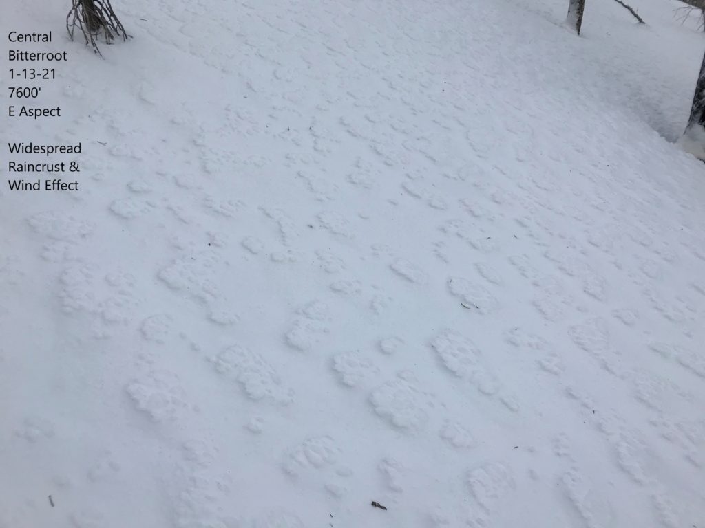
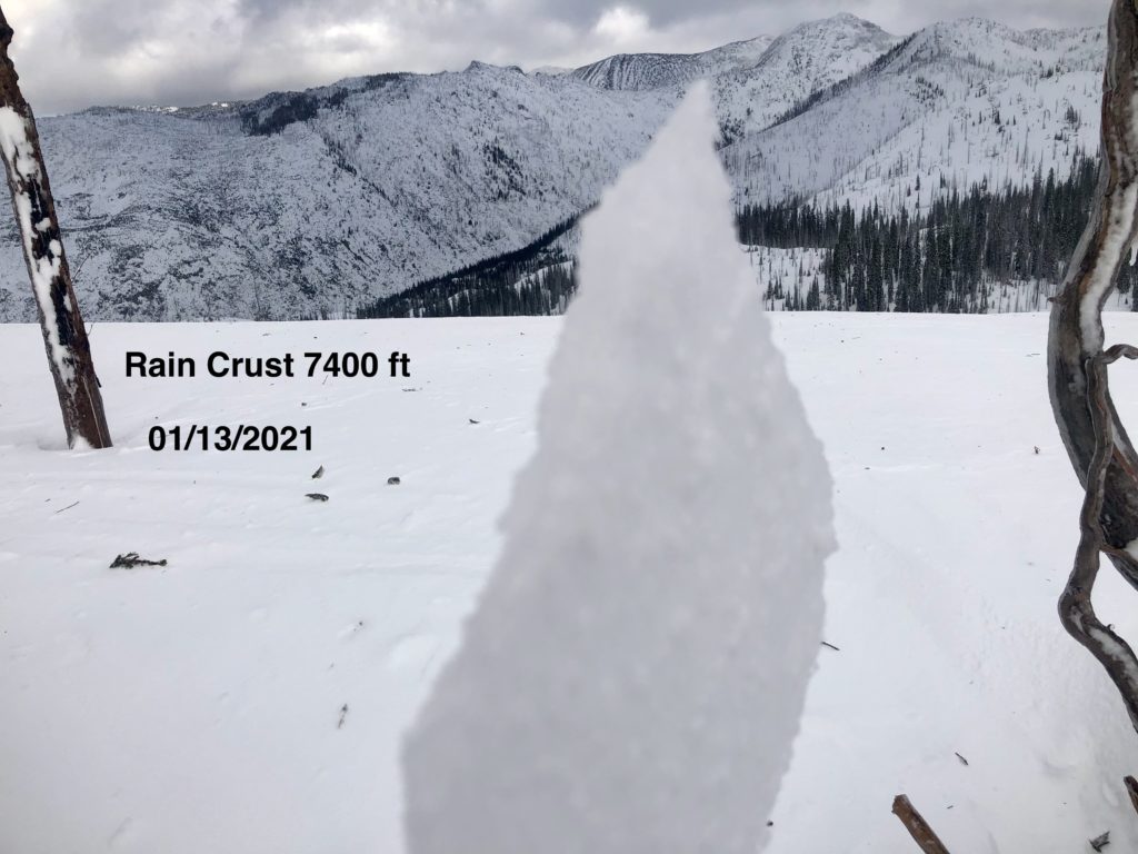
It’s been an eventful 48 hours. Stuart SNOTEL in the Rattlesnake reported a total of 2.2″ SWE, a massive load for the weakest snowpack in the forecast area. Winds reached 125mph on Mt. Sentinel, the Swans saw winds of 65mph and gusts to 101mph and, Lolo Pass had winds to 106mph. Temperatures reached 39ºF at 6400′ at Twin lakes and 34ºF at 7400′ on Stuart. Rain reached at least 7400′ in elevation. Above 7600′ in the central Bitterroot, there was up to 14″ of new snow. Skiing and riding conditions below the rain line were poor. A stout crust will be around for a while.
Conditions continue to be highly variable. We are forecasting today for the most unstable spots in the forecast area. Pockets of more stability may exist, however, the extent of the wind, loading, and number of natural avalanches observed yesterday warrant a cautious rating. It will take a couple of days to see what the extent of the natural avalanche cycle was and how the snowpack throughout the forecast area is responding to the new load. During that time it is wise to recreate on lower angle slopes.
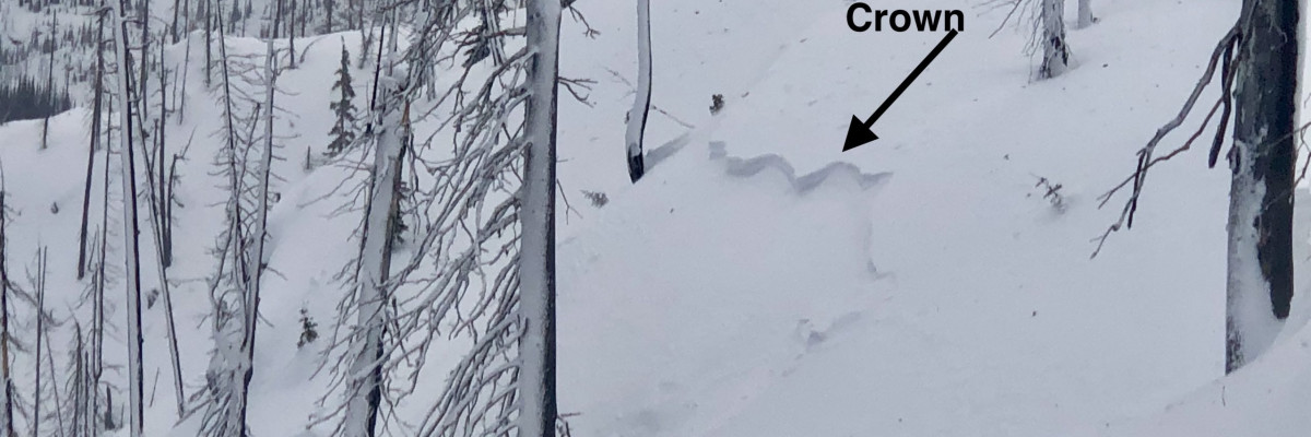
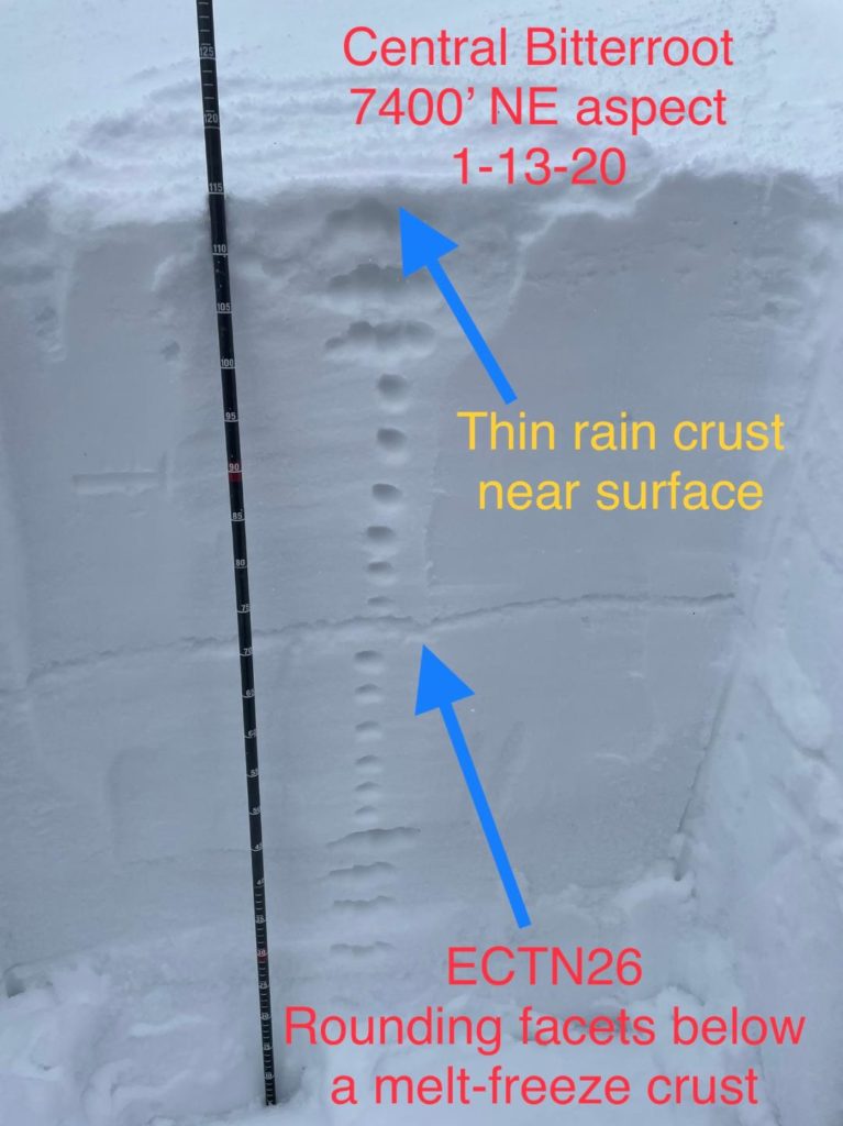
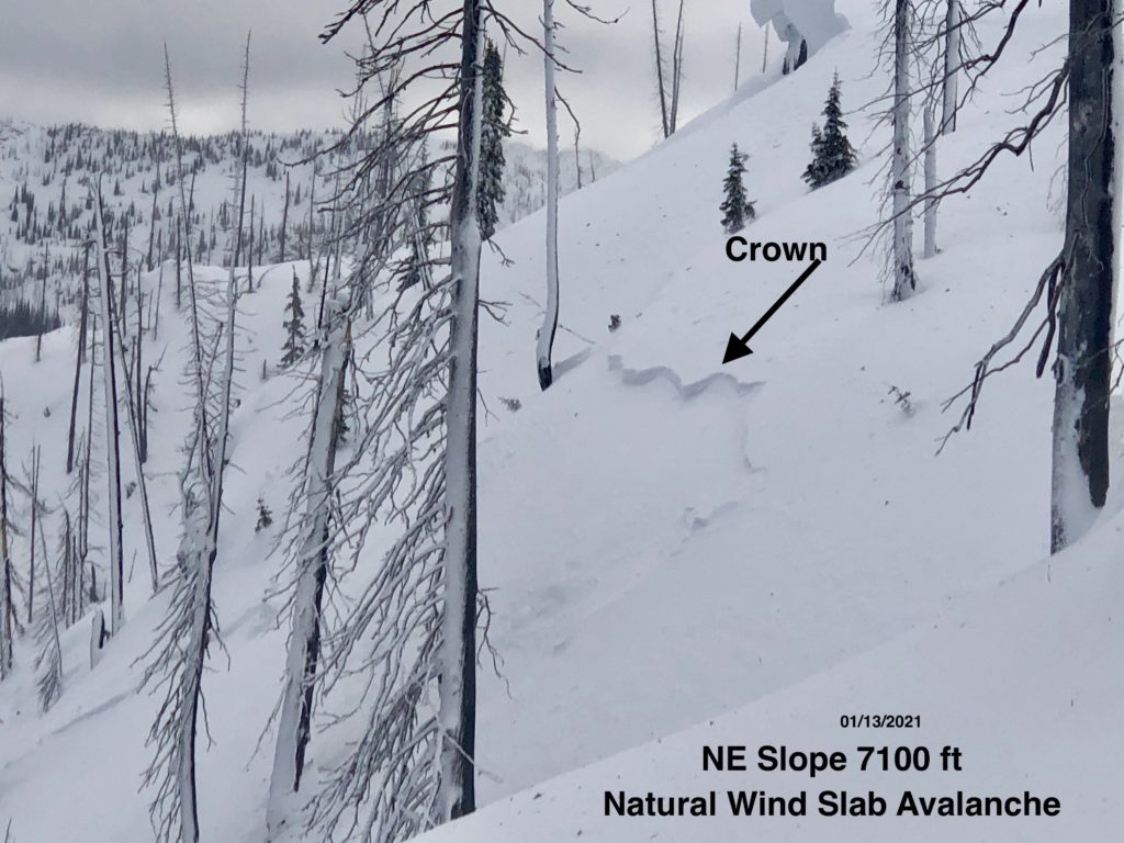
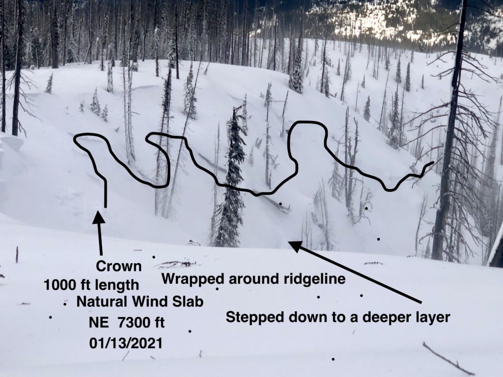
There was a lot of variance in what the storm produced. Yesterday in Crystal Amphitheater, 6″ of wet snow, capped with a crust, sat on top of the old snow. Under the new snow, surface hoar was still present and reactive in compression tests but the overlying slab was not stiff enough to propagate yet. Below this the snow was dry, moisture had not inundated the snowpack despite rain to 7400′. In Bass Creek, at 7000′, the snowpack was saturated to the ground and without evidence of natural avalanches. On the west side of the Bitterroot Crest, a widespread natural avalanche cycle had occurred. Windslab was failing naturally and propagating long distances, wrapping around terrain features.
In many areas, where the snowpack was saturated, persistent weak layers should stabilize with freezing. In others where the water did not penetrate the snowpack, persistent weak layers may continue to be an issue. Surface hoar from before this storm could still be lurking and reactive both above and below the rain line. What this means is you need to be heads up. Slight changes of aspect and elevation can still result in drastically different snowpack and stability. One pit and stability test will not suffice to give you a good handle on problem layers. The best way to deal with the myriad of current problems is to investigate the snowpack often.
Windslab is the biggest concern at higher elevations where abundant new snow is available for transport and there have been 48hrs of sustained wind.
The Bottom Line
Dangerous avalanche conditions exist, travel in avalanche terrain is not recommended. The snowpack has been rapidly loaded and how it is reacting throughout the forecast area is not yet clear. It’s best to give it a couple of days after this storm to settle out. It is certain to trigger wind slabs in steep upper elevation terrain. Avoid wind loaded slopes higher than 7000′. Travel one at a time in avalanche terrain, carry a beacon, shovel, and probe. Remember to reassess conditions throughout the day and stay alert for signs of instability. Dig a pit. Look for red flags.
Upcoming Education Events:
Please visit our education page for an up to date list of regional educational events and course offerings. Below are a few select events and opportunities to check out.
- January 20th, 6-7:30 PM MST | FREE Online 1.5-hr Avalanche Awareness Session | Missoulaavalanche.org + SheJumps event | Delivered by A3 Pro female instructors | Get more details and register HERE
- January 26th-31st | Women’s Avalanche Level 1 Course | Missoulaavalanche.org + SheJumps event | Delivered by A3 Pro female instructors | Get more details and register HERE
- January 26th-31st | Motorized AIARE 1 Course | Delivered by the Mountain Riding Lab | Get more details and register HERE
- February 6th | Motorized Avalanche Rescue Course | Delivered by the Mountain Riding Lab | Get more details and register HERE
- February 7th | Motorized Avalanche Rescue Course | Delivered by the Mountain Riding Lab | Get more details and register HERE
Public Observations
Thank you to everyone who has taken the time to send in a public observation. Please keep sharing what you find and see while out in the backcountry. This online forum is a great resource to glean information about current conditions.
Remember, you can submit your observations through the observation page anonymously. When submitted anonymously, the forecasters review the observation and utilize it when generating the forecast. The information does not appear on the public observation page.
Ski and ride safe.


