
The avalanche danger is MODERATE in the west central Montana backcountry today. Human triggered avalanches are possible today.
Good Morning. This is Travis Craft with the West Central Montana Avalanche Center advisory on Tuesday, January 19th, 2021. This advisory is sponsored by LB Snow. This advisory does not apply to operating ski areas and expires at midnight tonight. The USDA Forest Service is solely responsible for its content.
Weather and Snowpack
Mountain temperatures range from 11 degrees to 22 degrees F this morning. Winds are primarily calm today. The advisory area received no new snow overnight.
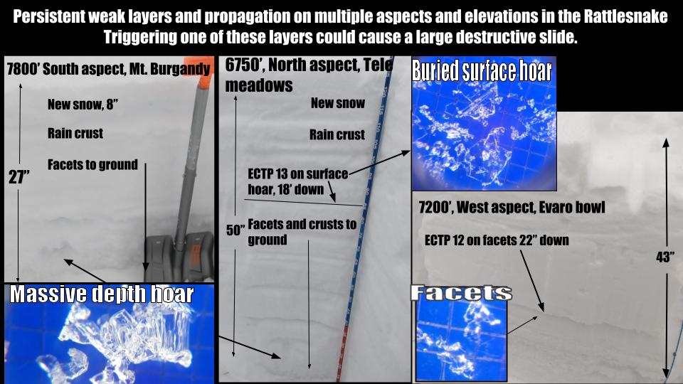
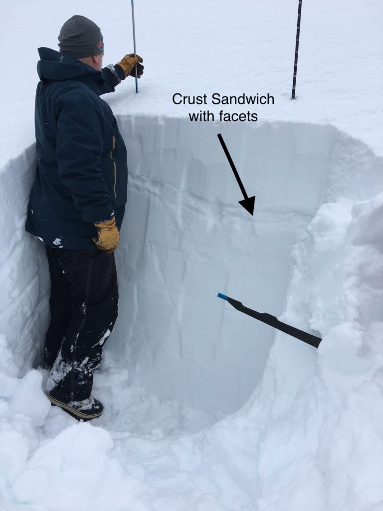
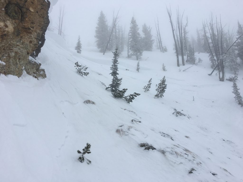
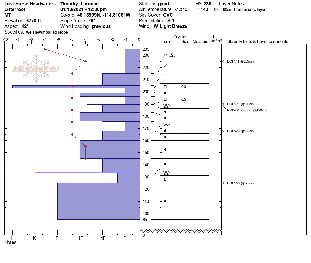
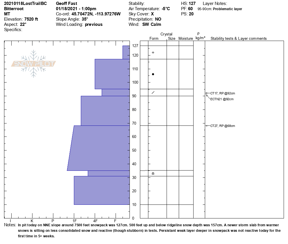
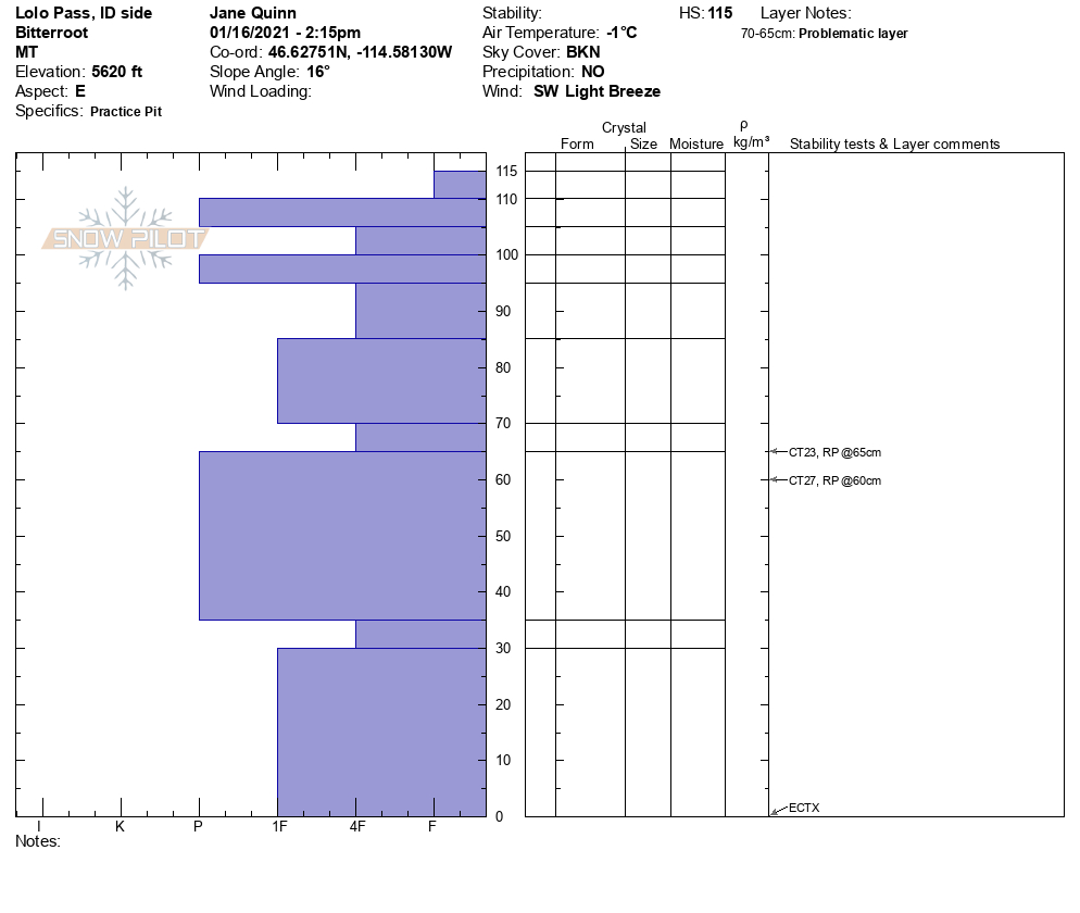
The snowpack is drastically different from drainage to drainage. This is spatial variability. Yesterday, a skier triggered a slide on Saddle Mountain by hitting the sweet spot on a cornice. The crown was 75′ wide and 1-2 feet deep on a 40-degree starting zone. The slide ran 500 ft of the 1500 ft path stopping in lower angle terrain. In the Rattlesnake, weak layers are propagating in pit tests. In the Lost Horse drainage, weak layers are not propagating but are still present. Gash Point, there are wind slabs at 8000 ft that are easily triggered and in lower elevations, widespread collapsing on buried weak layers. The rain crust seems to peter out around 7500 ft throughout the advisory area.
The definition of moderate danger is HEIGHTENED AVALANCHE CONDITIONS ON SPECIFIC TERRAIN FEATURES. EVALUATE SNOW AND TERRAIN CAREFULLY; IDENTIFY FEATURES OF CONCERN.
What does this mean for our snowpack? Look for signs of wind loading. Dig multiple pits as you change elevation and aspect. Choose sheltered lower angle terrain to get a feel for the snow. Use hand pits and small test slopes to get a picture of the snow.
Bottom Line
Today, choose sheltered lower angle slopes. Avoid slopes with weak sugary snow. Do multiple pits investigating the stripes in your pit wall. Avoid cornices and wind loaded terrain. Choose simple terrain that does not expose you to terrain traps. Avoid likely trigger points on slopes.
Travel one at a time in avalanche terrain, carry a beacon, shovel, and probe. Remember to reassess conditions throughout the day and stay alert for signs of instability. Dig a pit. Look for red flags.
Upcoming Education Events:
Please visit our education page for an up to date list of regional educational events and course offerings. Below are a few select events and opportunities to check out.
- January 20th, 6-7:30 PM MST | FREE Online 1.5-hr Avalanche Awareness Session | Missoulaavalanche.org + SheJumps event | Delivered by A3 Pro female instructors | Get more details and register HERE
- January 26th-31st | Motorized AIARE 1 Course | Delivered by the Mountain Riding Lab | Get more details and register HERE
- February 6th | Motorized Avalanche Rescue Course | Delivered by the Mountain Riding Lab | Get more details and register HERE
- February 7th | Motorized Avalanche Rescue Course | Delivered by the Mountain Riding Lab | Get more details and register HERE
Public Observations
Thank you to everyone who has taken the time to send in a public observation. Please keep sharing what you find and see while out in the backcountry. This online forum is a great resource to glean information about current conditions.
Remember, you can submit your observations through the observation page anonymously. When submitted anonymously, the forecasters review the observation and utilize it when generating the forecast. The information does not appear on the public observation page.
Ski and ride safe.


