
The avalanche danger is MODERATE in the west central Montana backcountry today. Human triggered avalanches are possible today.
Good Morning. This is Travis Craft with the West Central Montana Avalanche Center advisory on Tuesday, January 21st, 2021. This advisory is sponsored by LB Snow. This advisory does not apply to operating ski areas and expires at midnight tonight. The USDA Forest Service is solely responsible for its content.
Weather and Snowpack
Mountain temperatures range from 18 degrees to 25 degrees F this morning. Winds are 4 mph gusting to 8 mph out of the West. The advisory area received no new snow overnight.
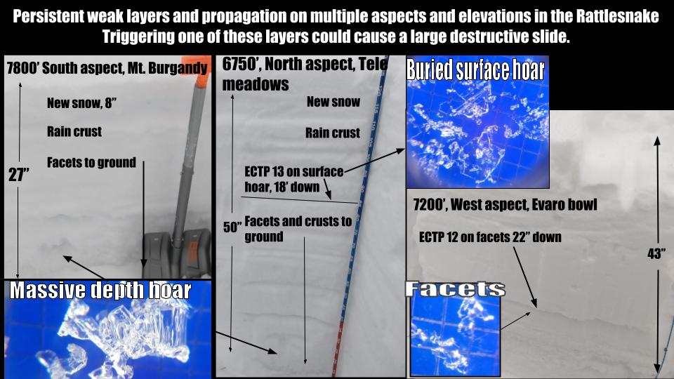
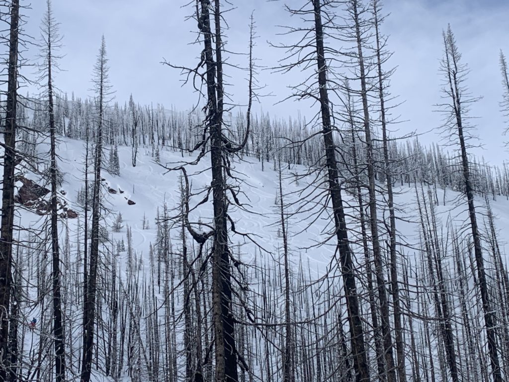
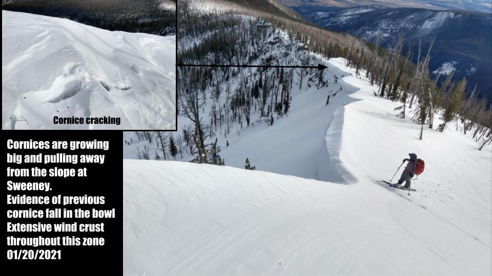
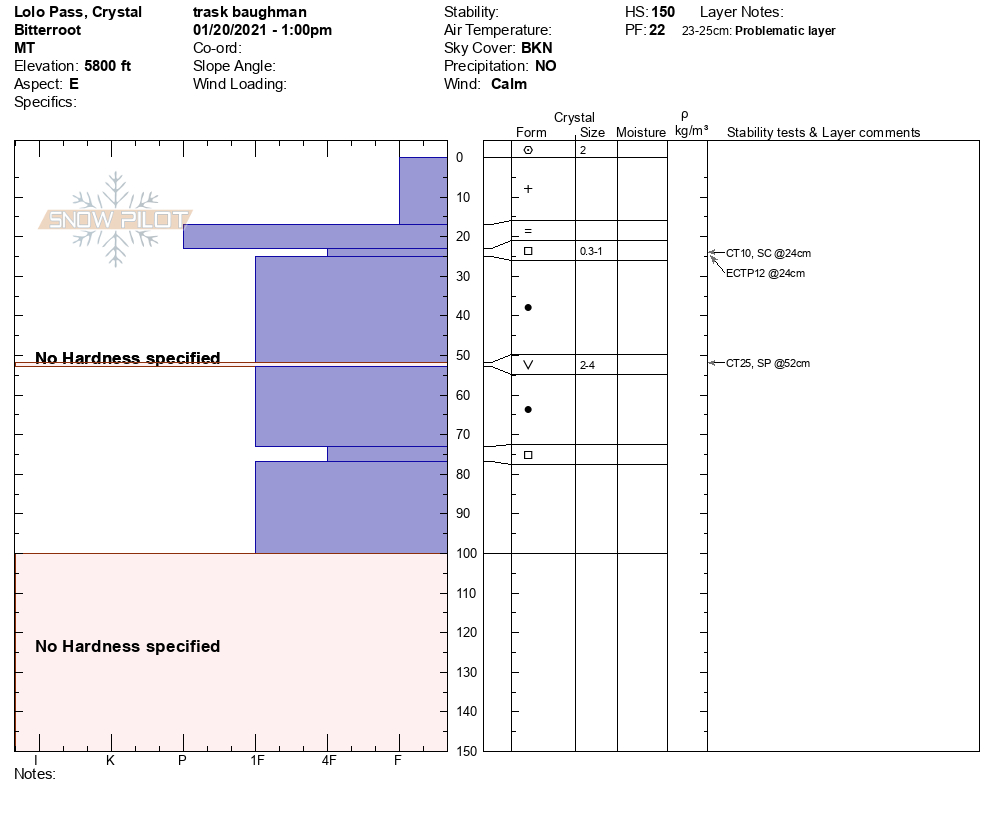
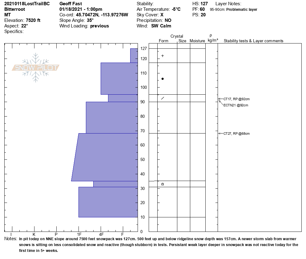
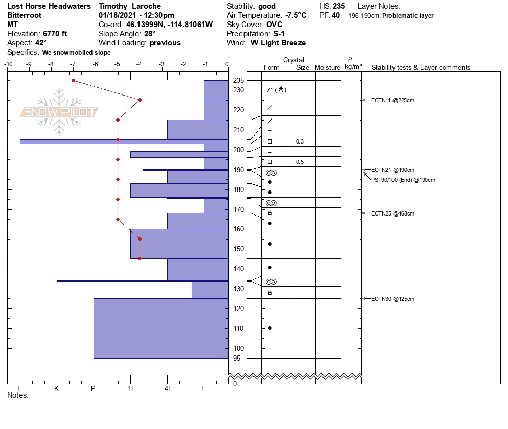
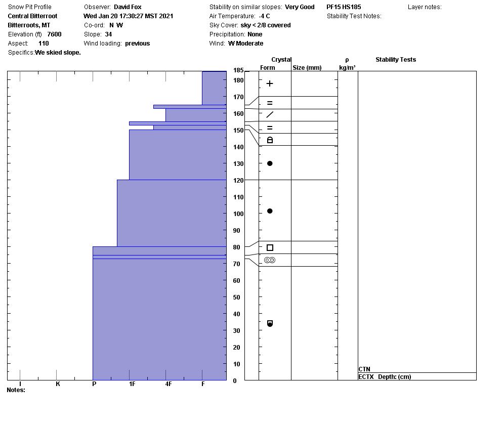
Persistent weak layers in the snowpack and wind drifted snow are the main avalanche problems. The likelihood of triggering an avalanche is decreasing slowly. It is still possible to trigger a wind slab on steeper slopes greater than 35 degrees at higher elevations near ridges. Cornices are getting large and getting weaker. The persistent weak layers are less reactive in pit tests. We could get facets below the rain crust from 01/13/2021 to propagate yesterday in the Lolo Pass area. In drainages in the central Bititterroot and Sweeny, this layer did not propagate. The buried surface hoar layers deeper in the snowpack (2 feet) are becoming less and less likely triggered. Overall we are gaining strength in the snowpack.
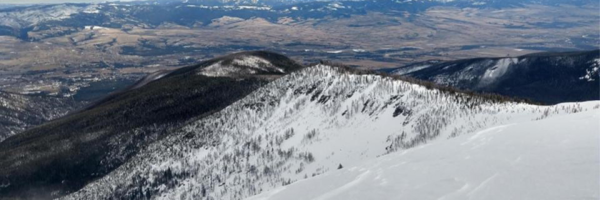
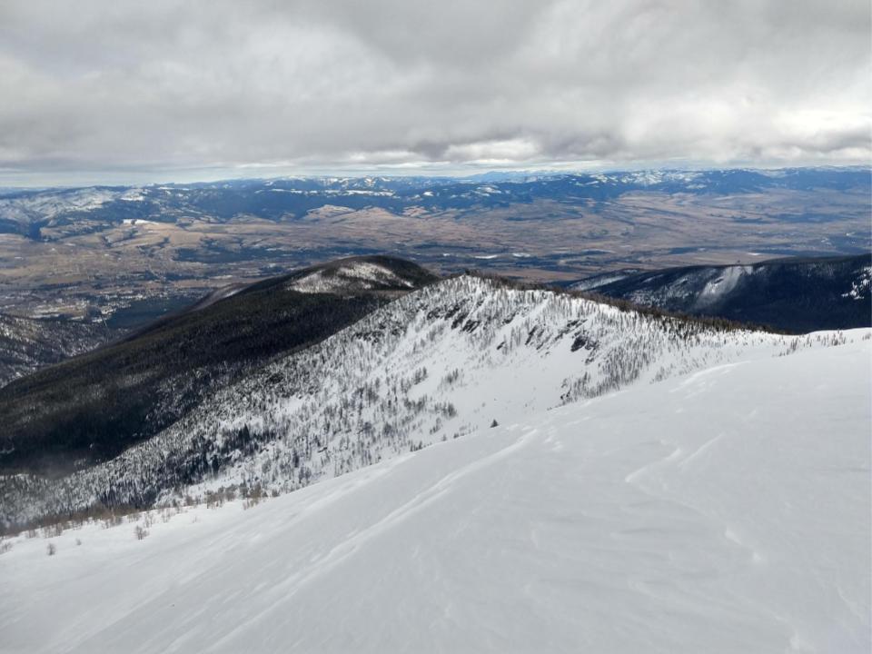
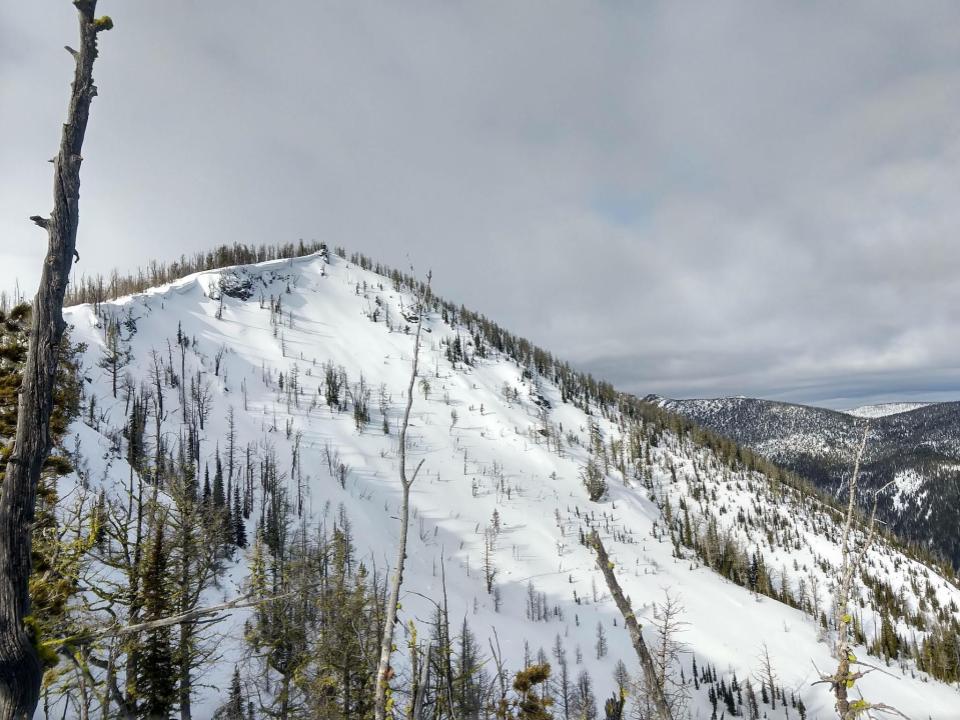
The shallowest snowpack in the forecast area is the Rattlesnake. There are still many shallow spots on slopes where triggering these weak layers is possible. The places to avoid on slopes are near cliff bands, rocks, and roll overs. These areas will have shallower snowpacks.
Terrain choice is the only option to reduce our exposure to avalanches. ATES is a way to describe terrain using the definitions simple, challenging, and complex. Here is a link to help understand the terminology and ranking. Looking at today’s avalanche problems I would choose simple terrain. Then after evaluating the snowpack with multiple pit tests and avoiding steep wind-loaded start zones, slowly ease into challenging terrain. This builds in safety margins.
Bottom Line
Today, choose sheltered lower angle slopes. Avoid slopes with weak sugary snow. Do multiple pits investigating the stripes in your pit wall. Avoid cornices and wind loaded terrain. Choose simple terrain that does not expose you to terrain traps. Avoid likely trigger points on slopes.
Travel one at a time in avalanche terrain, carry a beacon, shovel, and probe. Remember to reassess conditions throughout the day and stay alert for signs of instability. Dig a pit. Look for red flags.
Upcoming Education Events:
Please visit our education page for an up to date list of regional educational events and course offerings. Below are a few select events and opportunities to check out.
- January 26th-31st | Motorized AIARE 1 Course | Delivered by the Mountain Riding Lab | Get more details and register HERE
- February 6th | Motorized Avalanche Rescue Course | Delivered by the Mountain Riding Lab | Get more details and register HERE
- February 7th | Motorized Avalanche Rescue Course | Delivered by the Mountain Riding Lab | Get more details and register HERE
Public Observations
Thank you to everyone who has taken the time to send in a public observation. Please keep sharing what you find and see while out in the backcountry. This online forum is a great resource to glean information about current conditions.
Remember, you can submit your observations through the observation page anonymously. When submitted anonymously, the forecasters review the observation and utilize it when generating the forecast. The information does not appear on the public observation page.
Ski and ride safe.


